


 User Center
 My Training Class
 Feedback


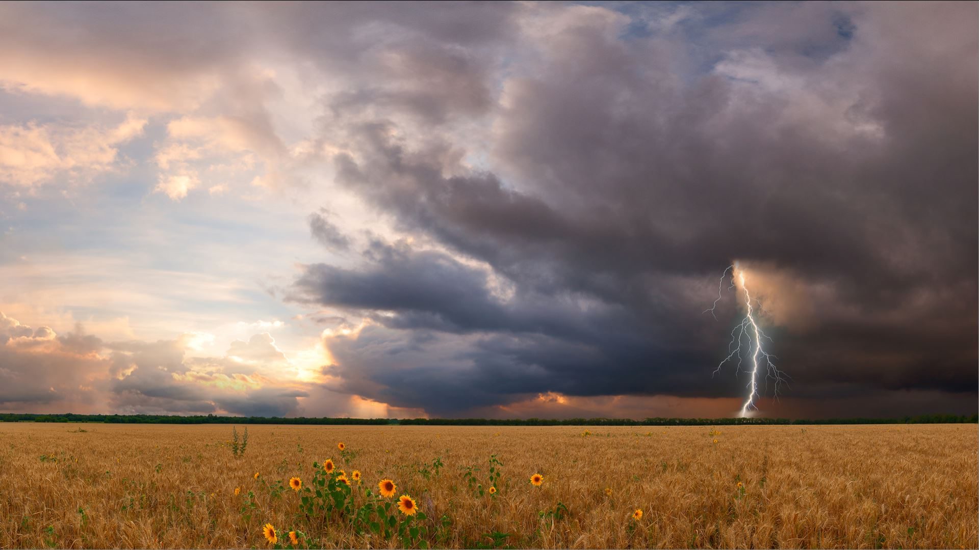
Severe Storms Target Northern Plains This Weekend
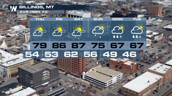
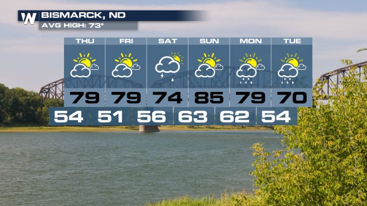
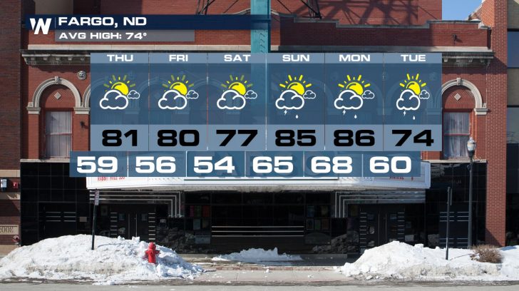
The first weekend of June will be a stormy one in the Northern Plains. The threat for severe thunderstorms will be possible in states such as Montana, the Dakotas, and even Minnesota.
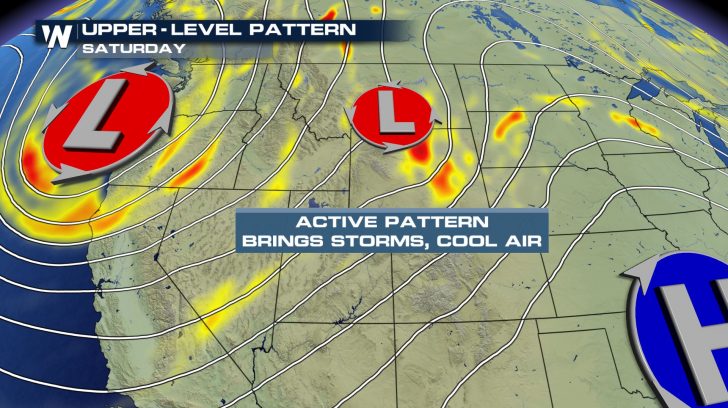
A vigorous trough will push into the western United States, creating this unsettled weather pattern. This trough will eventually lead to a drop in temperatures for next week.
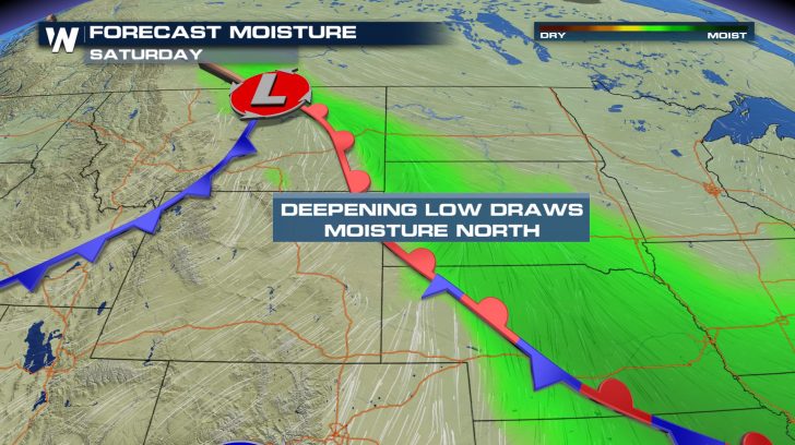
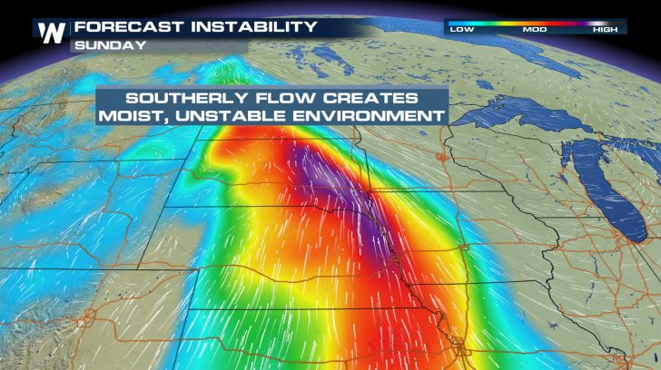
Ahead of the trough and surface cold front, temperatures are expected to be in the 80s and 90s—quite hot—across the Great Plains. Moisture transported from the Gulf of Mexico thanks to southerly winds will make it noticeably humid as well.
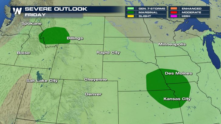
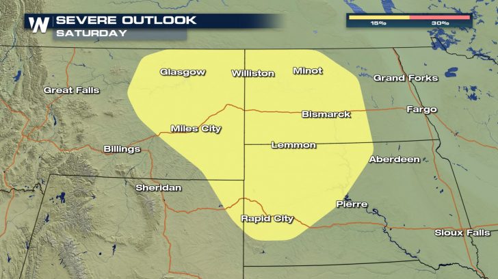
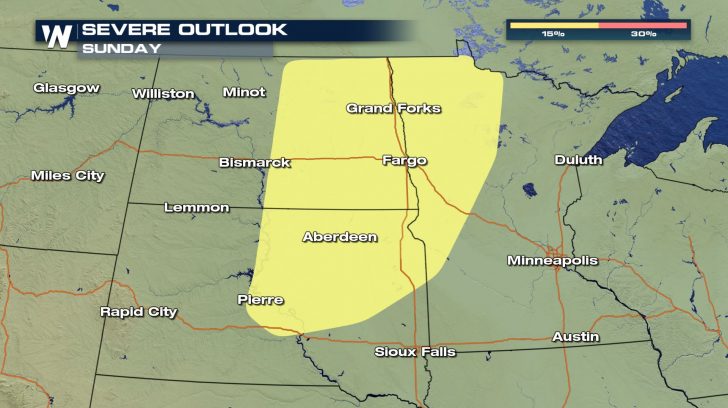
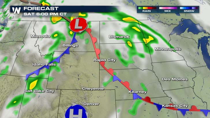
The temperature, humidity, winds, and fronts will all come together and create an energetic environment for thunderstorm development, especially on Saturday and Sunday.
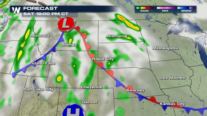
Here’s a look at which areas can expect the chance for rain, including severe thunderstorms. These thunderstorms will likely contain damaging wind gusts, large hail, frequent lightning, and the possibility of an isolated tornado.
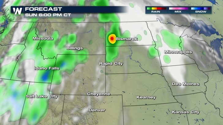
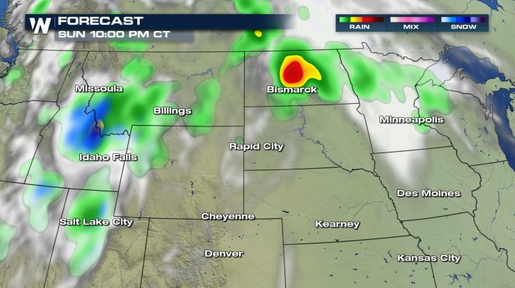
Once the front exits the region from west to east, the trend for cooler, more seasonable temperatures will take hold across the far northern United States next week. The chance for rain showers will linger.
Stay Weather Aware this weekend and be sure to follow WeatherNation for the very latest forecast information.


Comments
Something to say?
Log in or Sign up for free