


 User Center
 My Training Class
 Feedback


Tropics Update: Possible System in North Atlantic?
It’s far from the run of tropical storms that’s already greeted a busy start to the tropics season in the Atlantic. But, there’s at least one system worth monitoring in the north Atlantic, and it also looks like the eastern Pacific is starting to wake up from some early season doldrums.
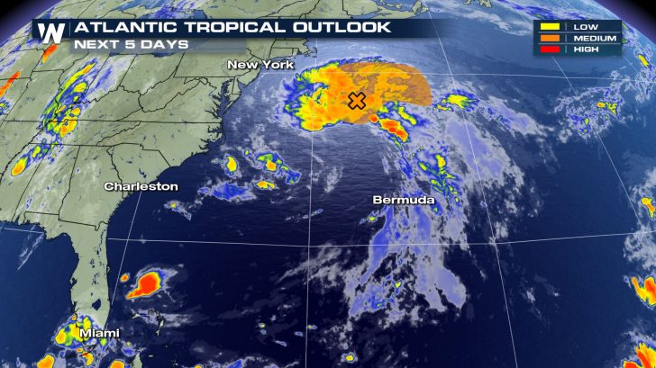
The National Hurricane Center (NHC) is monitoring a non-tropical area of low pressure off the mid-Atlantic coastline for possible development into early Monday. The system is spinning a few hundred miles southeast of Long Island, New York, and moving parallel to the U.S.’s Eastern Seaboard.
The window for development of this system, however, is small: it could quickly develop into a subtropical depression or storm into early Monday as it moves over the warmer waters of the Gulf Stream. As of Sunday afternoon, the NHC had a medium chance for development with the storm system.
“By Monday night and Tuesday, however, the system is expected to weaken when it moves back over the cooler waters of the north Atlantic,” the NHC wrote in its Sunday afternoon update.
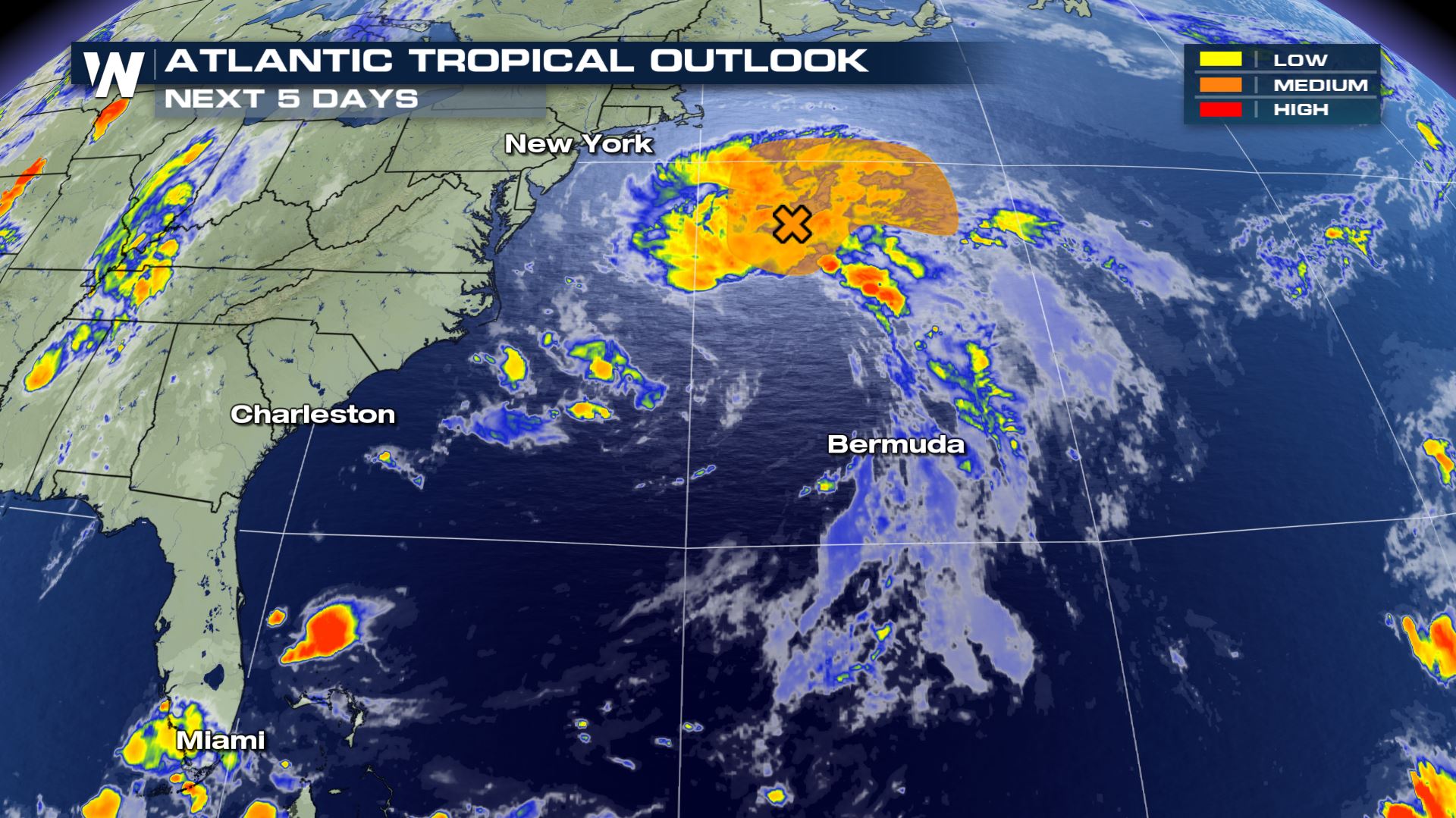
Regardless of development, however, no direct impacts to land are expected from the north Atlantic low.
On the eastern Pacific side of things, there are three separate systems that the NHC is keeping close tabs on, all moving westward off the west coast of Central America. Three areas of low pressure could all develop into either tropical depressions or storms later this week,
None of these systems are expected to directly impact land at this point. However, the system closest to the Mexican coastline could move parallel to that country’s coastline, leading to the possibility for heavy rain there later this week.
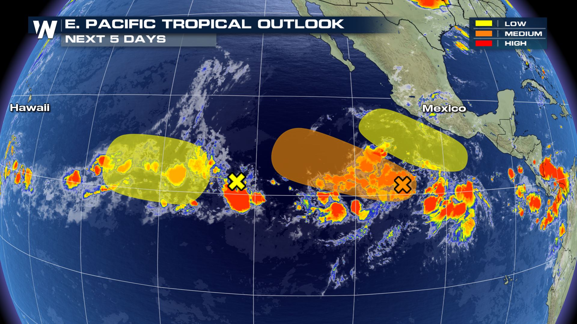
So far this season, there have only been two tropical systems in the eastern Pacific, and only one tropical storm (Amanda). It looks like that could change this week, with Boris, Cristina and Douglas the next names up on the eastern Pacific’s list.
Stay with WeatherNation for the latest on the tropics.


Comments
Something to say?
Log in or Sign up for free