


 User Center
 My Training Class
 Feedback


Tropical Depression 13 Forms in the Atlantic
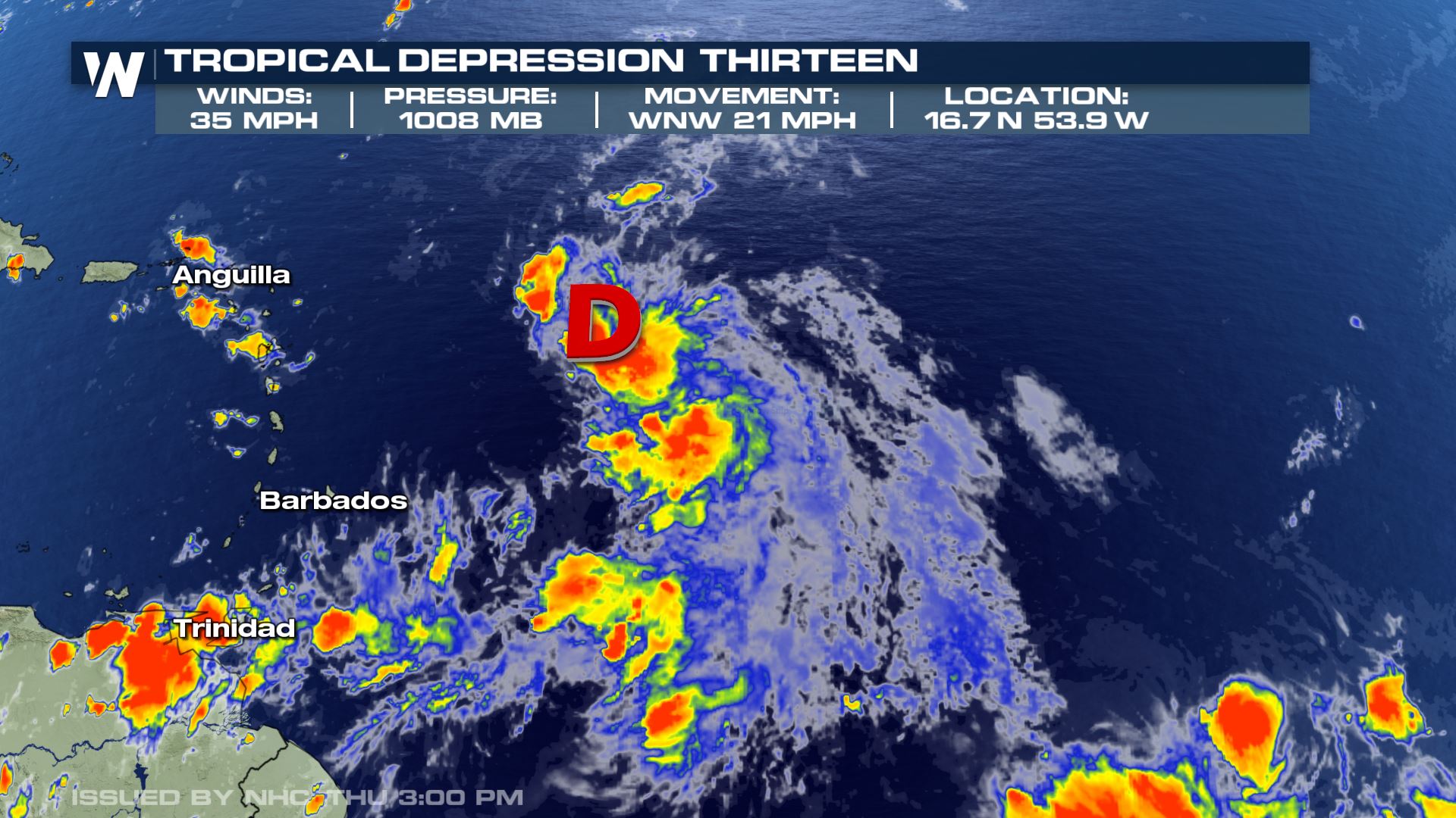
The busy 2020 Atlantic hurricane season continues. Tropical Depression 13 is currently about 600 miles east of the northern Leeward Islands. As of Thursday evening, the storm had a sustained wind speed of 35 miles per hour, moving west-northwest at 21 miles per hour. The central storm pressure was observed to be 1008 millibars.
Tropical Depression 13 is forecast to strengthen to a tropical storm by Friday morning and impact the northern Leeward Islands. A tropical storm watch has been issued for the Virgin Islands and Puerto Rico.
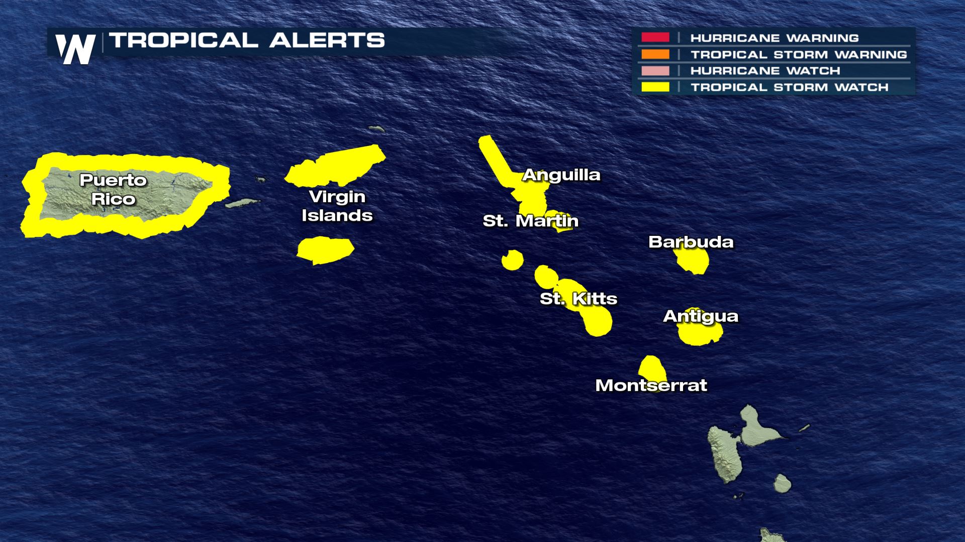
Tropical Storm Watches are also in effect for the Northern Leeward Islands, including St. Maarten, Antigua, Barbuda, St. Kitts, Nevis, Anguilla, Saba and St. Eustatius. Heavy rain, gusty wind, and high surf will be the primary concerns.
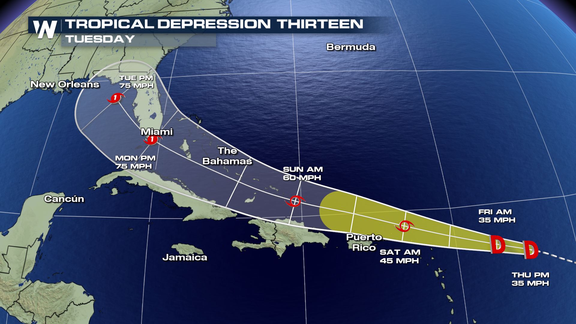
Tropical Depression 13 is forecast to become a Tropical Storm (winds of 39 mph or greater) as early as Thursday evening or Friday. The storm is forecast to move near or north of these U.S. island territories on Saturday.
Looking further into the forecast, the models continue a west-northwest movement and additional strengthening into a Category 1 hurricane as the system approaches the western Bahamas. Impacts could start in Florida early next week. Interests along the Atlantic and Gulf Coasts should pay attention to the forecast in the days ahead.
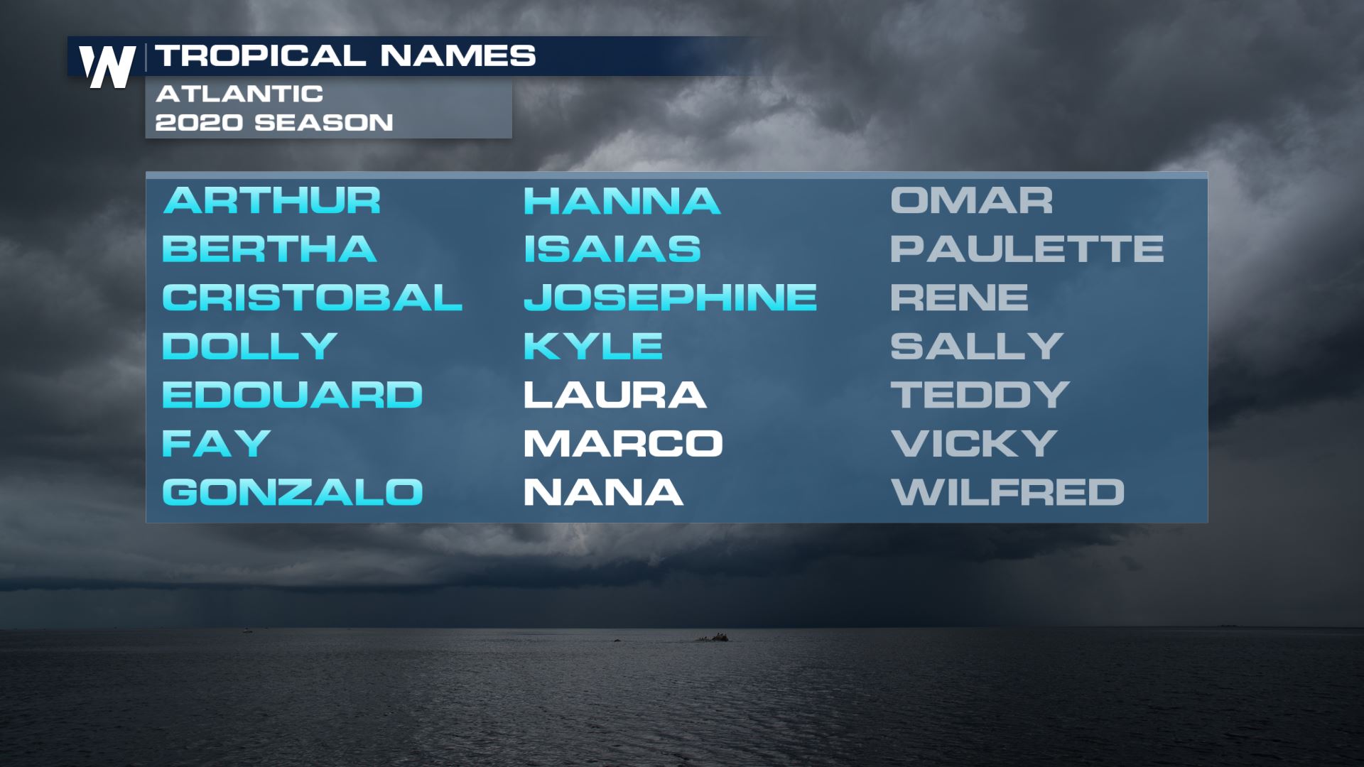
The next name on the 2020 Atlantic hurricane season list is Laura. Given the forecast, this will likely become the earliest “L”-named storm on record in the Atlantic basin. The current record-holder is Luis, which formed on August 29th during the 1995 season.
Keep it tuned to WeatherNation for the very latest tropical forecasts all season long.


Comments
Something to say?
Log in or Sign up for free