


 User Center
 My Training Class
 Feedback


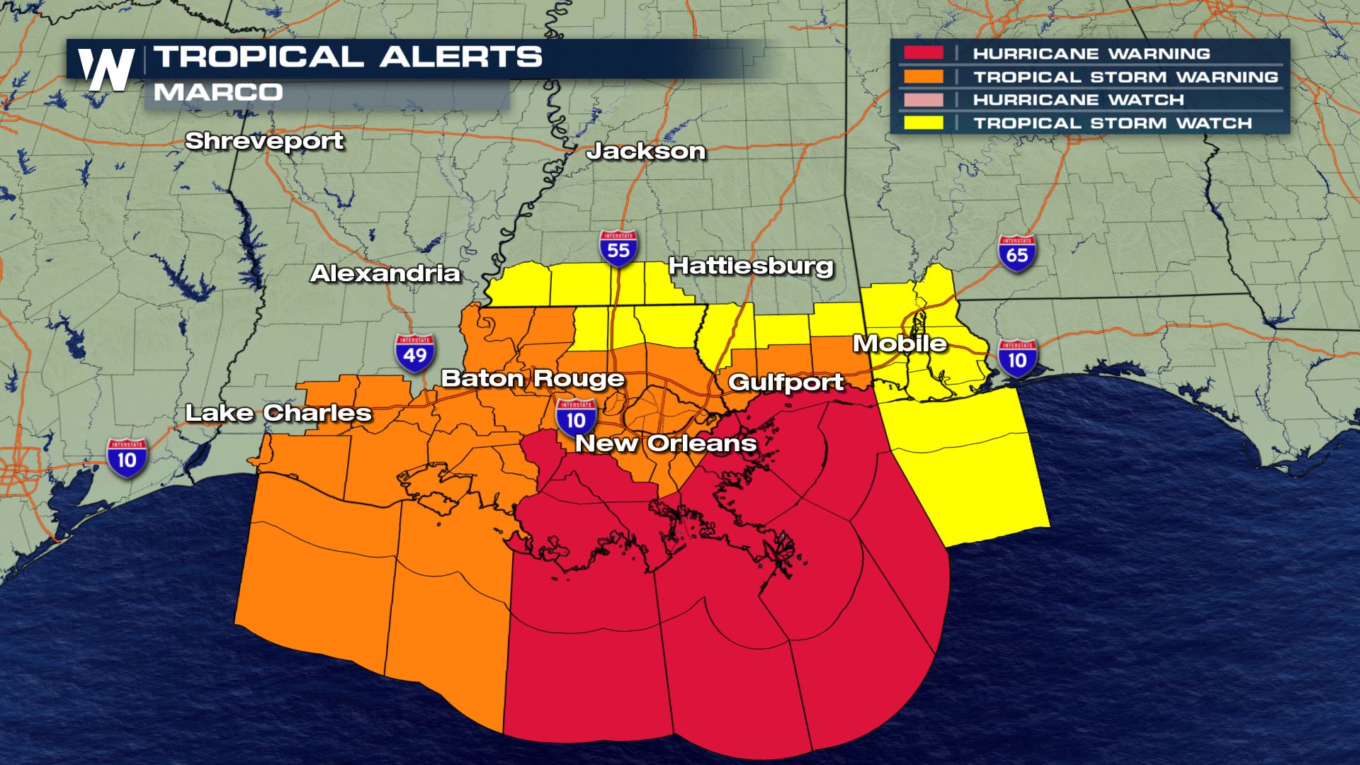
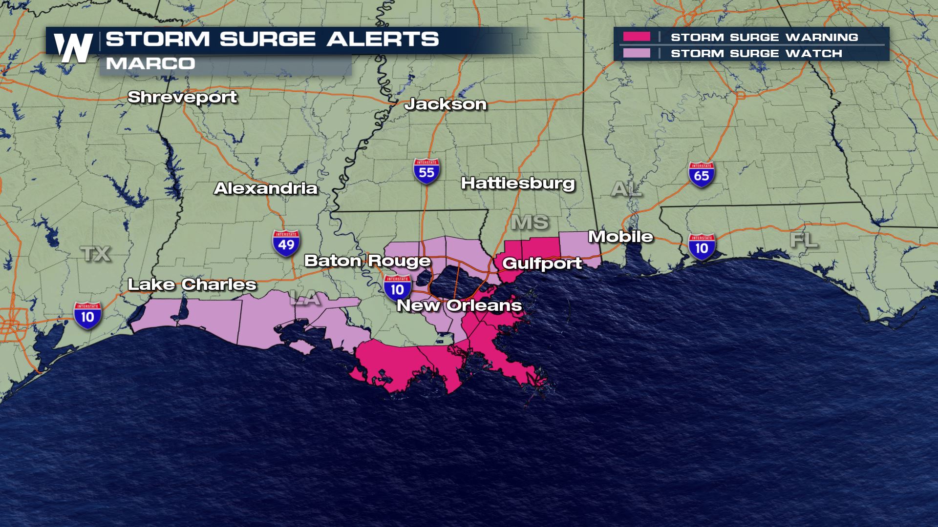
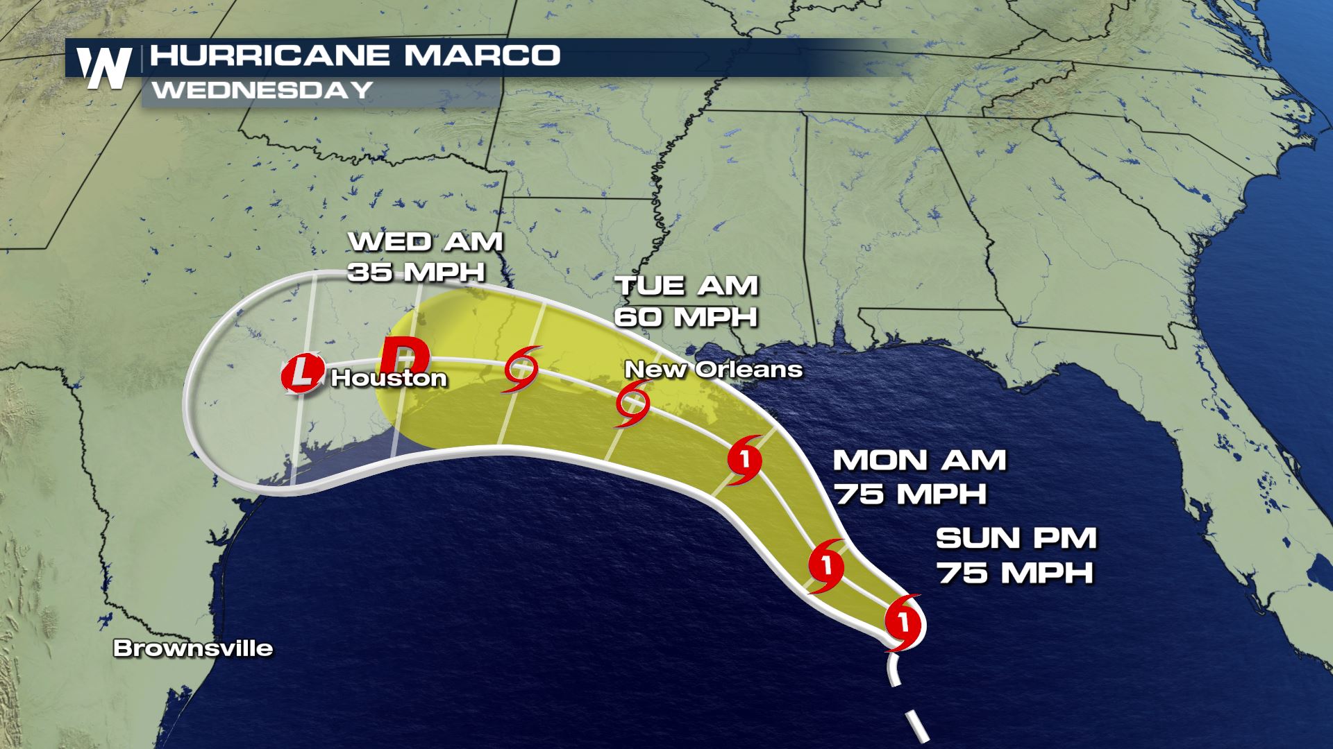
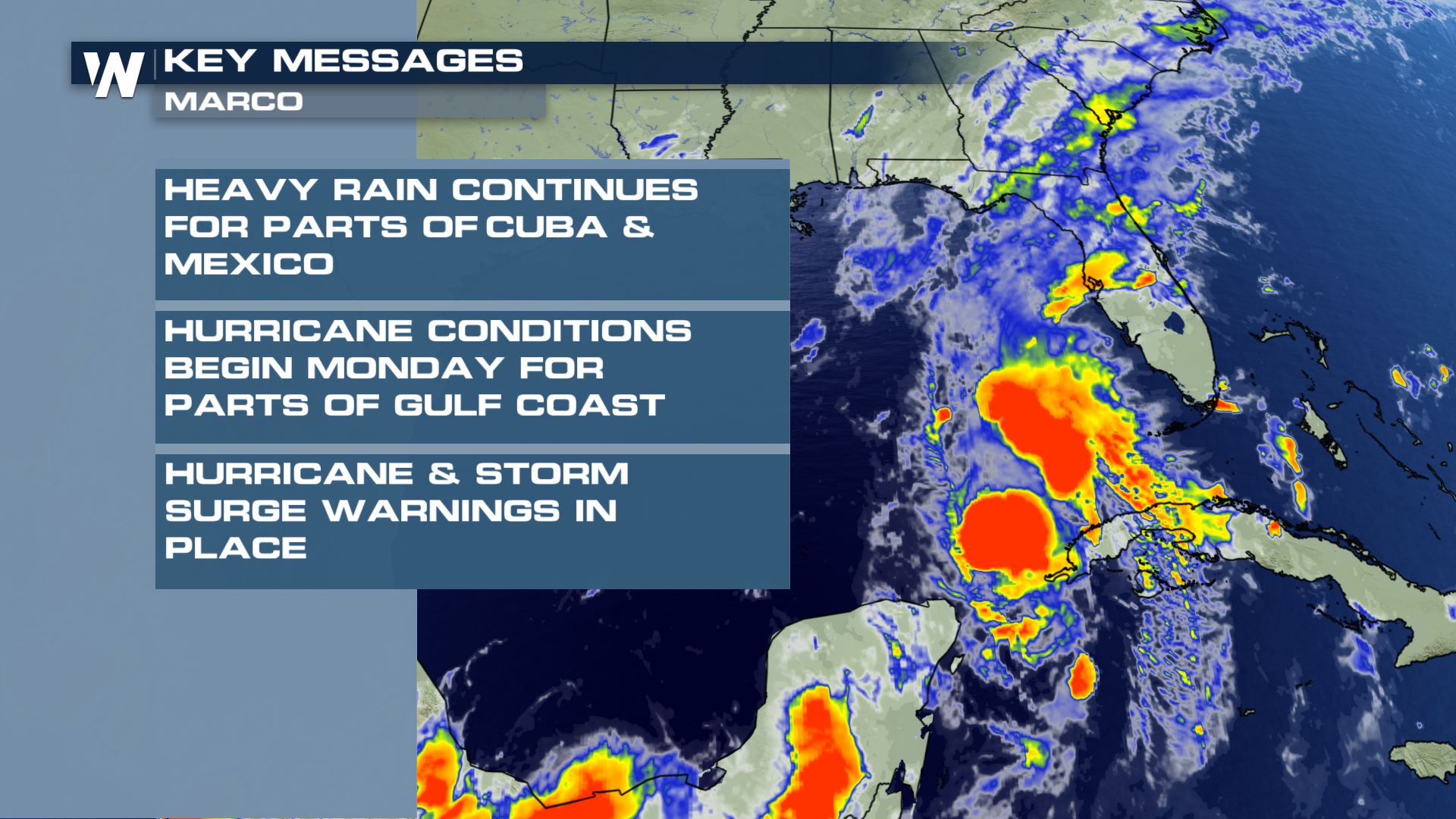
As Marco draws closer to the Gulf Coast of the U.S., tropical alerts have been issued and updated including storm surge alerts as well. Here are the latest:

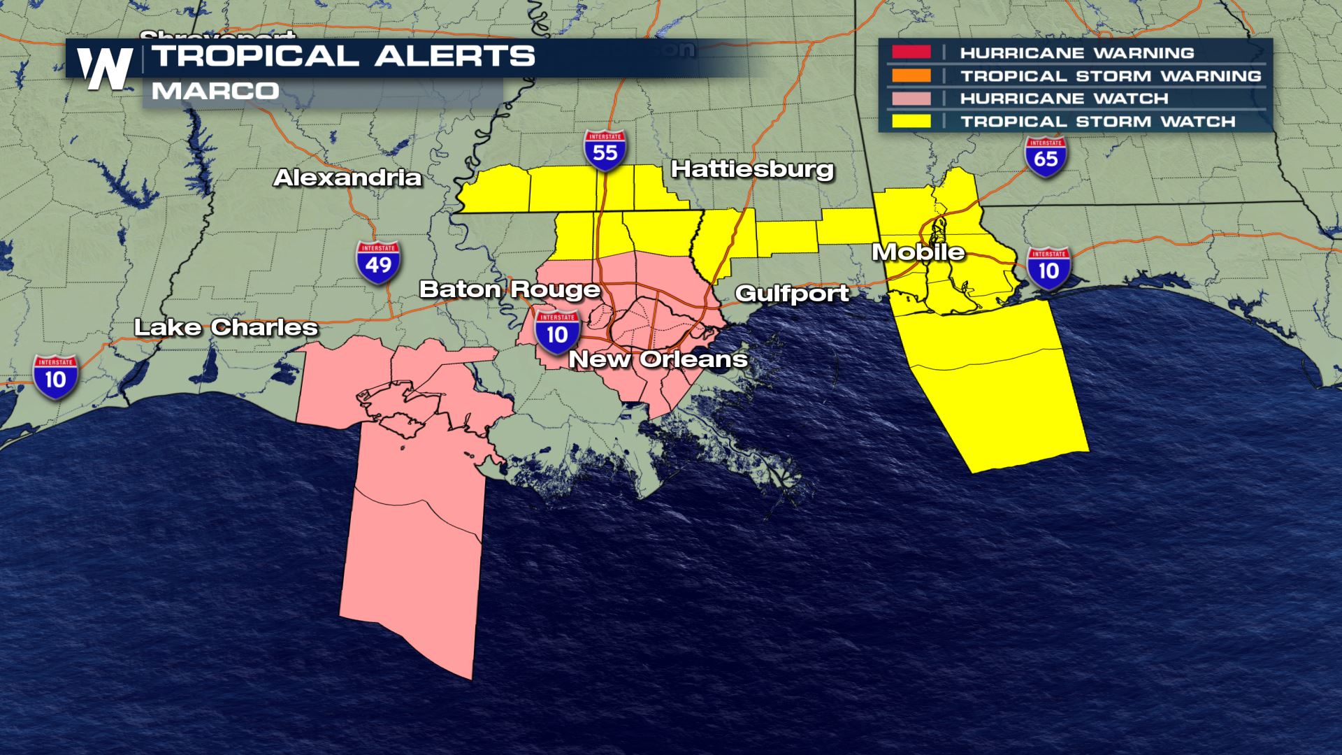
The highest impacted area is expected to be southeastern Louisiana and coastal Mississippi. However, the impacts don’t end there. Heavy rain, winds, and even storm surge may extend from the Texas/Louisiana border east to the border between the Alabama/Florida Panhandle!
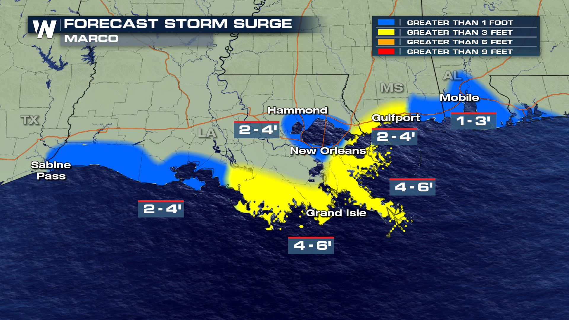
Marco is expected to continue to approach the northern Gulf Coast states on Sunday and Monday. Tropical storm-force wind may begin as early as Sunday night for coastal Louisiana, then Monday for most of the northern Gulf coast area. Strong storm surge has high as several feet may inundate low-lying coastal areas of Mississippi and Louisiana Sunday night through Monday night. Remember, always stay away from storm surge flooding and fresh water flooding from heavy rainfall.
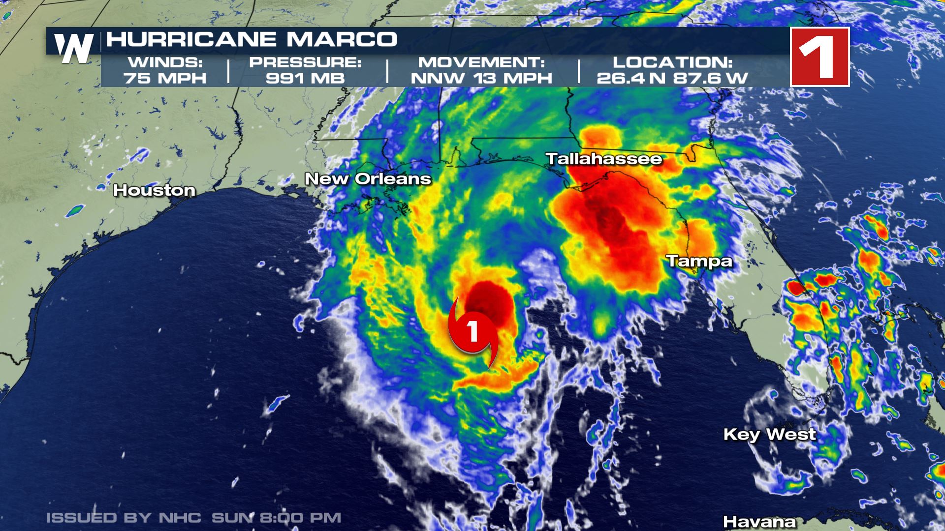
Marco is expected to produce rainfall totals of 1 to 4 inches across the central U.S. Gulf coast with isolated amounts up to 6 inches! That may result in urban or stream flooding. Hurricane force wind will be possible by midday Monday.
This isn’t the only storm! You can read more about Laura, the next storm coming into the Gulf of Mexico here.


Comments
Something to say?
Log in or Sign up for free