


 User Center
 My Training Class
 Feedback


Tuesday brought a severe weather threat across the Southern Plains starting with heavy rain and flooding in Oklahoma and Arkansas early Tuesday morning. As storms progressed into the peak of afternoon heating, the reports of severe weather increased across Oklahoma and Arkansas into Missouri and Tennessee and surrounding states. There were multiple reports of tornadoes that formed including the ones below.
ARKANSAS
Earlier Tuesday afternoon the first of the tornado warnings were issued in Arkansas; one of the confirmed tornadoes in Heber Springs, Arkansas as seen in the footage below.
**HAPPENING NOW** Numerous tornado warnings have been issued across parts of Arkansas with reports of damage from storms like this one near Heber Springs, AR late Tuesday afternoon. Have multiple ways to get warnings and do no rely on sirens alone! #arwx pic.twitter.com/mhFPL0l2w5
— WeatherNation (@WeatherNation) September 1, 2020
MISSOURI
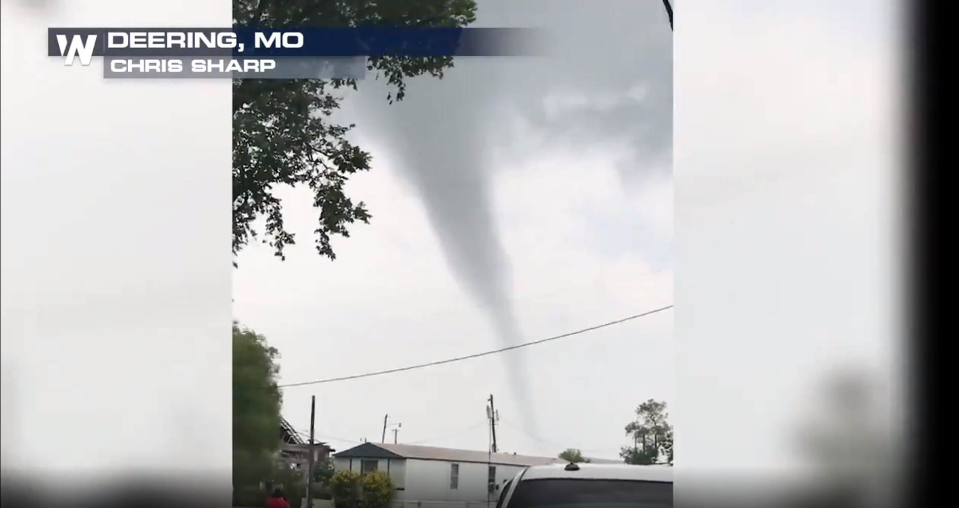
Although tornado warnings were never issued for Missouri, here is some viewer footage from Deering, Missouri before this confirmed tornado cross the Mississippi River and was later warned in far northwestern Tennessee. This was a small and rogue storm ahead of the more dominant activity but quickly dissipated before the warning was canceled near the Kentucky border.
How eerie! More reports of funnel clouds and tornadoes in far southern Missouri Tuesday evening, with the threat of severe weather continuing after dark. Stay weather aware! #mowx pic.twitter.com/tOy4yMYtdG
— WeatherNation (@WeatherNation) September 1, 2020
The severe weather threat diminishes for some of the areas into the overnight hours but heavy rain and flooding become our next threat. For the latest on severe weather reports make sure to follow us on twitter @WeatherNation and tune in the for the latest watches and warnings!


Comments
Something to say?
Log in or Sign up for free