


 User Center
 My Training Class
 Feedback


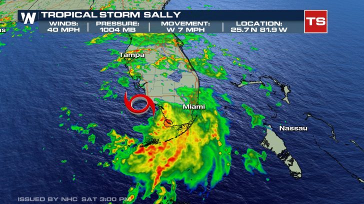
Tropical Storm Sally Forms In Gulf of Mexico

Tropical Depression Nineteen has strengthened into Tropical Storm Sally in the far southeast Gulf of Mexico. As of Saturday afternoon, the maximum sustained winds had increased to that critical tropical storm-strength of 39 miles per hour or stronger.
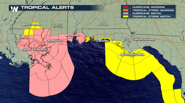
A Hurricane Watch has been issued for the Alabama, Mississippi, and southeast Louisiana Gulf Coast region. A Tropical Storm watch has been issued for portions of the Florida Panhandle to the Big Bend area south of Tallahassee, as well as for maritime areas in the Gulf of Mexico.
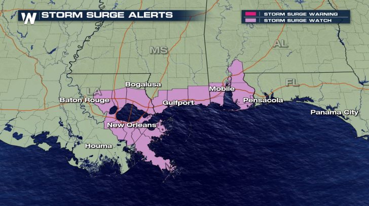
A Storm Surge Watch has been posted in areas adjacent to the Gulf of Mexico, Mobile Bay, and the shores of Lake Pontchartrain. Storm surge could potentially reach 6 to 9 feet from the mouth of Mississippi River in Louisiana to Ocean Springs, Mississippi. This also includes Lake Borgne. From Ocean Springs, Mississippi to the Mississippi-Alabama border, 4 to 6 feet of storm surge inundation is possible. East of there, including the Mobile Bay and parts of the Florida Panhandle, storm surge may range between 1 and 4 feet.
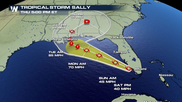
Interests along the northern Gulf Coast should continue monitoring the progress of this system. It is expected to strengthen to a hurricane as it approaches Louisiana and Mississippi Tuesday into Wednesday. The National Hurricane Center also expects the storm to slow down significantly, which would increase the risk for heavy rain and flash flooding.
Tropical Storm Sally is forecast to move to the west-northwest and over the warm waters of the southeastern Gulf of Mexico on Saturday, and across the north-central Gulf of Mexico through Sunday/Monday. Rainfall totals are expected to be 1-3″ with isolated maximum amounts up to 5″ across central and southern Florida. This rainfall may produce flash flooding.
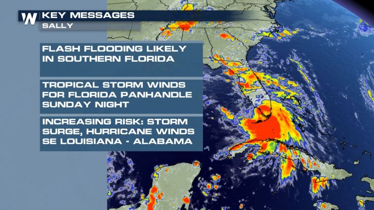
Dangerous impacts from storm surge, wind, and heavy rainfall will be possible along the Gulf Coast from the Florida Panhandle to southeastern Louisiana this weekend and early next week.
Continue to check in with us here at WeatherNation for updated information and please seek additional announcements for your area if you are in the path of this tropical cyclone!


Comments
Something to say?
Log in or Sign up for free