


 User Center
 My Training Class
 Feedback


Alberta Clipper Brings Snow Potential to the Northern Plains and Great Lakes
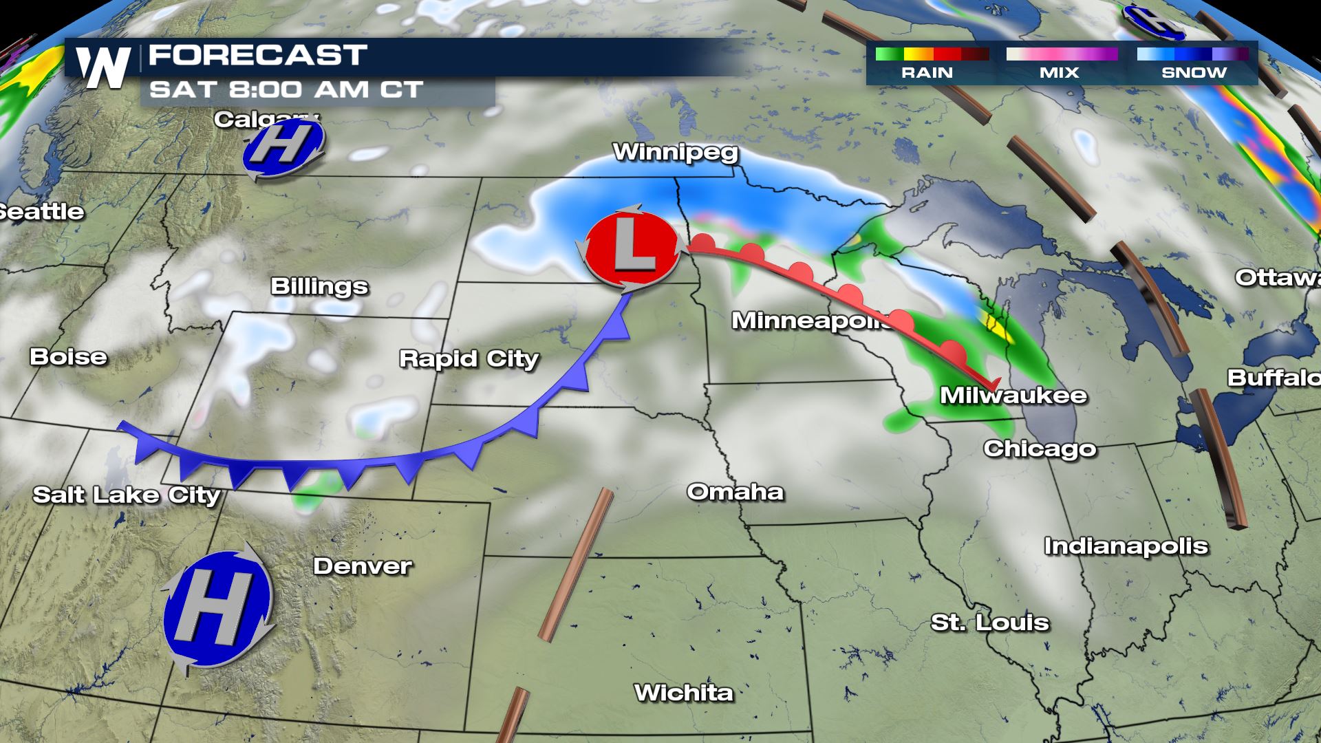
A fast moving frontal system from originating from Alberta is expected to move across the northern tier of the Central United States from Friday into Sunday. This Alberta Clipper is expected to bring rain and snow to the region, with confidence increasing that at least some light to moderate accumulations will be possible.
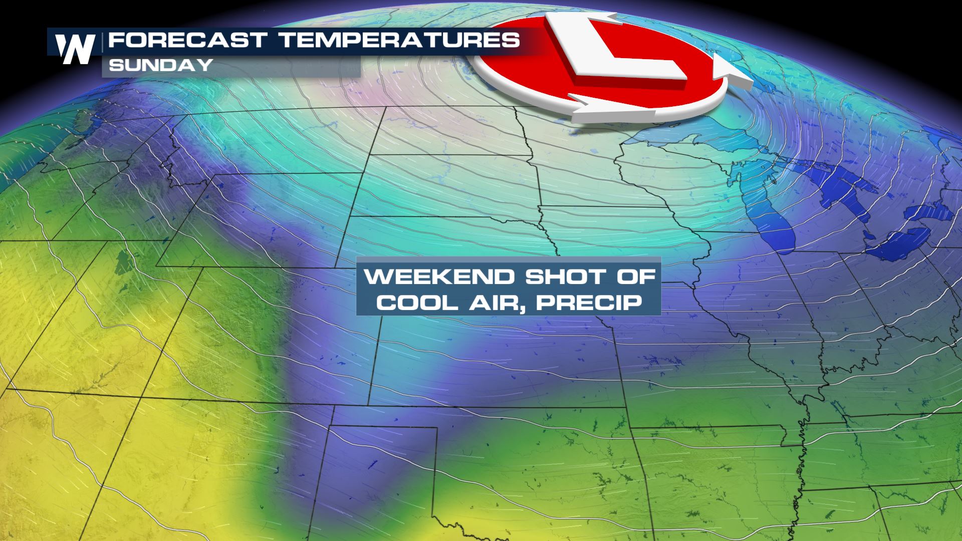
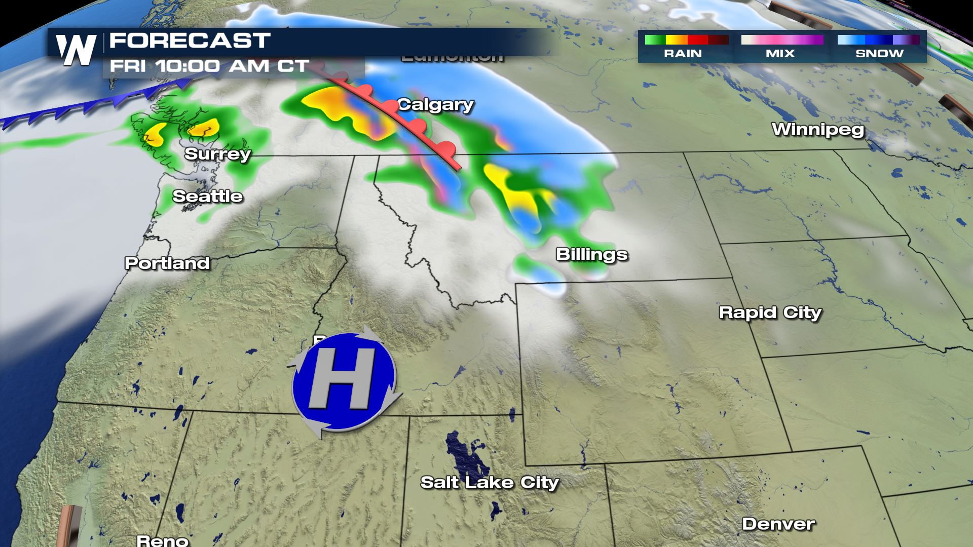
After an initial cold front lifts north and east of the region earlier in the week, a second system is expected to dive south into the Northwest by Friday morning. Rain and snow are expected to spread across Idaho and Montana before shifting east into the Northern Plains Friday afternoon.
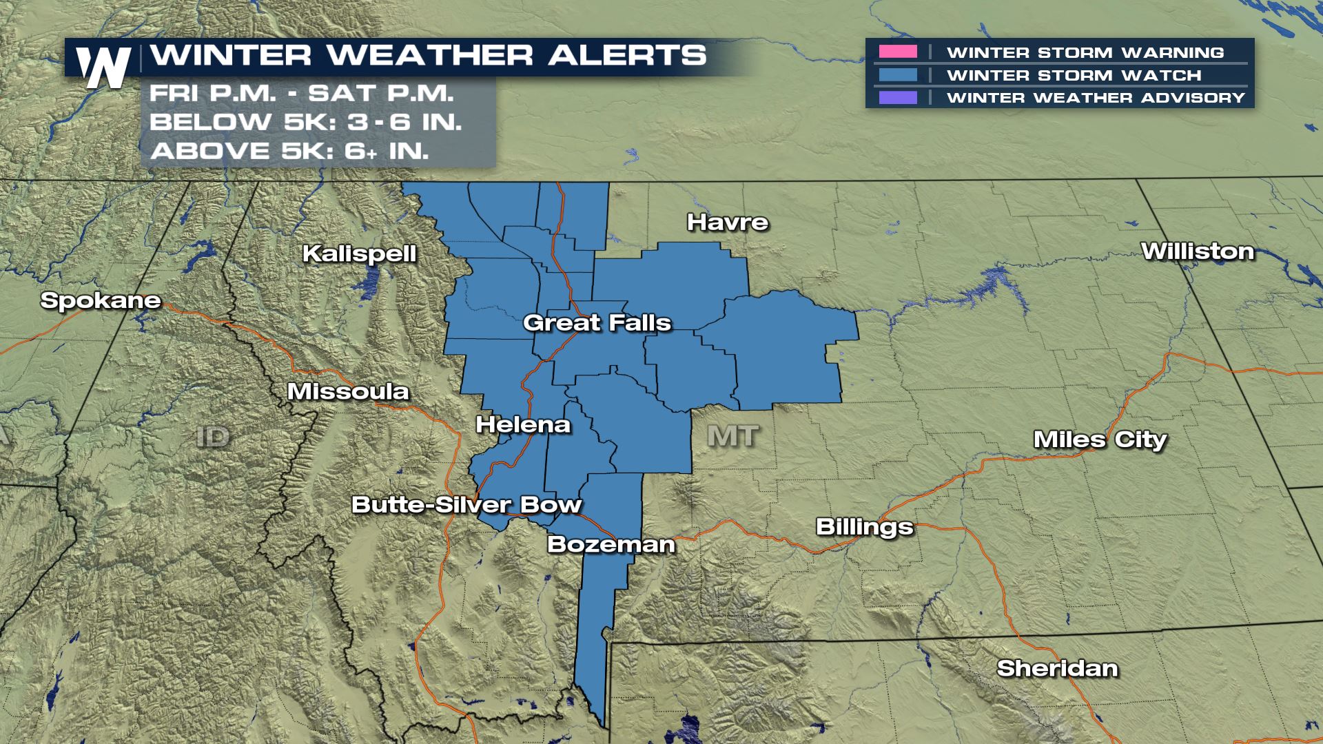
Winter storm watches have been issued for portions of Western and Central Montana that go into effect Friday afternoon and last through Saturday afternoon. Below 5000 feet, 3-6 inches of snow could accumulate, with more than six inches above 5000 feet. Gusty winds will also accompany the frontal passage, with gusts up tp 70 mph.
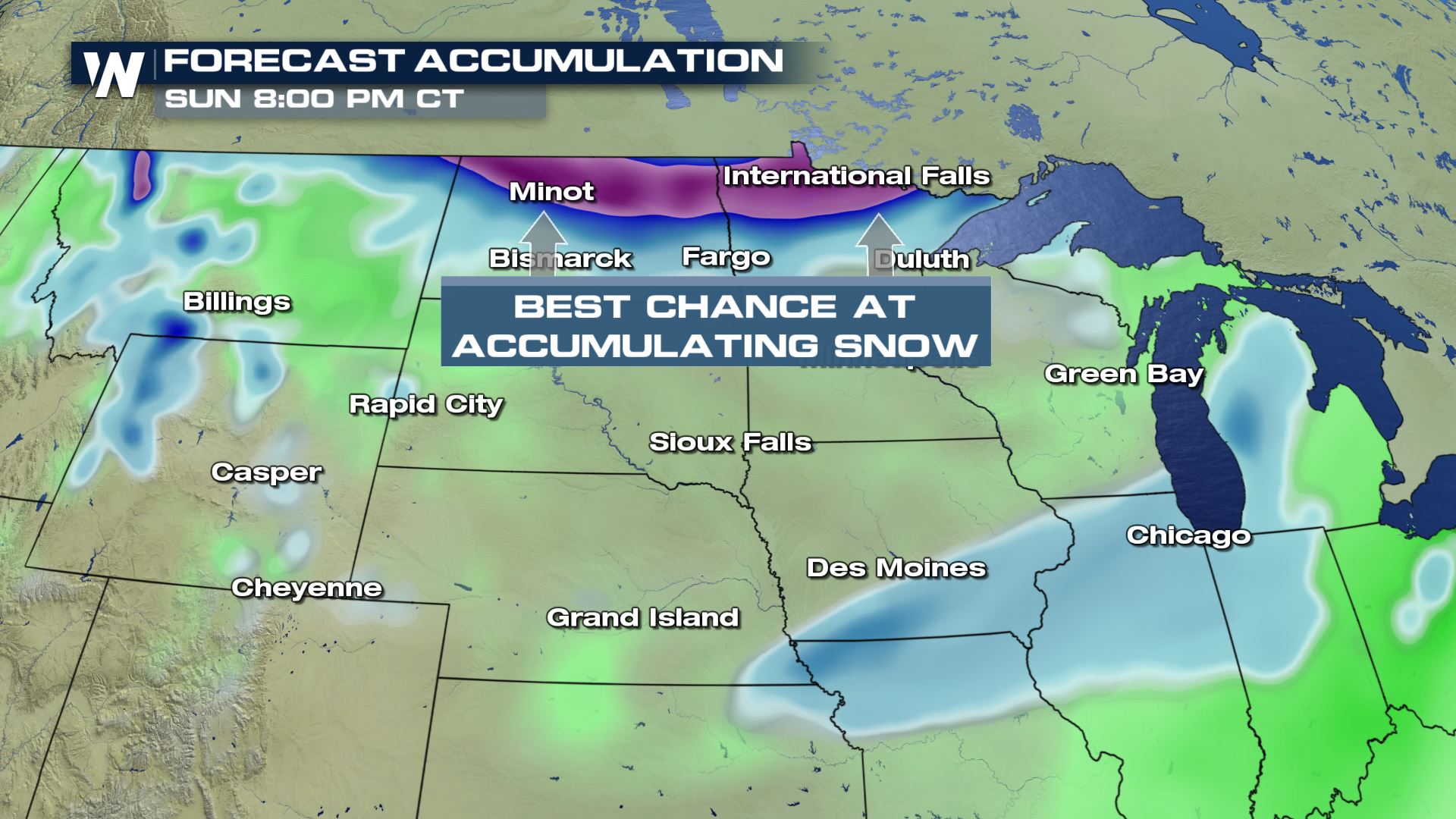
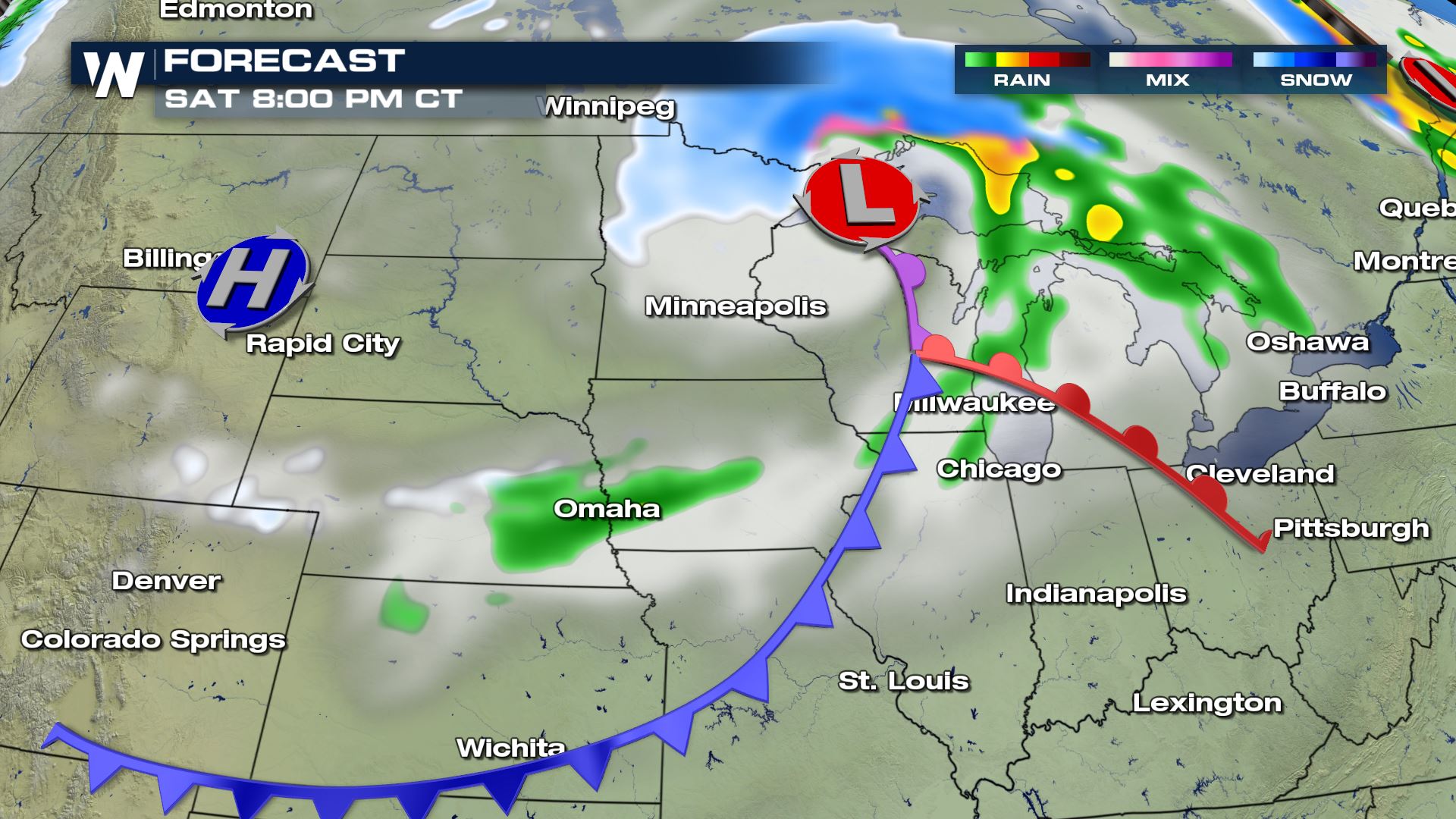
By Saturday morning, as the low moves from South Dakota into Minnesota and Iowa, the snow is expected to spread into Minnesota, Wisconsin, and the Upper Peninsula of Michigan.
As the low pivots to the north toward Lake Superior Saturday afternoon, additional snow could wrap around the low and spread east through early Sunday.
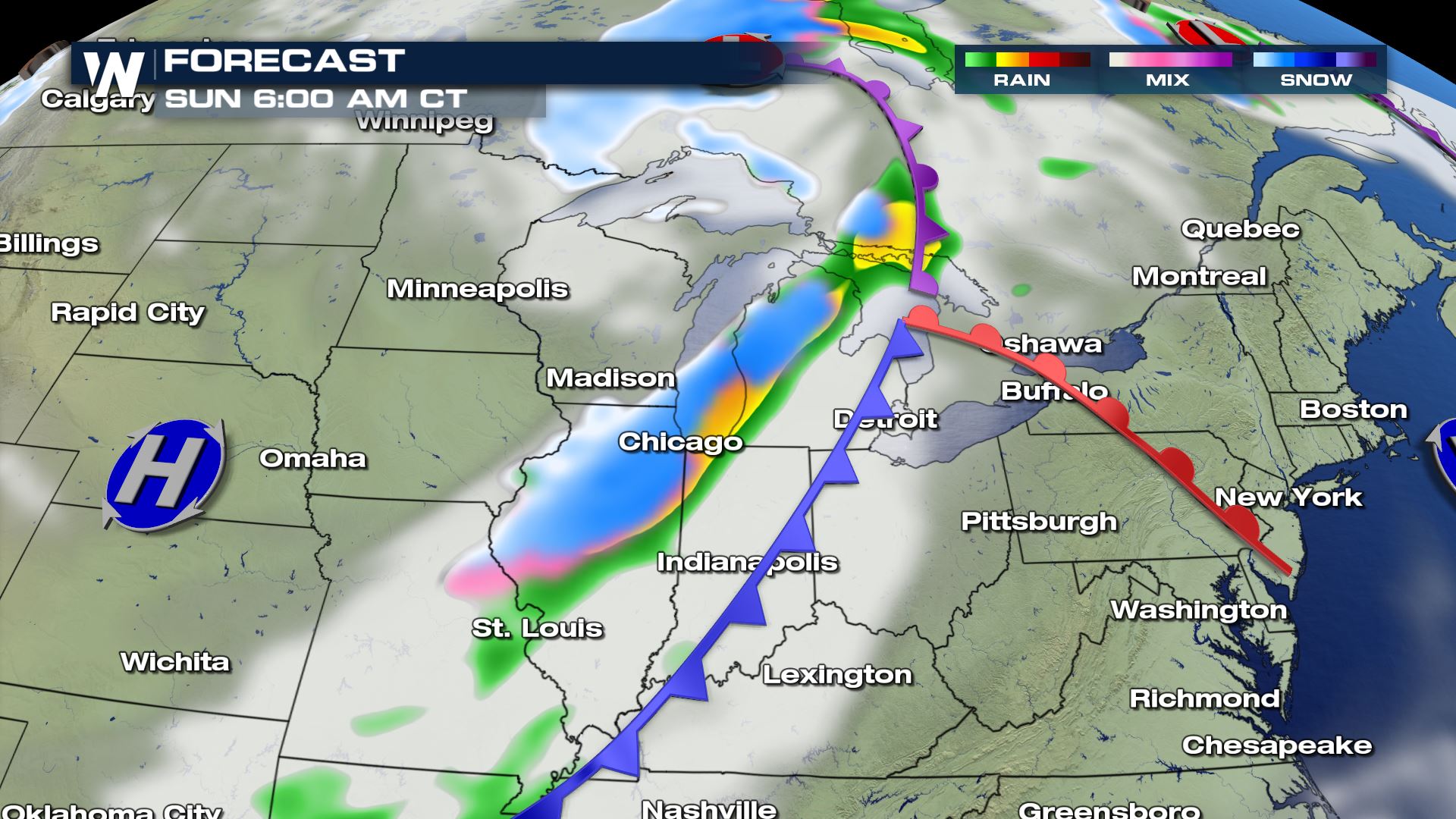
Additional snow showers could follow the low into Sunday afternoon, though the trailing snow is expected to be scattered and light, with little accumulation possible.
Snow totals are expected to range from a dusting to up to six inches in some locations, though confidence is currently low on exactly where and how much will be able to accumulate. Model differences should be resolved in the days ahead to help fine-tune these forecast details, although mild ground temperatures may limit how much snow is able to stick. Either way, through this region from Friday through early Sunday may be impacted by the wintry precipitation.
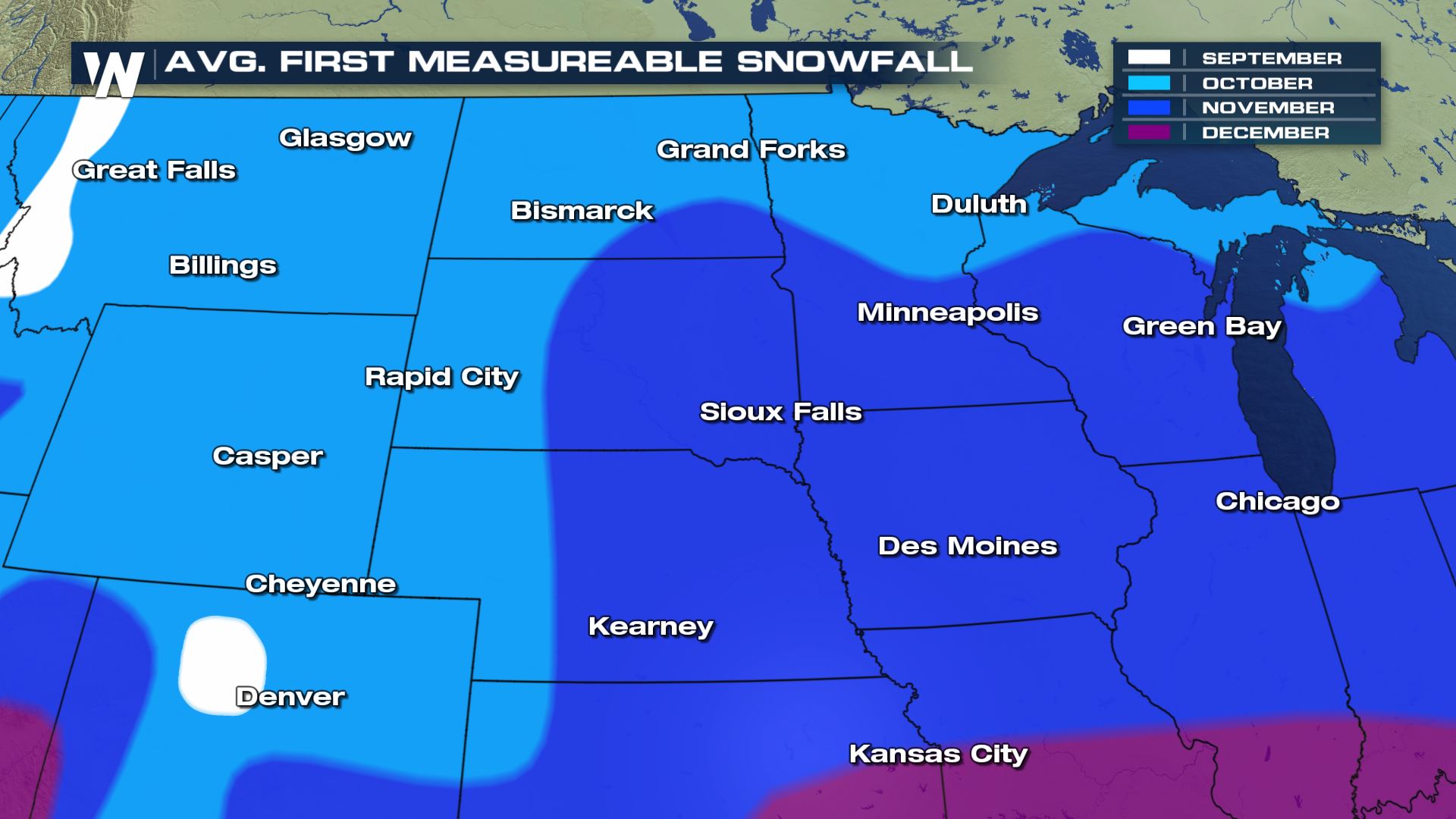
If the snow is able to accumulate, it would be the first measurable snowfall of the season for many across the Northern Plains and Upper-Midwest. The average first measurable snowfall of the year in Bismark is October 28th. In Duluth, the average is October 24th, and in Minneapolis, the average date is November 4th, though the average date for an inch of snow is November 18th.
This page will be updated as additional data becomes available and the forecast is adjusted. Stay with WeatherNation on air and online for the latest.


Comments
Something to say?
Log in or Sign up for free