


 User Center
 My Training Class
 Feedback


Increasing Snow Chances for the Northeast Wednesday
A strong shortwave and surface cold front will sweep across the Great Lakes and into the northeast overnight tonight and early Wednesday morning. This will likely lead to some bursts of heavy snow across New York State and into the rest of the northeast. Here is the very latest on this forecast.
Next System
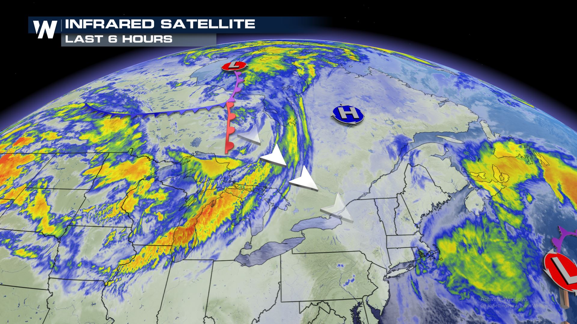
The system that will bring the snow is moving through Canada today and should start to impact the Great Lakes later tonight.
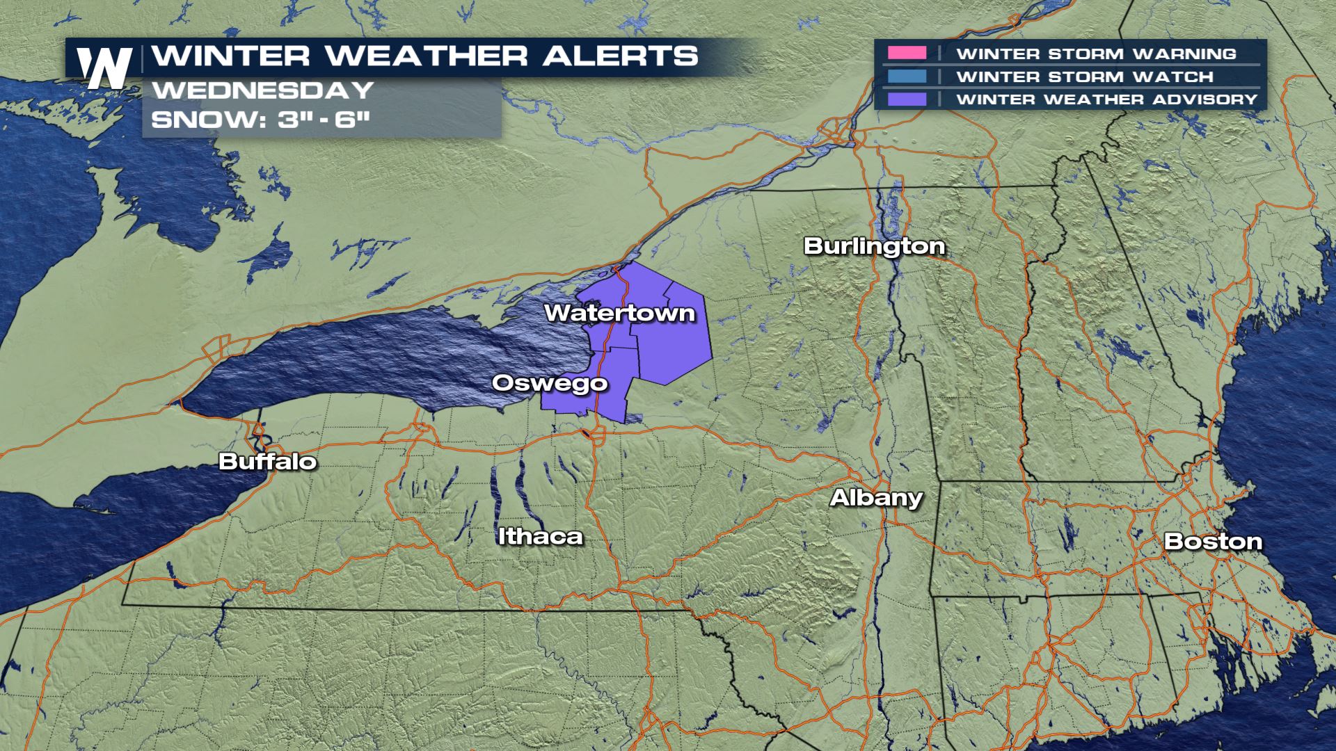
Winter Weather Alerts
Winter Weather Advisories have been issued for upstate New York. This includes the Tug Hill Plateau and the higher terrain. Up to 3-6″ can be expected in these areas with likely less than 3″ in the lower terrain.
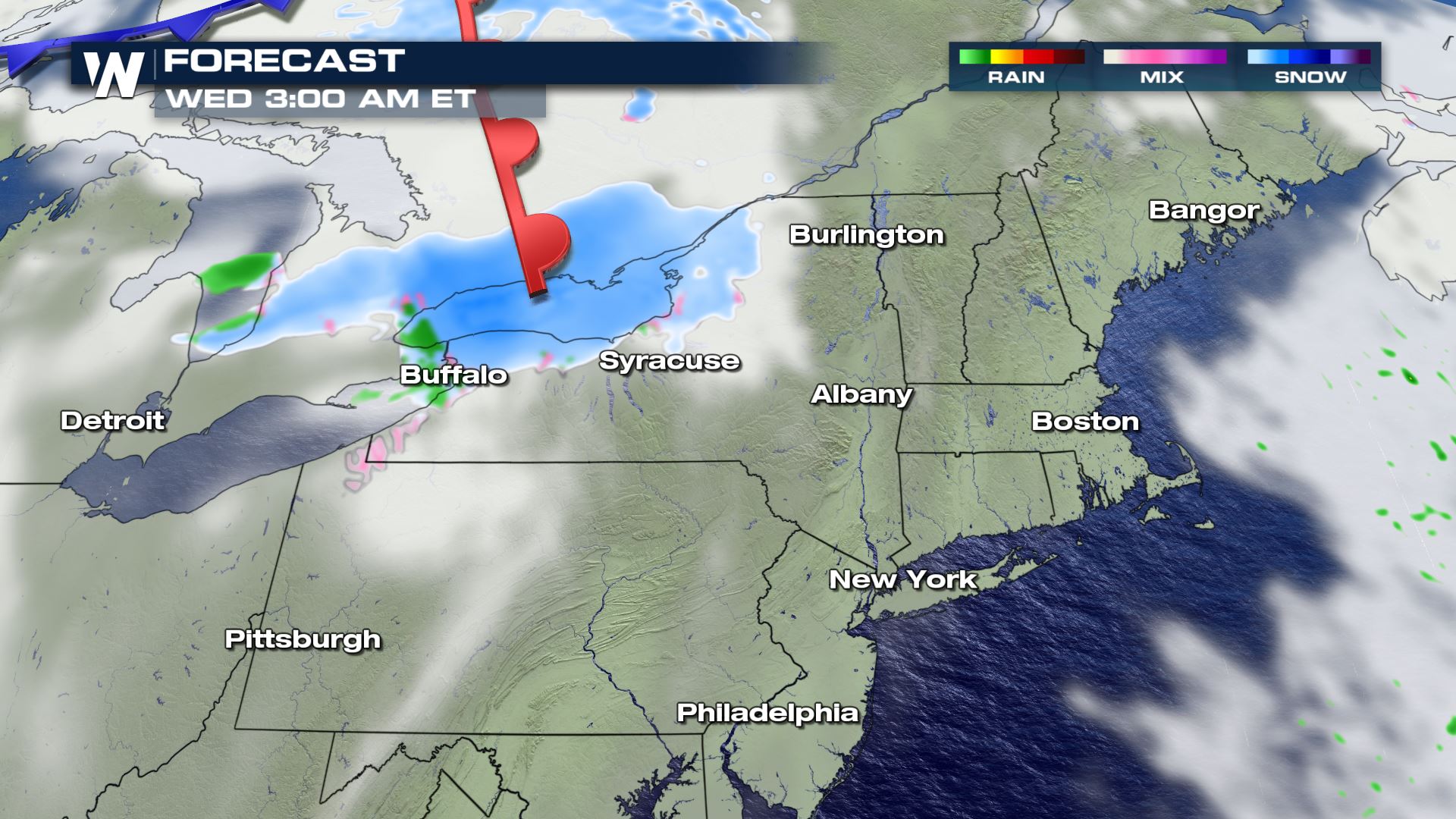
Forecast
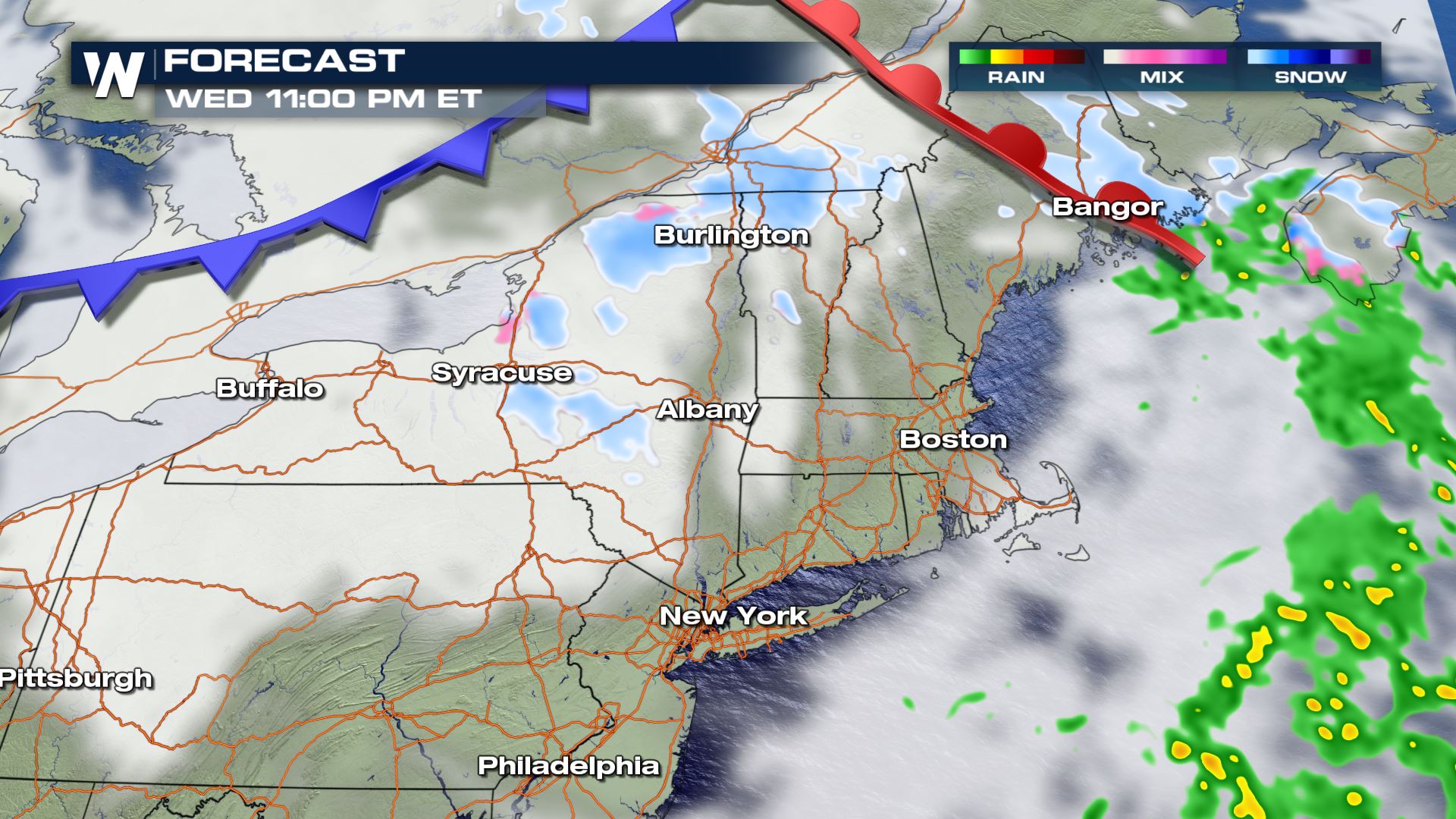
Snow will likely start to move over Lake Ontario around 3:00 AM ET Wednesday and through dawn we will see more fill in across the Tug Hill and through Upstate New York. This includes Buffalo through Syracuse and quickly into northern Vermont.
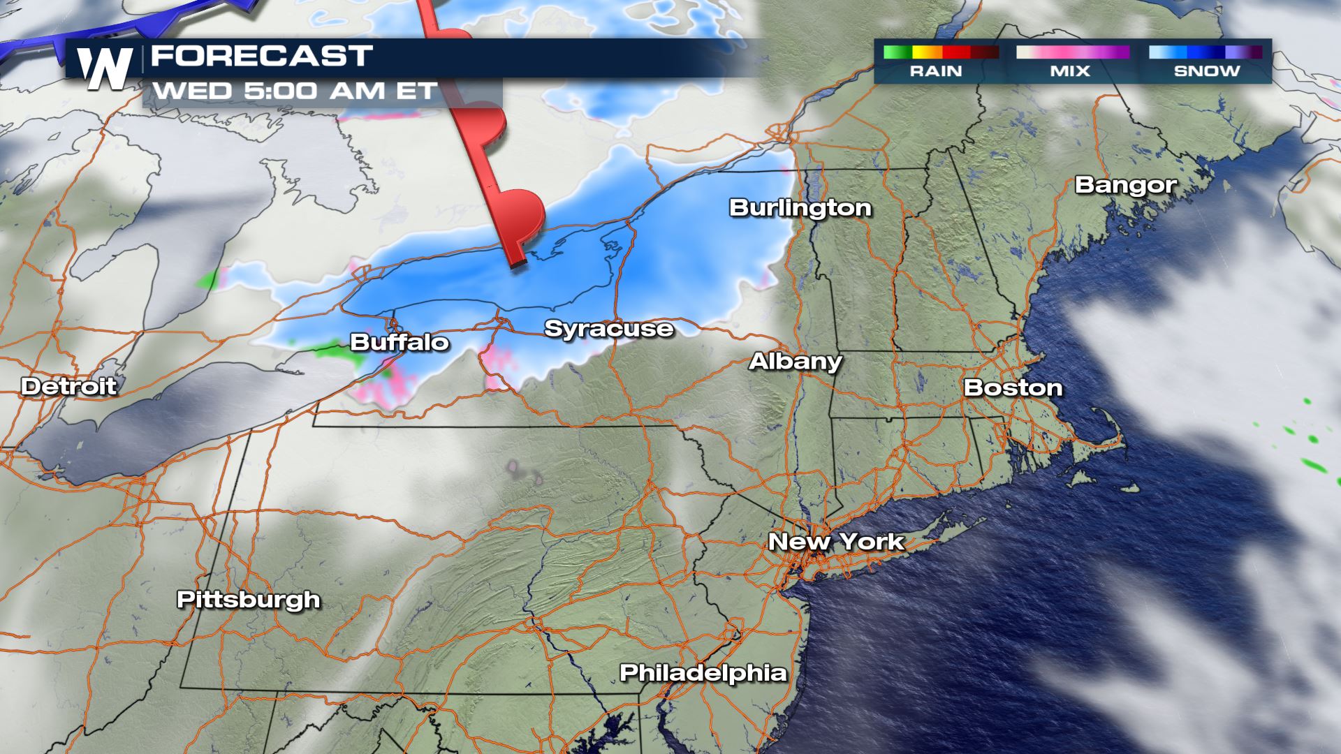
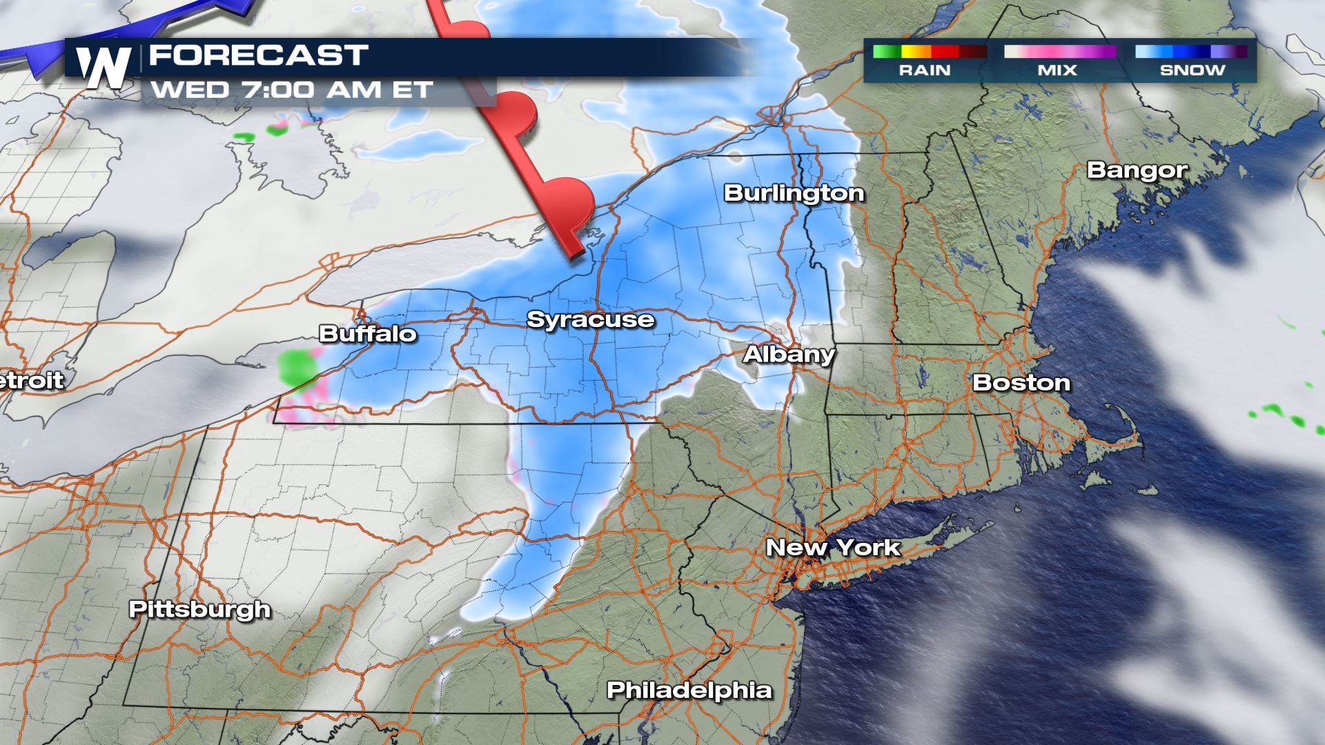
After sunrise, snow extends as far south as Pennsylvania and crosses into Vermont and New Hampshire. By late morning, we can expect snow to filer into Massachusetts, Connecticut, and the rest of New England.
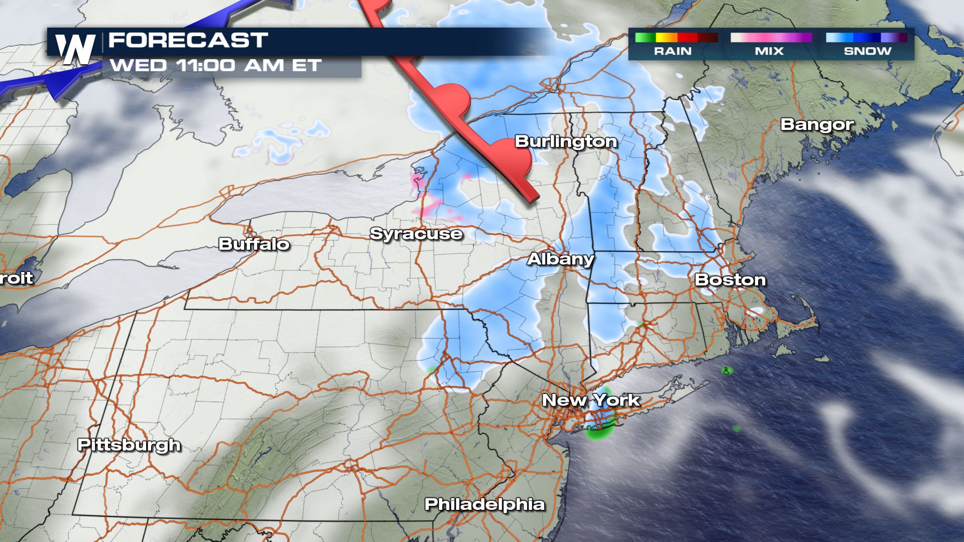
By the afternoon, the warm front continues to bring some lift for snow.
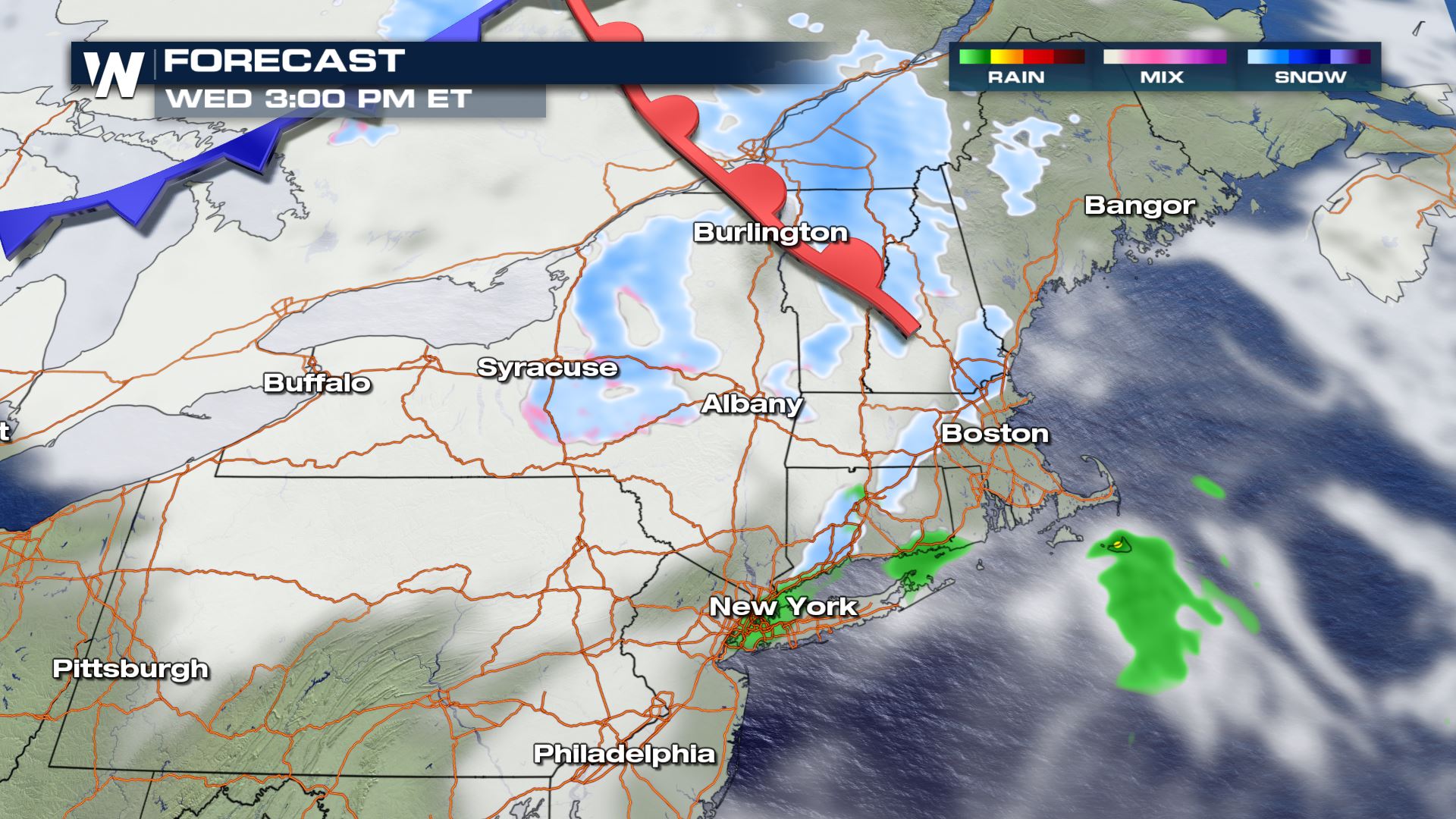
Overnight the trailing cold front moves over the Great Lakes and brings additional northwesterly winds which may bring a few more lake enhanced snow bands through the northeast. Snow should be tapering off overnight and into early Thursday morning.
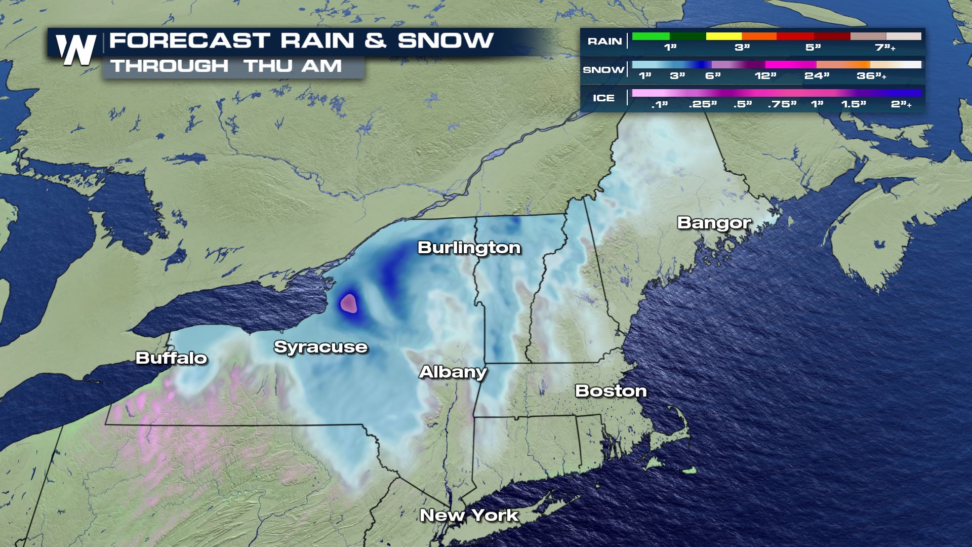
Snowfall Potential
Snowfall totals will likely range from 1-3″ in the lower terrain, but some isolated spots could see some higher totals between 3-6″. Nonetheless, the snow will likely lead to some travel headaches during the Wednesday morning commute.
Tune-in to WeatherNation for more updates the wintry weather during your top weather headlines and always 10 minutes past the hour in your Eastern Regional Forecast!


Comments
Something to say?
Log in or Sign up for free