


 User Center
 My Training Class
 Feedback


Beneficial Moisture Coming to Southwest U.S.
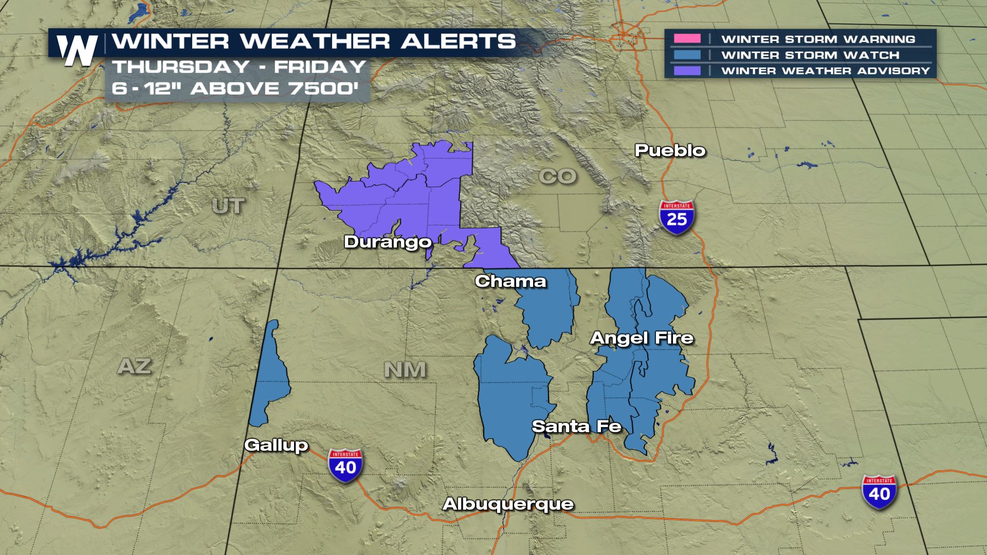
As extreme drought continues across portions of the Southwest United States, some much-needed precipitation will fall from the sky and onto the arid ground. Thursday and Friday will hold our best chances for rain and snow. In fact, winter weather alerts have been issued for parts of the Four Corners. Take a look:
A unique weather pattern is upon us. There has been an upper-level low pressure system, in this case referred to as a cut off low, sitting south of California this week. As a result, it has given southern California strong wind while increasing the fire danger. That area of low pressure is now starting to move again, now taking aim at the Four Corners of the United States.
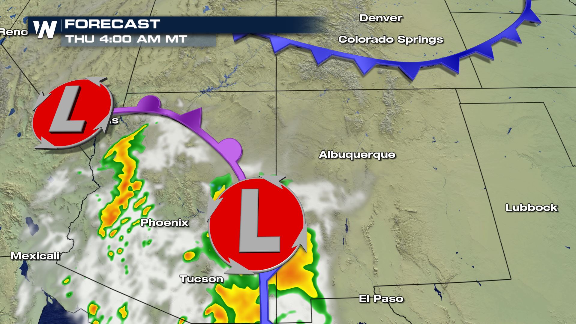
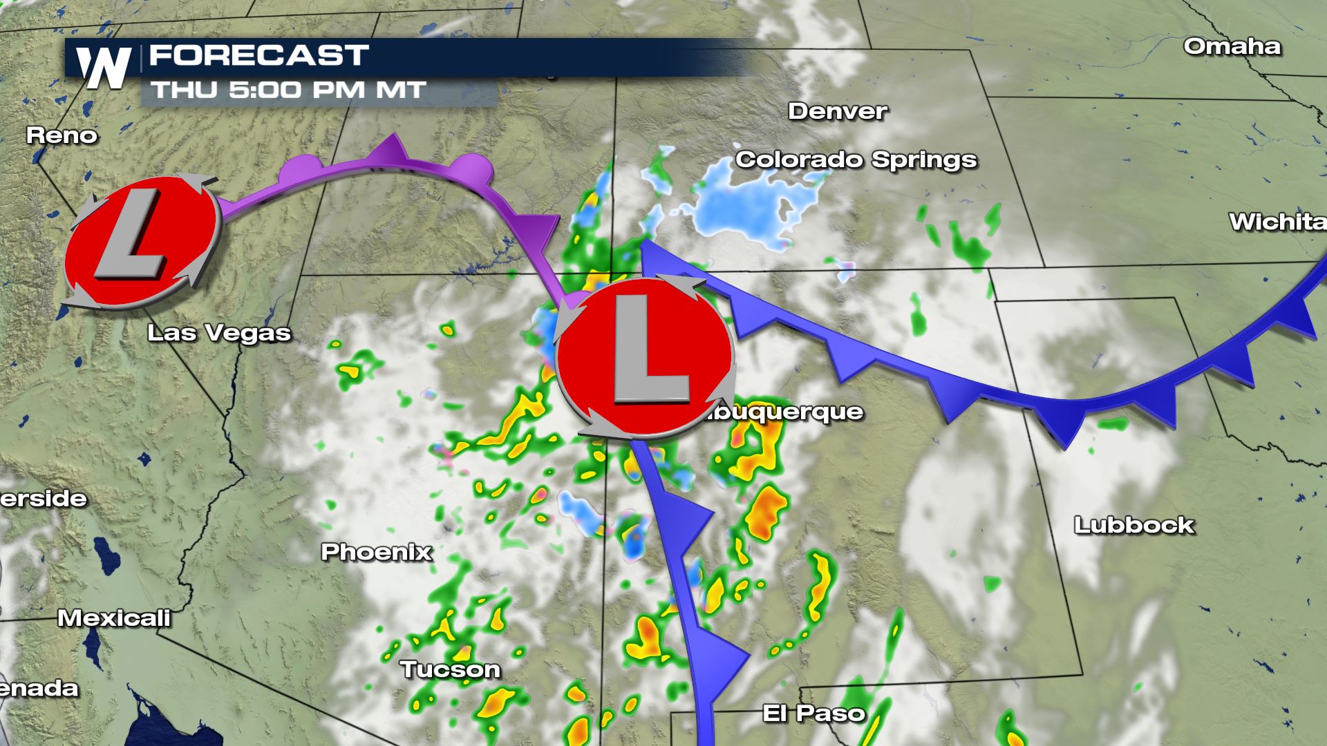
On Thursday low pressure will move across Arizona, spreading scattered rain showers across the valleys and snow showers on the mountains. By Friday, the low pressure will be affecting Colorado and New Mexico.
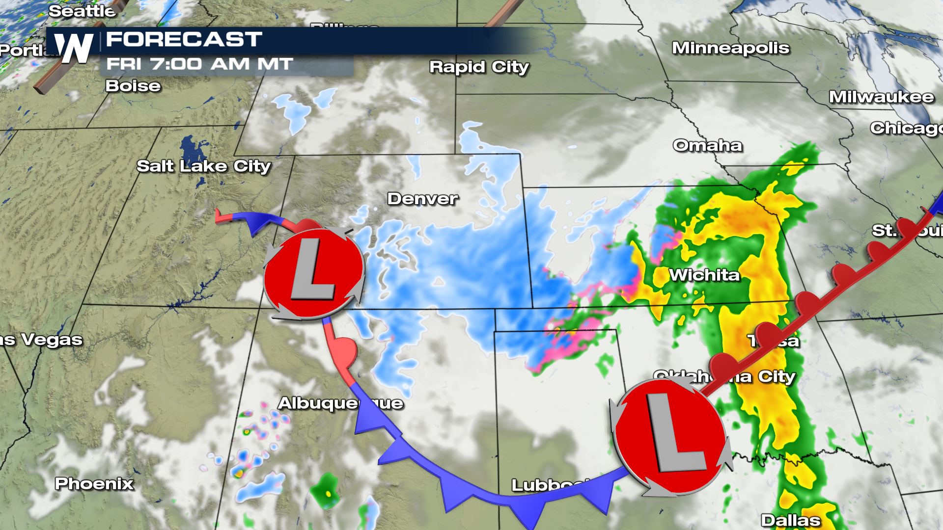

The storm’s center, indicated by the ‘L’ on the map, will continue to gain strength Friday as it moves across the eastern Four Corners and western Plains.
Related Story: Heavy Snow Plains, Midwest This Week
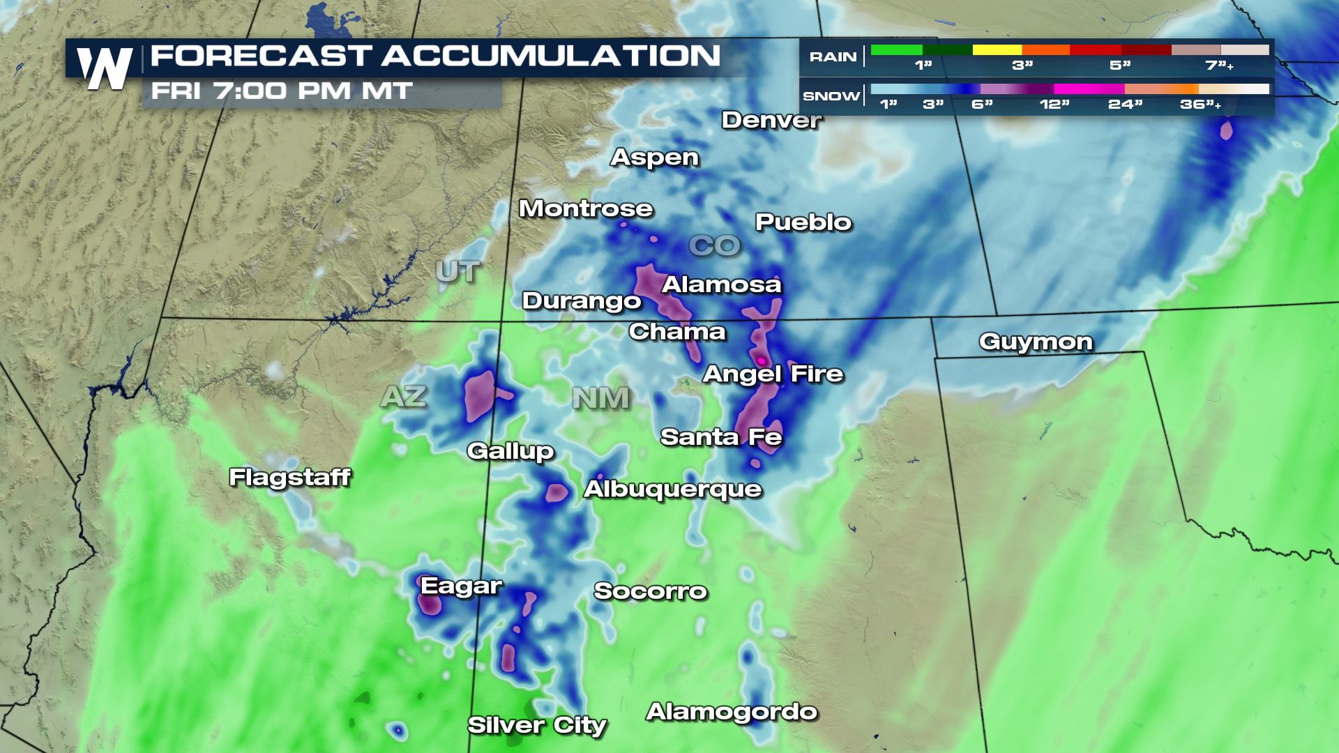
The biggest takeaways from this storm system will be the extent of which it spreads wintry conditions. Especially for these drought-stricken areas of the Southwest, it hasn’t rained/snowed too often. As a result, you’ll want to be prepared for winter driving conditions if you must travel. Dust off those winter driving skills you have!
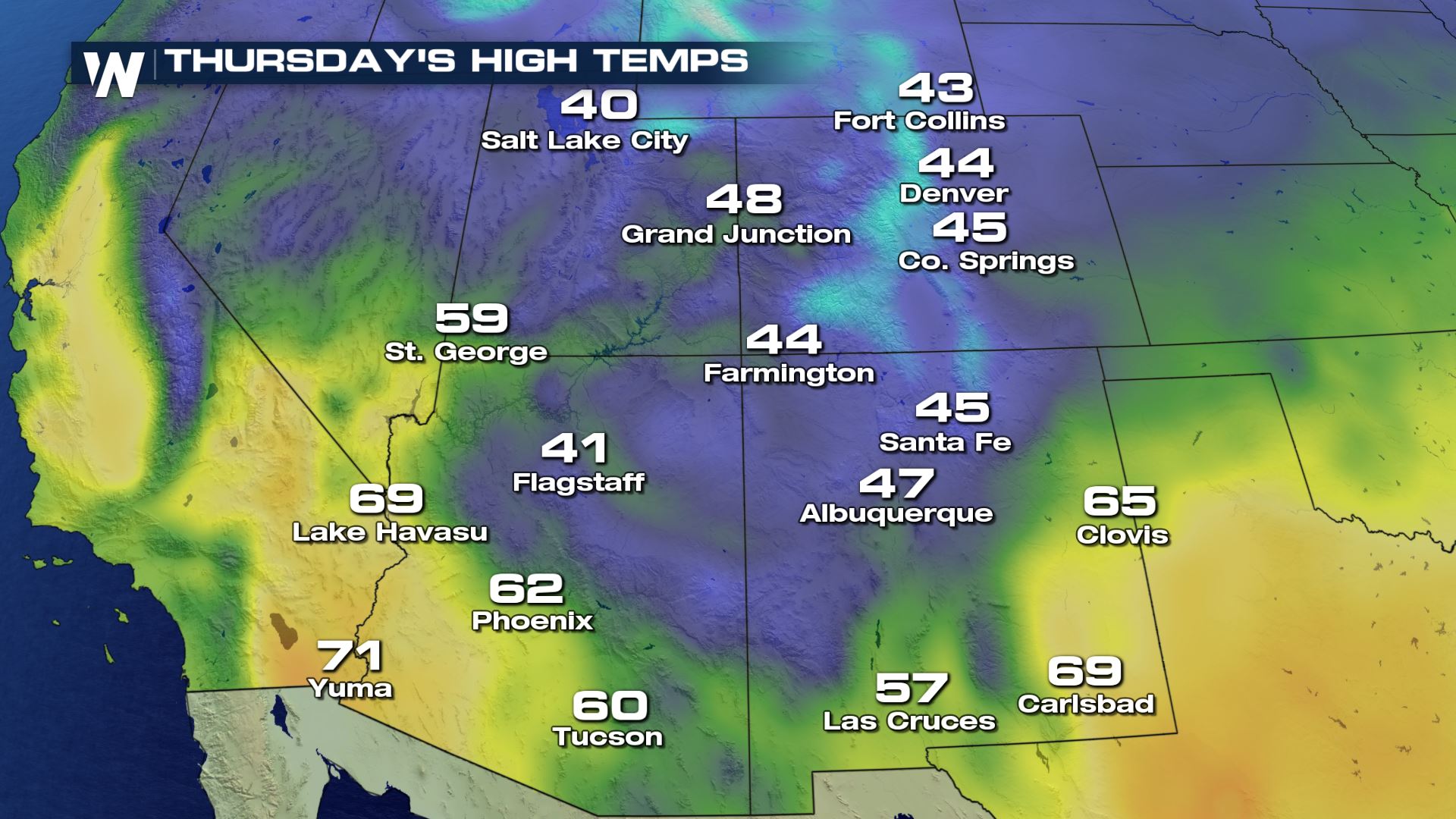
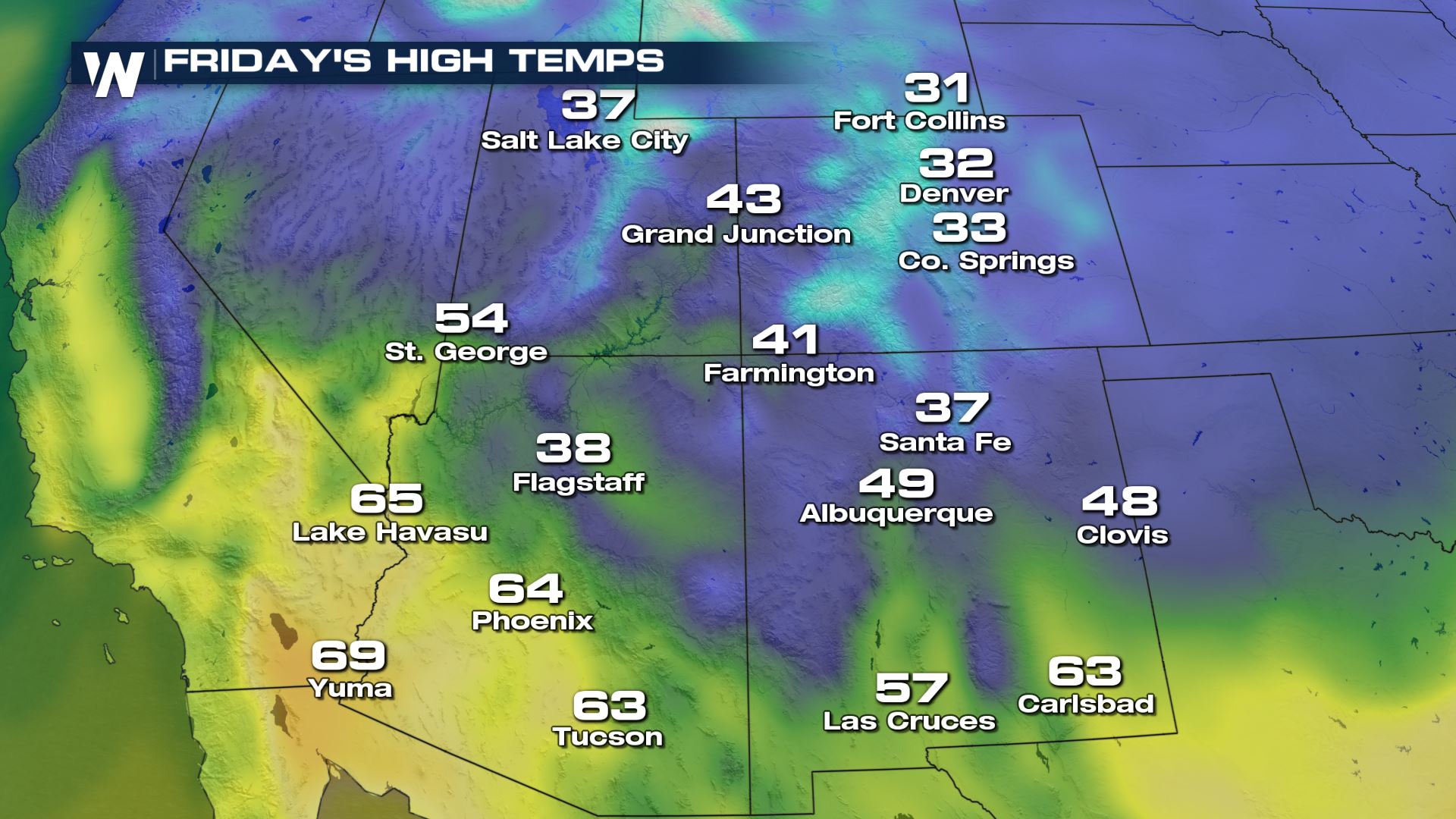
Cold air will settle into place the next couple of days, coming in from the Northwest U.S.
Related Story: Rain, Snow, Ice for the Northwest
The combination of the cold air and moisture will result in accumulating snowfall Thursday and Friday. Here’s a look at one weather model’s guidance on how much snow may accumulate.
Of course, the weather doesn’t stop here. Stay with us here at WeatherNation as we take you through the rest of this storm’s forecast rain, snow, and impacts heading into this weekend.


Comments
Something to say?
Log in or Sign up for free