


 User Center
 My Training Class
 Feedback


Severe Risk Midweek Across the Southeast

As 2020 comes to a close, the weather remains active with a multi-day threat of severe storms across the south into the southeast starting on Tuesday.
We have a front that will bring in ingredients needed for severe storms to develop, including a strong clash of air masses.
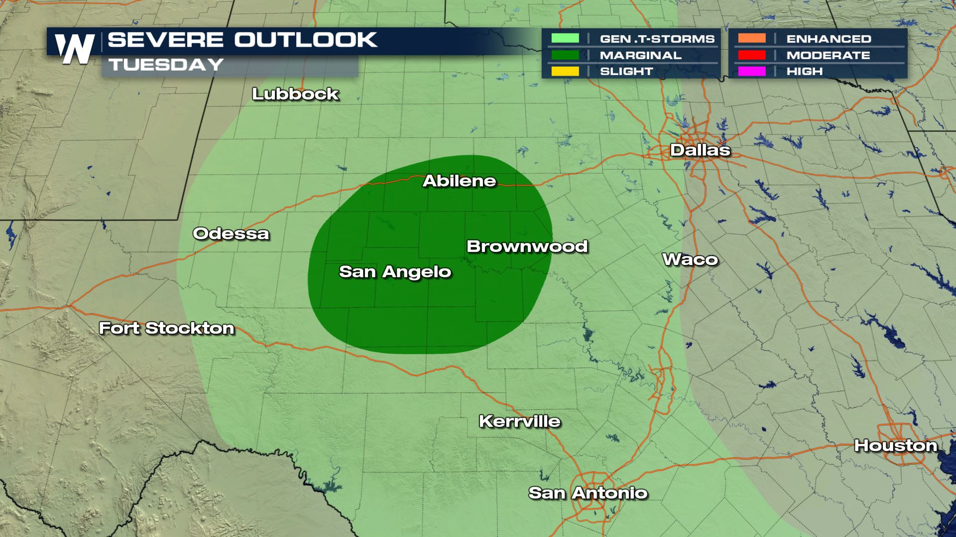
The risk for severe storms on Tuesday would be later in the day overnight into the morning hours on Wednesday. The biggest concerns with storms that do turn severe would be for damaging wind gusts and large hail.
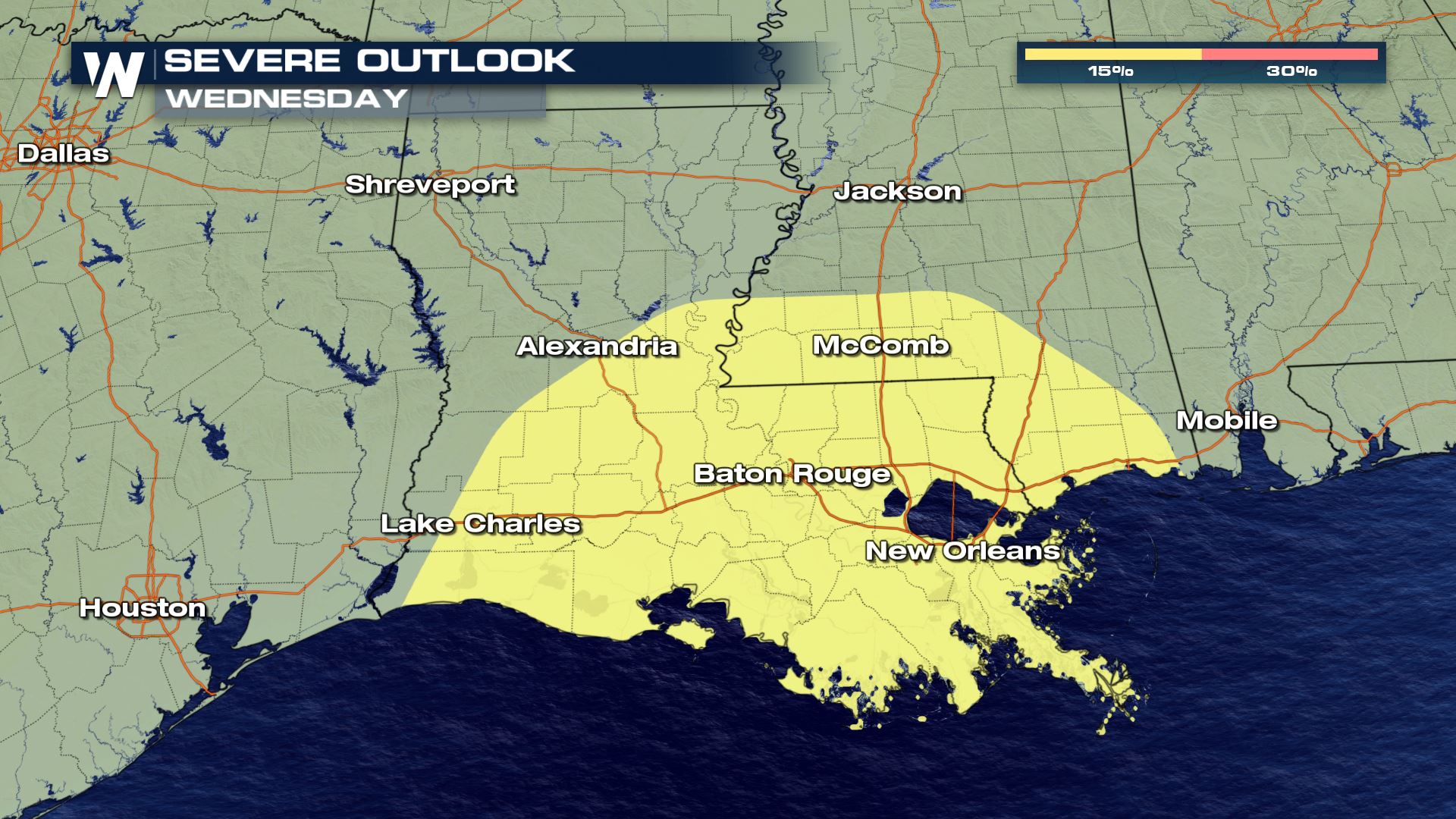
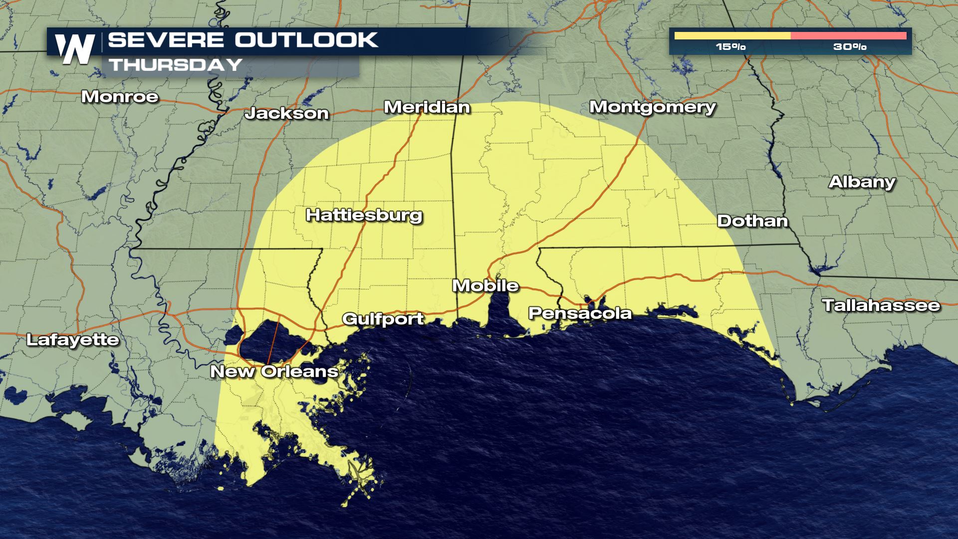
The risk continues not only Wednesday, but also into New Year’s Eve on Thursday as well along the Gulf Coast from Louisiana into the Panhandle of Florida. The threat with these storms would mainly be for isolated powerful wind gusts and a few tornadoes.
Stay with WeatherNation for the latest updates on this developing system and make sure to have multiple ways to get warnings.


Comments
Something to say?
Log in or Sign up for free