


 User Center
 My Training Class
 Feedback


Snow Expected Across The Plains Through The Ozarks
A cold front is sweeping itself through the Plains today bringing along cooling temperatures and the potential for some wintry weather. A surface low is expected to develop and enhance snowfall. Alongside this surface front, an upper level trough is sending in some cooler temperatures from the north to also help with snowfall chances.
Forecast
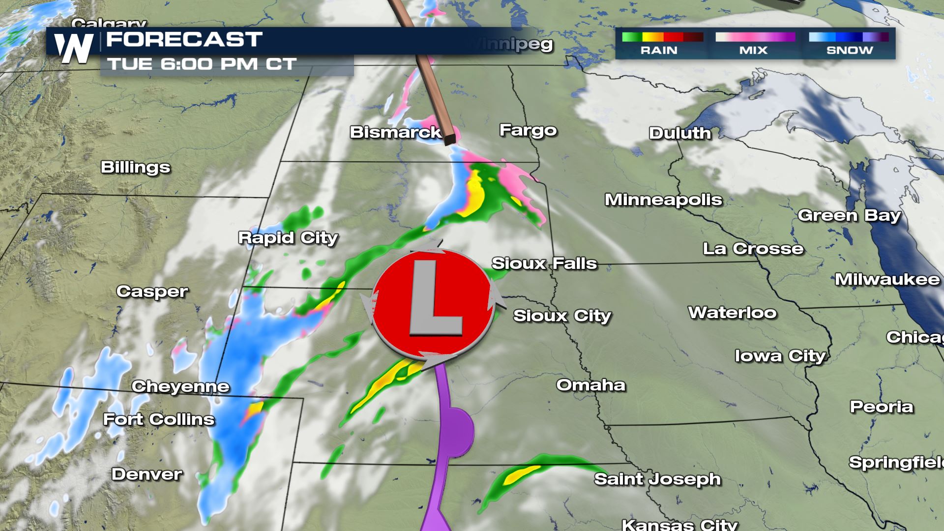
The storm will bring some snow first to North and South Dakota later this Tuesday and into tonight. The surface low develops over South Dakota and brings some snow to western Nebraska and the Dakotas.
After dark, in cooler atmosphere’s where surface temperatures drop below freezing we will see some additional snow flurries and start to see some accumulative snow.
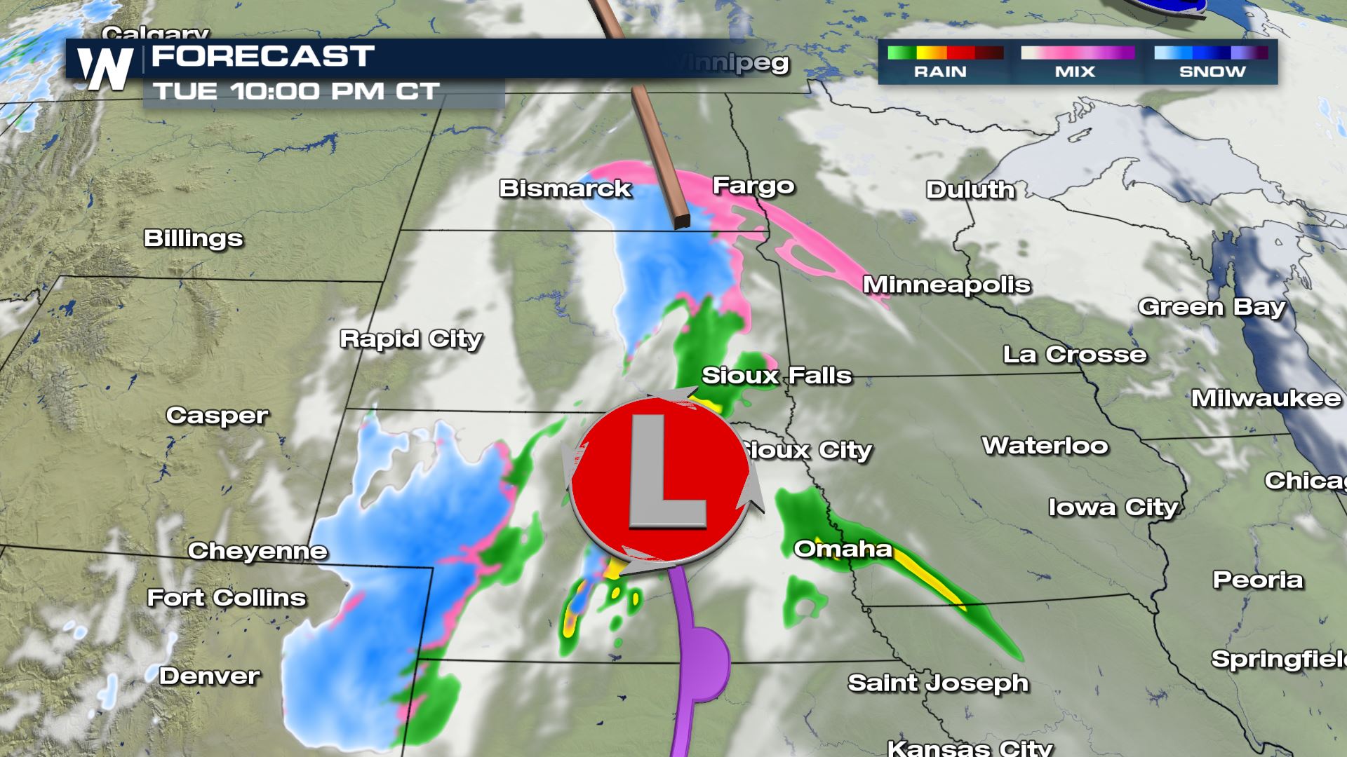
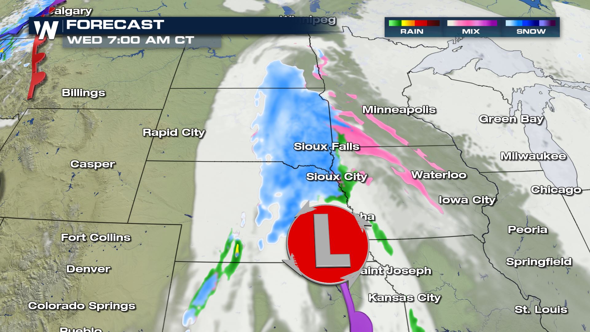
Into the early morning hours of Wednesday, Sioux Falls and Sioux City will city under the center of this low pressure system. Temperatures will be chilly enough to support a wintry mix and possible some wet snow.
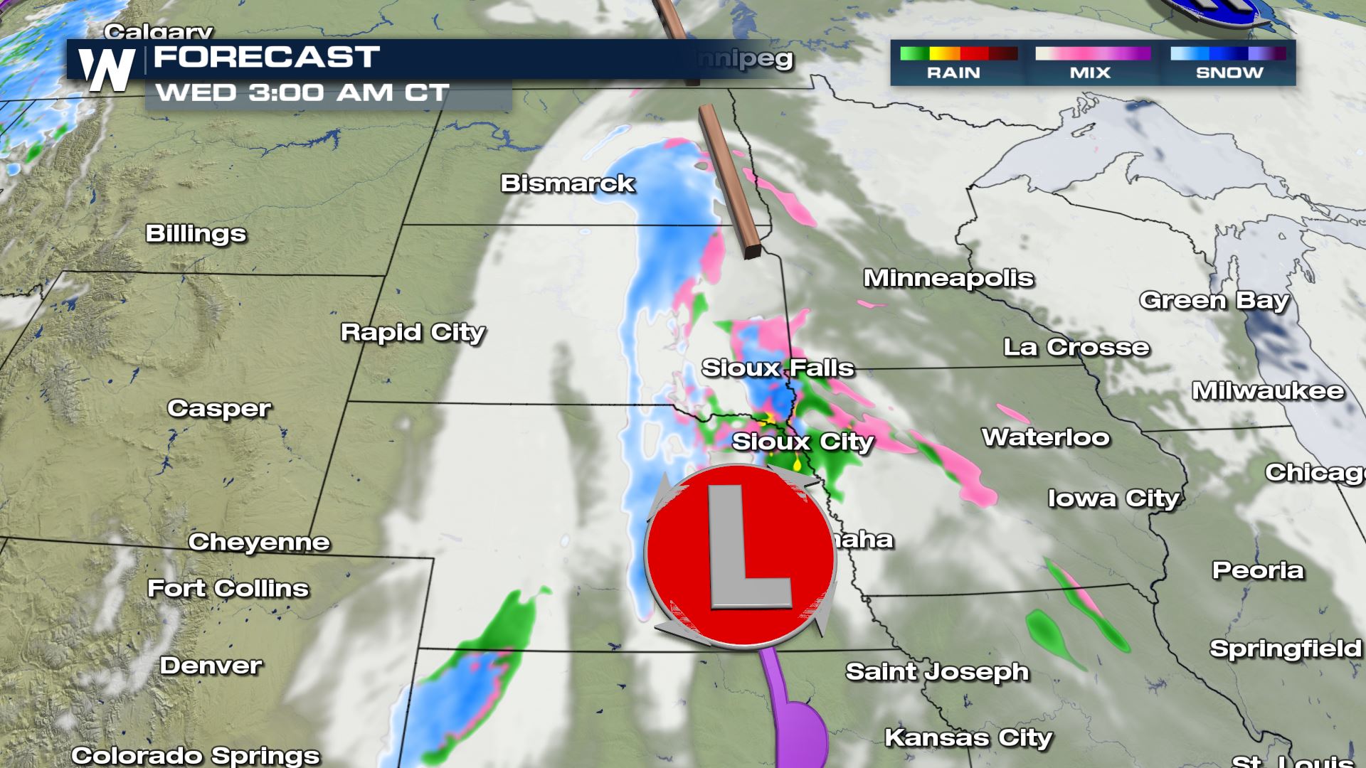
By sunrise Wednesday, snow bands fill in across the High Plains and even Minnesota and Iowa tap into some light wintry mix flurries. Sioux Falls and Sioux City are seeing mostly snow Wednesday morning.
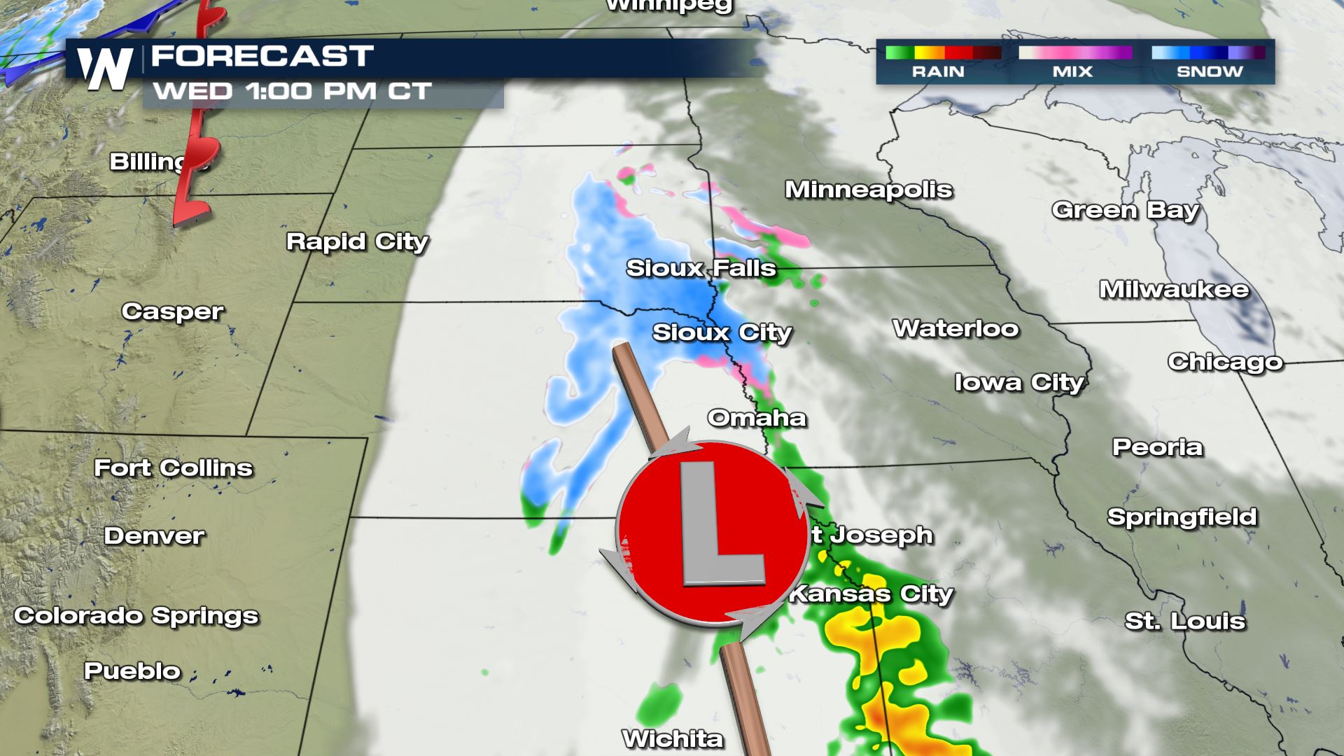
Our low continues to dive south into the Ozarks throughout the day. Initially temperatures in Missouri will be too warm to support snowfall. So Kansas City is expected to mostly see rain throughout the day.
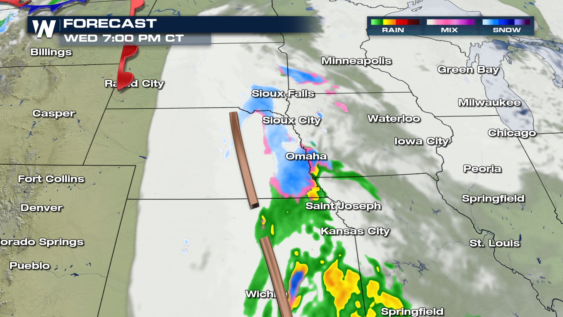
Then, after we lose some daytime heating and head overnight into Thursday morning, central and eastern Kansas sees snow. A few flurries start to overcome the melting layer in southern Missouri and northern Arkansas but still mostly rain.
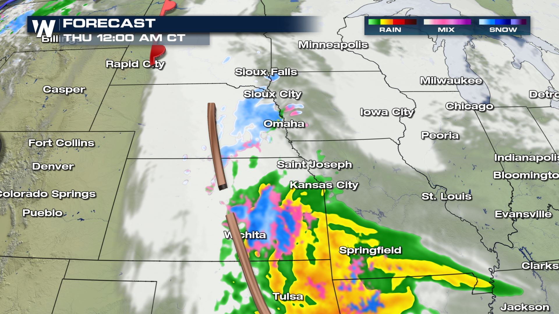
Just before sunrise, snow bands take over the rain from Springfield, Missouri to Tulsa, Oklahoma and event Oklahoma City may see yet another winter weather system into Thursday.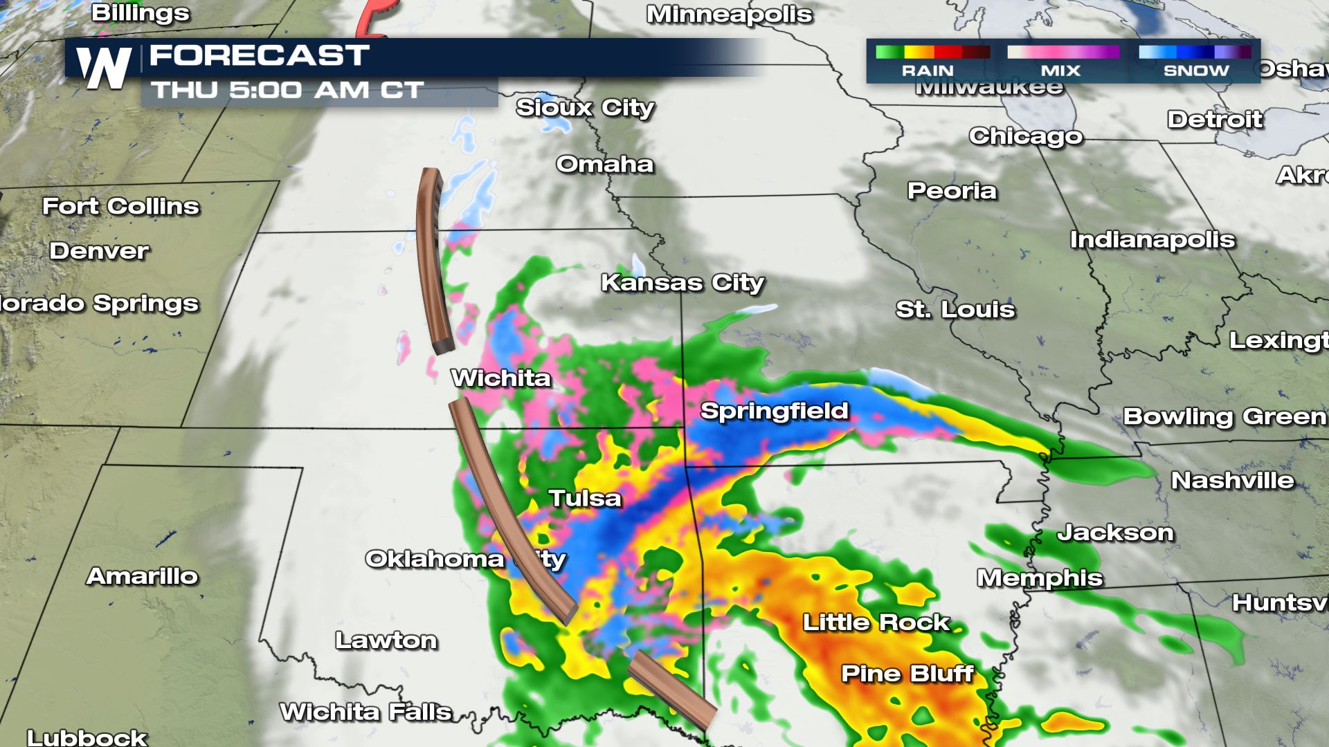
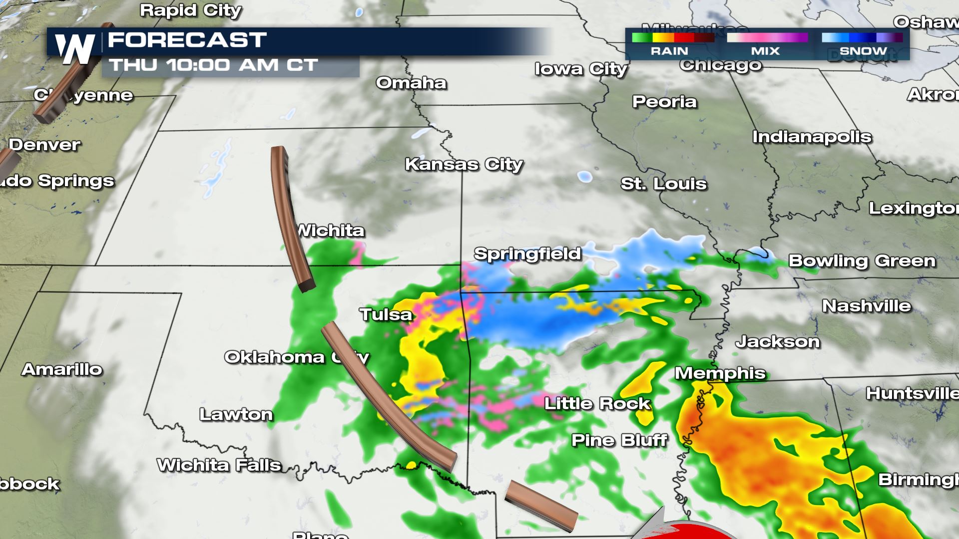
Once snow start to accumulate into Thursday mid-morning that will keep the ground cold enough to see snowfall accumulations across the Ozarks. Especially because the terrain in the hilly and mountainous areas will see slightly cooler temperatures so we will likely accumulate some snow in Northern Arkansas and Southern Missouri.
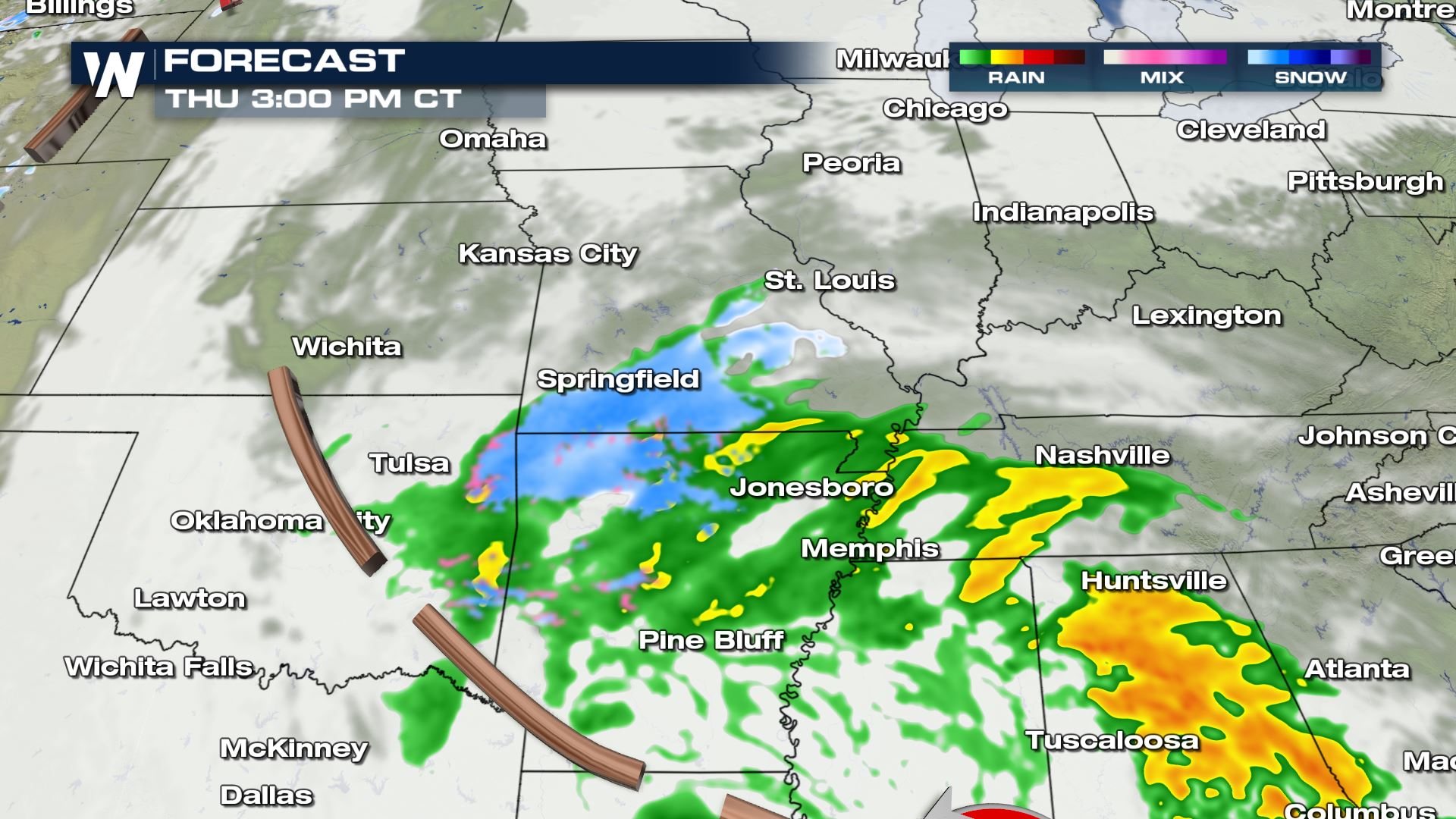
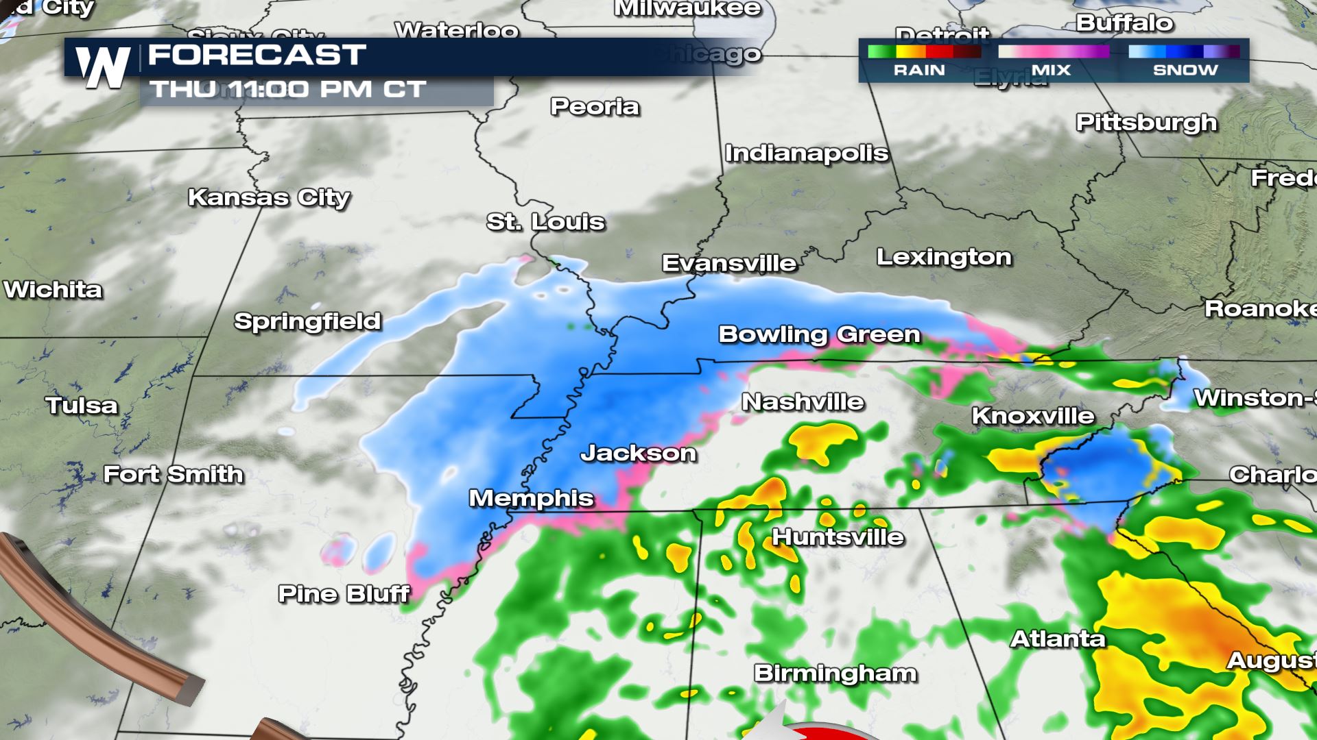
Thursday afternoon and evening we continue to track this low as it heads east toward the Tennessee Valley starting off as mostly rain before nighttime temperatures drop to bring in some snowfall.
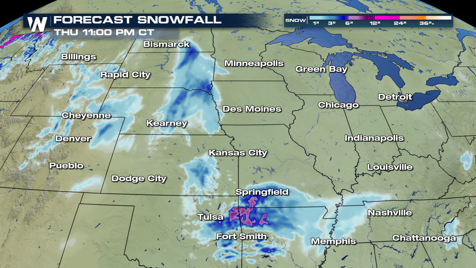
Accumulation Forecast
Here is the latest accumulation forecast. The Dakotas see the first of the snowfall with a couple inches expected before the low quickly dives south towards the Ozarks. For Arkansas and southern Missouri we could see up to 3-5″ of snow.
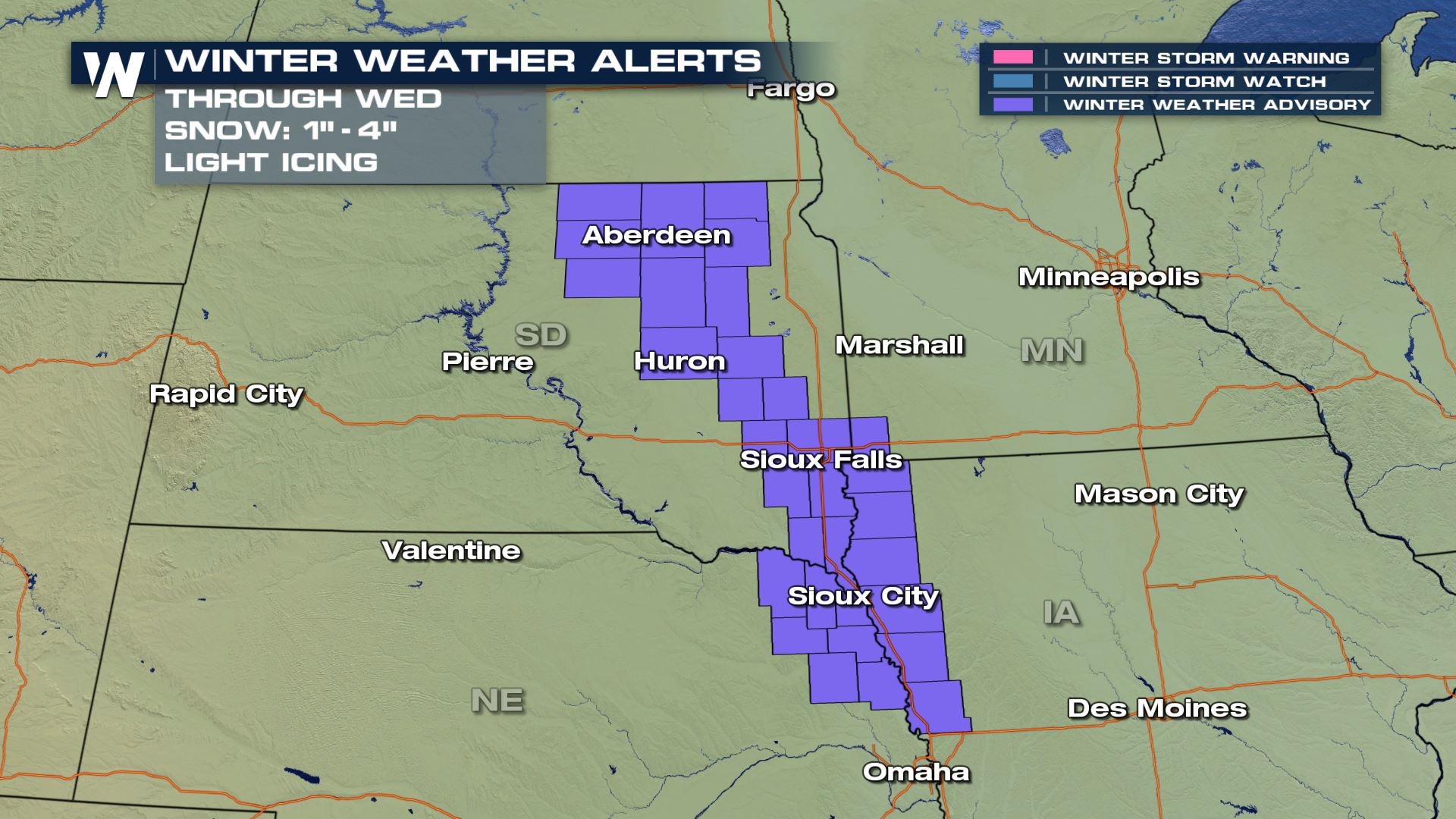
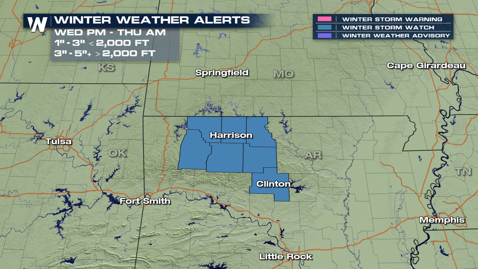
Winter Alerts
For the snow today, tonight and early tomorrow morning the Plains are under Winter Weather Advisories for up to 1-4″ of snow and some light icing possible.
For the Ozarks, Arkansas has Winter Storm Watches issued for Wednesday into Thursday for 3-5″ of snow possible in the higher elevations.
Stay with WeatherNation to keep you updated!


Comments
Something to say?
Log in or Sign up for free