


 User Center
 My Training Class
 Feedback


Midweek Storm Will Bring Rain, Snow and Ice to the North-Central U.S.
The strong storm system impacting the Northwest today will move east and bring widespread precipitation. You would think this time of the year that it would bring all snow, but the big warm-up ahead of this energy will allow rain first before it changes over to snow and ice. Here is the very latest forecast.
Set-Up
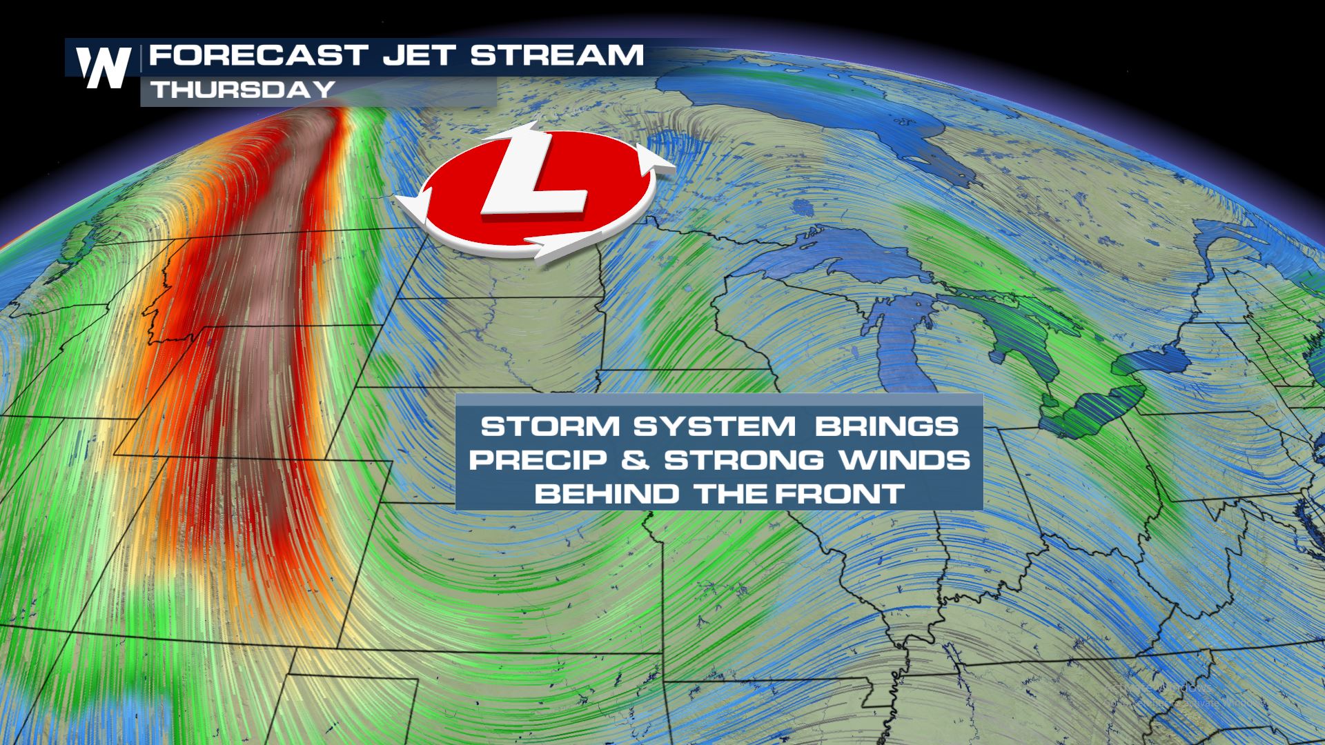
The upper-level trough will be digging out of southern Canada late Wednesday and early Thursday. This will translate into a cold front at the surface which will help to trigger some scattered rain showers.
Rain Side Forecast
Here is a look at the rain forecast before the cold air catches up to change the rain to snow.
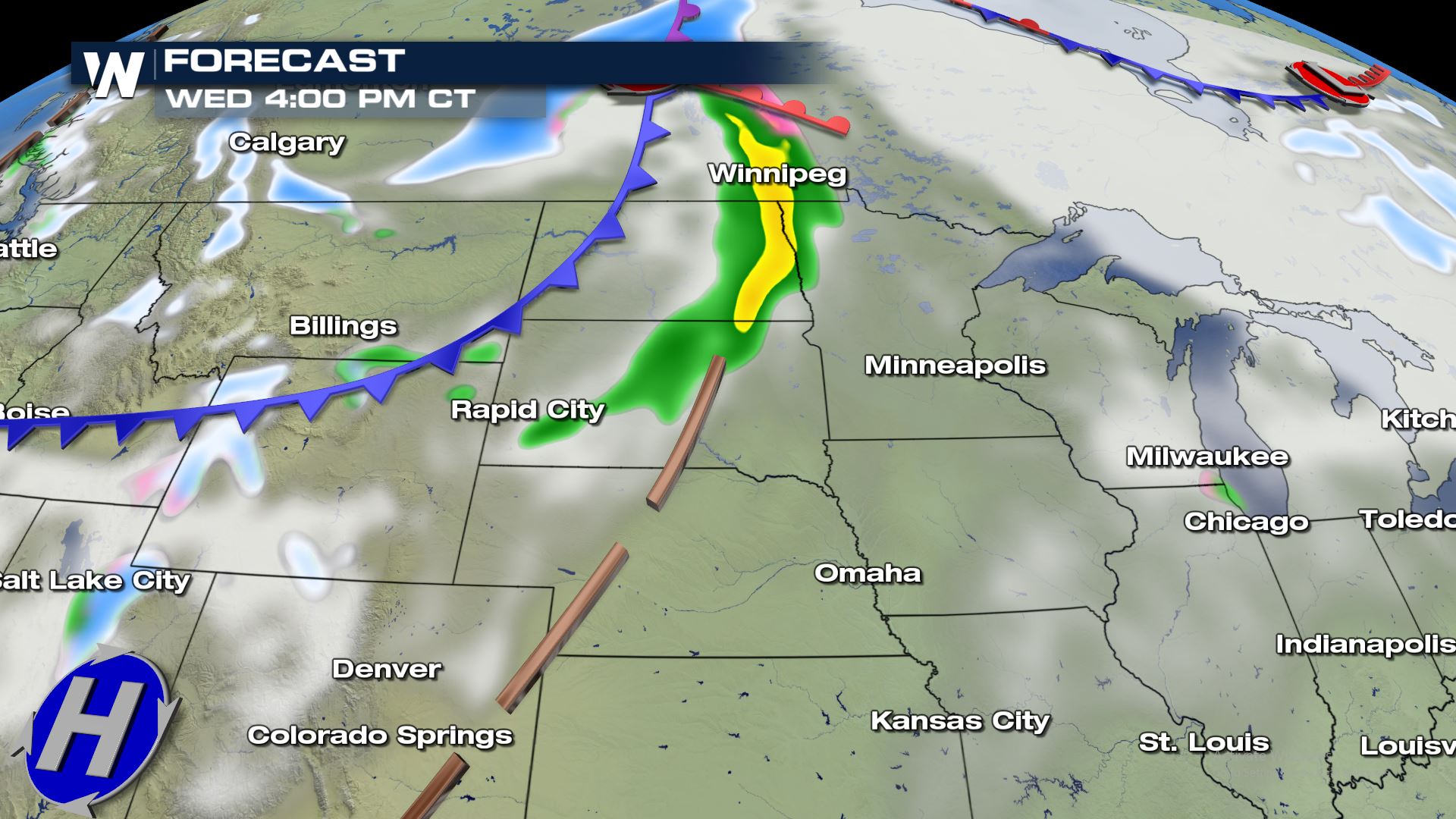
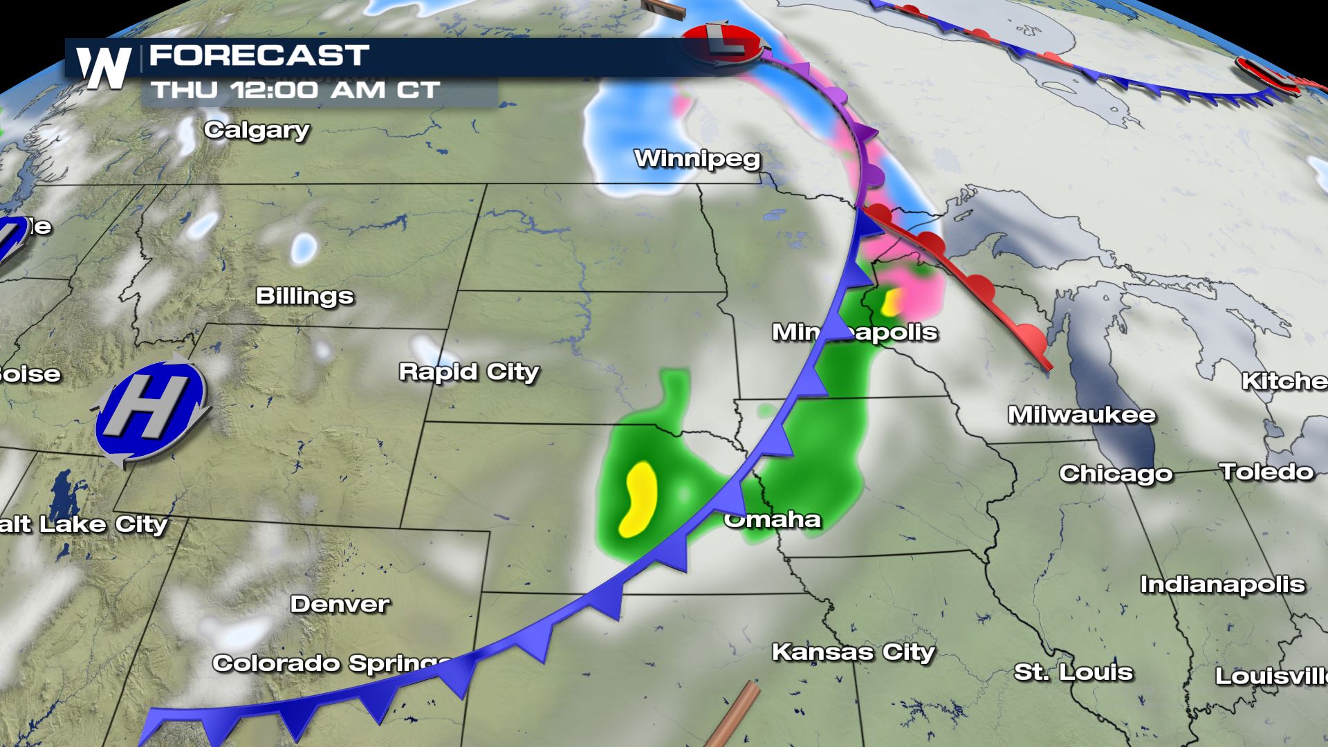
Rain will impact the Northern High Plains and the Upper Mississippi Valley before the snow enters the forecast.
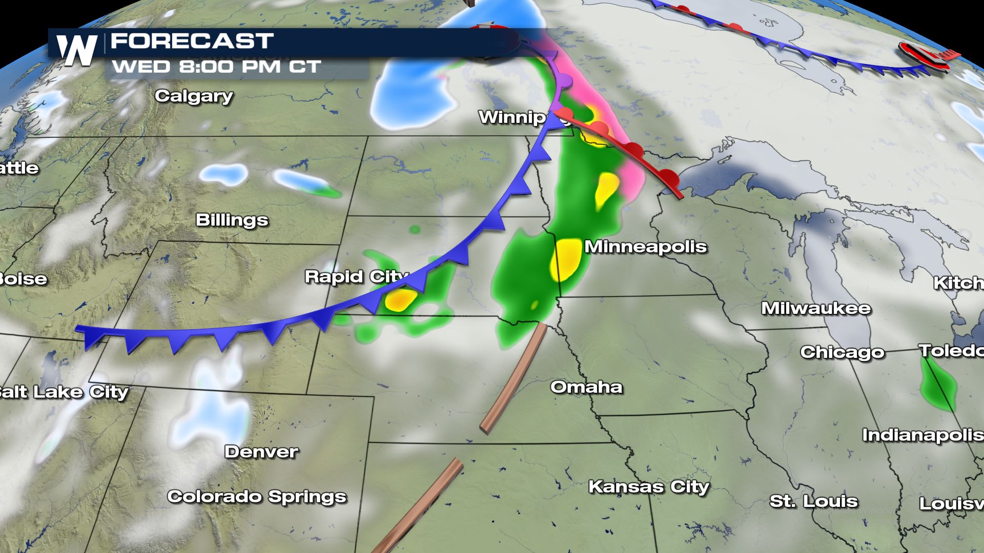
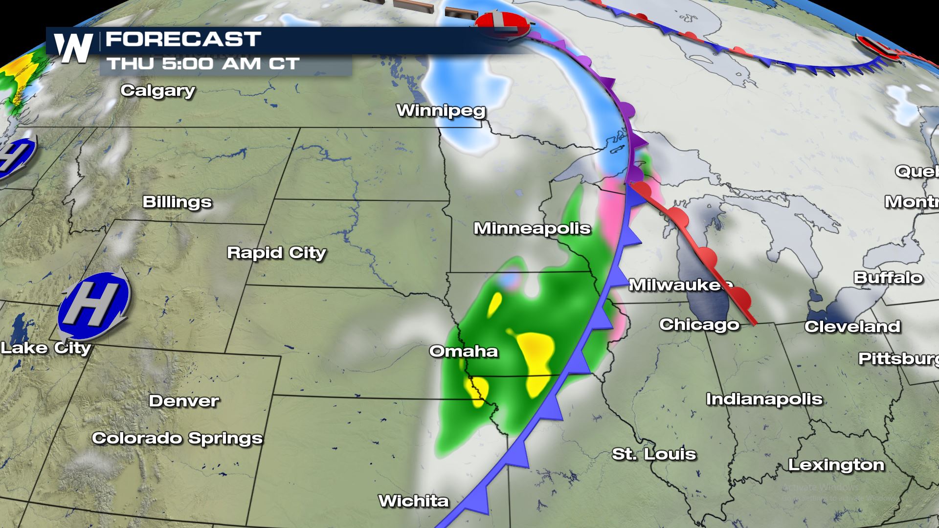
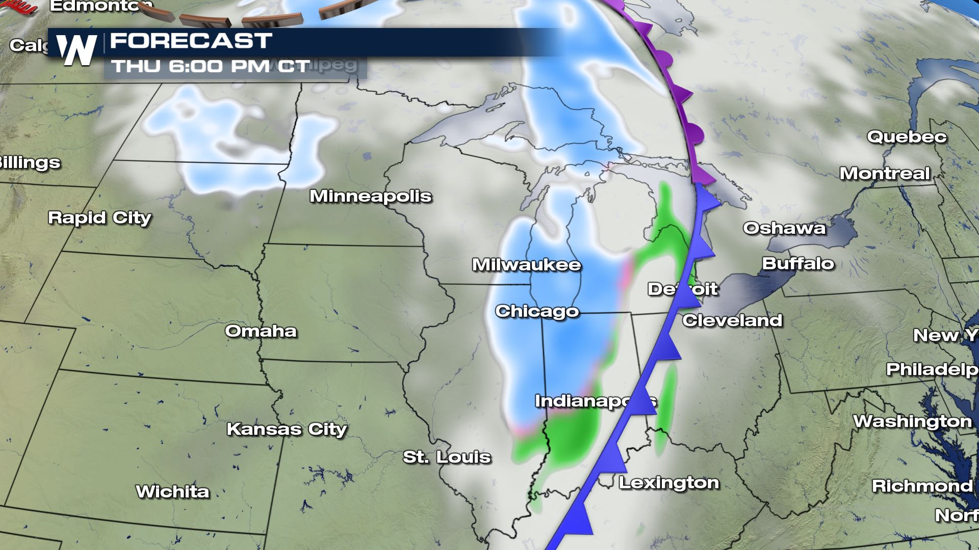
Snow Side Forecast
The cold air begins arrives and changes the rain to snow beginning late Wednesday and early Thursday. Here is the latest snow forecast.
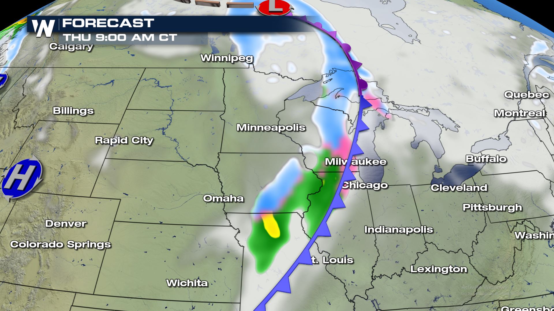

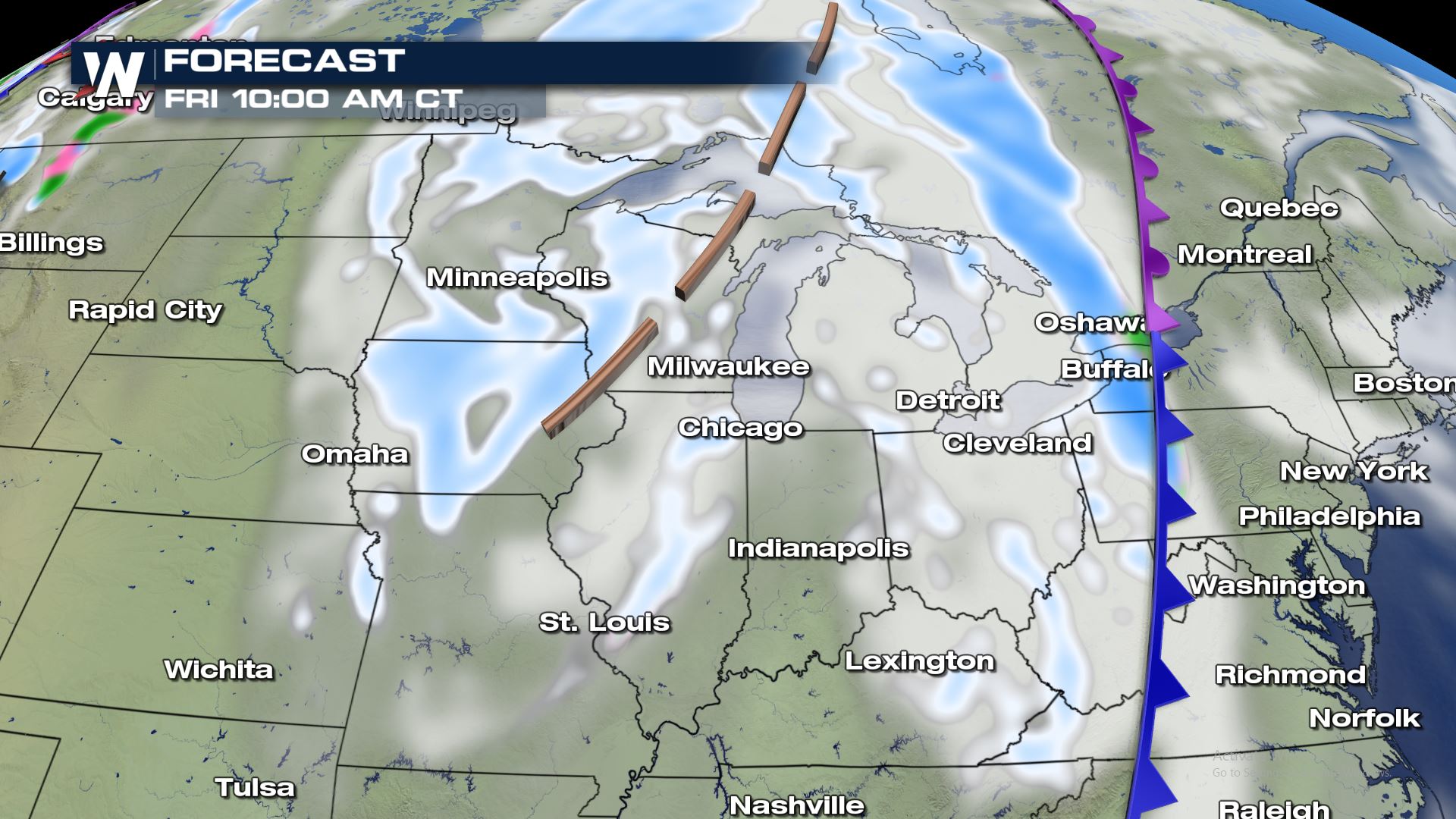
A secondary wave of energy wraps around the main low up in Canada and provides more snow chances for Friday.
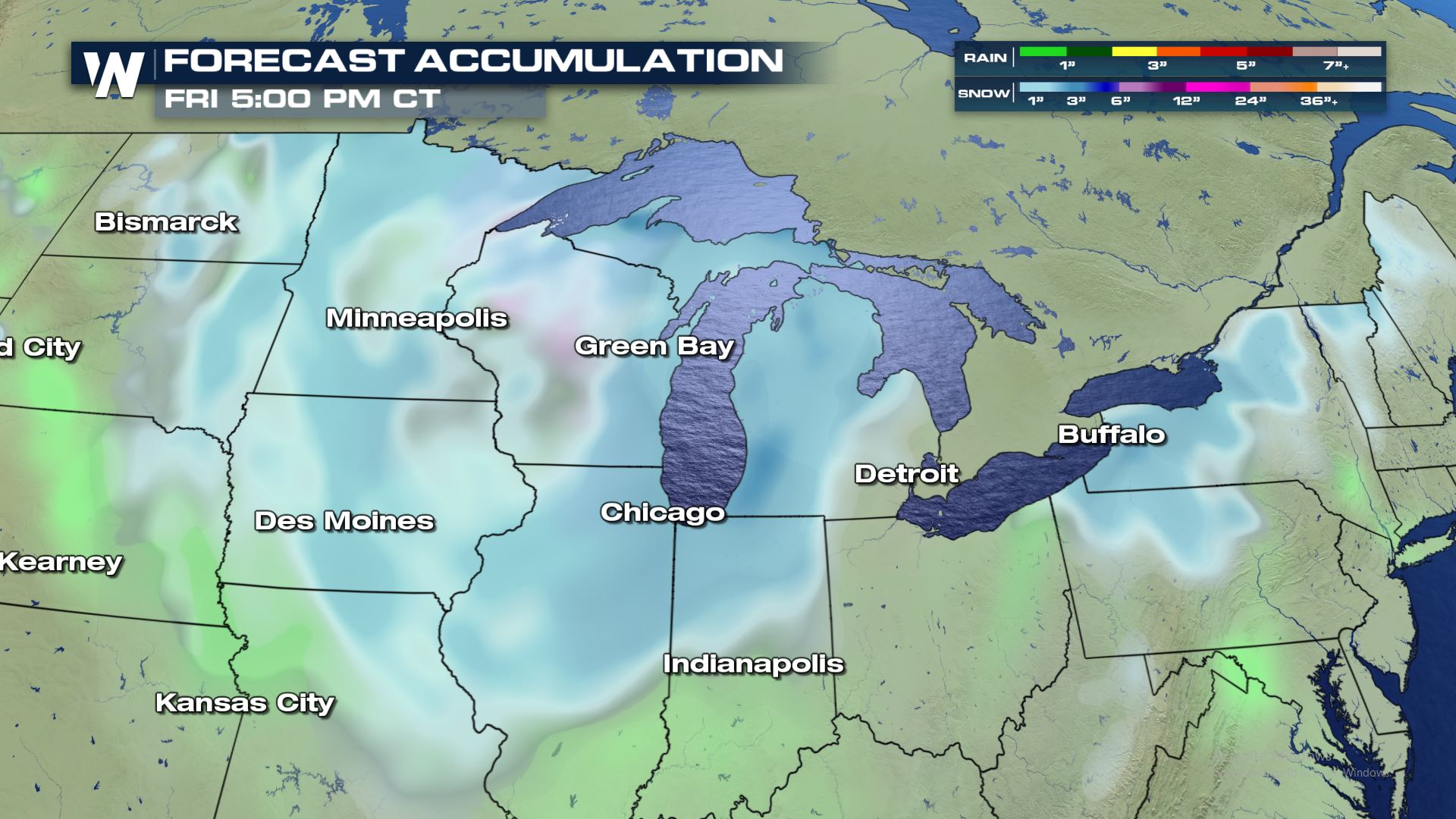
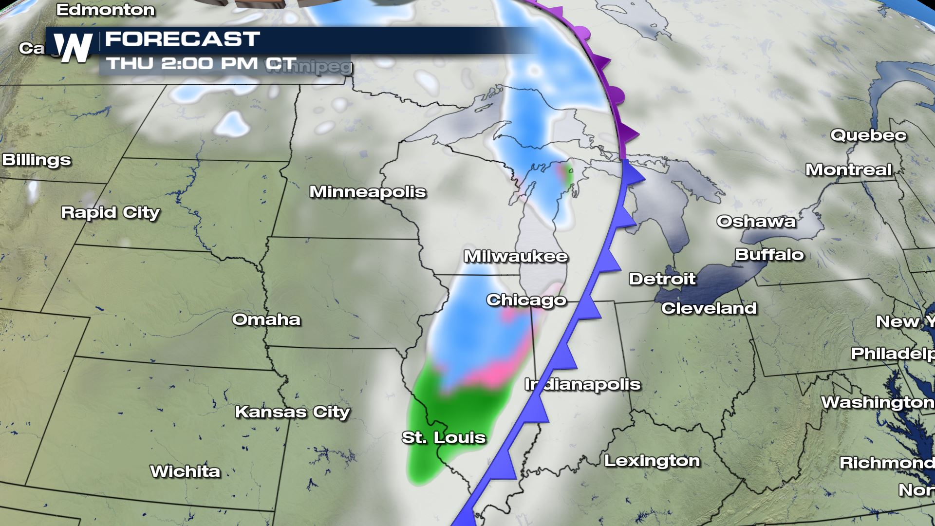
Snowfall Forecast
The snow accumulation looks to be around the 1-3″ range with the higher accumulation likely in the Great Lakes and towards the Northeast.
Keep checking with WeatherNation for more updates on the snowy weather on the way to the northern U.S..


Comments
Something to say?
Log in or Sign up for free