


 User Center
 My Training Class
 Feedback


Southwest Potential Record Warmth and Fire Weather Concern
A strong ridge of high pressure building in the southwest will lead to very warm temperatures today and tomorrow. Record highs will be possible into States like California, Nevada and Arizona. With this ridge of high pressure building off the Pacific of California some of the down-sloping winds around the high will enhance the fire weather potential.
Set-Up

We will get some ideal conditions for a warming trend across the Southwest as a ridge of high pressure moves-in out of the Pacific Ocean. This means sunshine and sinking air…two ways to warm the atmosphere. For more information on the increased potential for fire weather danger, scroll down.
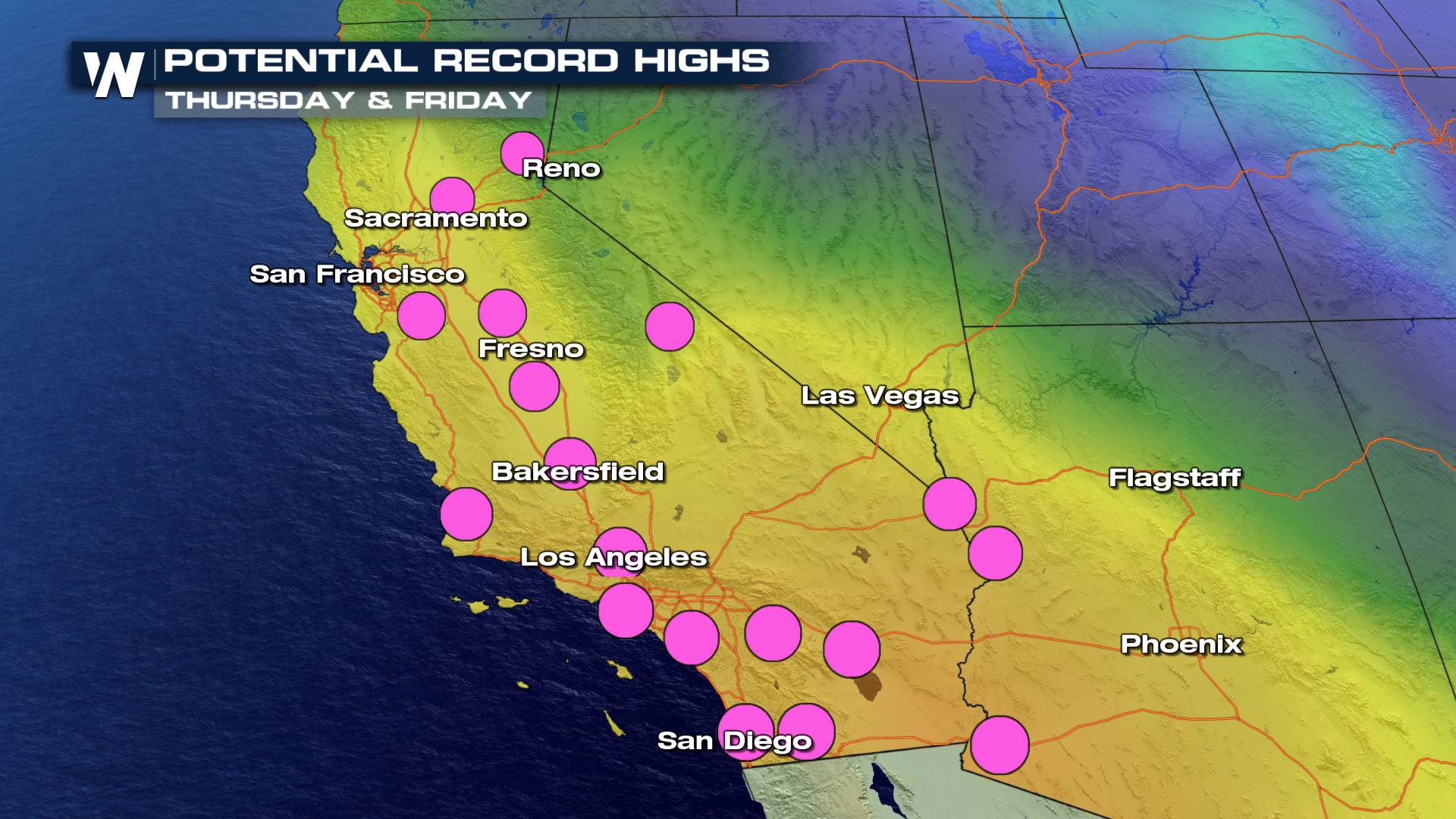
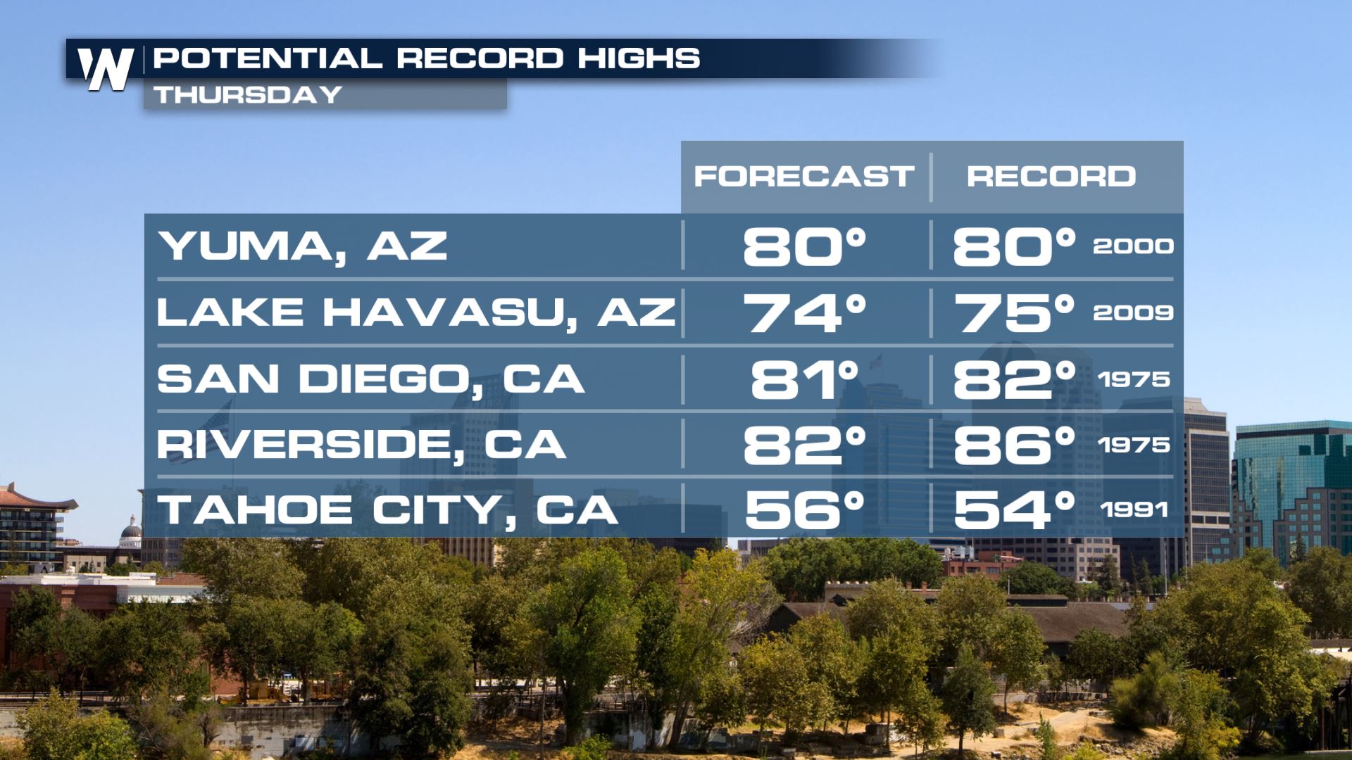
Record High Potential
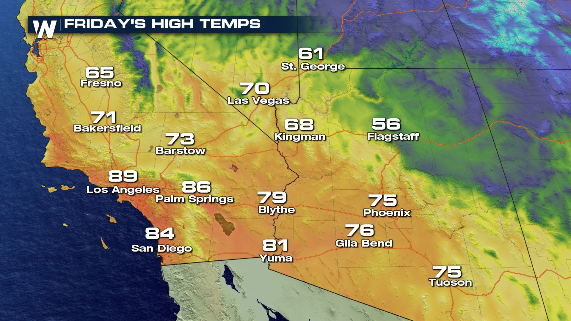
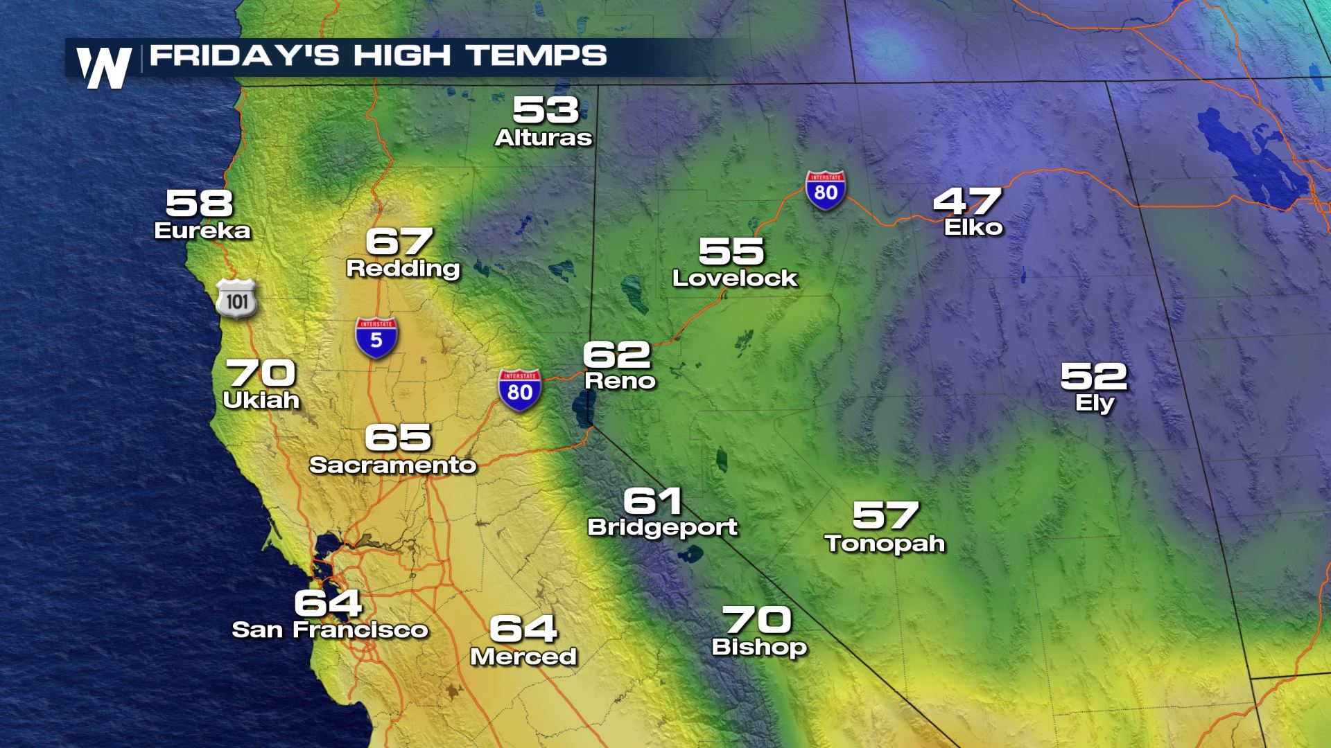
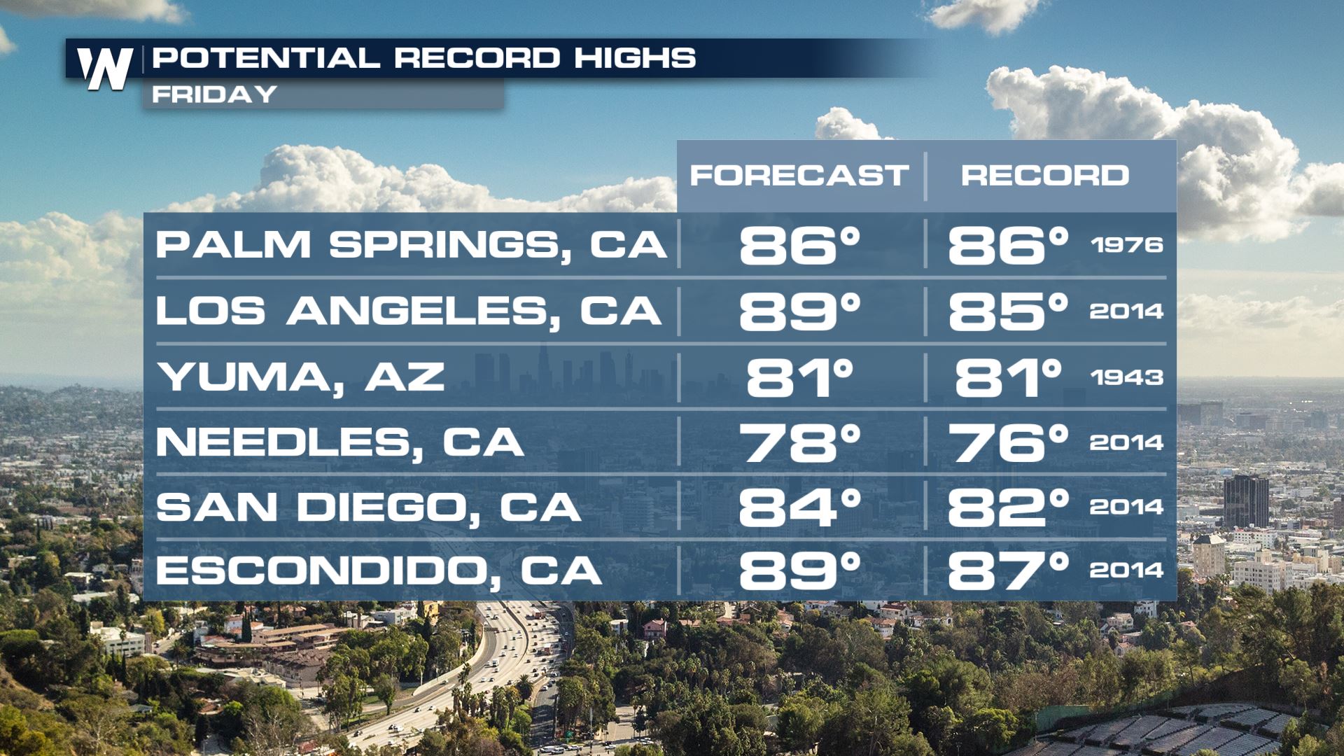
Record high potential is in the forecast for today and Friday across the Southwest. Afternoon highs will be anywhere from 15-25° above-average.
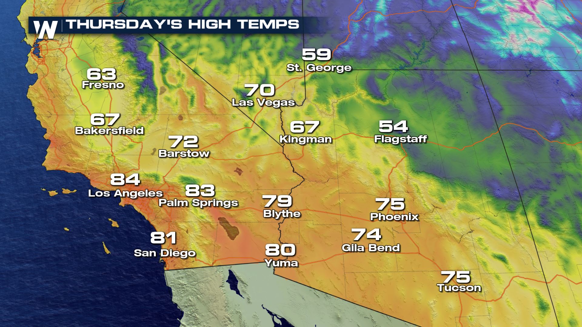
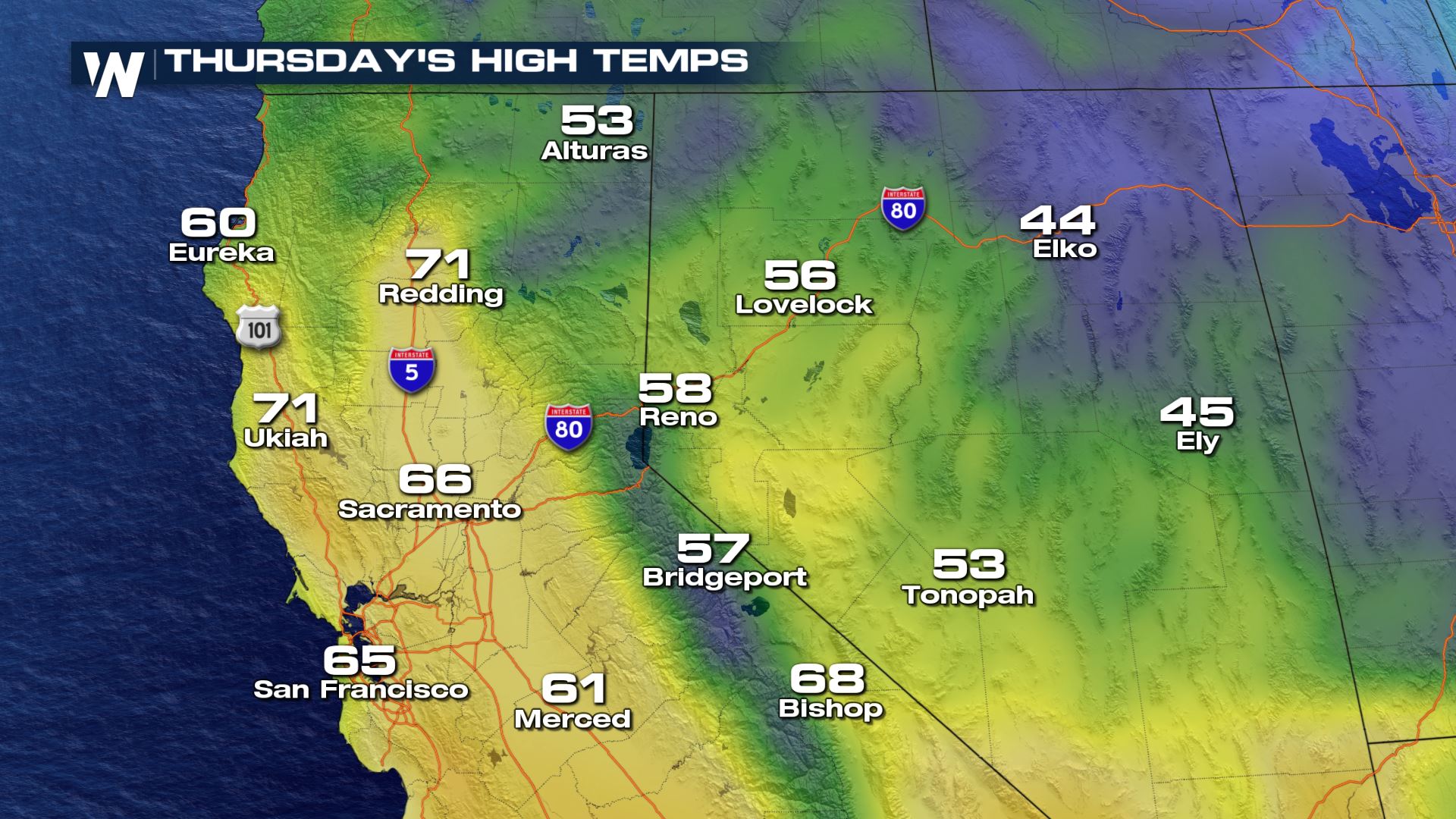
Temperature Forecast
Here is the very latest temperature forecast for both today and Friday. Hard to believe we are in mid-January!
Today (Thursday)
Friday
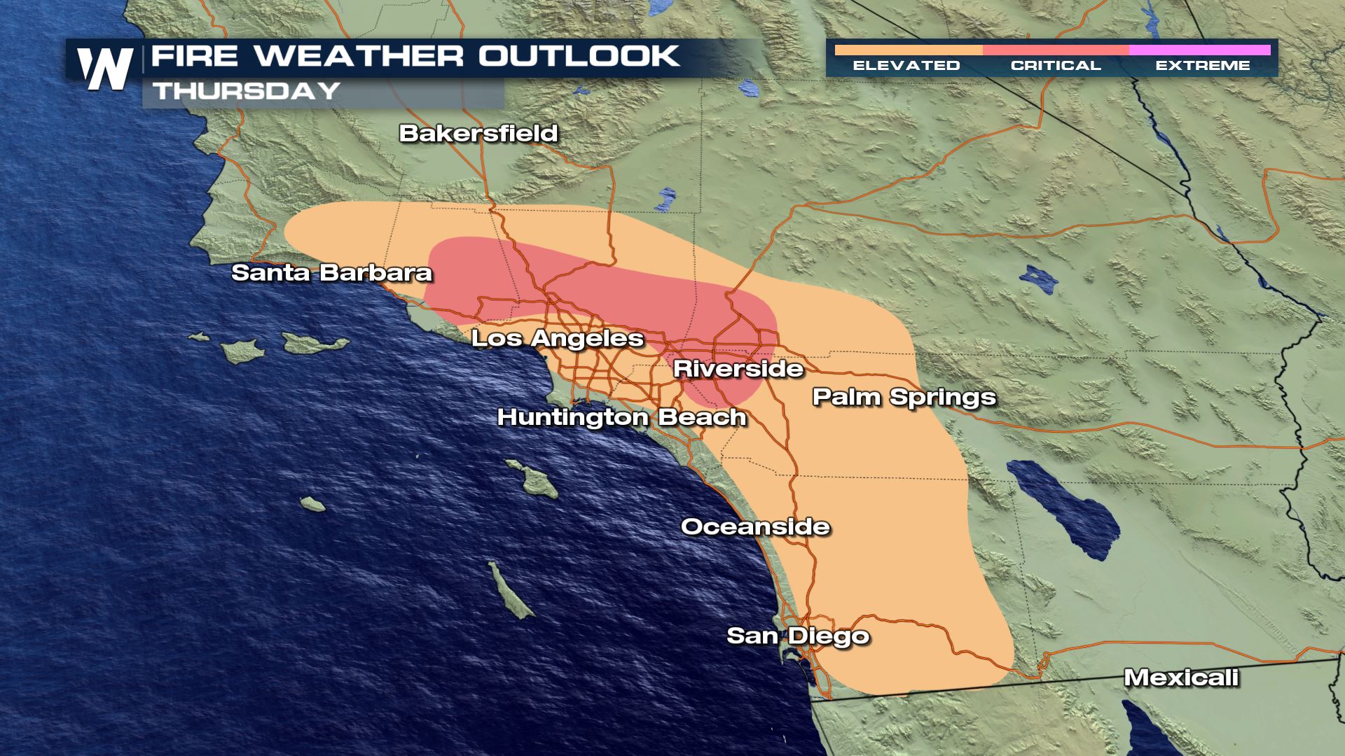
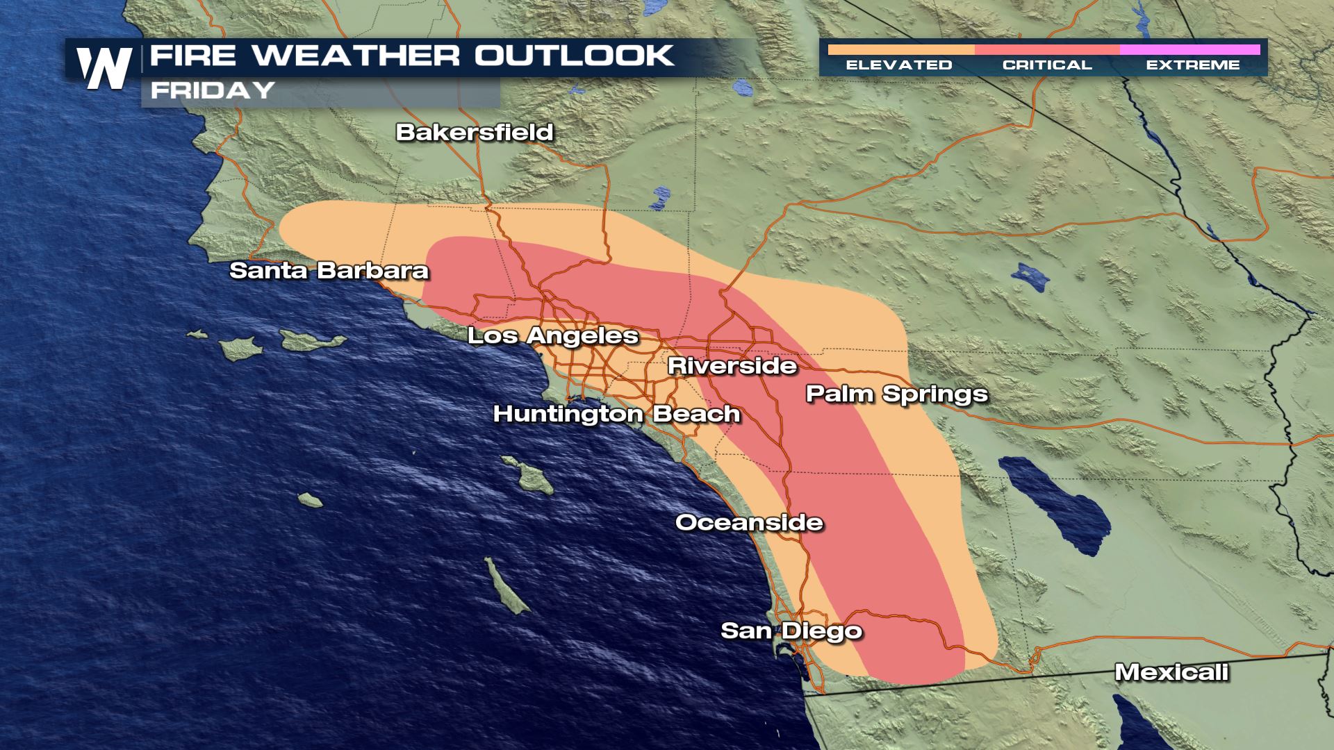
Unfortunately the position of the ridge offshore will also promote gusty offshore winds. This will lead to wildfire danger for today and Friday.
Fire Weather Concern
Red Flag Warnings have been issued through Friday and Saturday across southern California as winds up to 30-45 mph in the lowlands and 50-55 in the foothills, low relative humidity and warm temperatures increase the risk for rapid wildfire growth. This will likely lead to a moderate Santa Ana wind event for the southwest.
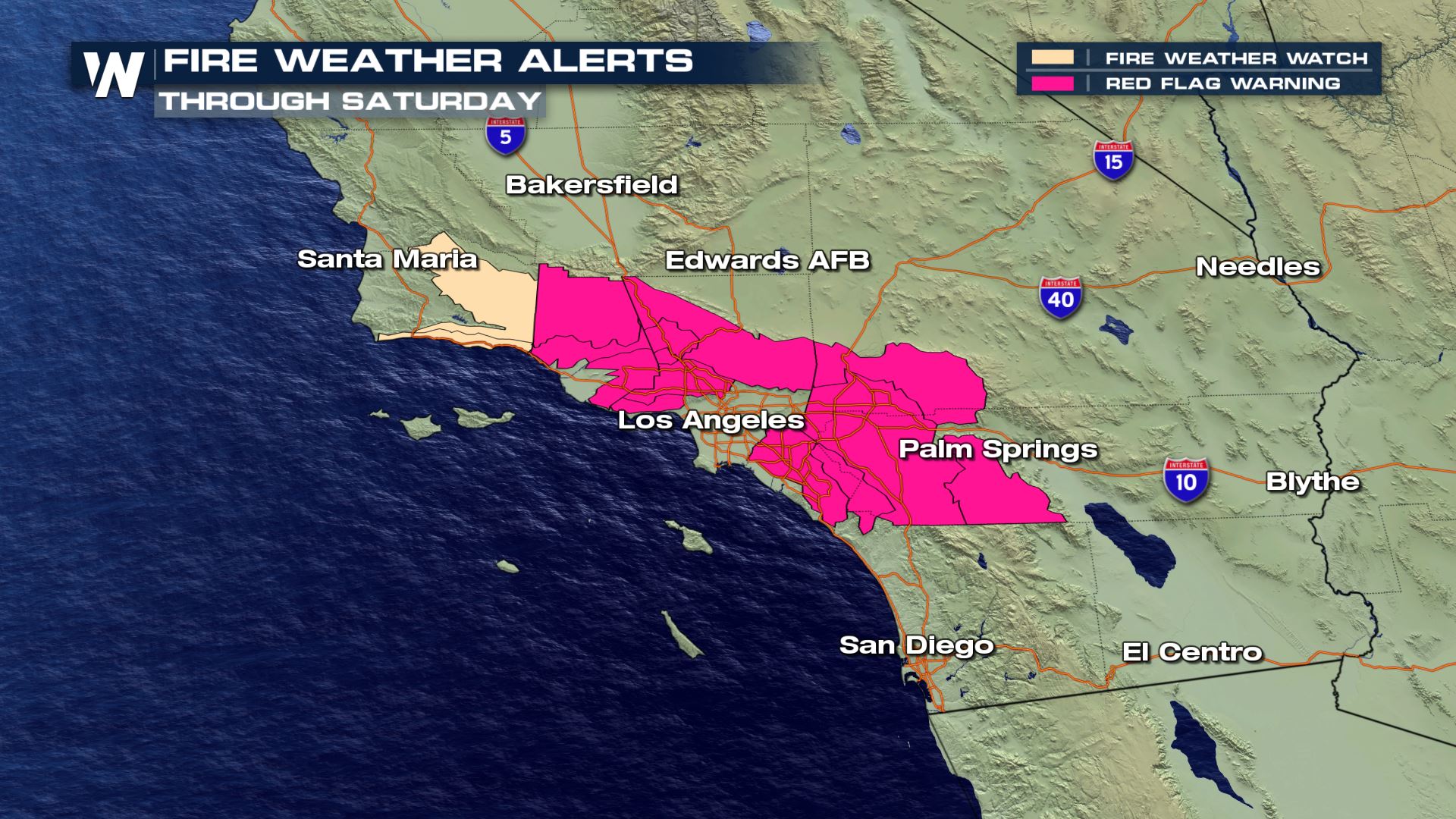
There is an elevated to critical fire weather risk for parts of southern California on both Thursday and Friday. Increasing winds and low relative humidity (8-12%)will enhance the fire weather outlook to critical.
We will be tracking this warm weather and fire weather forecast on WeatherNation so check us out for free on Roku, AppleTV, Amazon Fire and PlutoTV on Channel 217.


Comments
Something to say?
Log in or Sign up for free