


 User Center
 My Training Class
 Feedback


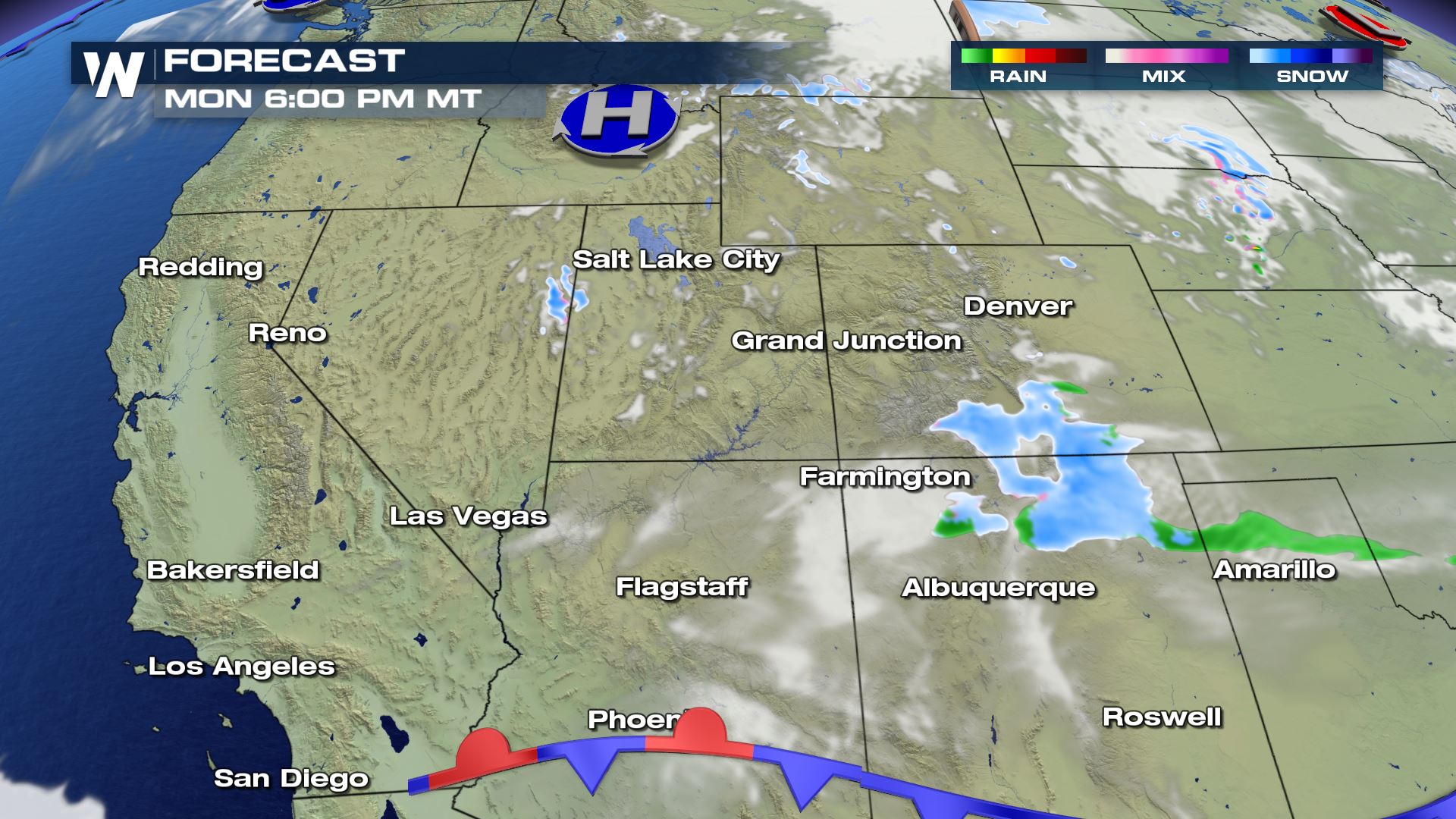
After a cold front makes it’s way down the Rockies and into the Plains, Colorado and New Mexico are likely to see a “back-door cold front” set up bring in heavy snow for this portion of the Four Corners. This in combination of an upper level low in the Pacific of California will bring the potential for accumulative snow from Monday through Tuesday.
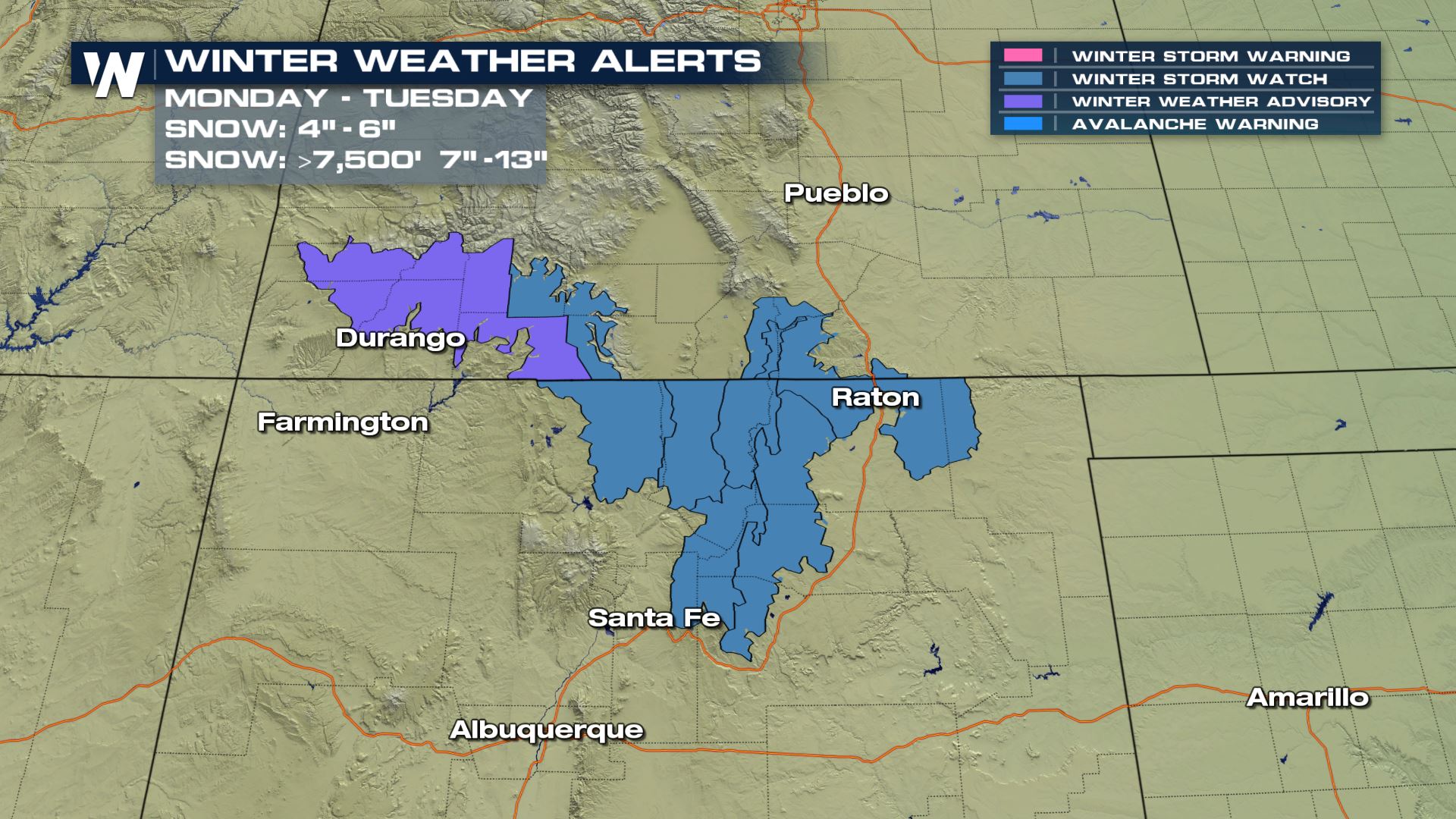
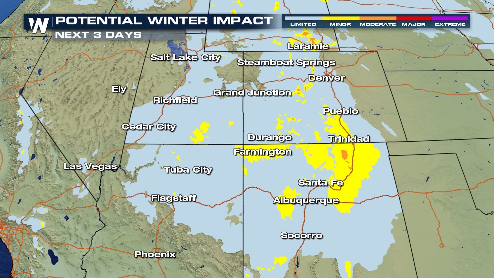
Winter Weather Alerts
Winter Storm Watches have been issued in blue for northern New Mexico which includes the Sangre de Cristo Mountains through the upper Rio Grande Valley where we could see heavy snowfall totals up to 4-6″ and up to 1 foot above 7500 ft. In purple, Winter Weather Advisories are in effect through southern Colorado through the San Juans where we could see 6-10″ of snow with locally higher accumulations up to 1 foot as well. These will remain in effect through Tuesday evening.
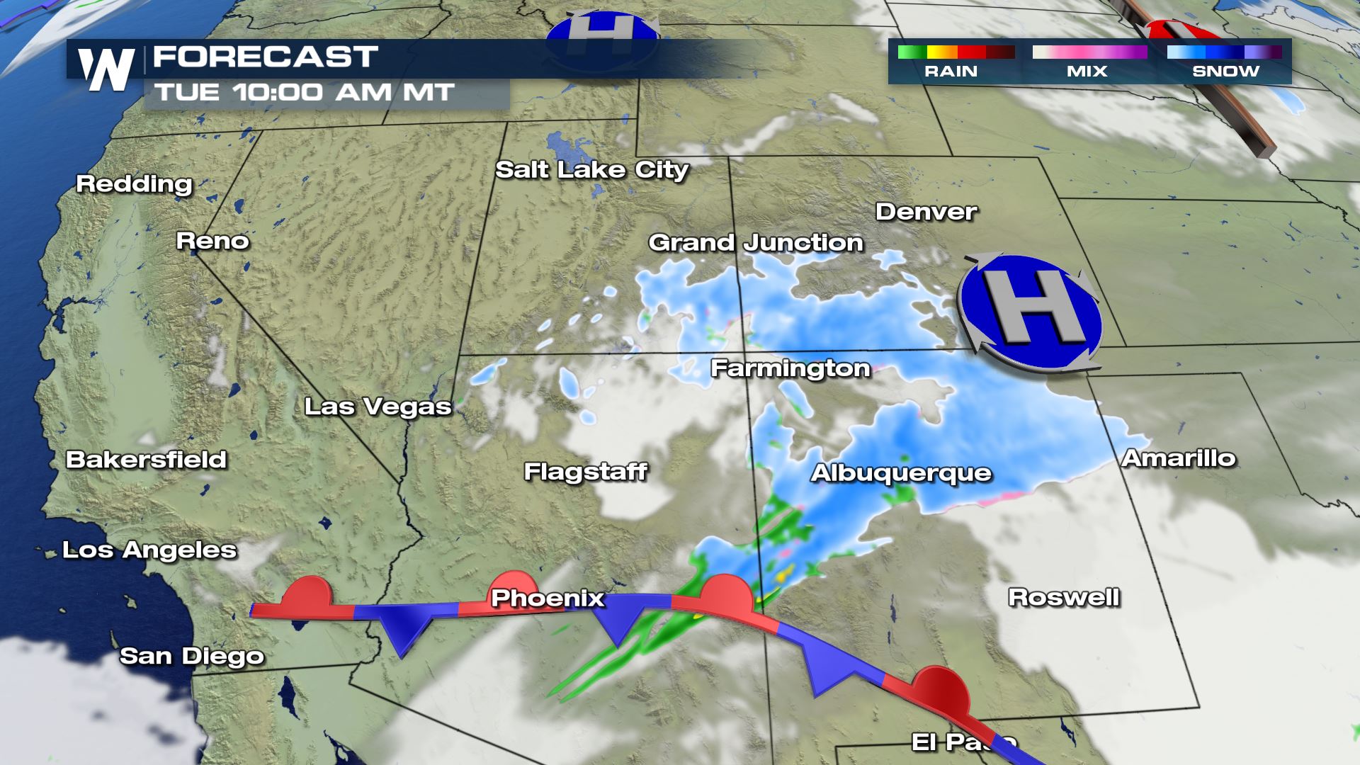
Forecast Models
As a cold front brushes through, on the back-side snow will be possible starting Monday evening.
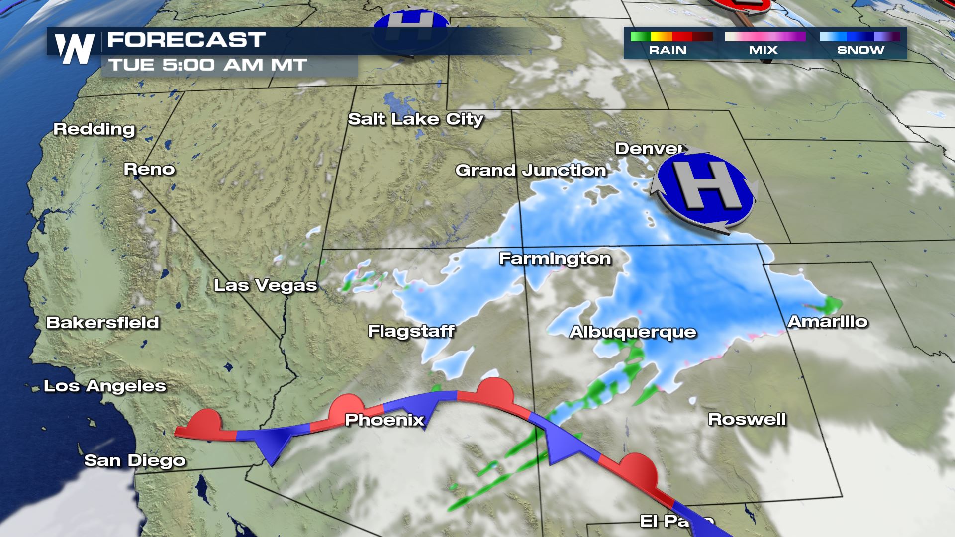
Overnight Monday and into early Tuesday morning, snow continues to fall across the San Juan Mountain range of Colorado through northern New Mexico and will start to accumulate across this area. High pressure wraps around some energy into Tuesday morning.
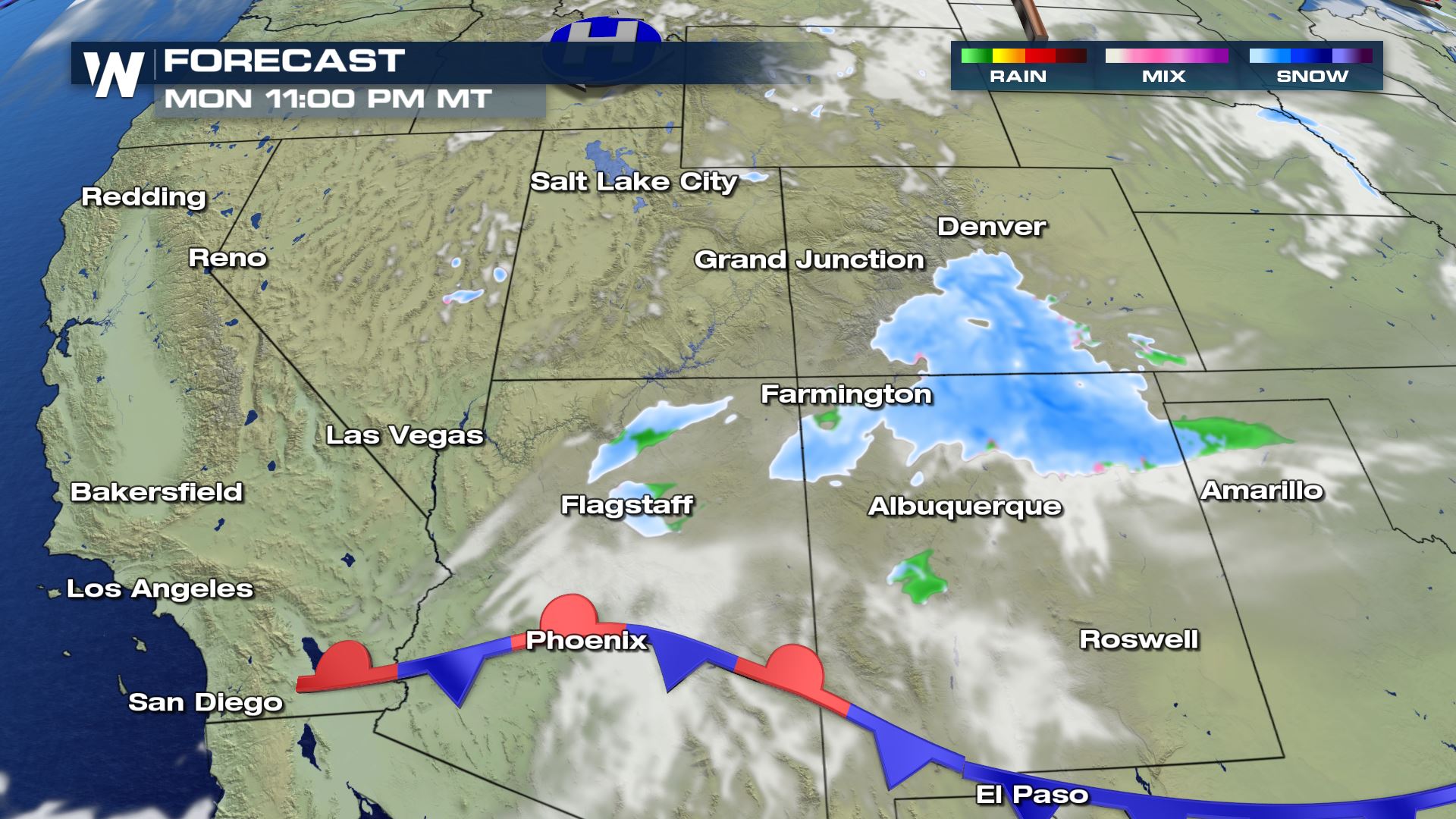
In the southern edge of this system, a stalled out front extending off a complex system off the Pacific coast brings in additional moisture to southern Arizona and New Mexico where it will be too mild to see snow. Places like Durango through Albuquerque are still looking at snowfall throughout the day.
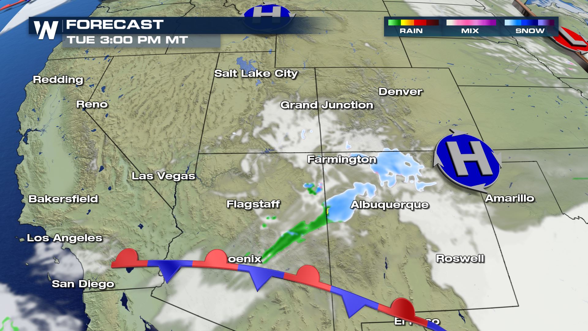
Snow chances taper off into Tuesday night and the winter alerts start to expire around then too.
Accumulation Forecast
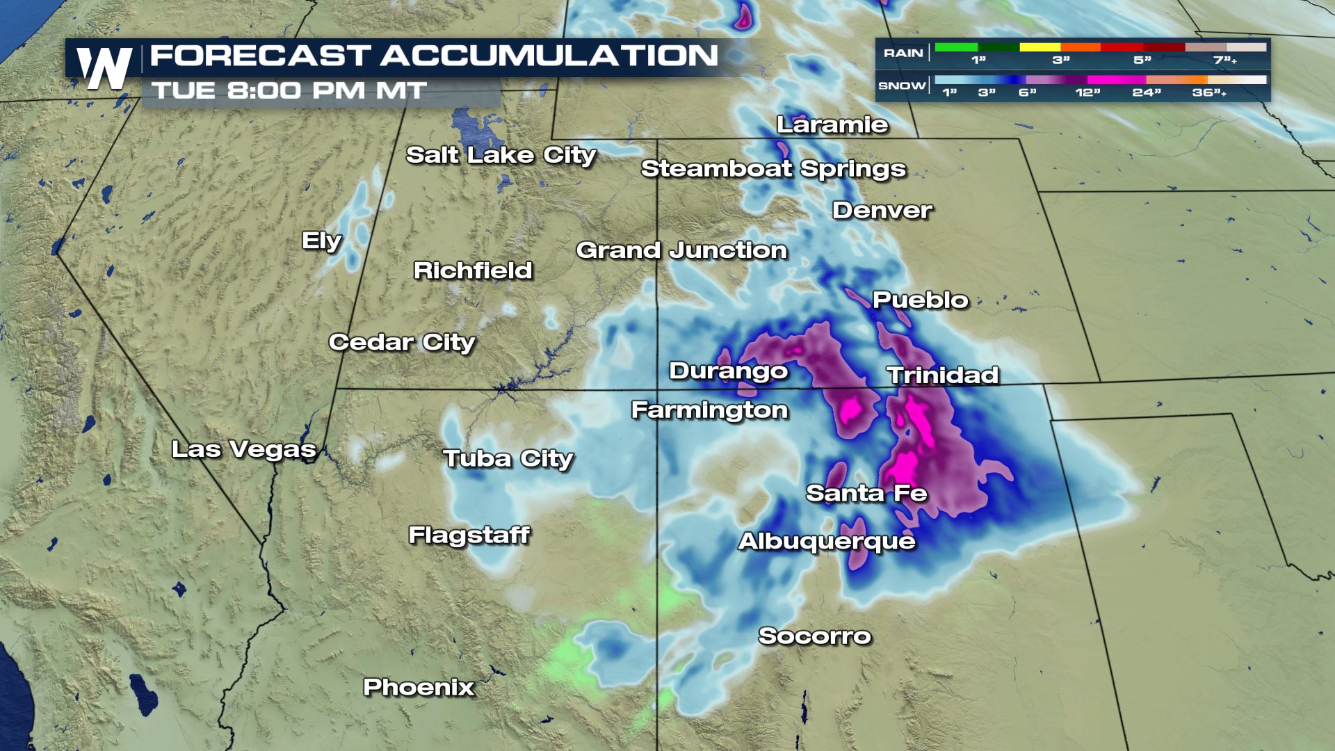
Higher elevations will see some heavy snow in parts of New Mexico and Colorado. Some spots may see up to 1 foot shaded in the purples and pinks.
This will likely lead to potential winter weather impacts within areas that we expect higher snow totals.
More updates are on the way on WeatherNation for more information on this changing pattern in the Southwest.


Comments
Something to say?
Log in or Sign up for free