


 User Center
 My Training Class
 Feedback


More Snow for the Plains & Midwest: Blizzard Warnings Issued
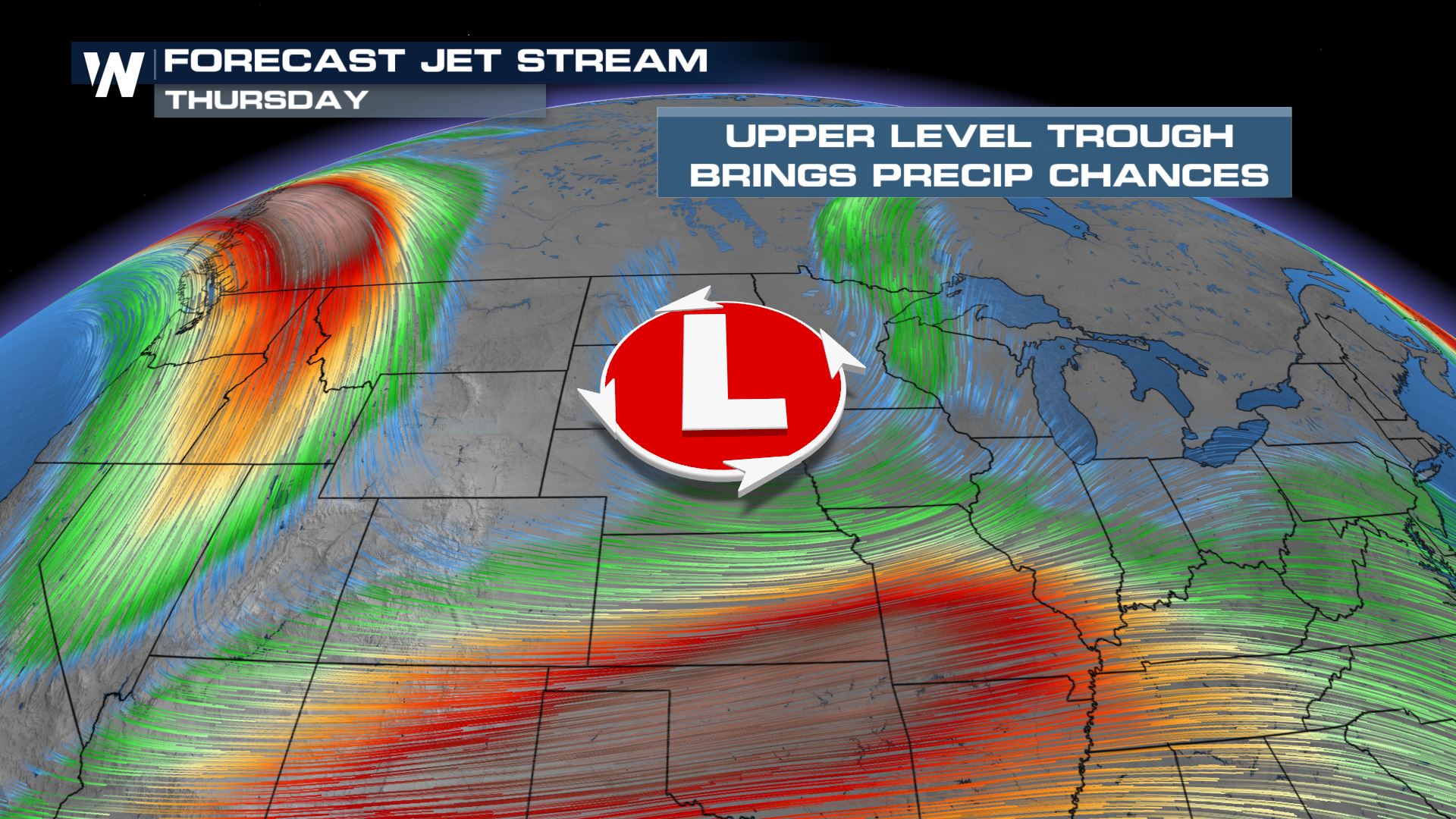
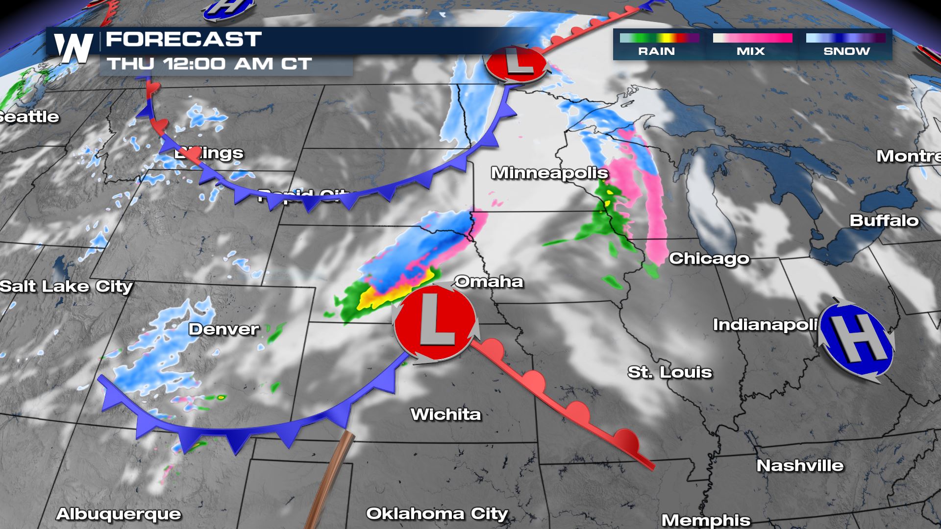
Additional snow and gusty winds are on the way to the Plains and Midwest through the latter half of the week, followed by a plunge in temperatures. An energetic trough of low pressure will quickly move out of the Northwest on Wednesday, pushing snow chances across the Plains, followed by a rapid drop in temperatures. Behind the front, winds are expected to quickly increase. Gusty winds combined with falling snow could lead to blizzard conditions in some locations.
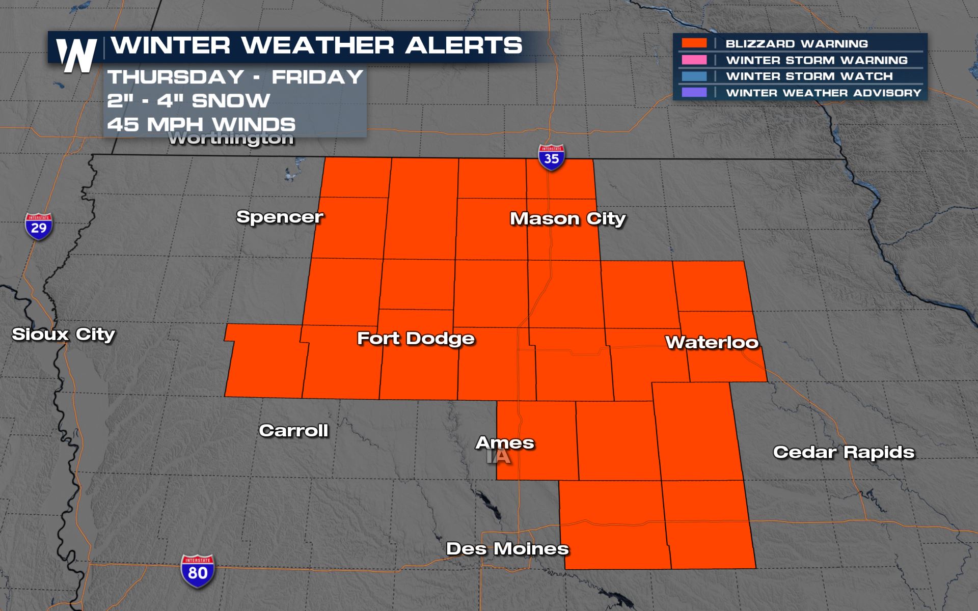
The National Weather Service in Des Moines, Iowa, has issued Blizzard Warnings for a section of their forecast area from early Thursday through early Friday. Winds are expected to gust to over 40 mph at times, reducing visibility and making travel difficult to impossible.
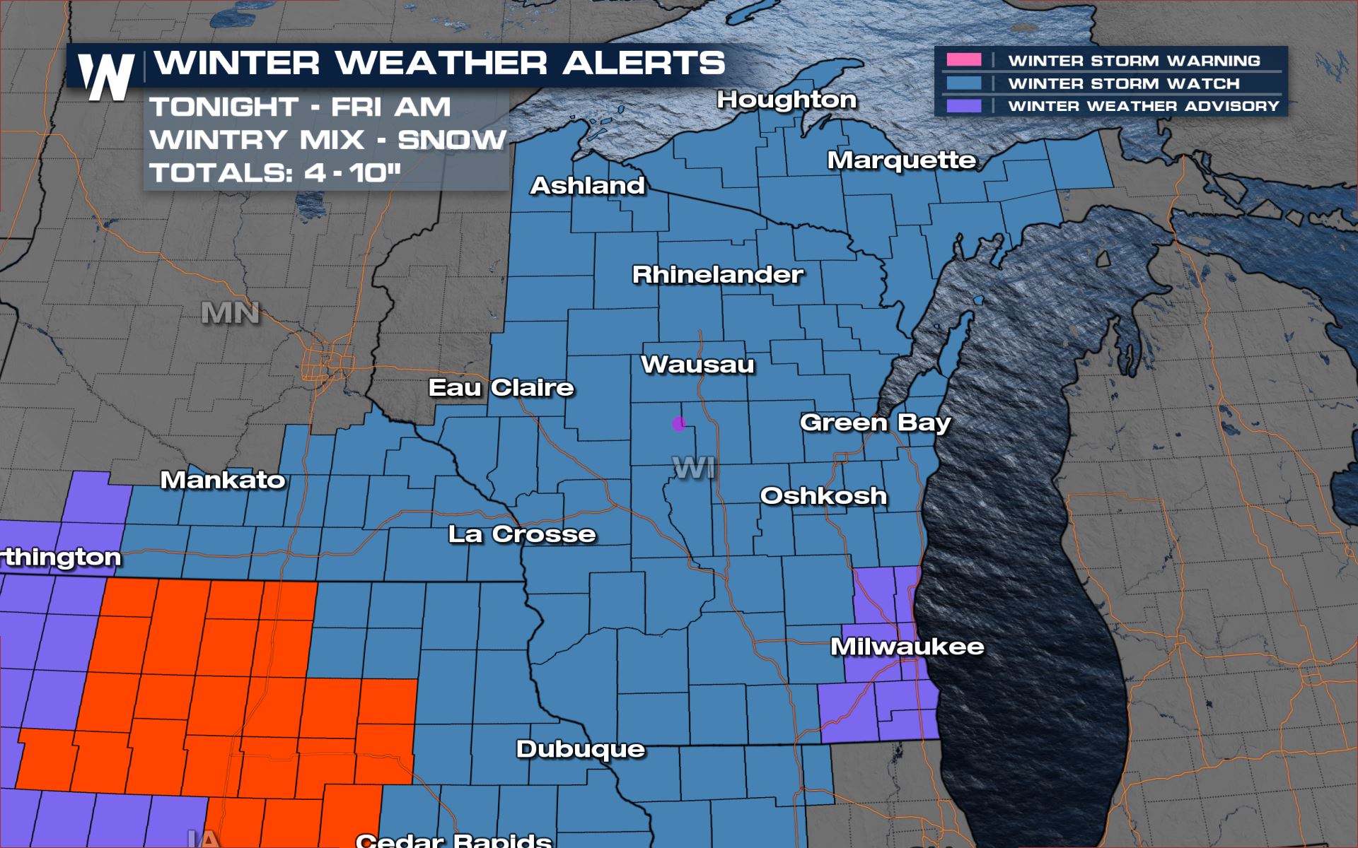
Winter Weather Advisories have been issued into Nebraska with Winter Storm Watches through the Upper Peninsula of Michigan, where heavier snow is expected, potentially over a foot in some locations when combined with trailing lake effect snow showers.
Forecast
As the surface front associated with the trough swings into the Plains Wednesday afternoon, light to moderate snowfall is expected ahead of and just behind the front. This could bring slowdowns to portions of I-94 Wednesday afternoon and evening.
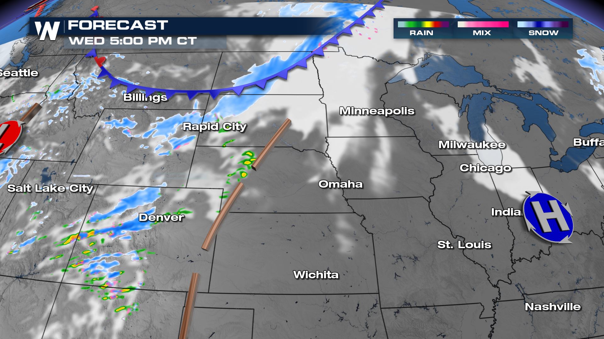
As a another low develops in the lee of the Rockies, more robust moisture will be drawn north into the Plains, leading to heavier snowfall rates late Wednesday into early Thursday. This heavier band of snow will move east through sunrise Thursday, bringing snowfall rates as high as 1 inch per hour to some locations across the Plains into the Midwest. Travel may be difficult to impossible at times along sections of I-29, I-80, and I-90.
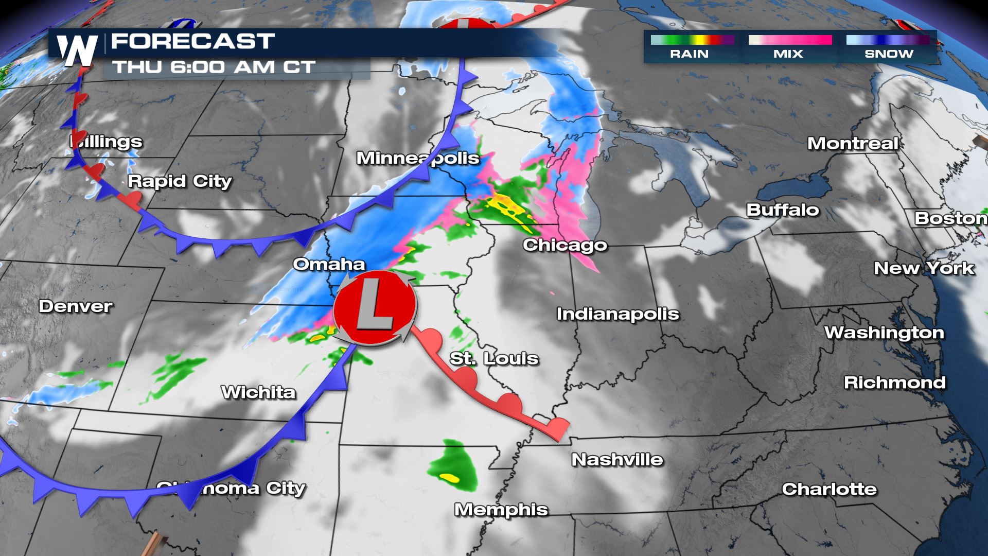
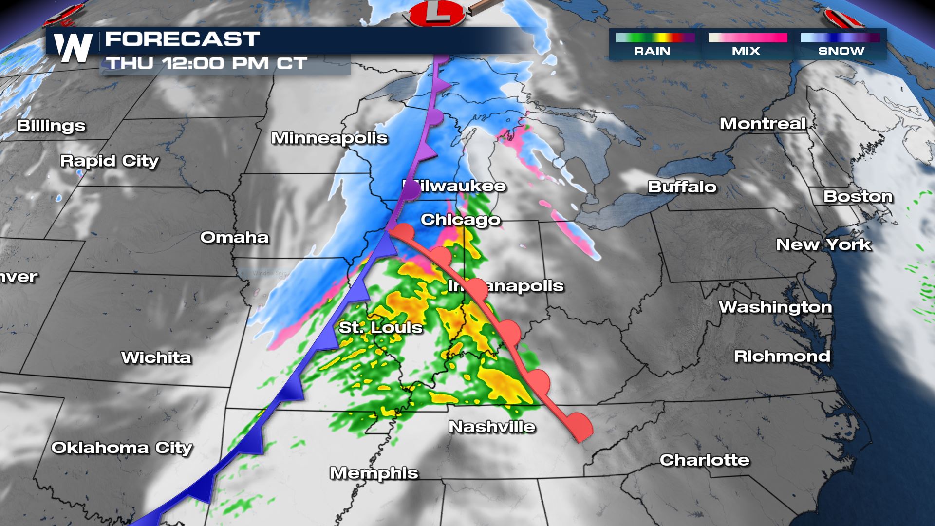
Moderate to heavy snow will continue to fall as the surface features combine into a larger front Thursday afternoon and evening. Some areas are expected to see 5-10 inches of snow with the frontal passage, along with gusty winds that could lead to an expansion of Blizzard Warnings. As the front moves into the Northeast, lake effect snow could add to the already impressive totals around the Great Lakes.
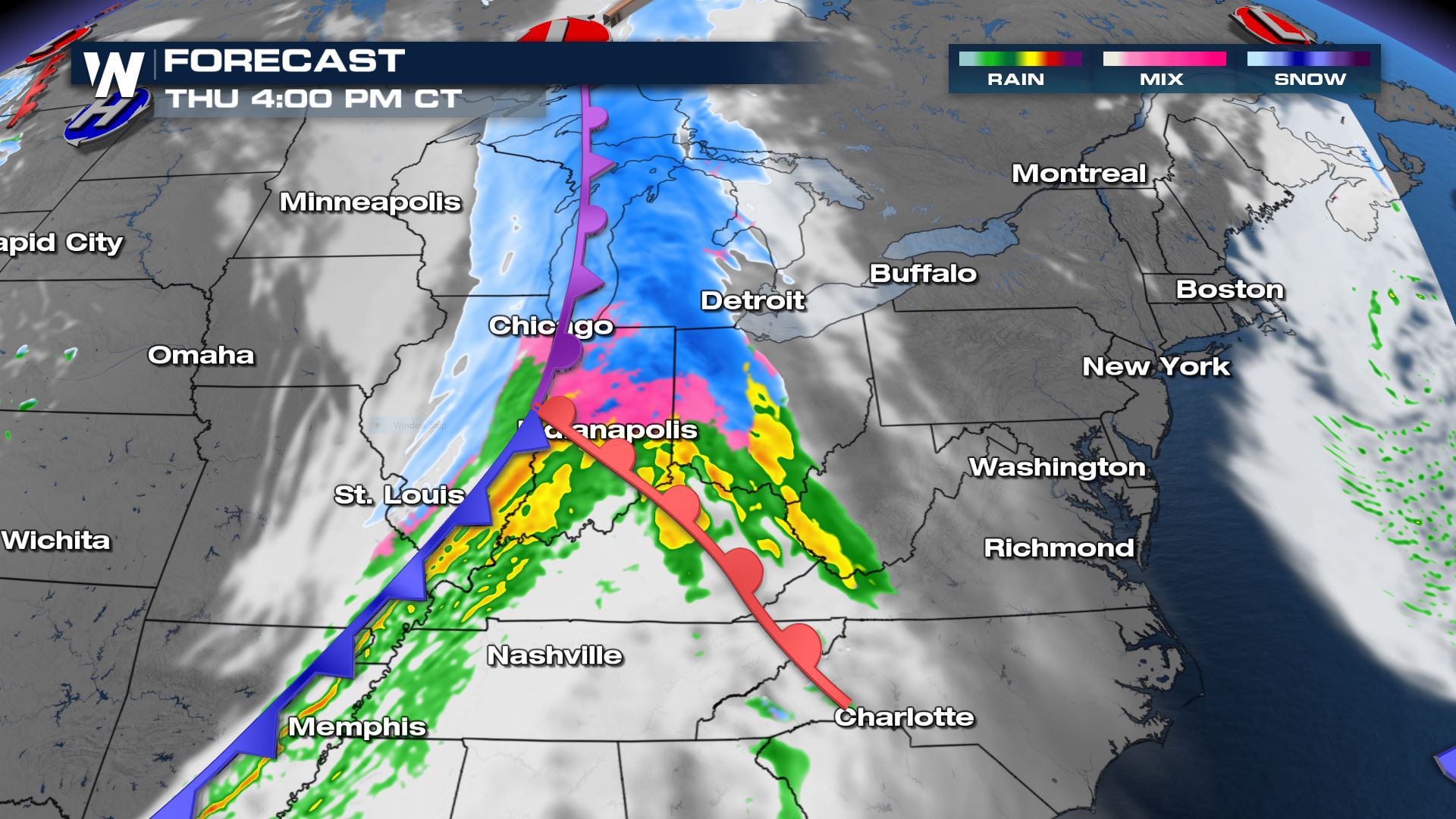
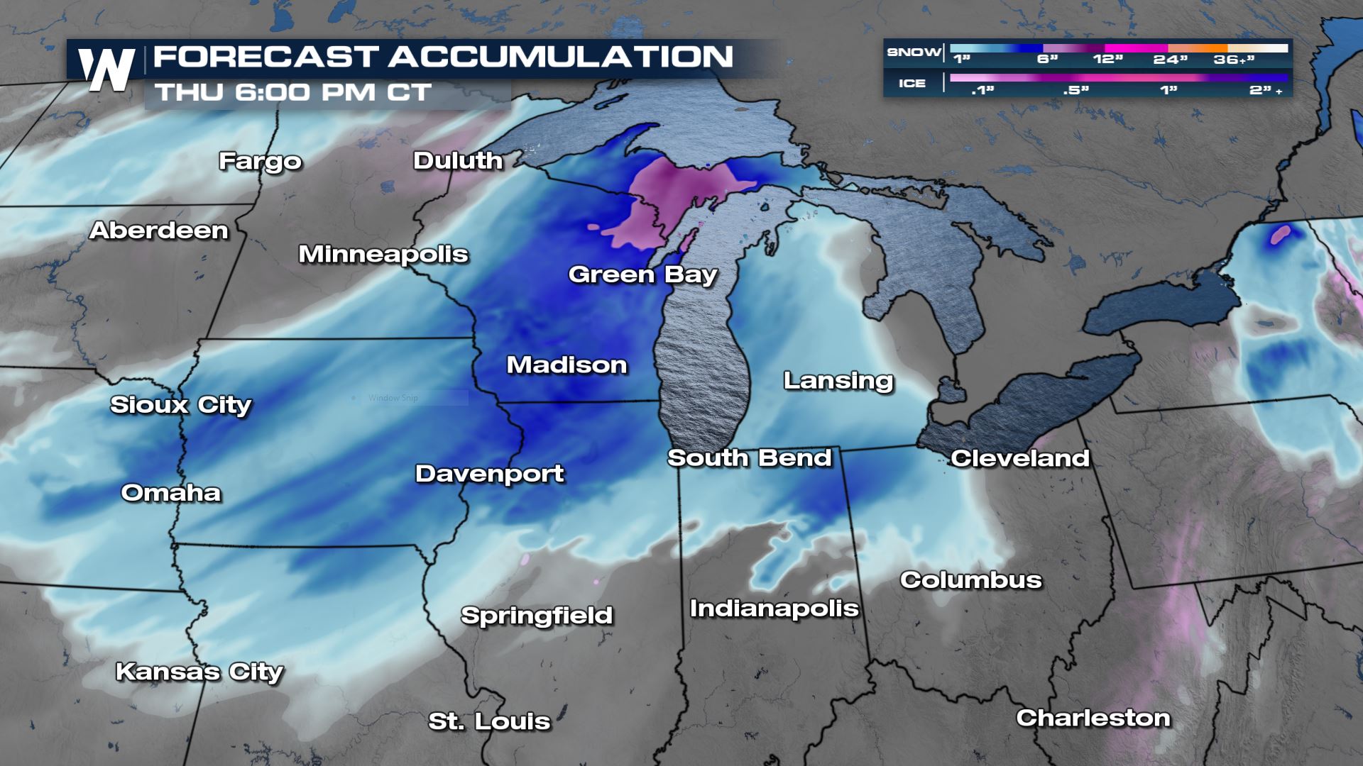
Snow totals will be lighter across the Plains into Nebraska, where 1-3 inches are expected. Heavier snow, over 4+ inches, is in the forecast from Northeast Iowa through the Upper Peninsula of Michigan. This forecast will still change leading up to and after the frontal passage. As mentioned previously, strong winds are expected in many areas behind the front, which could lead to low visibility and difficult travel. This article will be updated as necessary through the event.


Comments
Something to say?
Log in or Sign up for free