


 User Center
 My Training Class
 Feedback


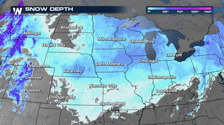
With a frigid, arctic air mass in place, it’s no wonder any precipitation in the Great Plains and Midwest would be of the frozen variety. Several rounds of snow since the beginning of February have allowed the snowpack to build across the northern United States.
Several rounds of winter weather are expected to move through the Plains and into the Midwest from Friday into early next week, adding to the snow already on the ground.
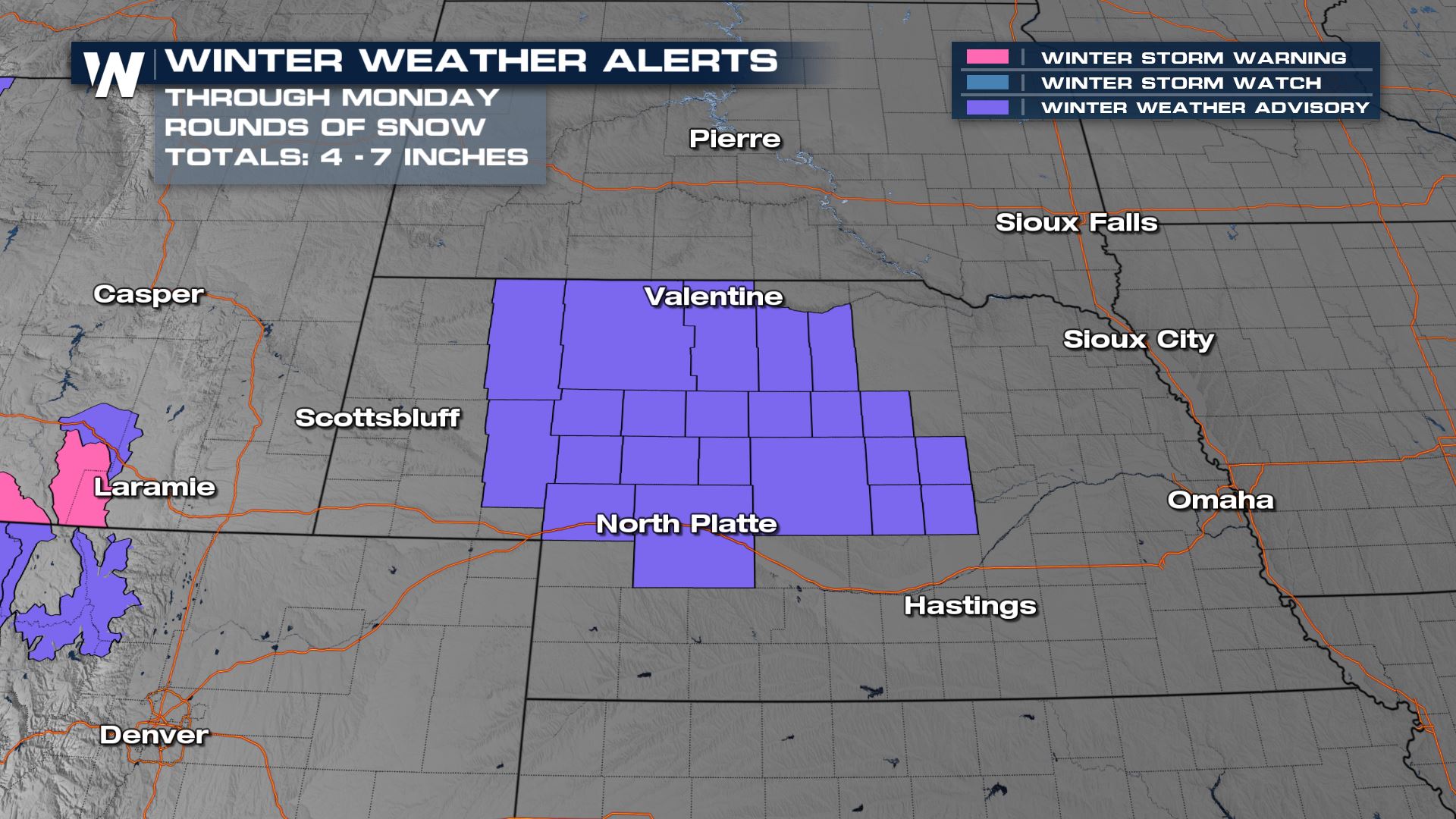
Winter Weather Advisories have been issued through Central Nebraska for both rounds of snow, which will each have the potential to bring several inches to the area.
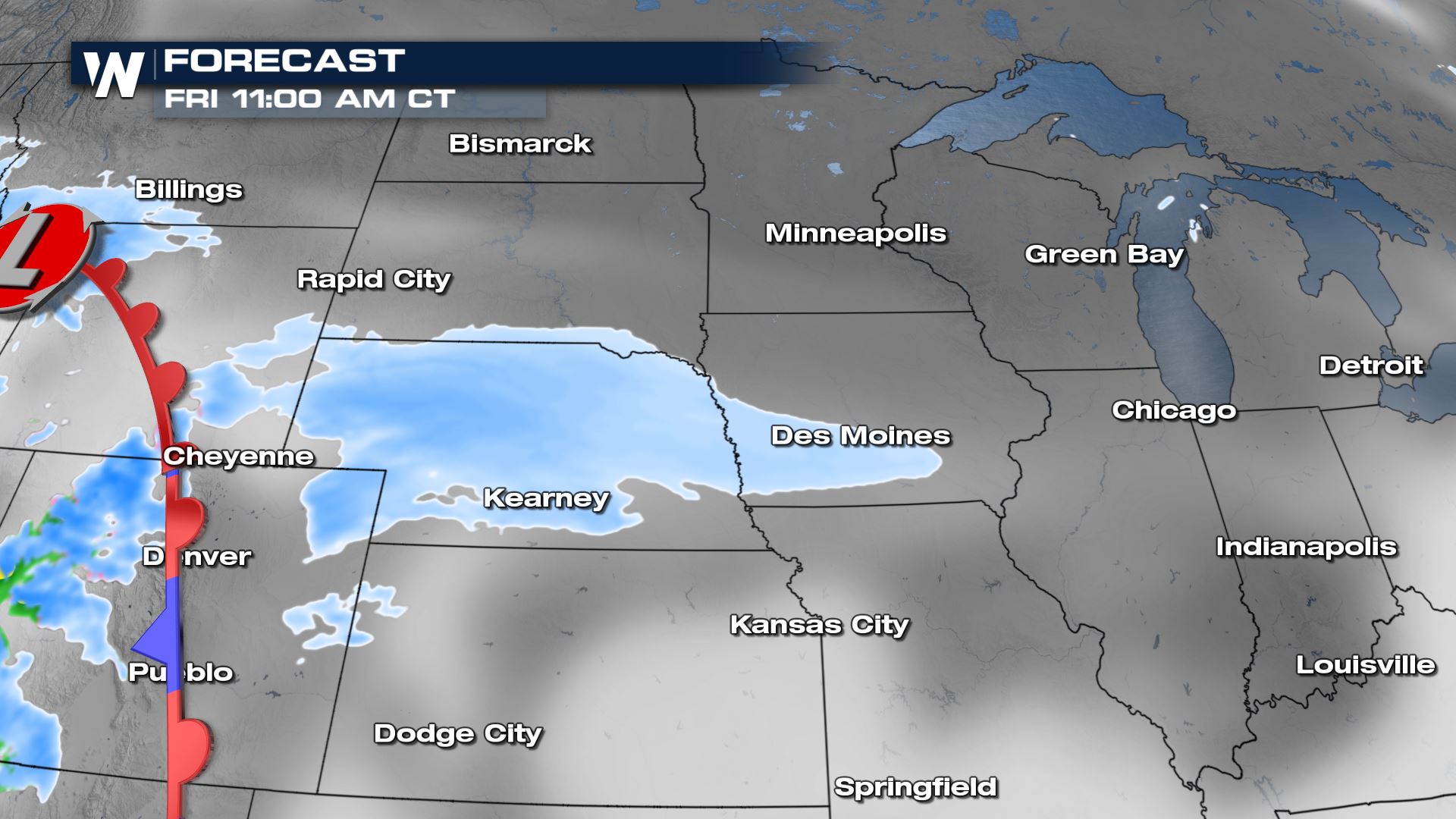
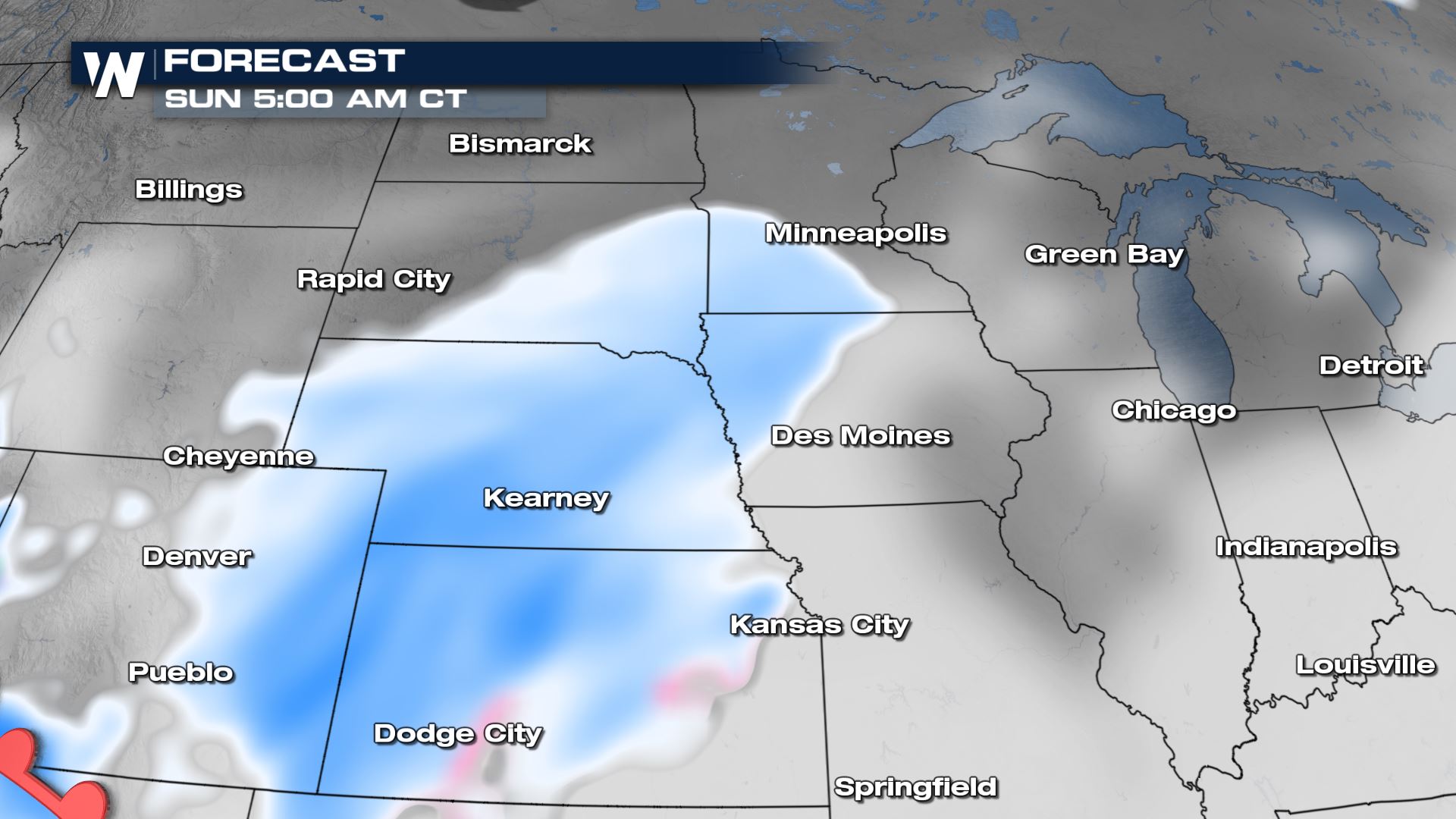
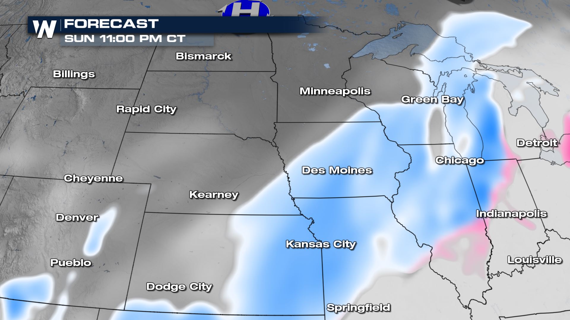
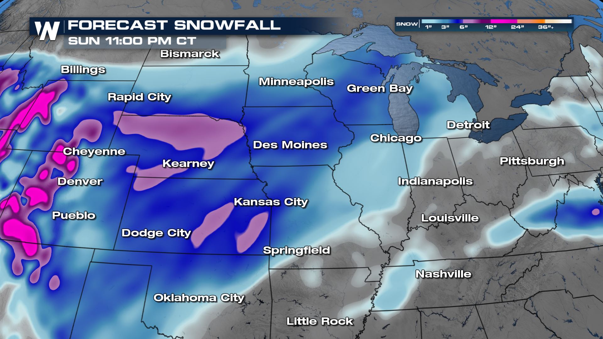
Forecast
The first batch of snow will move out of the Western U.S. and Rocky Mountain region and into the Plains on Friday. Before midday, light snow is expected mostly west of I-35 but could impact a long portion of I-80. The rest of the I-80 corridor to Chicago will see the chance for light snow showers into the afternoon and evening.
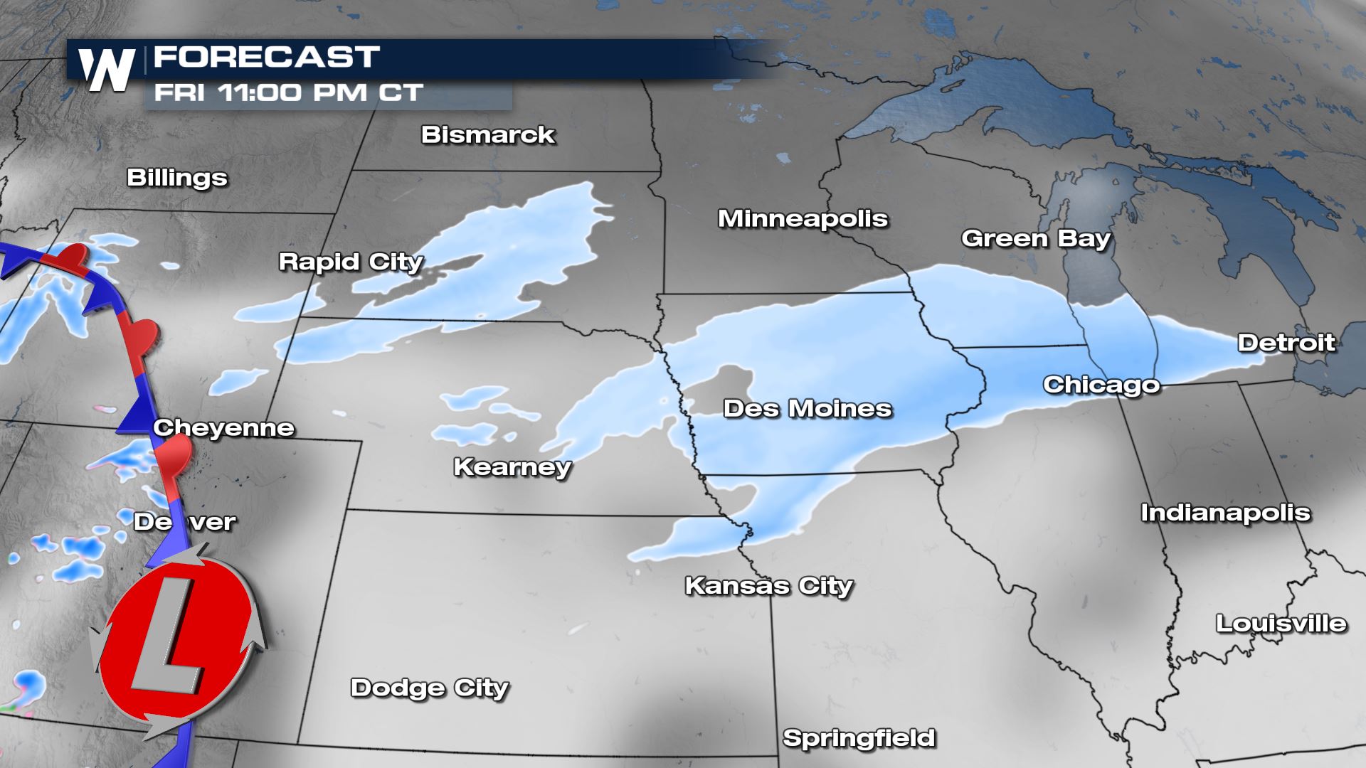
A second round of snow will develop and push out of the Rockies and into the High Plains for Saturday night. This, too, will move east toward the Midwest into early next week.
Total snowfall accumulations for each system will be on the lower-end. Generally 2 to 4 inches for each round. There is the potential for a few locations to pick up 5 to 7 inches. While not a blockbuster snow event, it will be impactful throughout the region. Road conditions will be snow-covered and slippery at times, with blowing-and-drifting snow likely in open areas.
Don’t forget to tune into WeatherNation at :30 past the hour—every hour—for your Central regional forecast and the very latest winter weather information.


Comments
Something to say?
Log in or Sign up for free