


 User Center
 My Training Class
 Feedback


Here is the latest on the severe thunderstorms we’re tracking overnight Tuesday into Early Wednesday morning
**UPDATE**
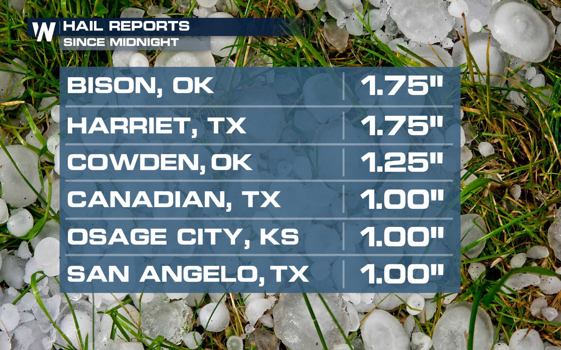
Newest hail reports from the storms this morning.
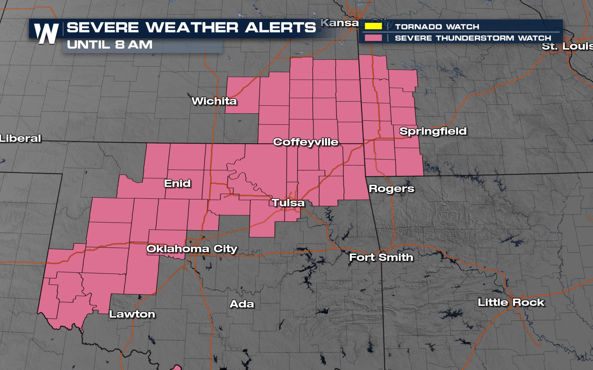
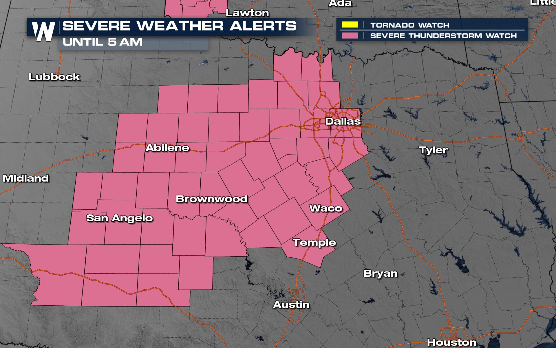
Watches
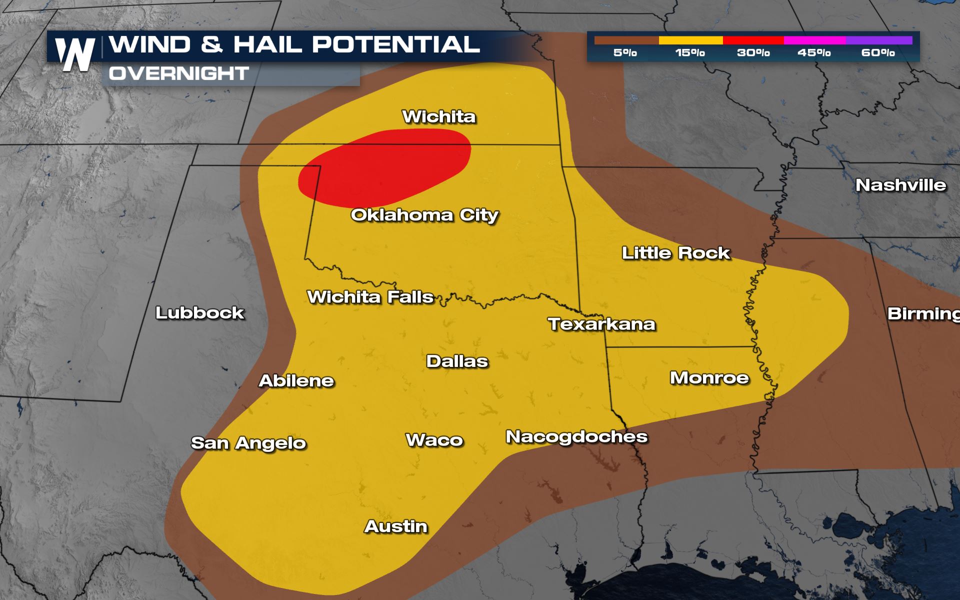
Two severe thunderstorm watches are currently in effect, mostly for large hail to the size of 2″ or bigger. There is also a threat from winds up to 70 mph, and an isolated tornado or two cannot be ruled out as well. Both of these watches last until the early morning hours on Wednesday.
Severe Outlook
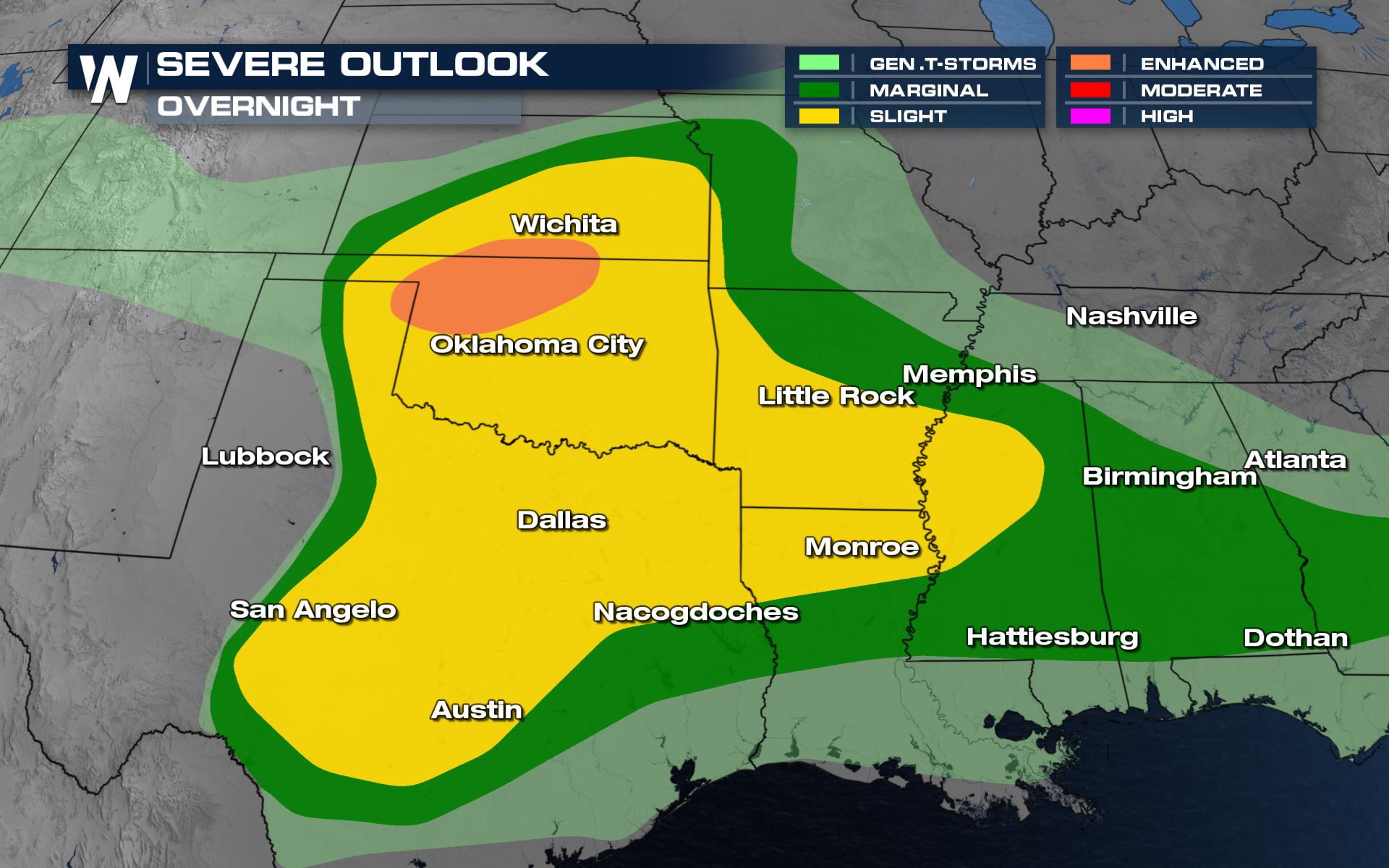
Severe thunderstorms tonight are bringing large hail to areas of Western Oklahoma, and might cross the border into Kansas into the early morning hours Wednesday.
Severe Risks
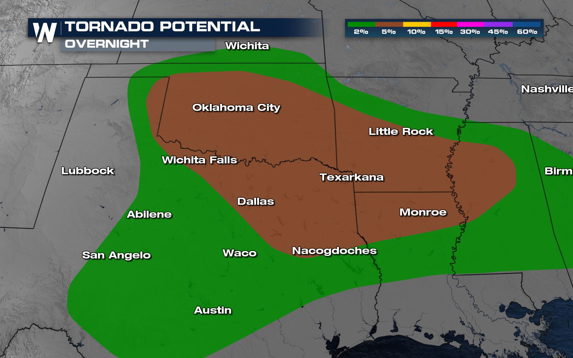
All modes of severe weather will be in the forecast, including a 5% risk of tornadoes over Oklahoma. Have a plan in place if you are in the forecast for severe weather over the next few days as tornadoes will likely be a major concern.
Forecast Southern Plains
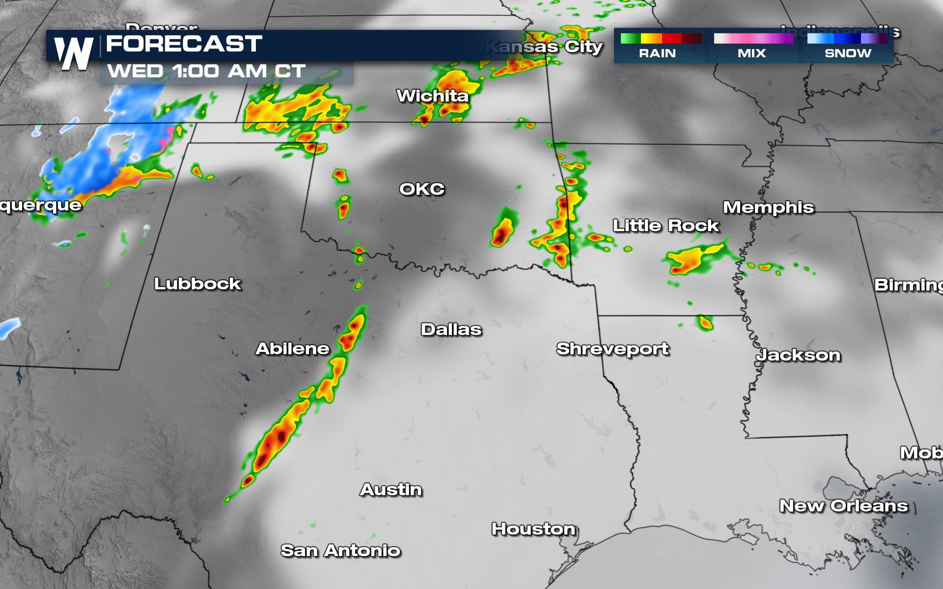
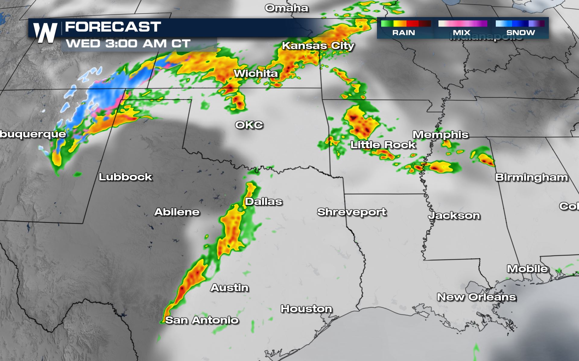
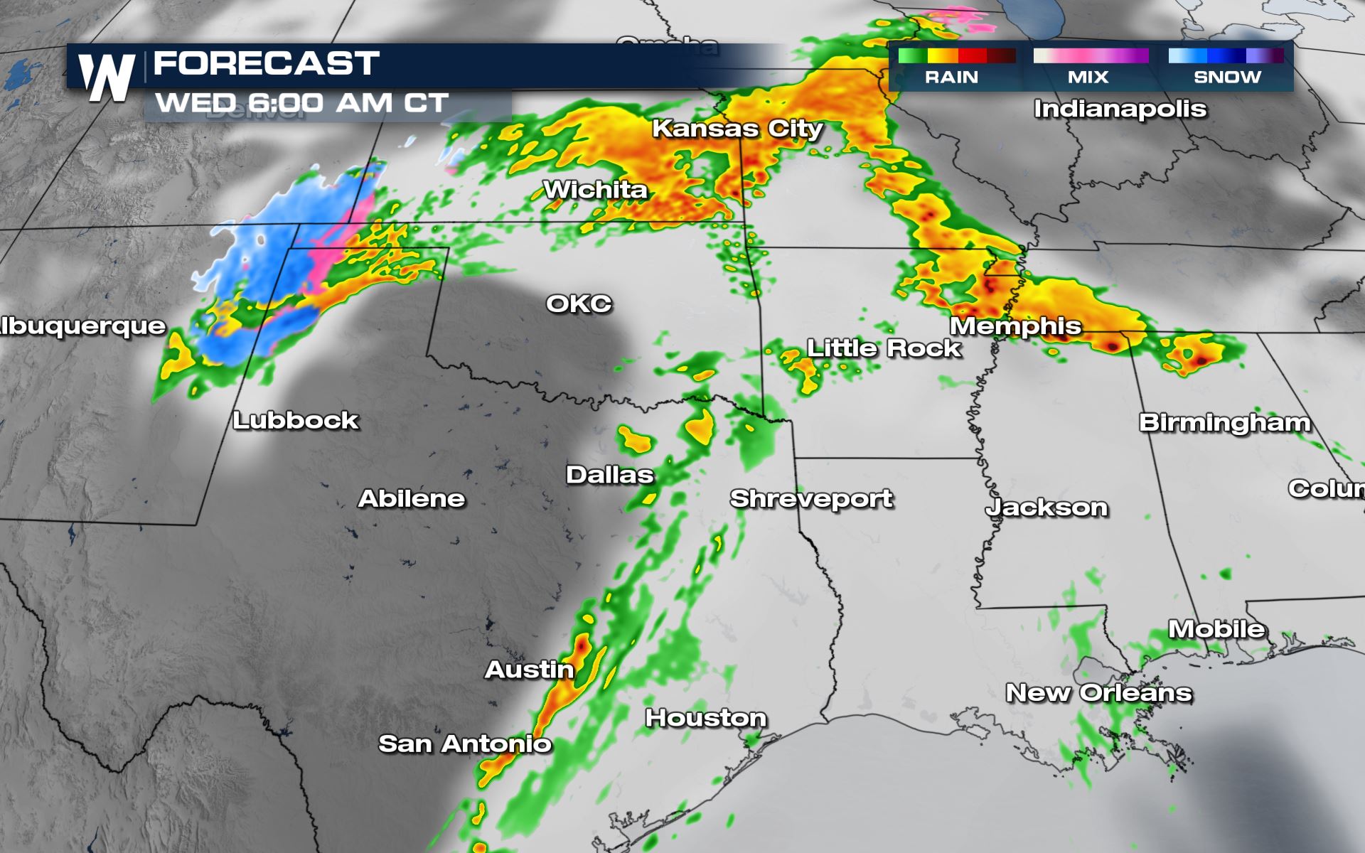
We’re currently tracking severe thunderstorms across the Southern Plains right now that will last into tonight and early Wednesday morning. This means overnight storm chances for Oklahoma and Texas. Have a plan in place in these areas if you have to take cover while you’re sleeping.
Keep checking with WeatherNation for more updates on the severe risk over the next few days.


Comments
Something to say?
Log in or Sign up for free