


 User Center
 My Training Class
 Feedback


Severe Risk Increases in the Southern Plains and Arklatex
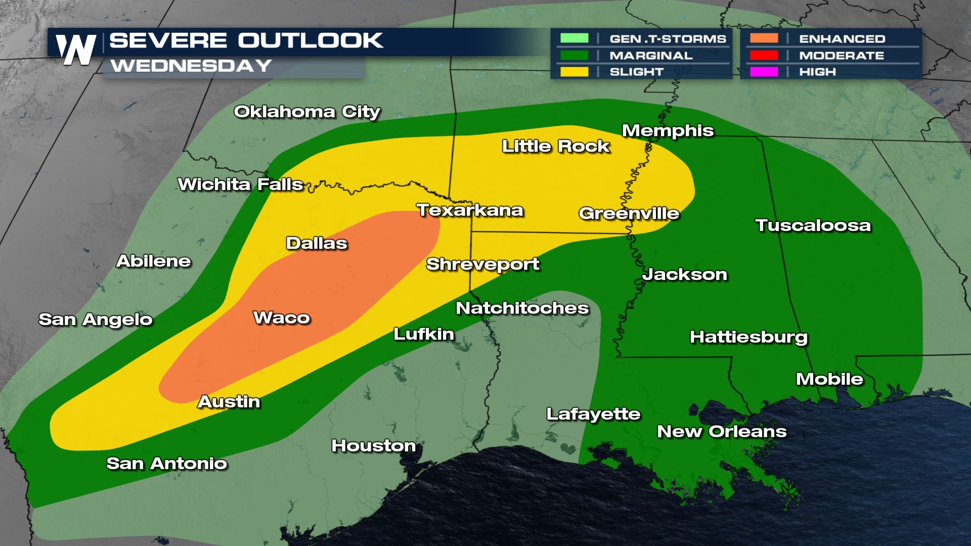
A multi-day severe weather event is forecast through the end of the week as a strong storm system brings instability and increasing humidity to the Central Plains, Arklatex and Deep South.
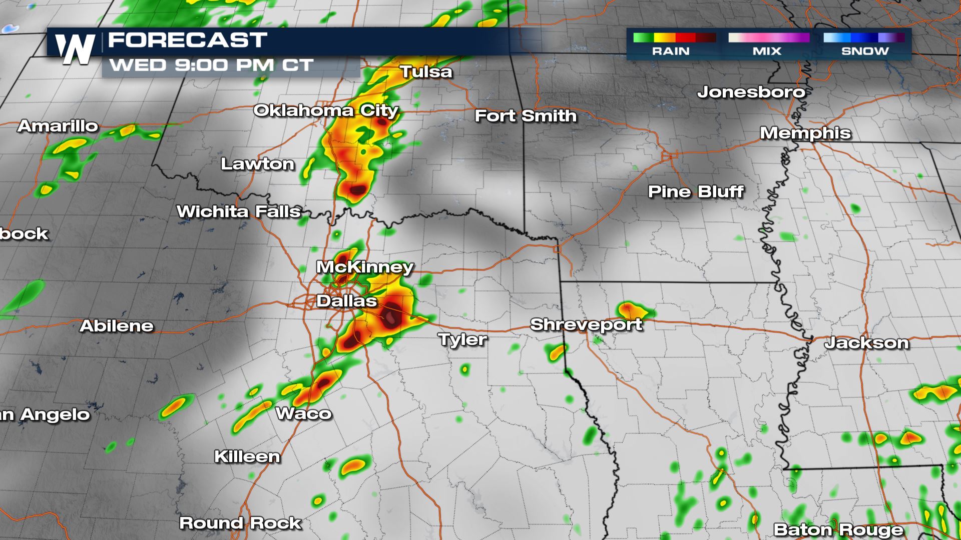
Severe thunderstorms are possible tonight from Oklahoma and Texas into the lower Mississippi Valley. The most likely timeframe for greatest coverage of storms is this evening, although isolated strong to severe storms will be possible throughout the morning hours as well. Multiple Severe Watches are in place stretching from Austin, TX up through the Oklahoma border.
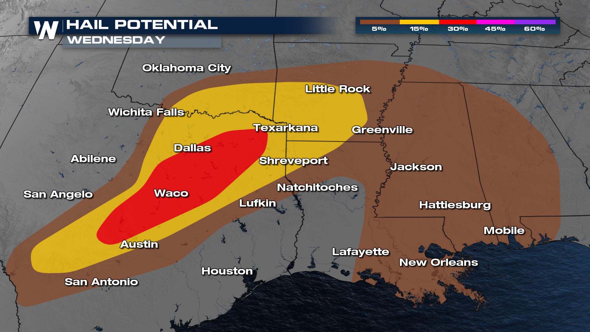
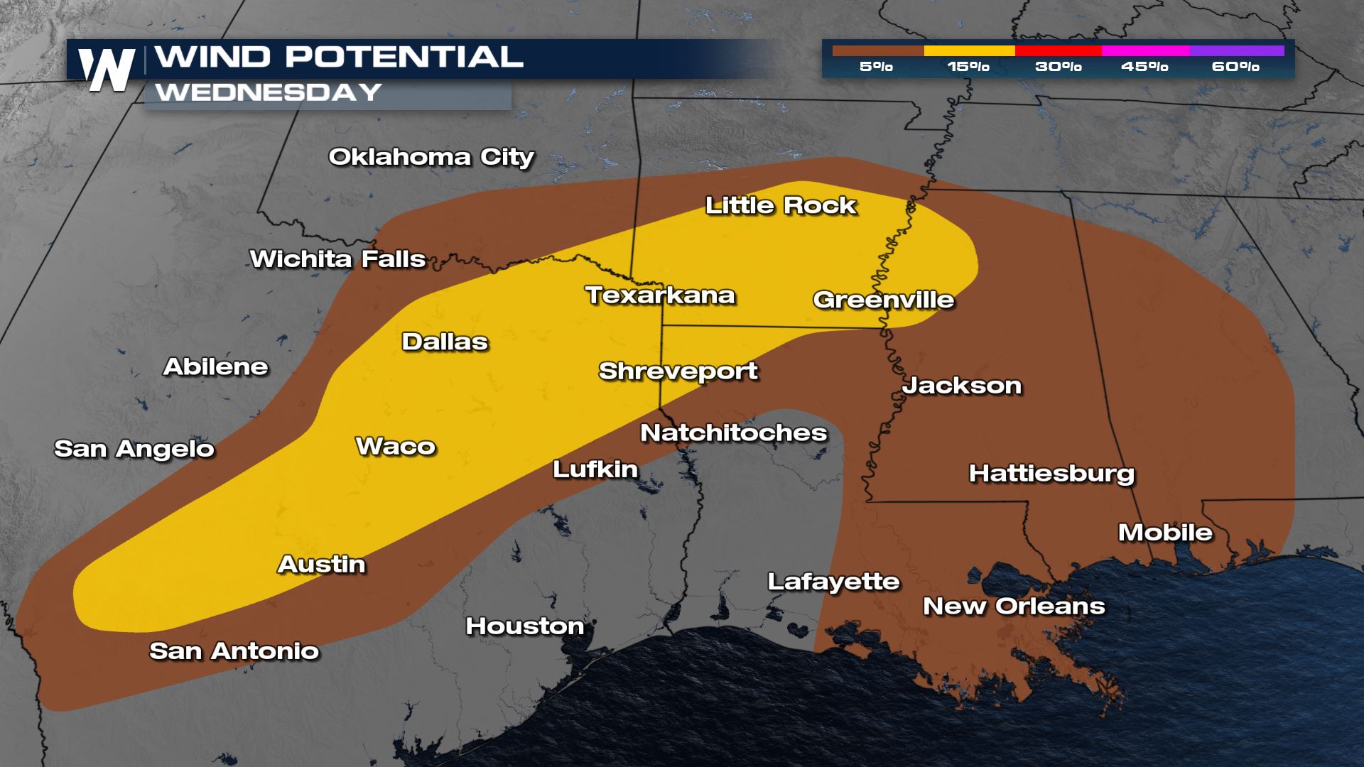
The risk for severe thunderstorms is focused from north central Texas to southeast Oklahoma and western Arkansas, where there is an Enhanced Risk (Level 3 out of 5). Large hail, greater than 1″ in diameter and 60 mph wind gusts are the main severe weather threat.
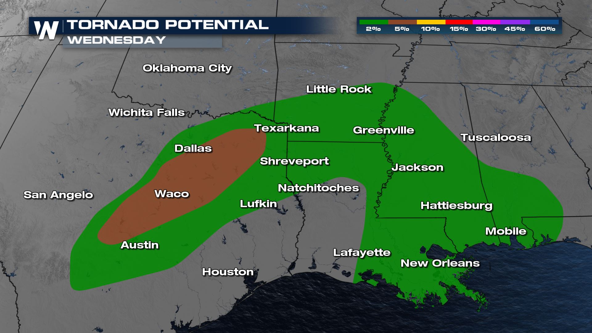
A brief tornado is also possible especially in the late afternoon and early evening. The tornado potential would be highest in Texas during the afternoon with storms moving east through the evening into the lower Mississippi Valley.
Forecast
The cold front will interacted with jet stream energy which started generating strong to severe storms in Texas and southern Oklahoma. Storms will continue to intensify and move east through the evening. These storms will have the potential for large hail and gusty winds. If storms are able to form outside the main line, they would have a higher chance to rotate and produce tornadoes. Hail and wind will remain the biggest hazards, with a tornado possible if storms are able to rotate.
Even as energy decreases overnight, the severe storm threat will persist into Arkansas and Mississippi. Severe storms will be more isolated but still capable of producing mainly large hail with a few strong wind gusts possible.
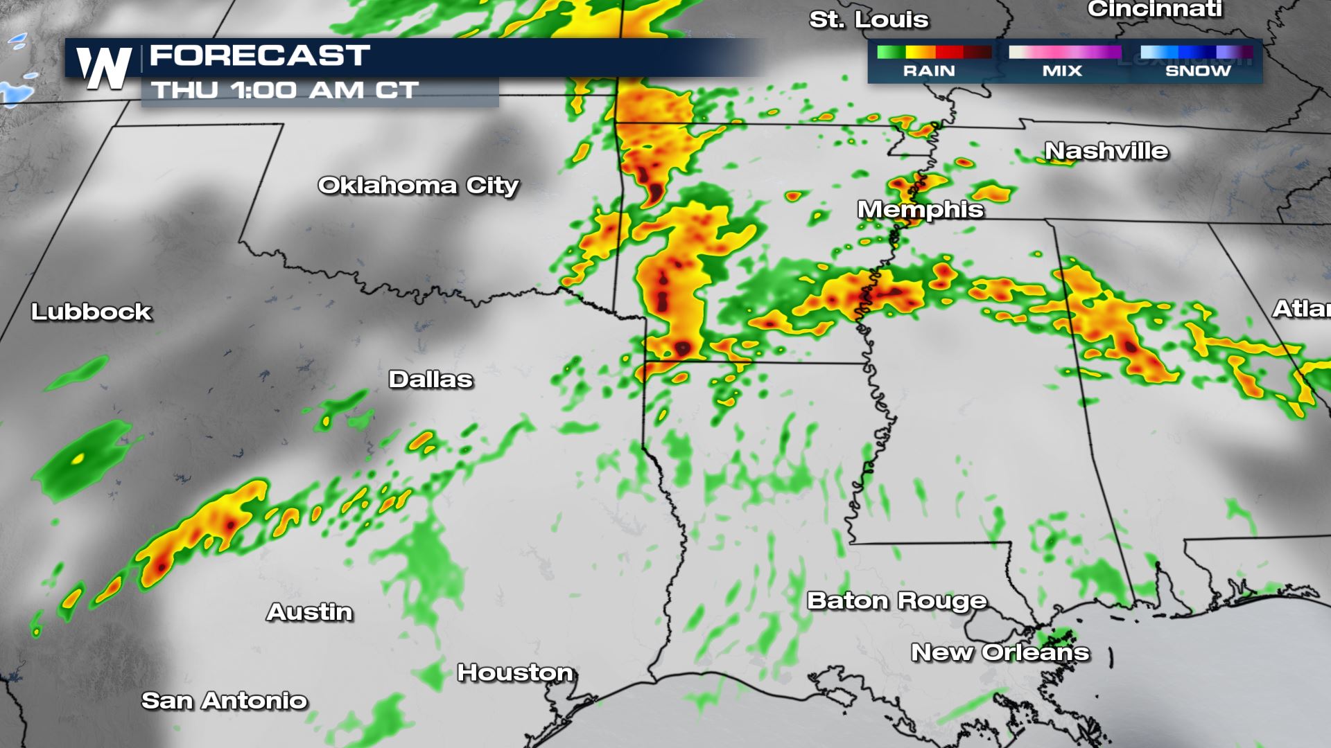
By sunrise Thursday this round of heavy rain and storms will be lifting to the north. A few scattered thunderstorms may continue to form through the morning hours in Texas, Oklahoma and Arkansas.
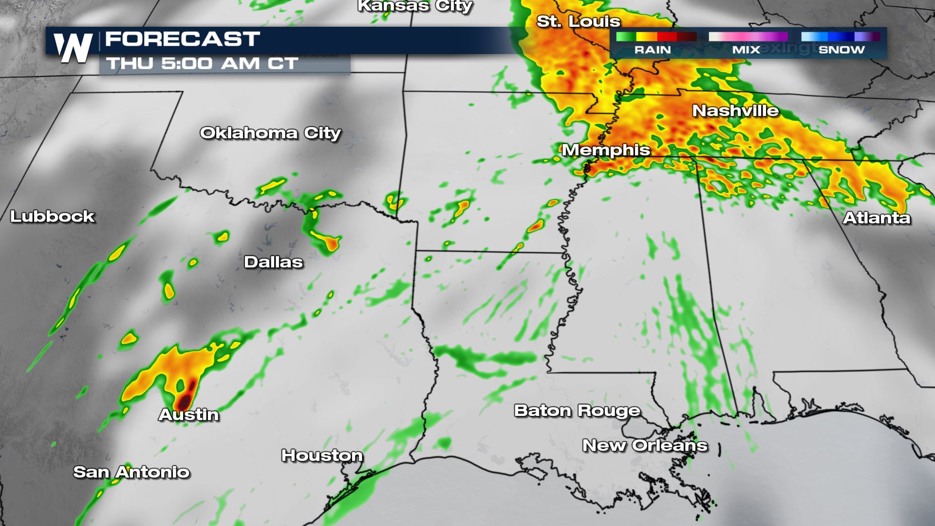
However with the main jet stream energy starting to move into Texas and then the Mid-South, a more significant severe weather event will unfold into Thursday afternoon. This is another of our top weather stories.
WeatherNation will keep you updated on the severe weather and flooding potential through the rest of the week. We’re always streaming 24/7 on multiple platforms as well as our WeatherNation app.


Comments
Something to say?
Log in or Sign up for free