


 User Center
 My Training Class
 Feedback


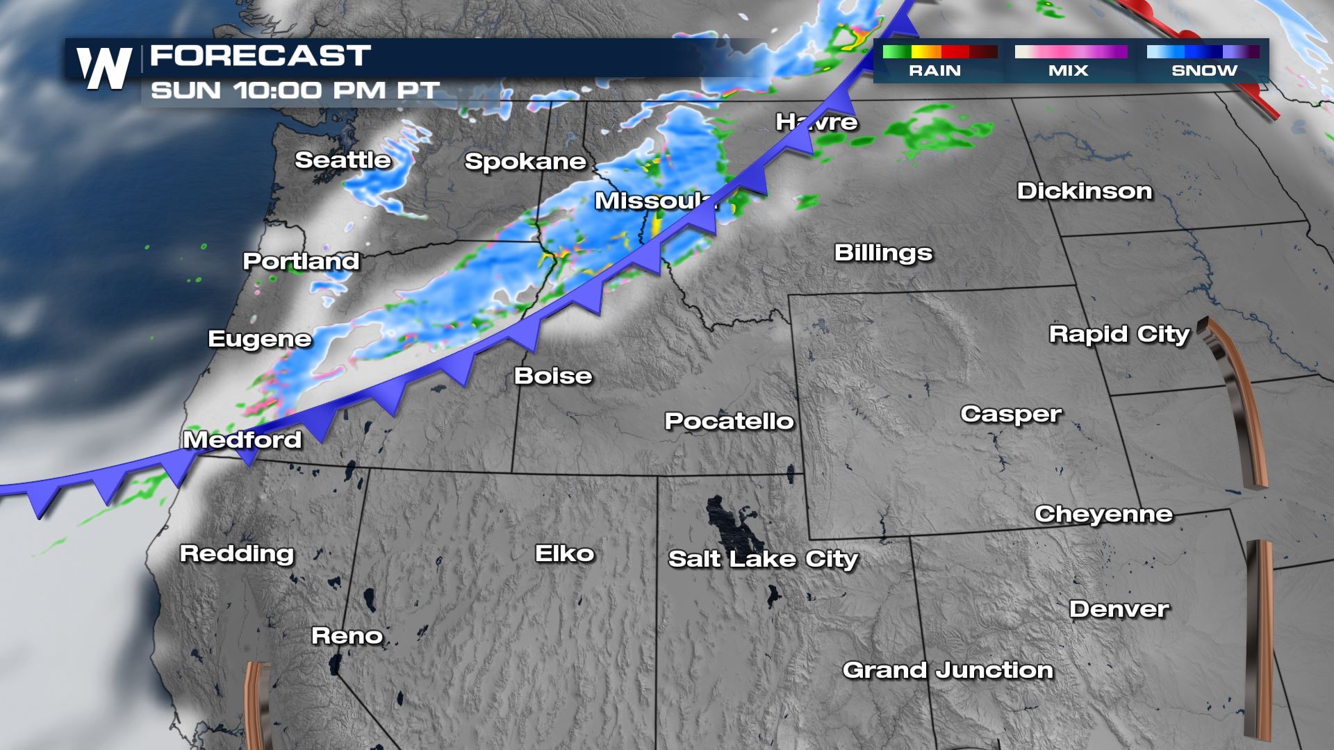
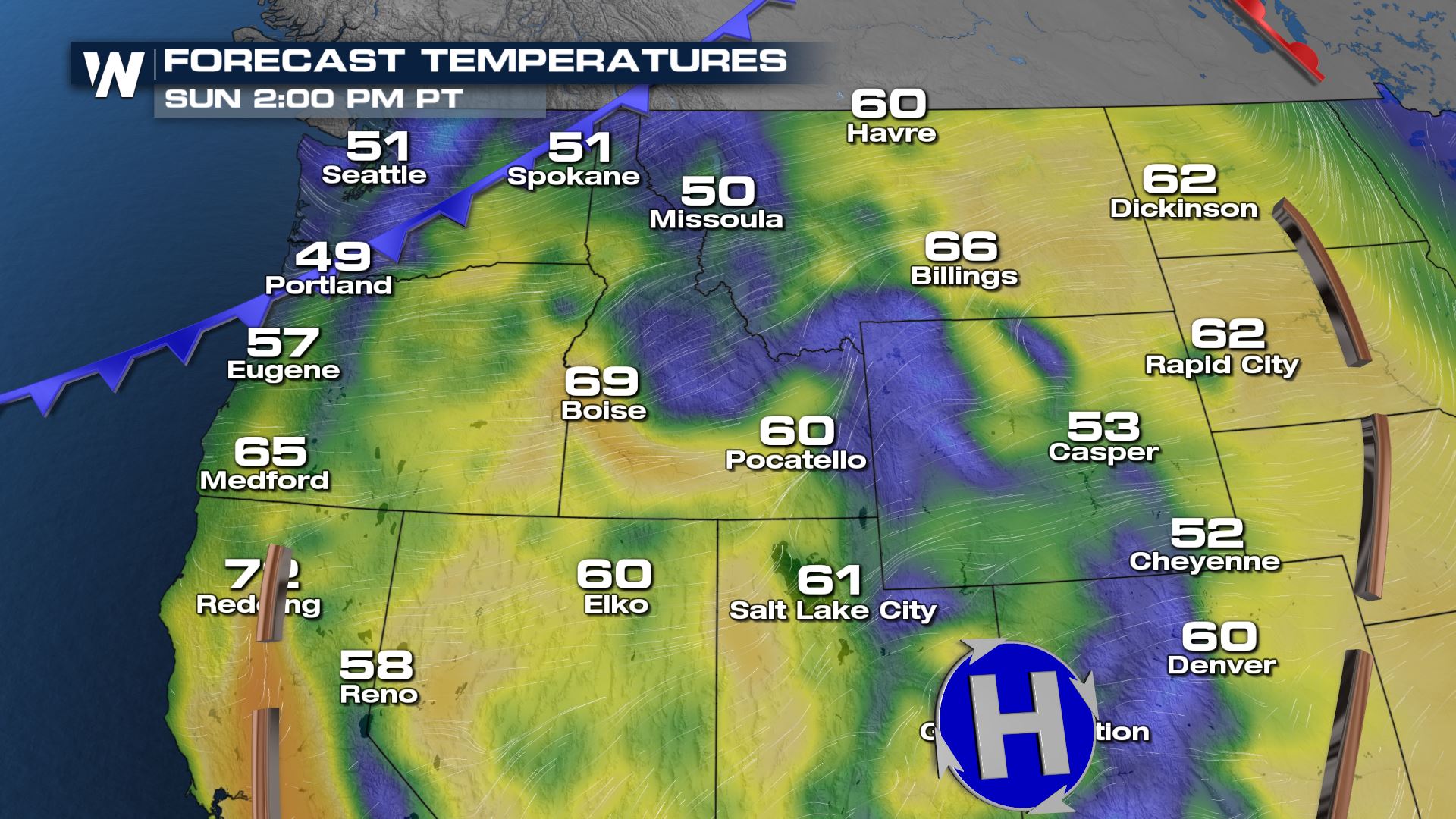
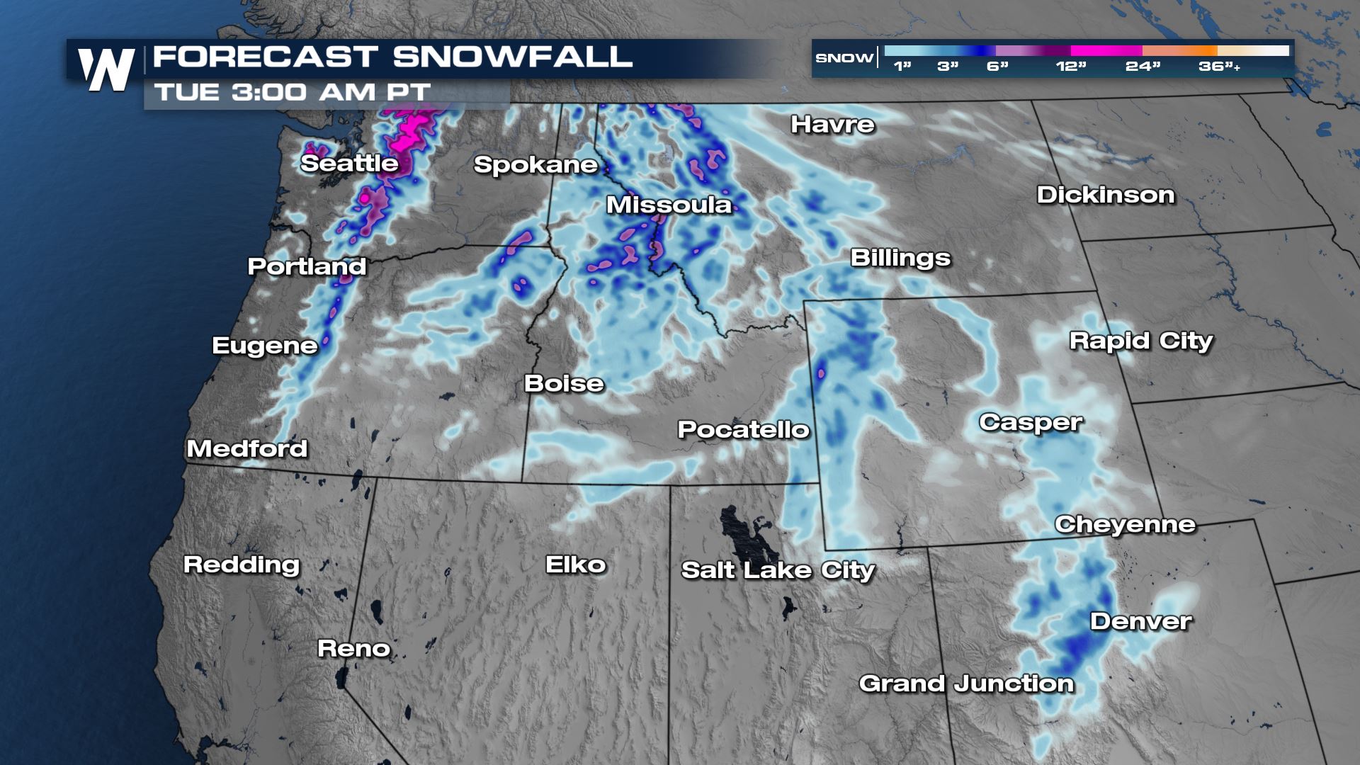
Our next cold front will move off the Pacific on Sunday, bringing heavy rain and snow showers to the Pacific Northwest and the Rocky Mountains Sunday through early next week. Out ahead of the cold front, warm temperatures and strong winds will prompt fire danger concerns.
Rain and snow showers will move onshore into the Seattle area and the coast of Washington mid-morning on Sunday and continue through the daytime hours.

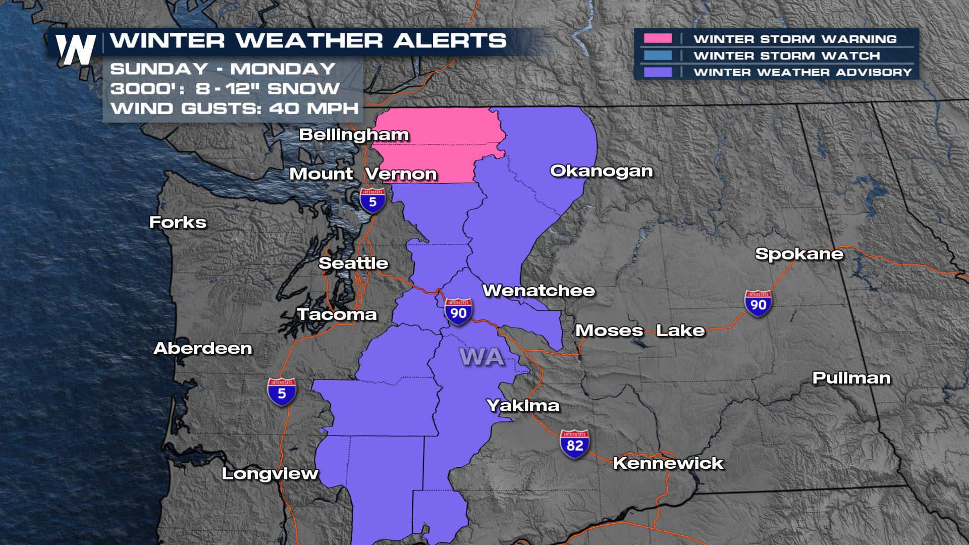
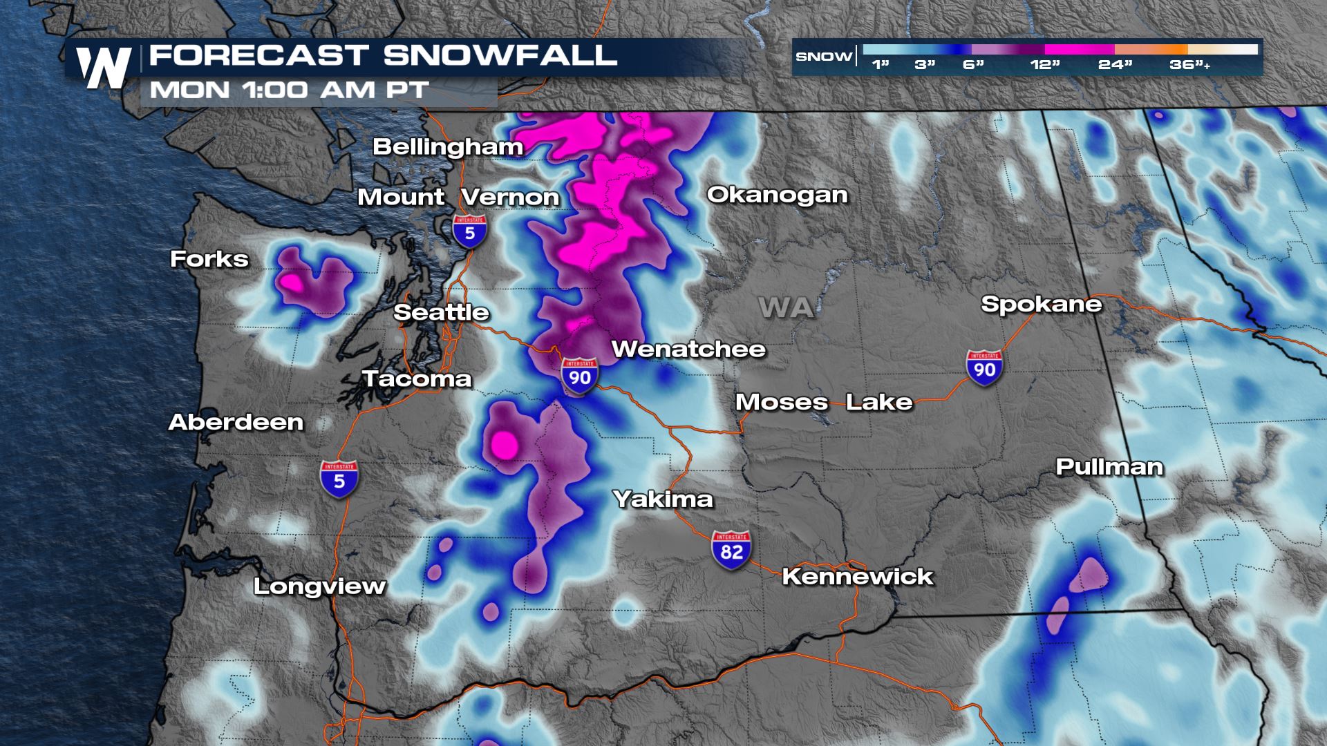
Winter weather alerts are in place for the Cascades through Monday. Accumulations between 2-8″ are possible for the high terrain areas with even locally higher amounts.
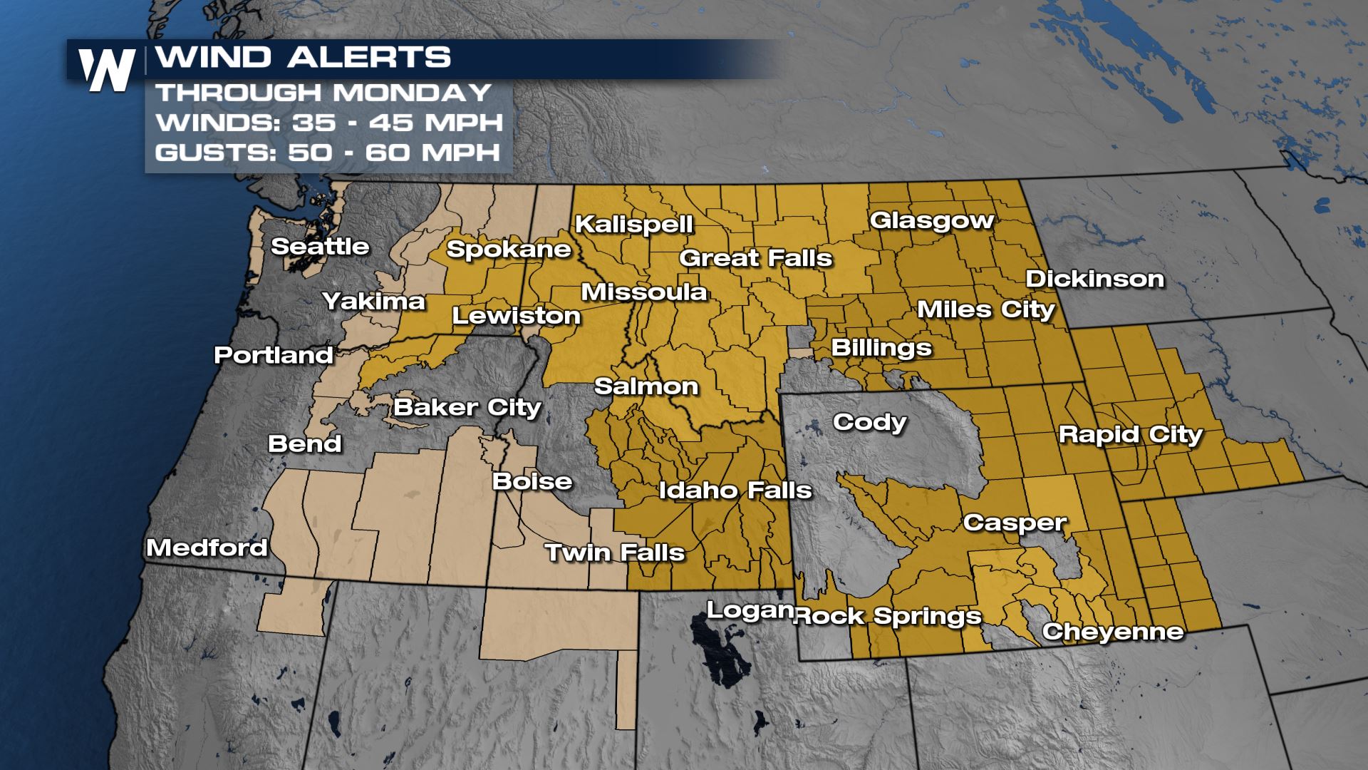
The pacific cold front will race to the south and east, bringing snow to the northern Rocky Mountains of Idaho, Montana and Wyoming by Sunday night. Out ahead of the cold front, we will see wind gusts in the range of 45-55 mph on Sunday.
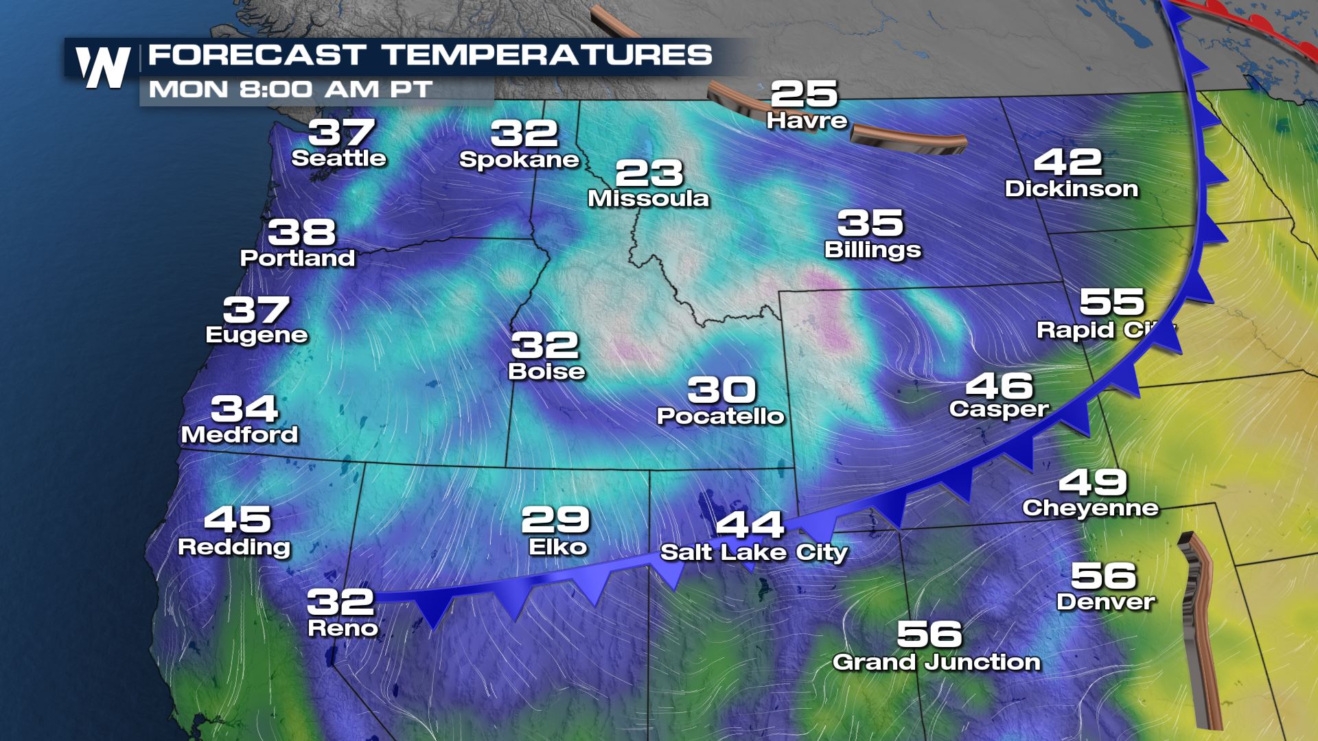
A pretty significant cool-down is expected Sunday into Monday, with highs dropping about 30° – from the 60s and 70s to only the 30s and 40s by Monday. Old man winter is hanging on!
Snow showers will continue through the overnight hours Sunday into Monday, making travel difficult on the I-90, I-84, I-80 and I-25 corridors during those time frames. This system will move through quickly, so by Monday evening we are clearing snow-showers out of southern Wyoming and will see clearing across the northern Rockies.
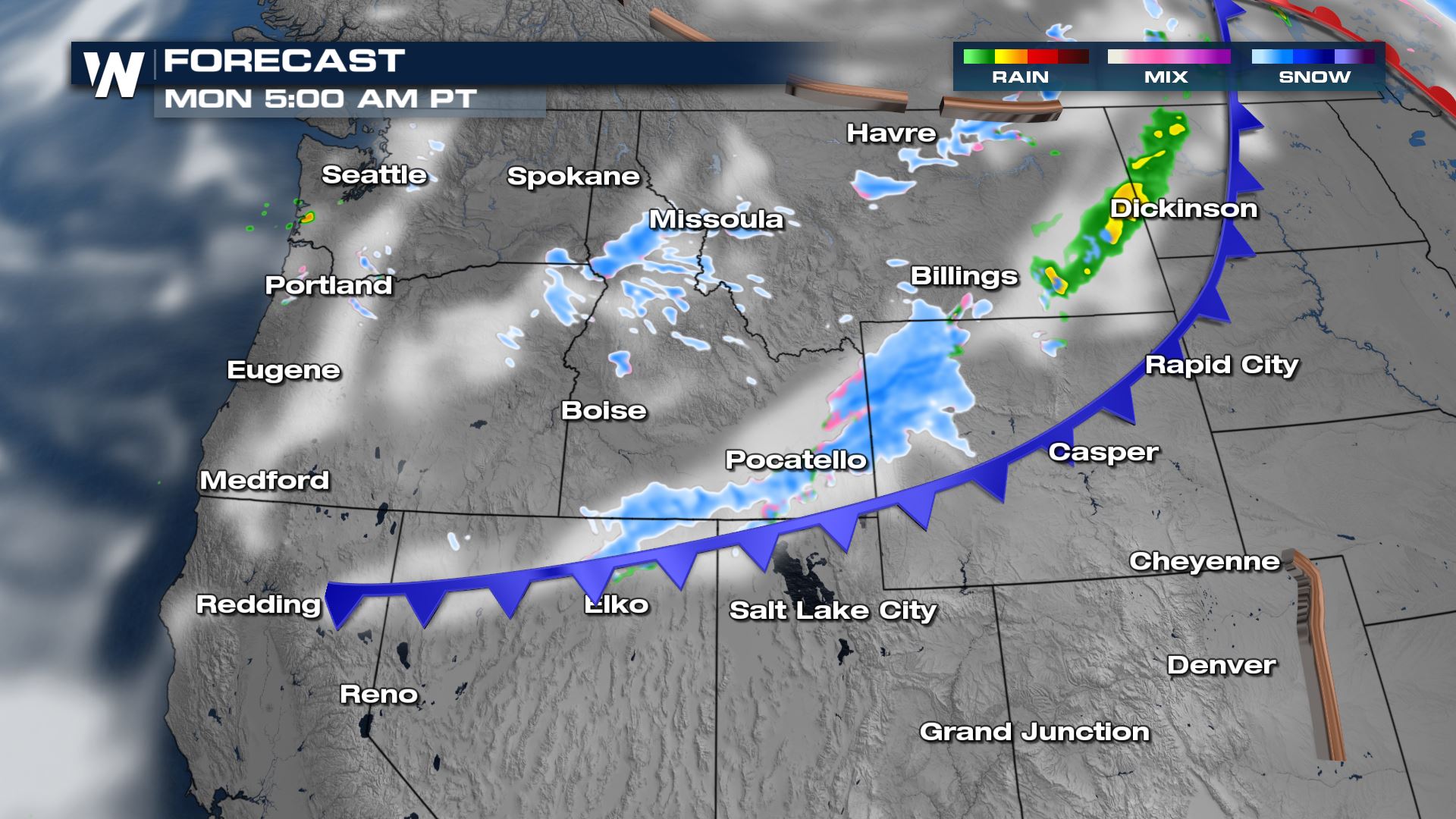
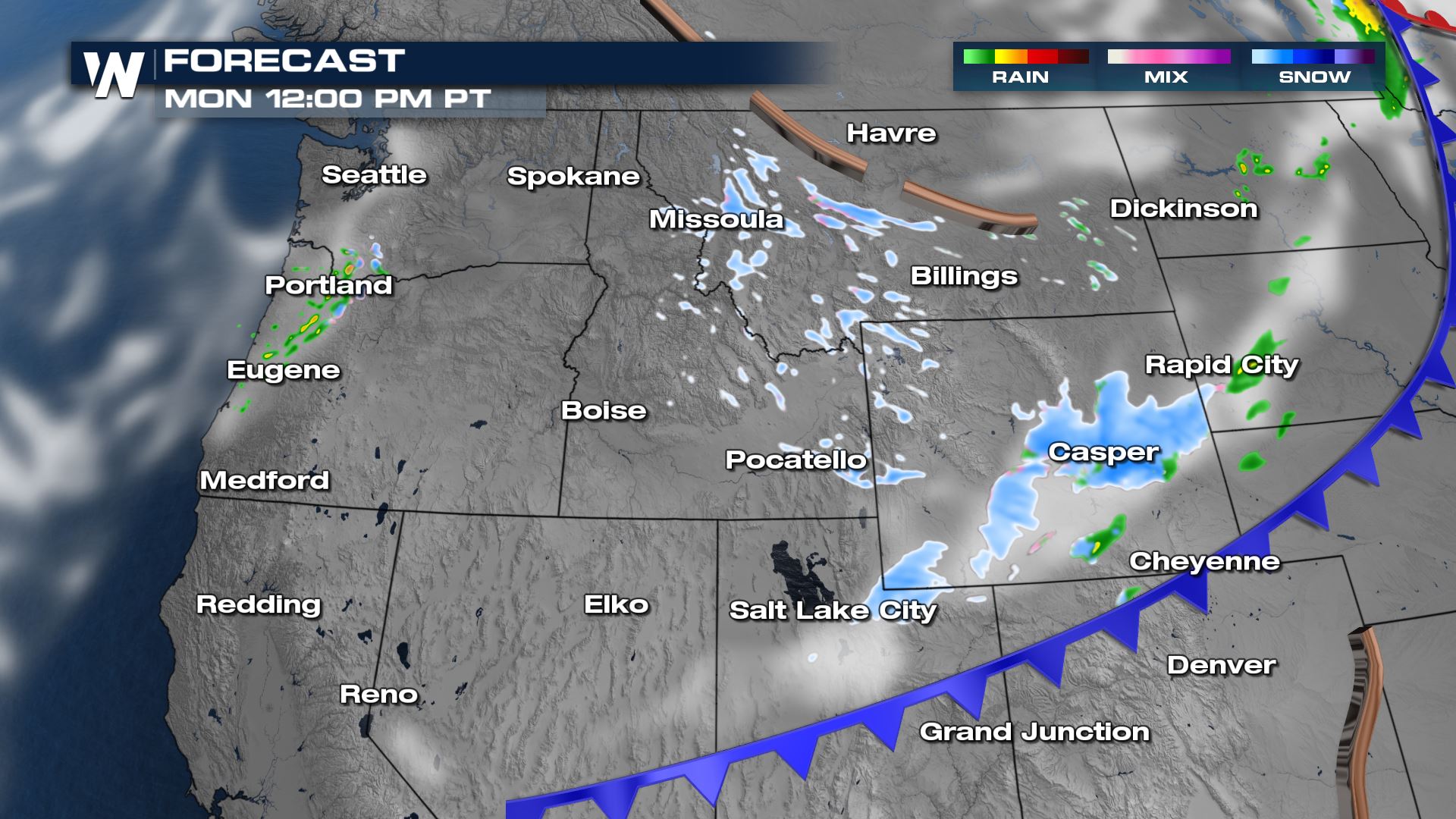
Snowfall accumulations will be between 1-4″ for much of central Wyoming, Idaho and Montana, outside of the mountains, which could see 3-8″ of new snowfall (this includes the continental divide and Front Range of Colorado into Tuesday).


Comments
Something to say?
Log in or Sign up for free