


 User Center
 My Training Class
 Feedback


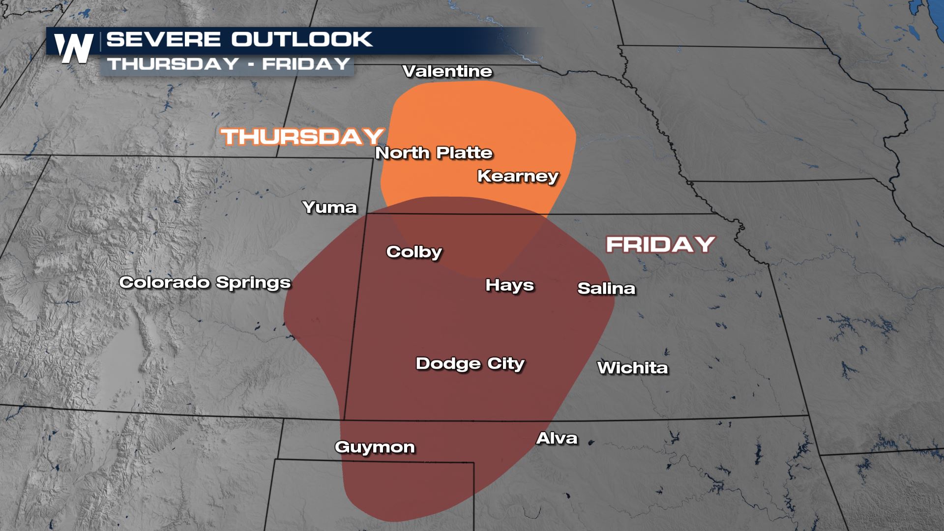
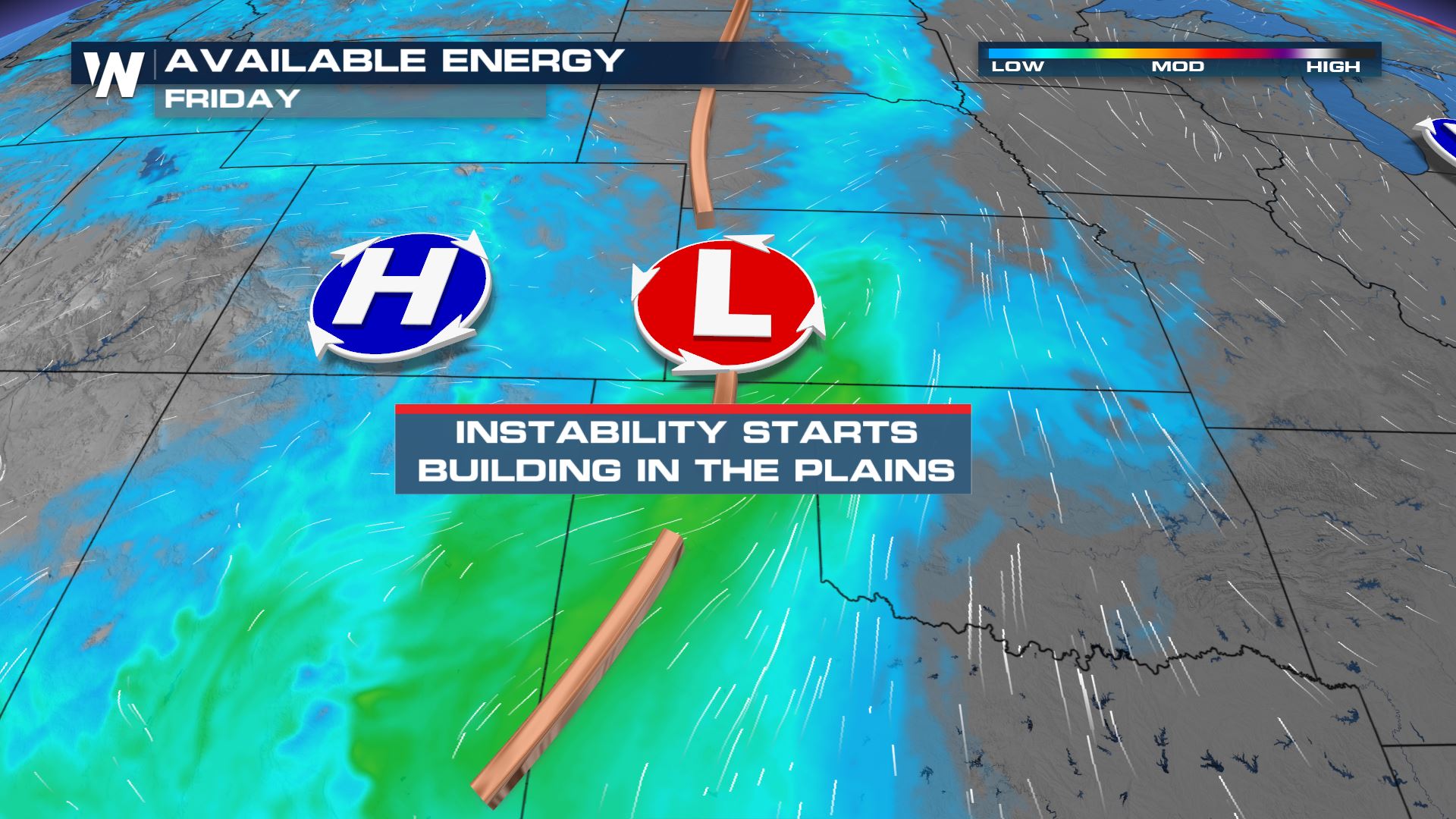
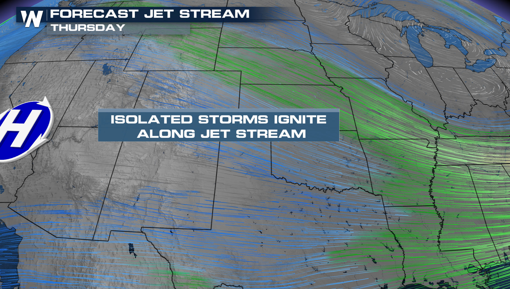
The threat for severe thunderstorms returns to the Plains for the end of this week. Instability will build ahead of a storm system as jet stream energy moves into the region from the West.
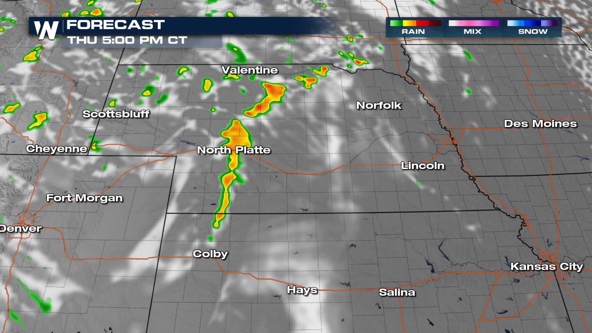
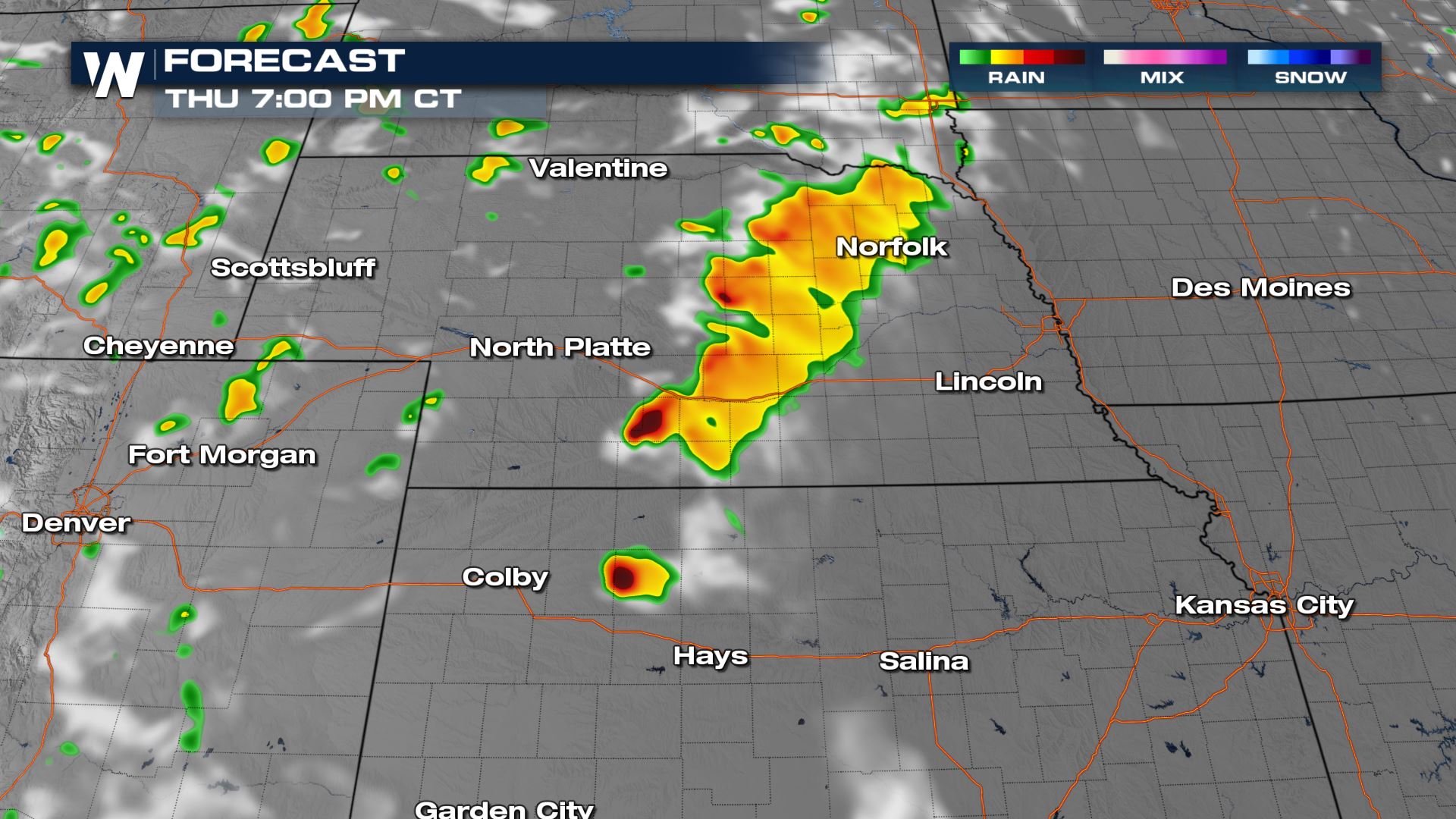
On Thursday, there is a marginal risk for severe thunderstorms (level 1 on a scale from 1 to 5) in central Nebraska. Strong wind gusts greater than 58 mph are the main threat.
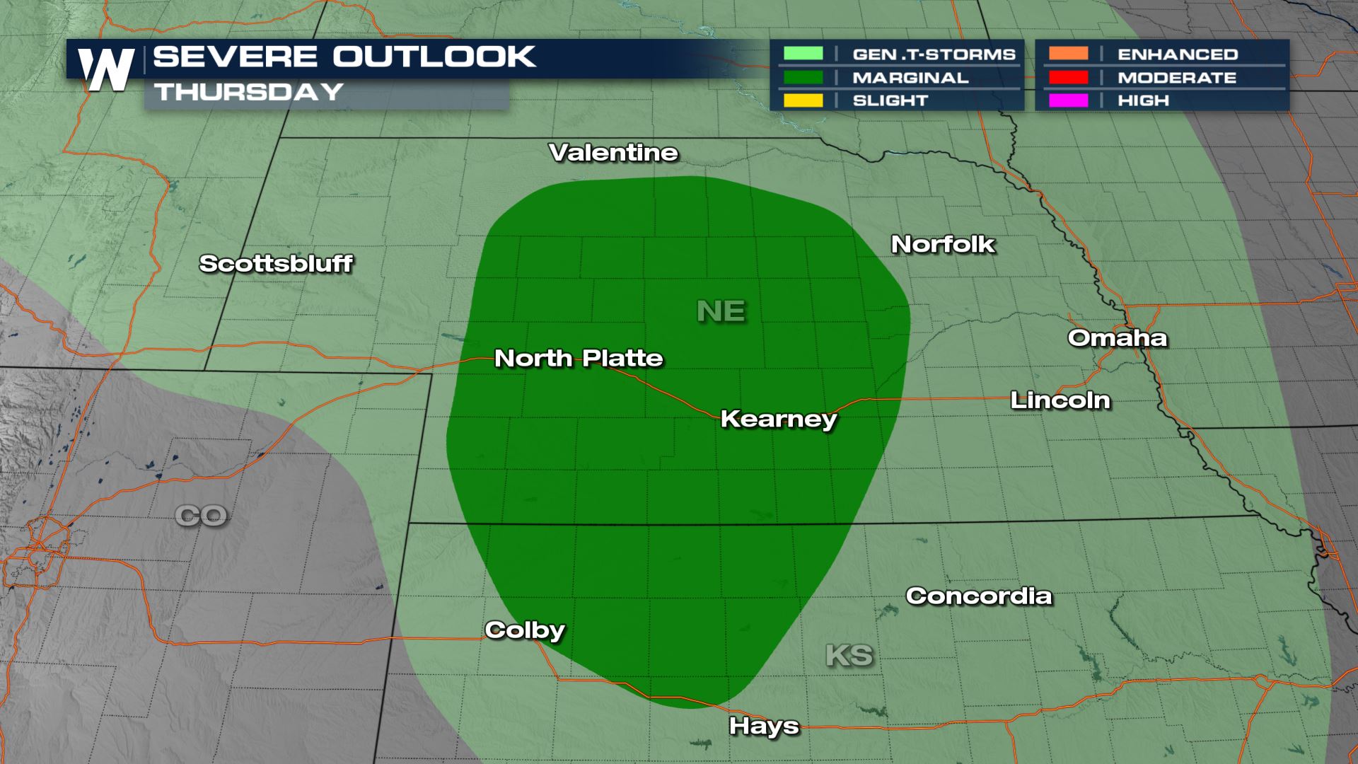
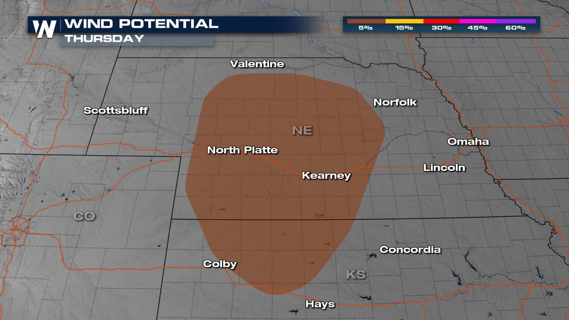
Storms will fire ahead of a surface trough in central Nebraska in the afternoon ahead of a weak upper level disturbance. The strongest storms will occur in the late afternoon and early evening. As storms moves eastward, intensity will diminish, especially after sunset.
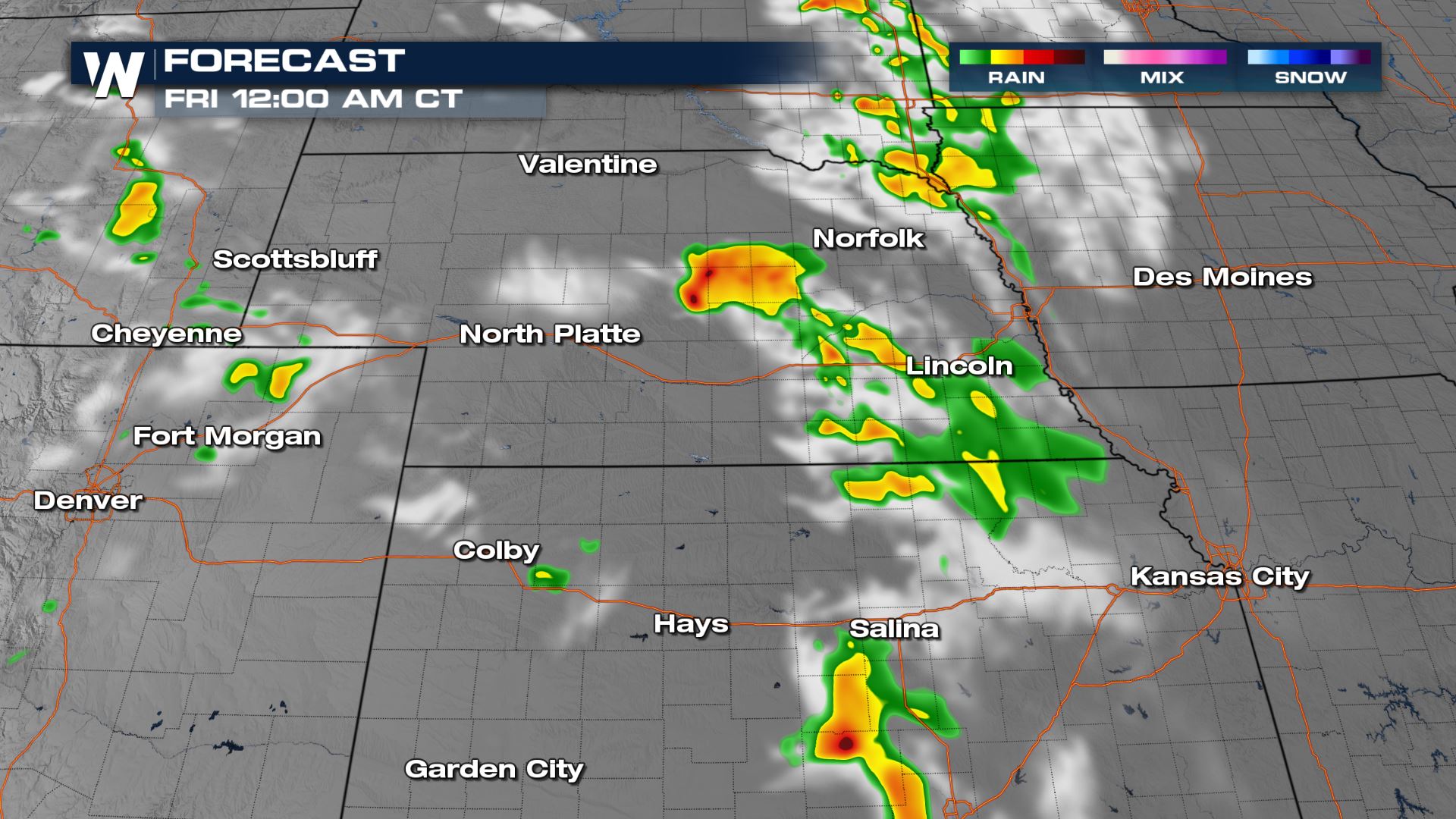
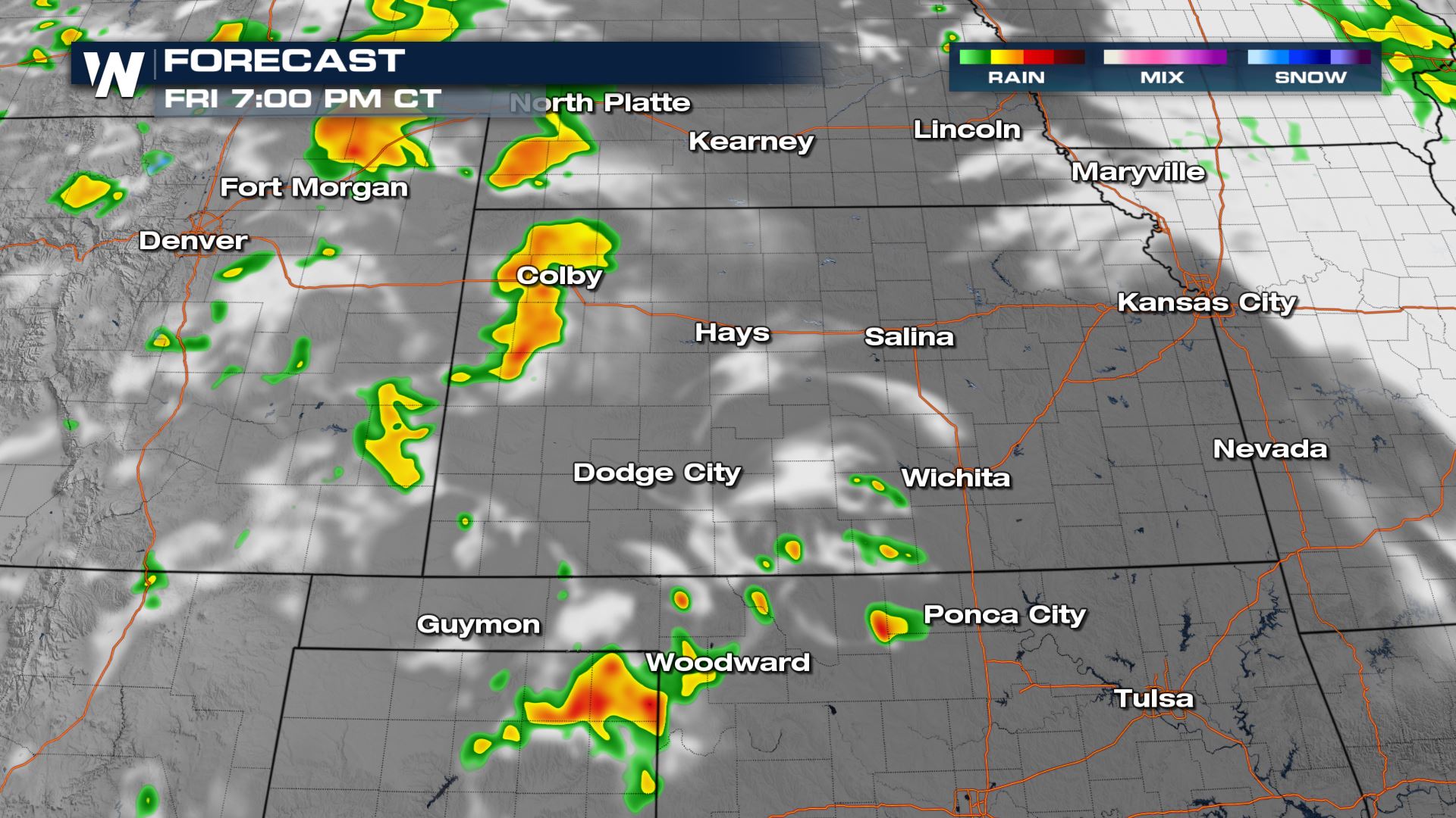
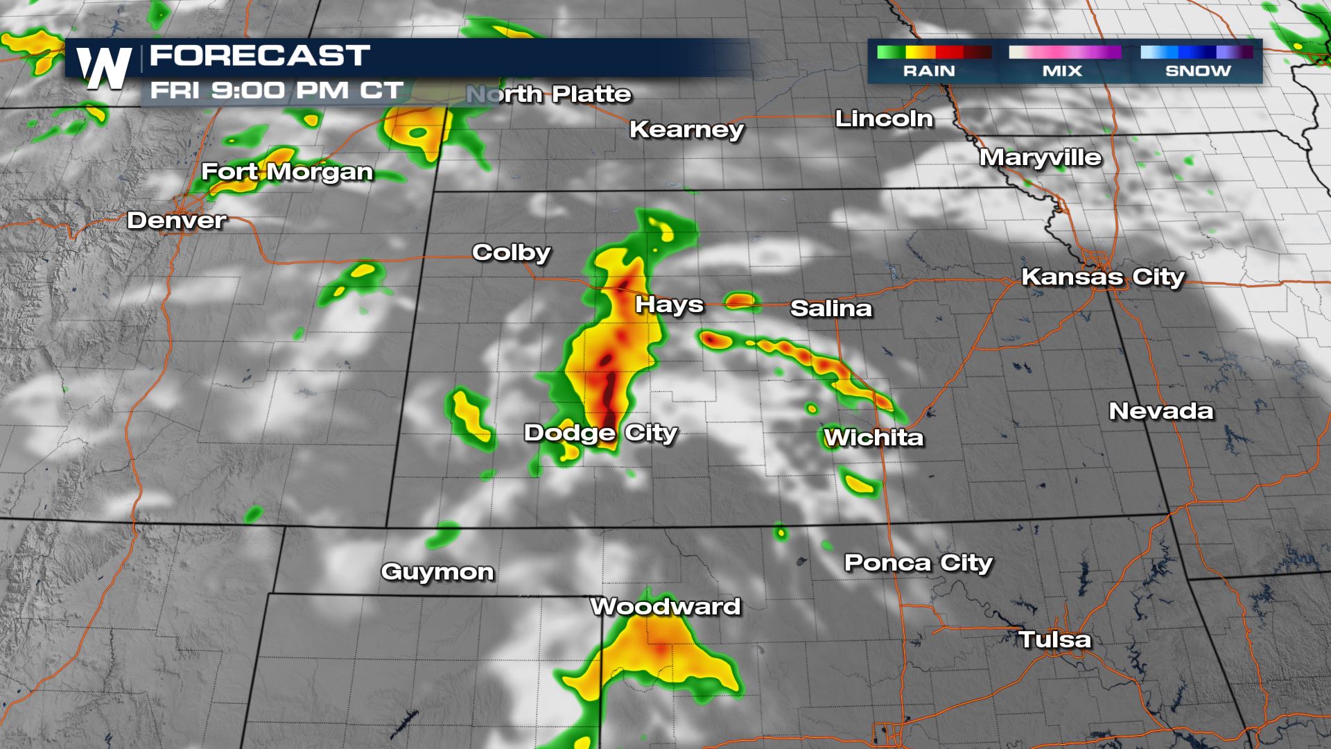
For Friday, the severe weather risk shifts southward from Kansas and eastern Colorado into the Oklahoma and Texas Panhandles. A developing low pressure center and dryline will likely produce a few thunderstorms with large hail and strong wind gusts.
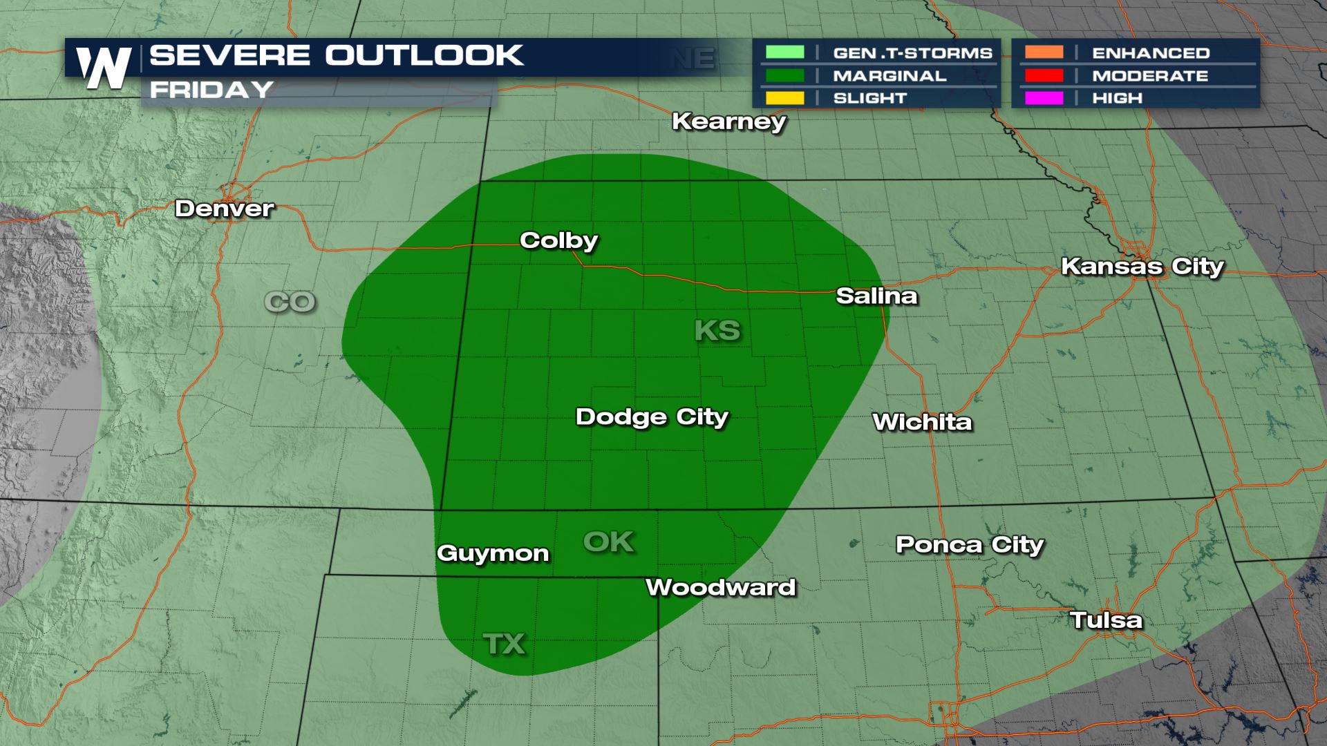
Friday’s storms appear to be a bit stronger based on our model reflectivity.
Check back with WeatherNation on-air and online for the latest severe weather updates.


Comments
Something to say?
Log in or Sign up for free