


 User Center
 My Training Class
 Feedback


Isolated Severe Risk from Colorado, New Mexico through Texas
The active pattern continues today across the Central and Southern Plains. We could see some isolated severe storms today from Denver to the border with Mexico. Here is the very latest on today’s severe forecast.
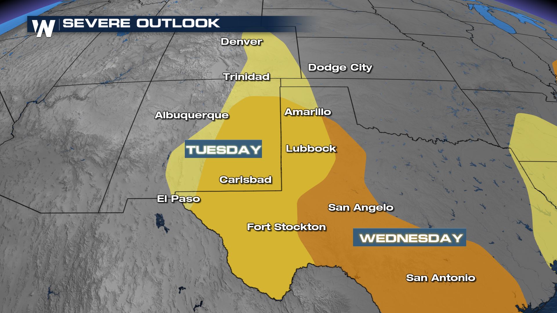
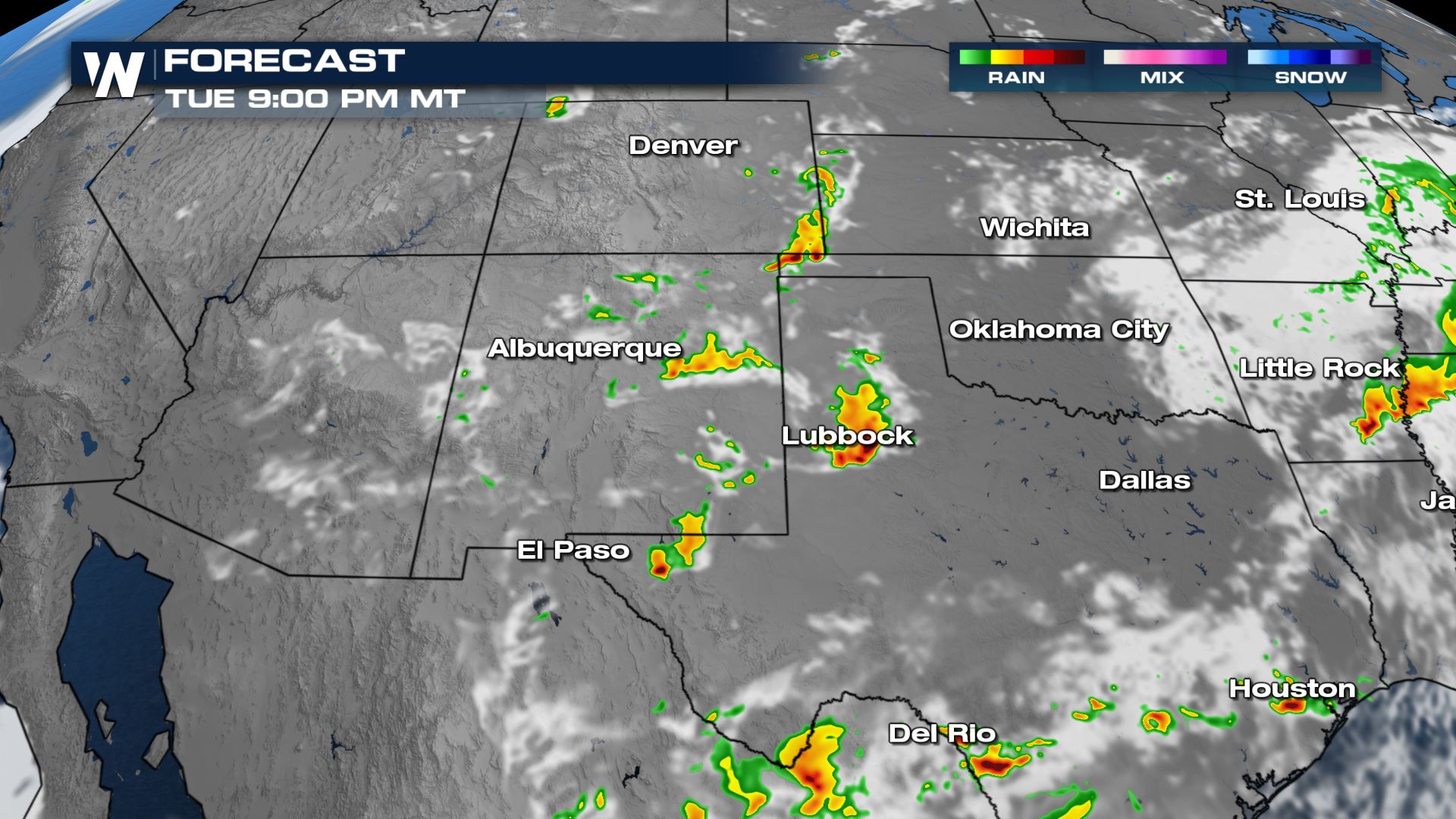
Tuesday Storm Outlook
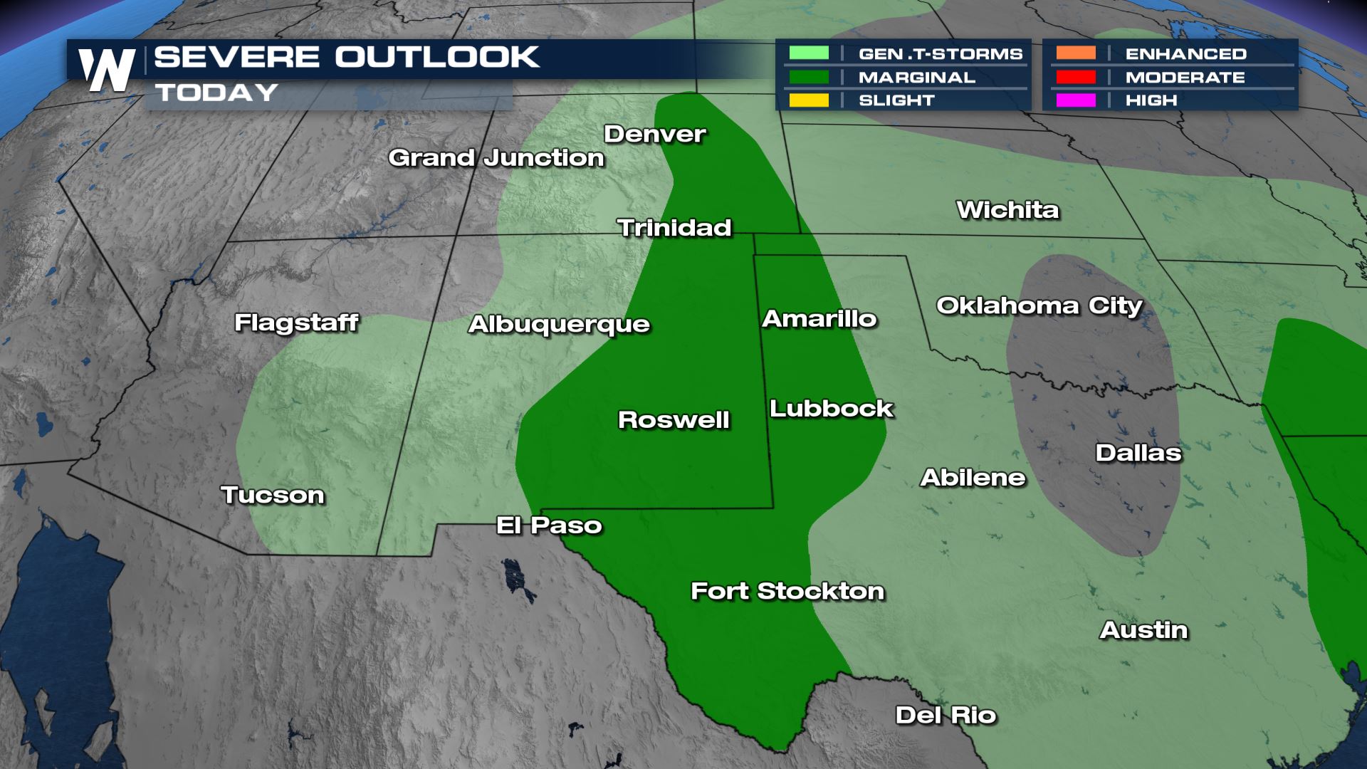
The Storm Prediction Center has issued a marginal risk (level 1 out of 5) for isolated severe storms from the Colorado Plains through New Mexico and west Texas.
Severe Risks
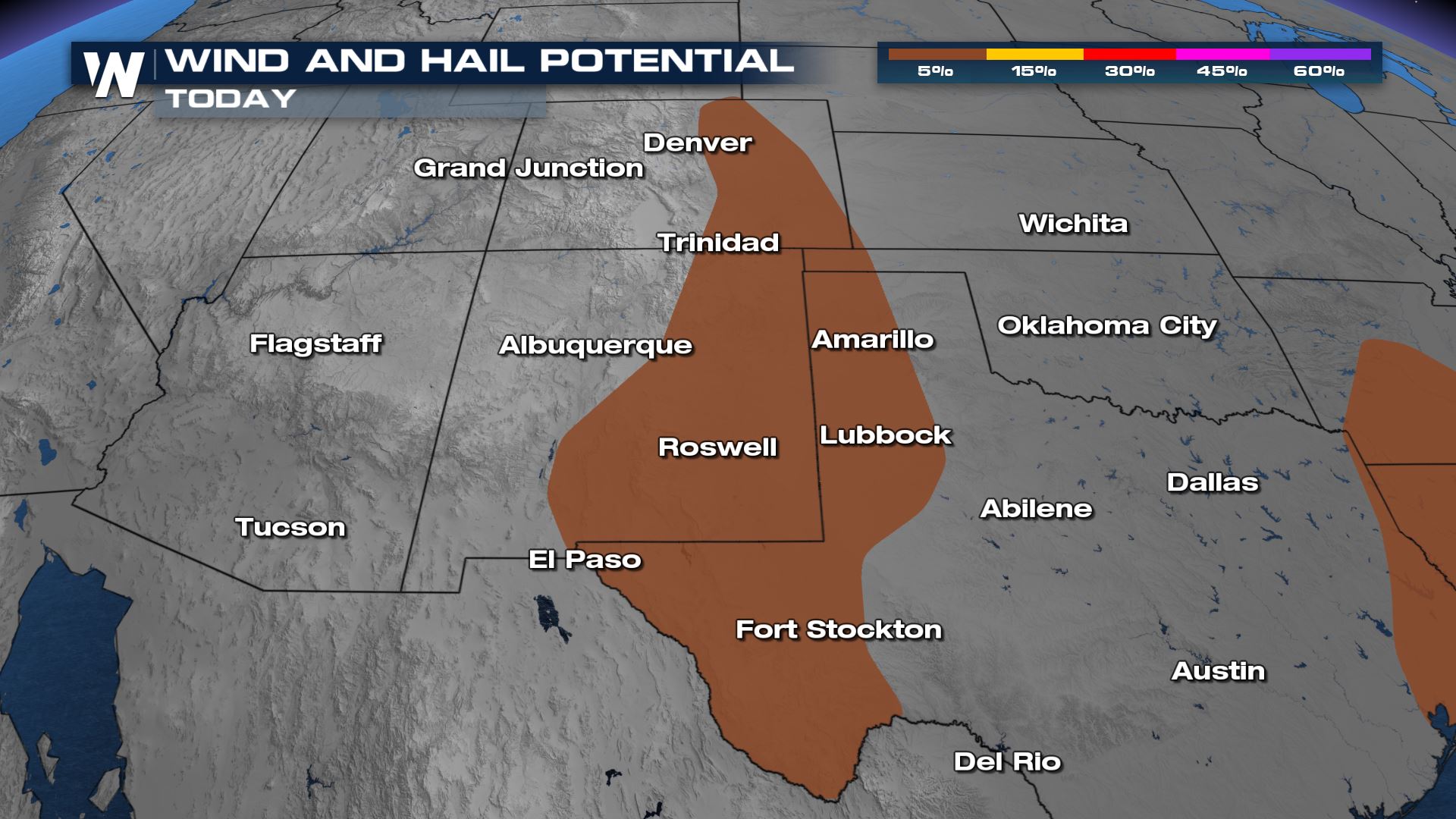
The main threats with today’s severe risk will be large hail and damaging winds. These threats will be isolated, but it only takes one severe storm to do damage to life and property.
Forecast
Storm will fire in these areas during the peak heating hours this afternoon. That is when the ingredients for isolated severe storms should come together. Most storms will be fairly isolated in nature throughout the afternoon hours in Colorado and New Mexico but some of these areas have been saturated from previous storms and may be prone to additional flash flooding.
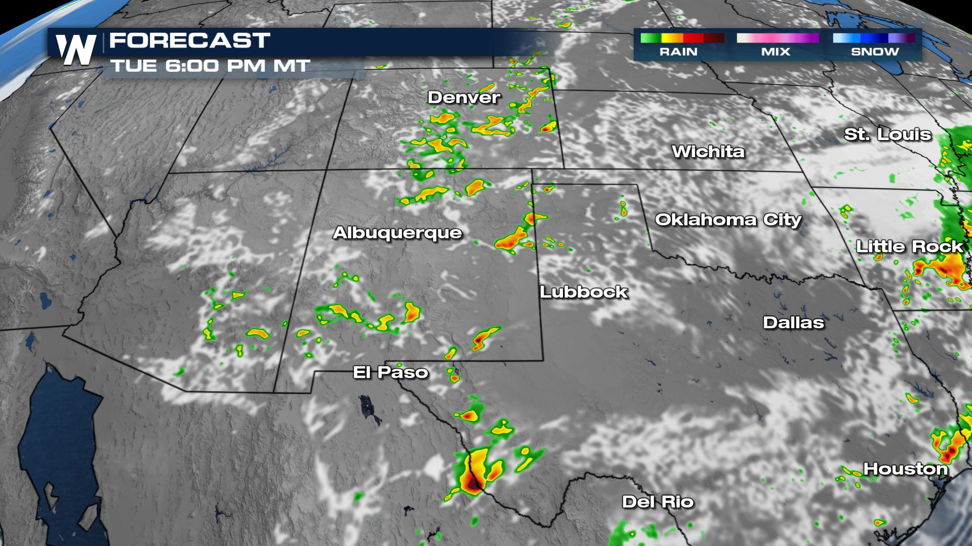
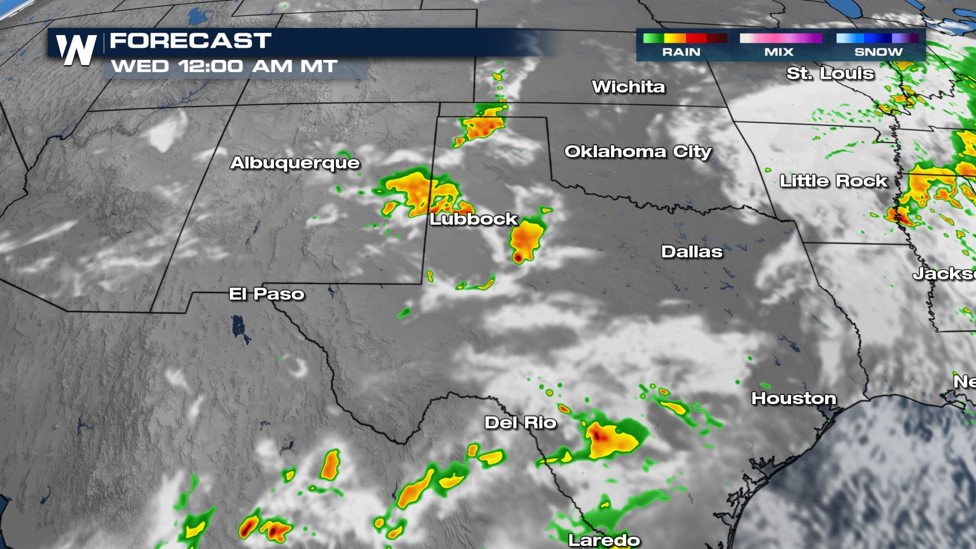
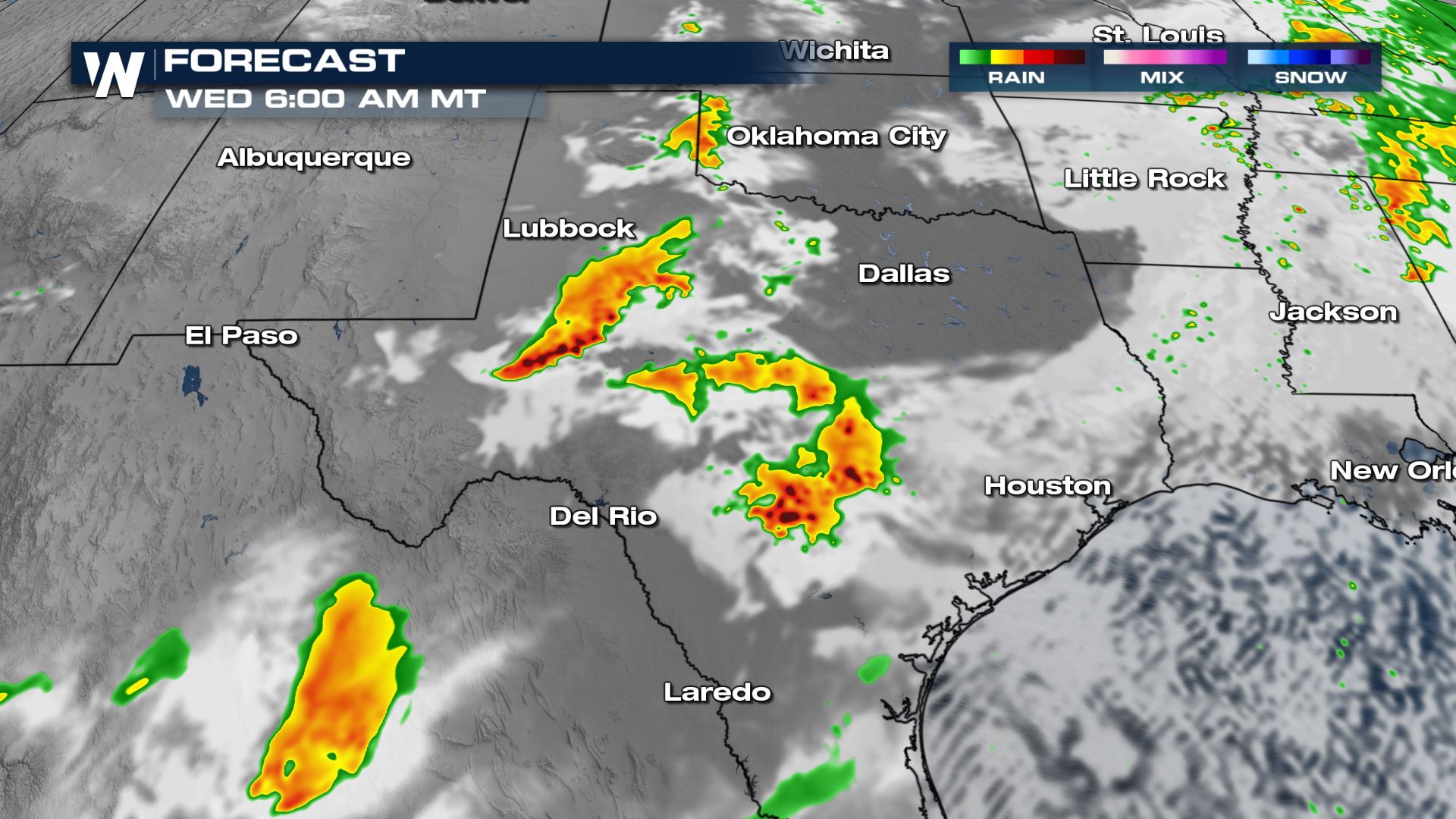
These cells progress east into west Texas around and after sunset tonight.
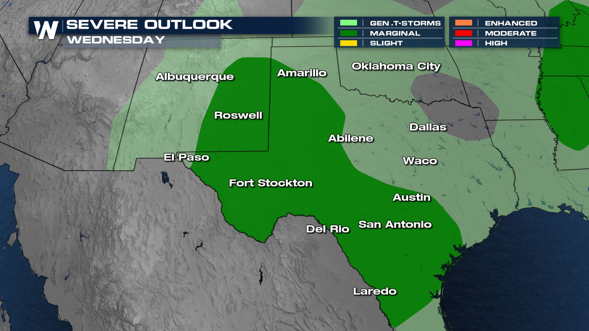
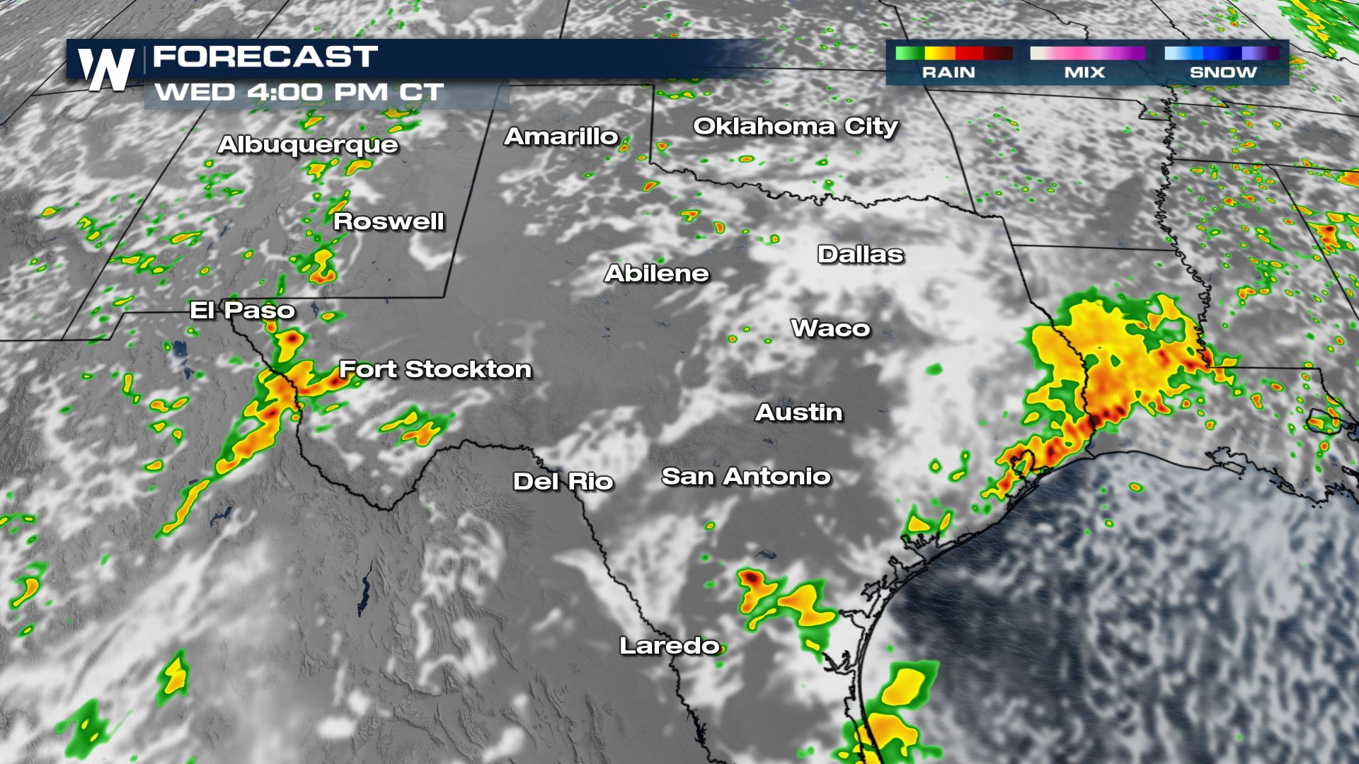
Wednesday Storm Outlook
By Wednesday, the risk for severe weather will likely be into west and south Texas and eastern New Mexico as daytime heating will help fire up additional storms in the usual dry-line regions.
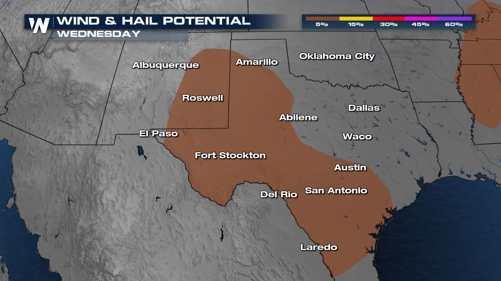
Wind gusts up to 60 mph and hail up to 1″ in diameter will be the primary threats with these discrete storms.
Forecast
As cells complex together in the morning hours and move east and south heavy rain and flooding will be possible for many along the I-20 corridor. Throughout the day this round of rain moves and dissipates east before we fire up a few more storms in New Mexico and west Texas.
Stay tuned to WeatherNation fore more updates on the severe weather threat.


Comments
Something to say?
Log in or Sign up for free