


 User Center
 My Training Class
 Feedback


Severe Storms Possible from the Midwest to the Northeast
A weak trough dropping into the Upper Midwest/Great Lakes will bring a chance of severe storms first to the Midwest, then to the Northeastern U.S. by midweek.
Setup
High heat and humidity will be abundant, so even though this storm won’t bring in what we refer to as the greatest dynamics (wind speeds through the atmosphere, or wind shear), there will be enough ambient instability to bring a risk for severe storms first to the Midwest, then to the Northeast.
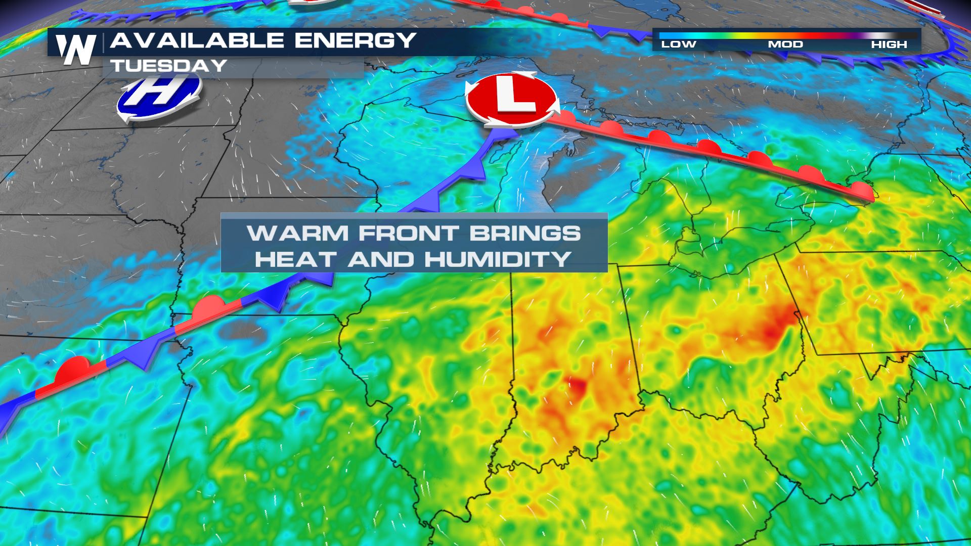
Tuesday
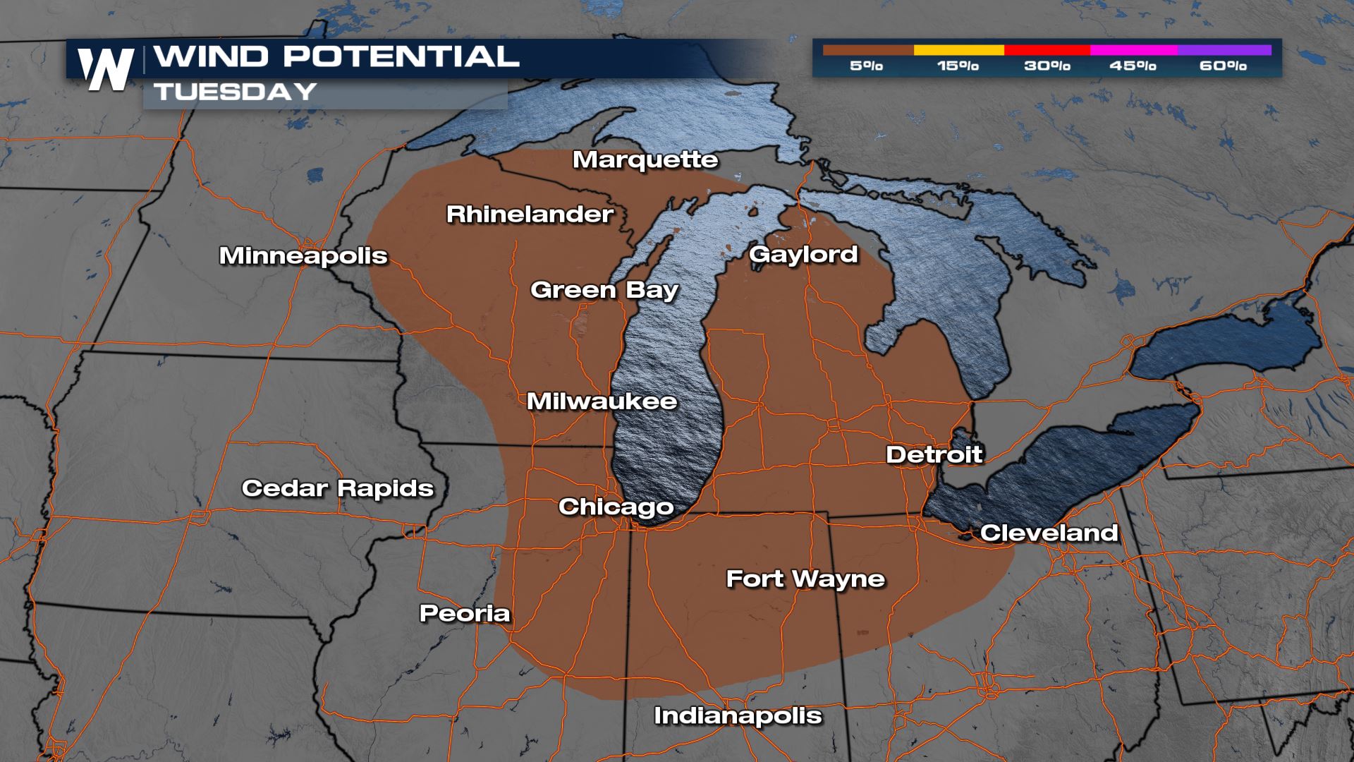
The risk for the severe threat on Tuesday expands to much more of the Upper Midwest where another ‘marginal’ or level I risk has been defined by the SPC.
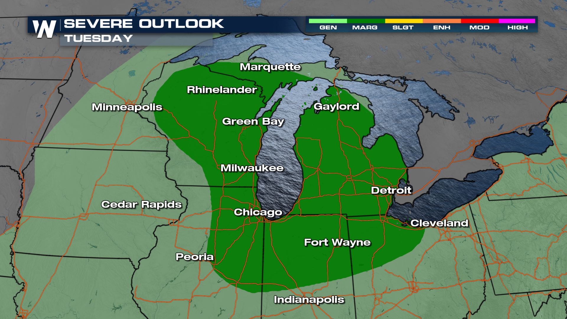
The greatest threat is, again, from strong winds over 58 mph.
Forecast
Storms could still produce heavy rainfall even around sunrise from the previous day’s storms.
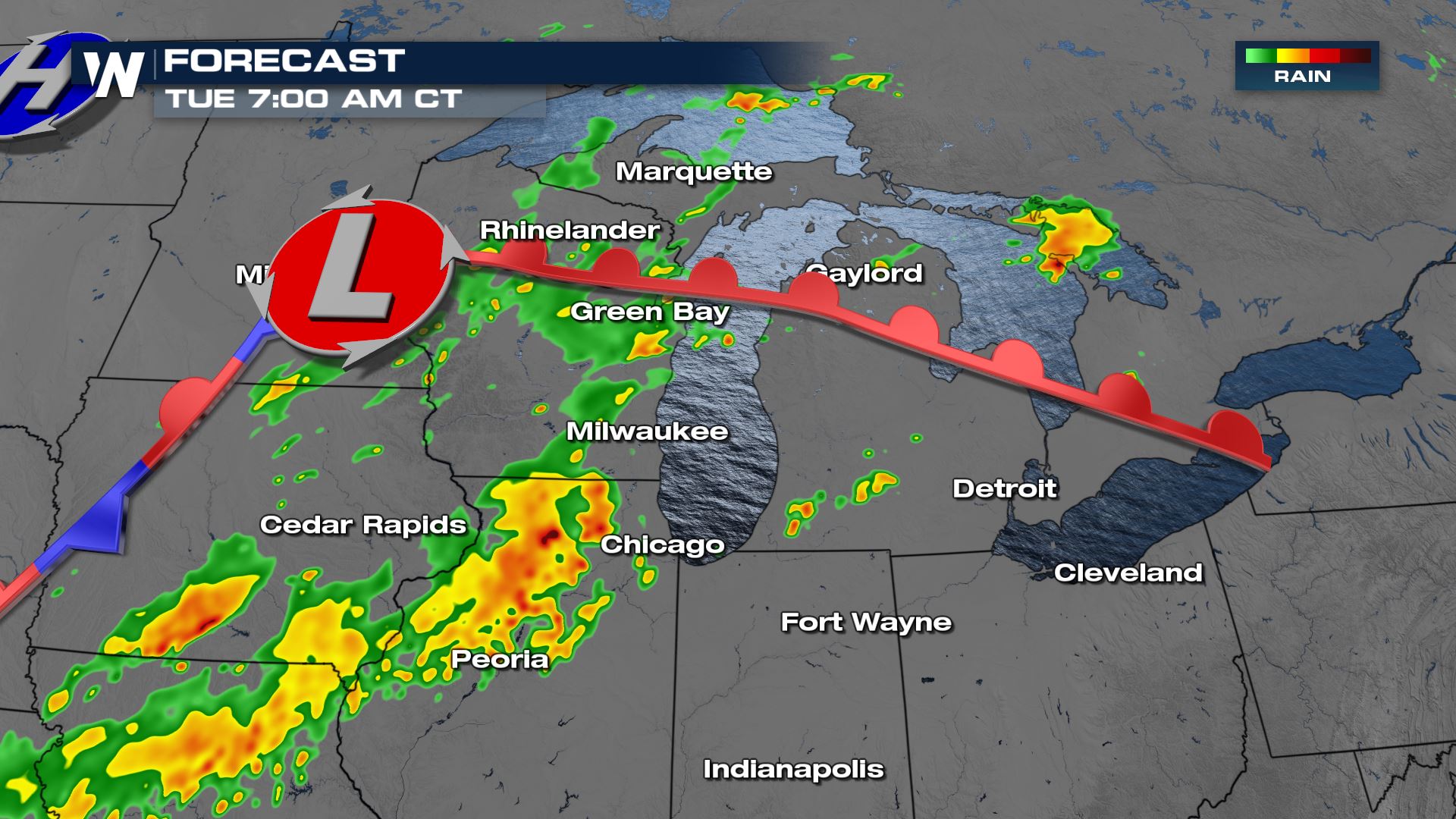
More numerous t-storms are likely in the afternoon hours.
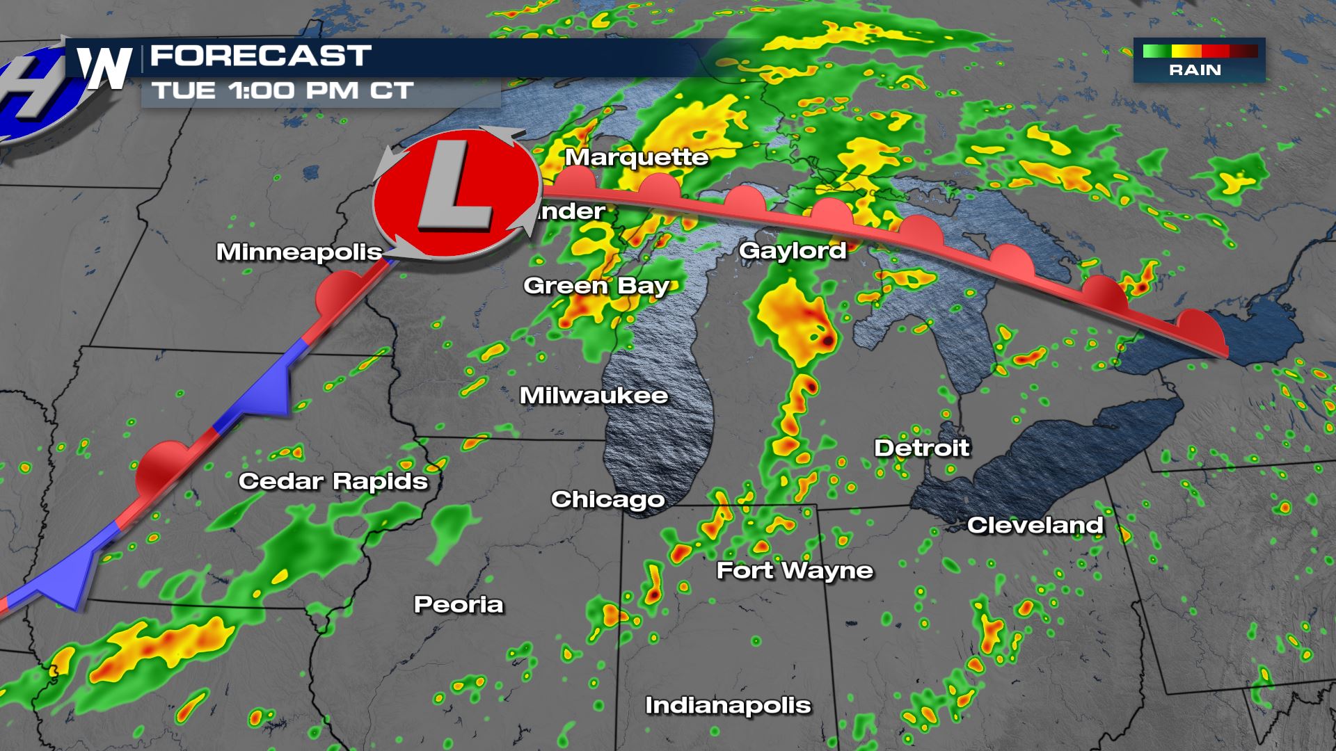
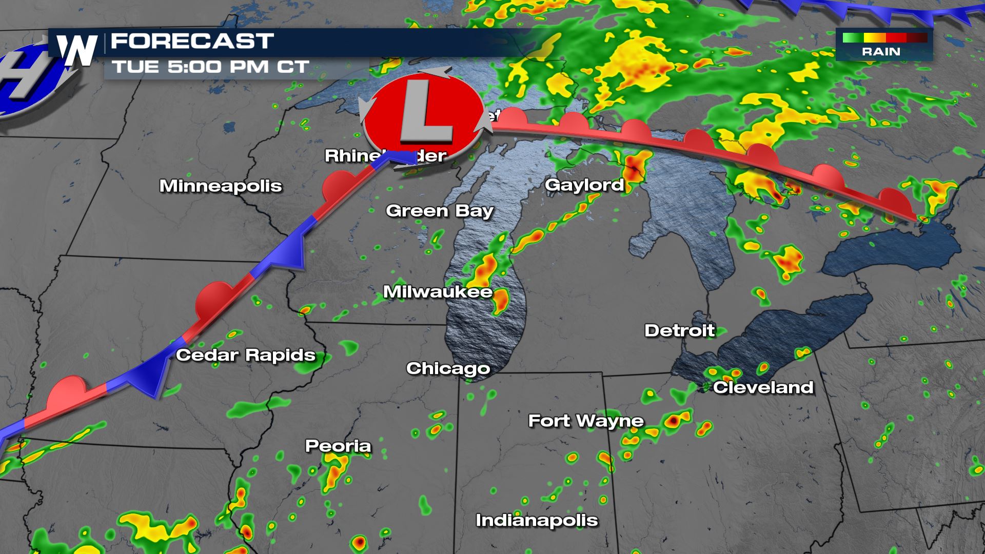
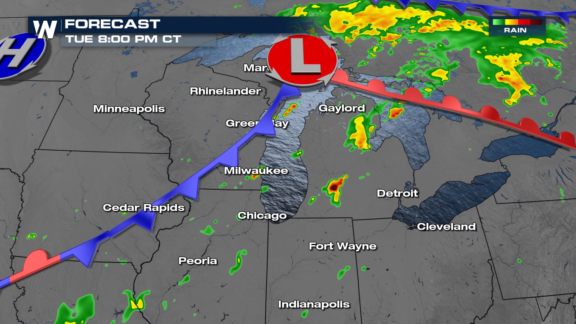
Thunderboomers are also likely into the evening and nighttime hours too before fading well after sunset in the overnight hours.
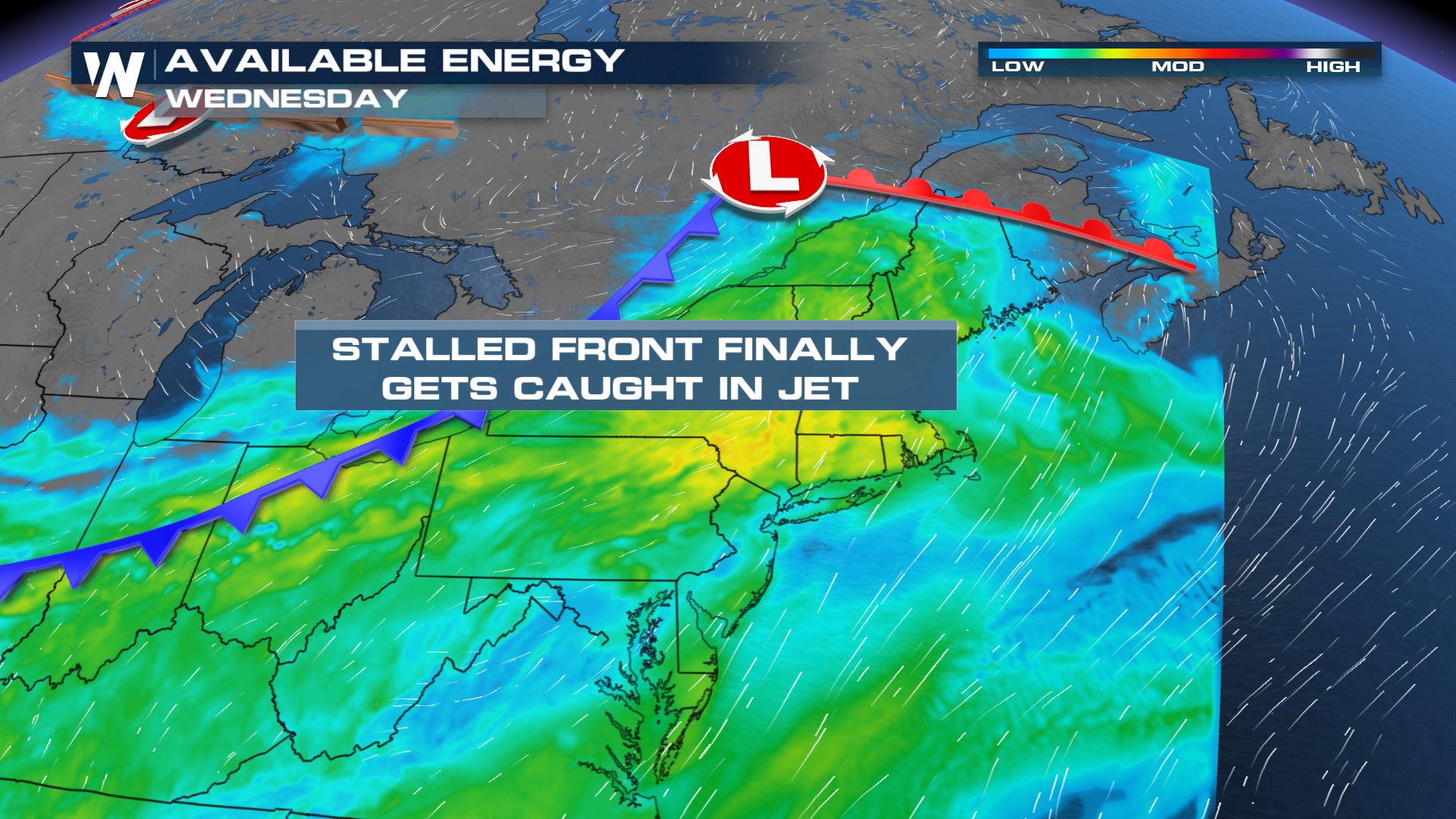
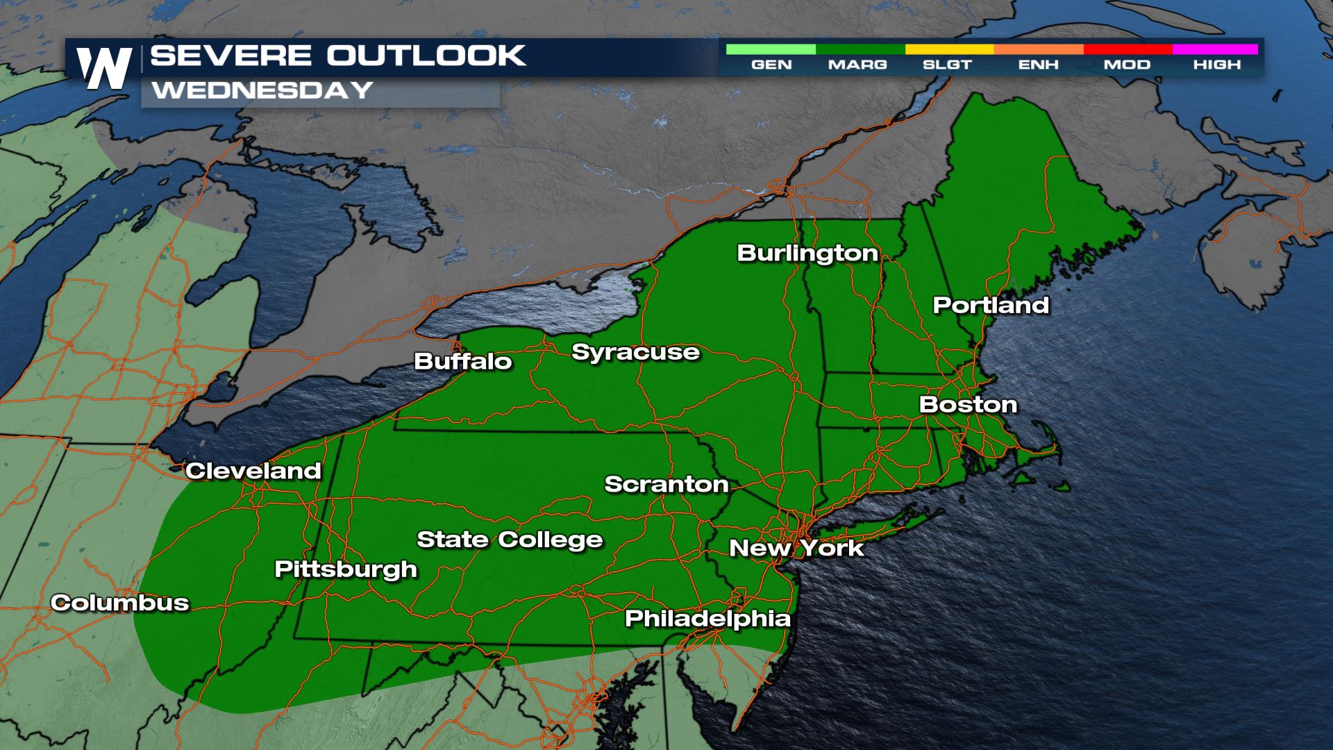
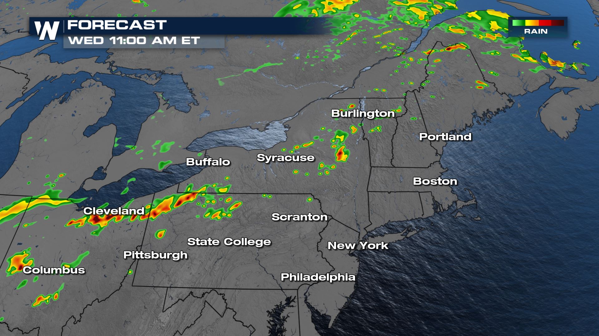
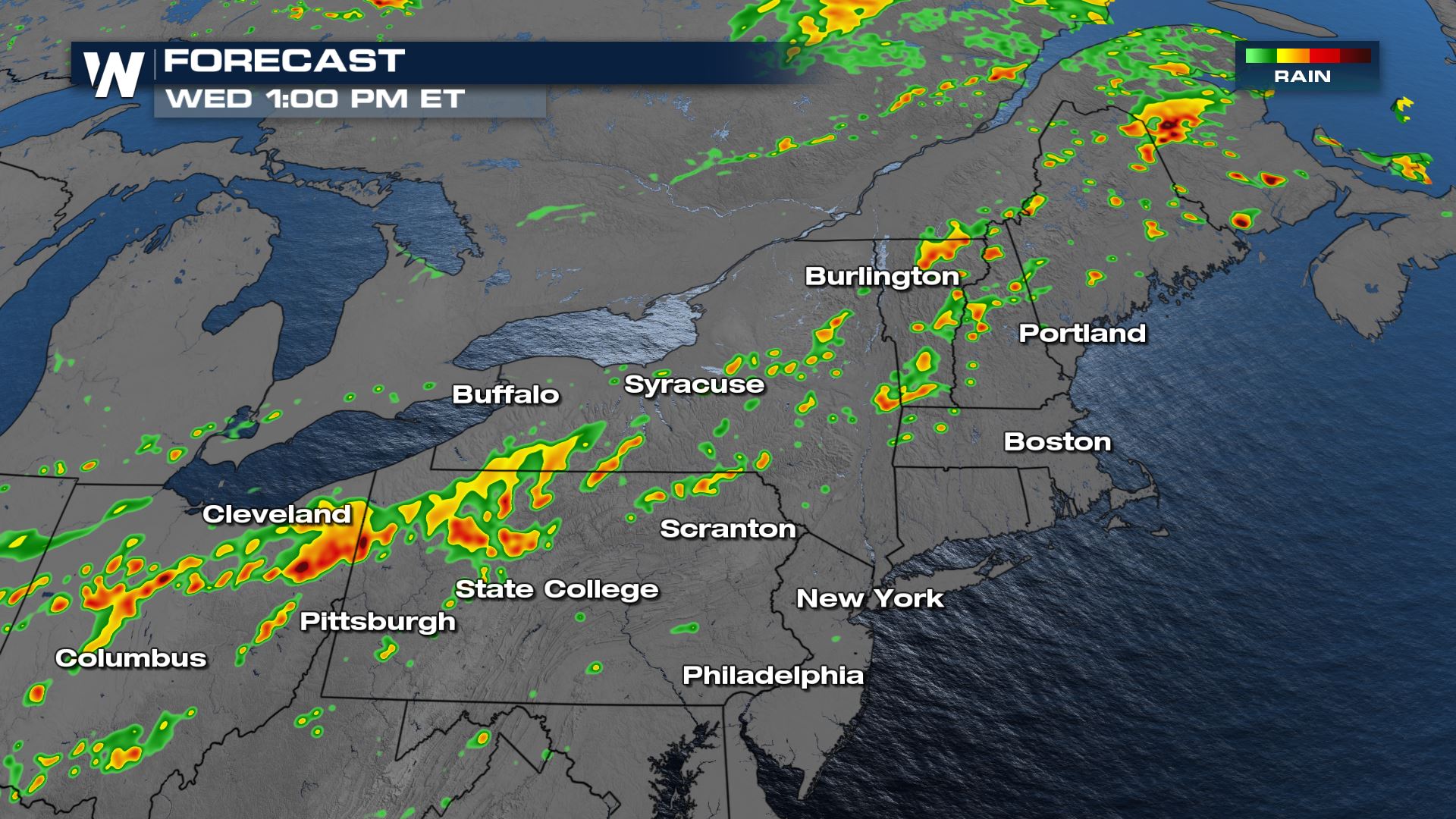
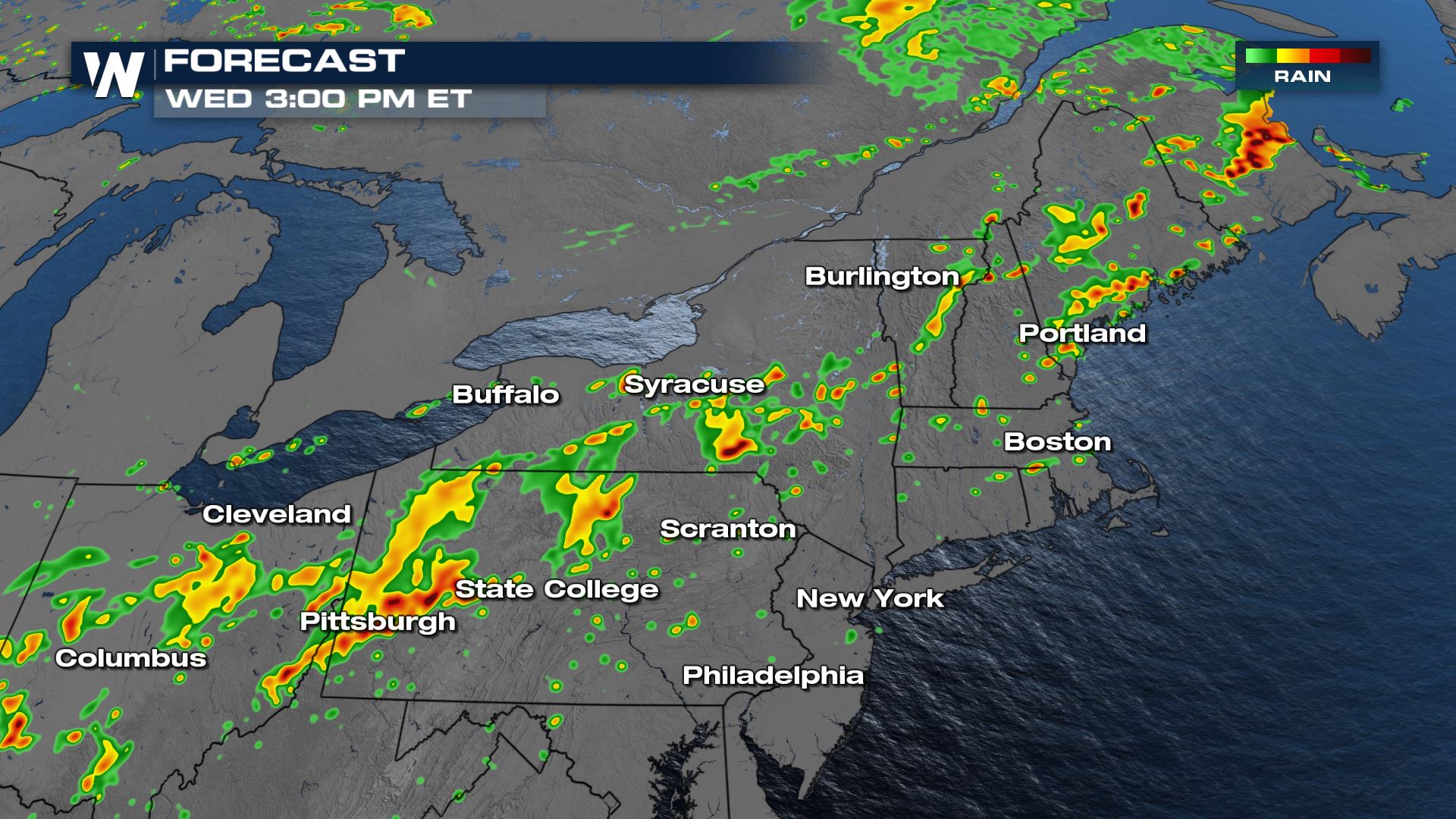
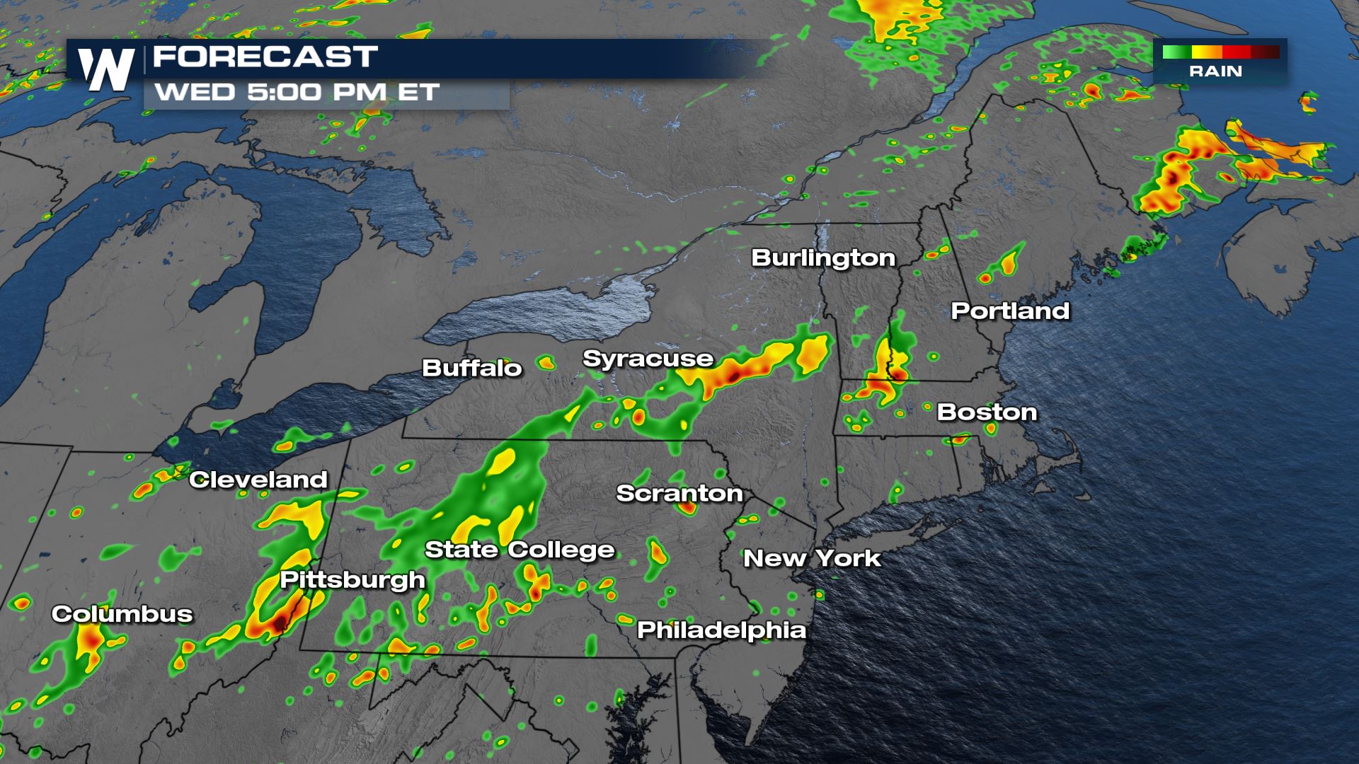
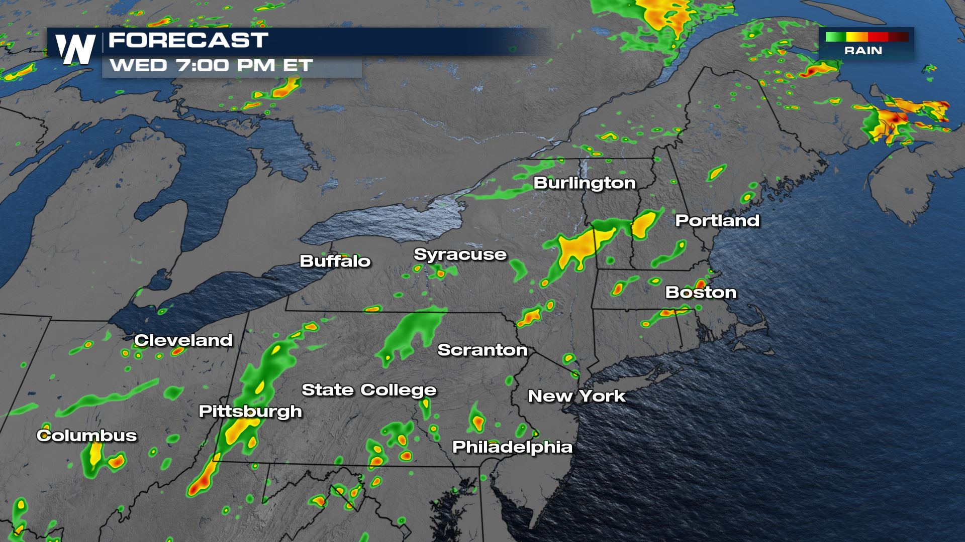
Wednesday
By midweek, the trough and associated weak front will move eastward and pose a severe threat to New England.
Forecast
Storms are to be most numerous, and likeliest to produce severe events in the afternoon and early evening hours on Wednesday.
Stay with WeatherNation for all the latest on these possible severe storms over the next few days.


Comments
Something to say?
Log in or Sign up for free