


 User Center
 My Training Class
 Feedback


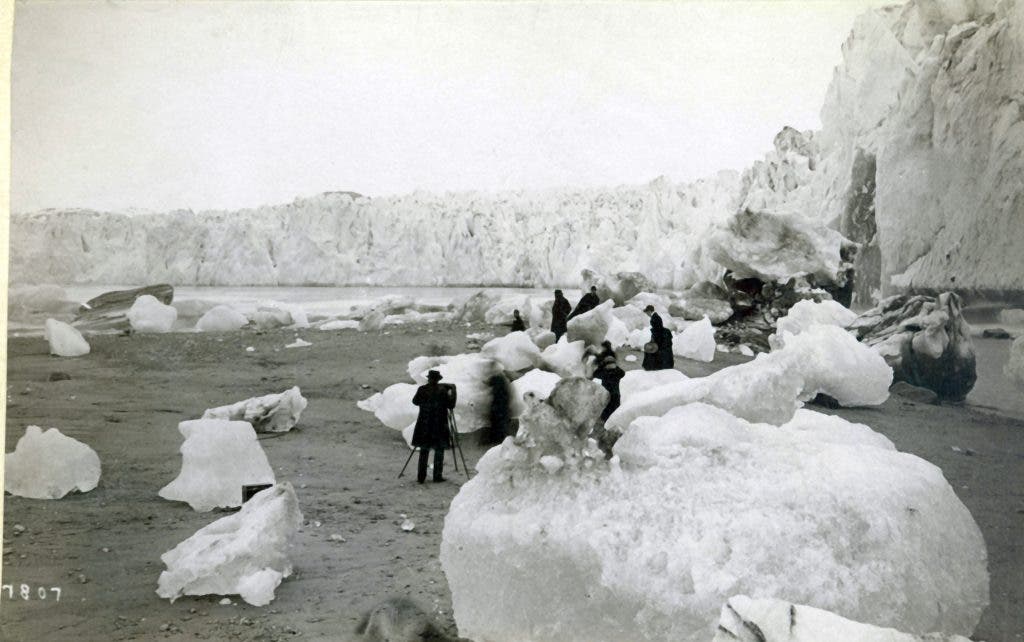
Repeat photography (or rephotography) is a technique in which photographs are taken repeatedly at a site to see how it evolves. It’s especially useful for glaciers, particularly because other remote ways of estimating glacial mass, depth, and rate of retreat are imperfect. These photos depict how this technique was used at a number of locations in Alaska.
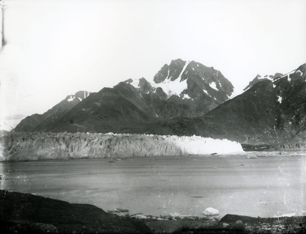
September 2, 1892
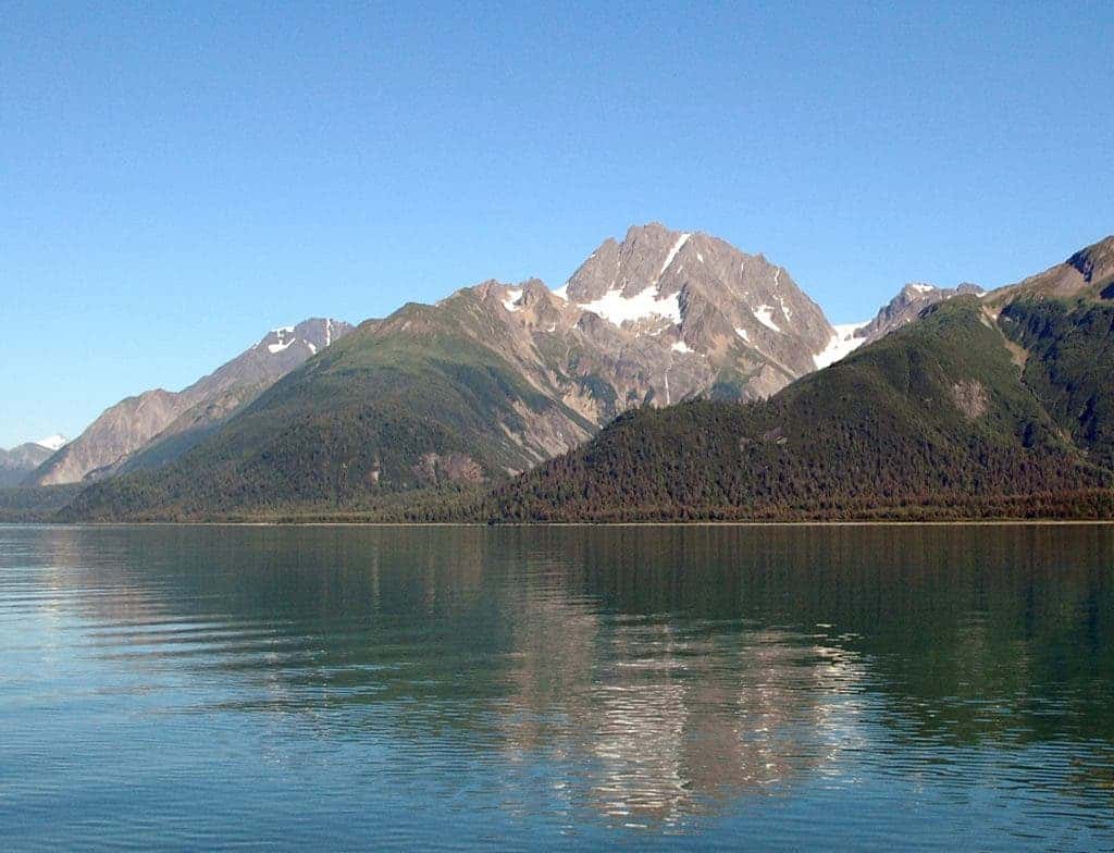
August 11, 2005
Here, we see a pair of photographs taken more than a century apart, at the Muir Glacier in Alaska. In the second photograph, Muir Glacier isn’t even visible, as it has retreated over 50 kilometers (31 miles). Furthermore, note the lack of vegetation in the first one, and the abundant forest in the second one; there’s also no floating ice whatsoever.
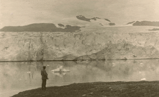
Between 1880s – 1890s.

August 11, 2005
If you wouldn’t know, you’d have a hard time believing these pictures were taken in the same place, also at the shoreline of Muir glacier. The early photograph shows the more than 100-meters (328-feet) high tidewater, while in the second one, there’s no ice in sight (in the foreground at least).
But it isn’t just Muir glacier that’s retreating – virtually all the glaciers in Alaska have retreated as an effect of global warming. Here are some pictures of Plateau glacier, less than 50 years apart:
September 9, 1961
September 14, 2003
Plateau Glacier retreated out of the field of view and has all but melted away, after leaving a small remnant, Plateau Remnant, on the flanks of the Bruce Hills. The vegetation, once inexistent in the area, is now so dense that geologists were unable to reach the point of the headland occupied by the two individuals in the 1961 photograph. The fact that snow and ice have made way for vegetation and darker terrain will trigger a domino effect – darker terrain attracts more sunlight, which warms the area even more (the so-called albedo effect). The same thing can be seen at Pedersen Glacier:
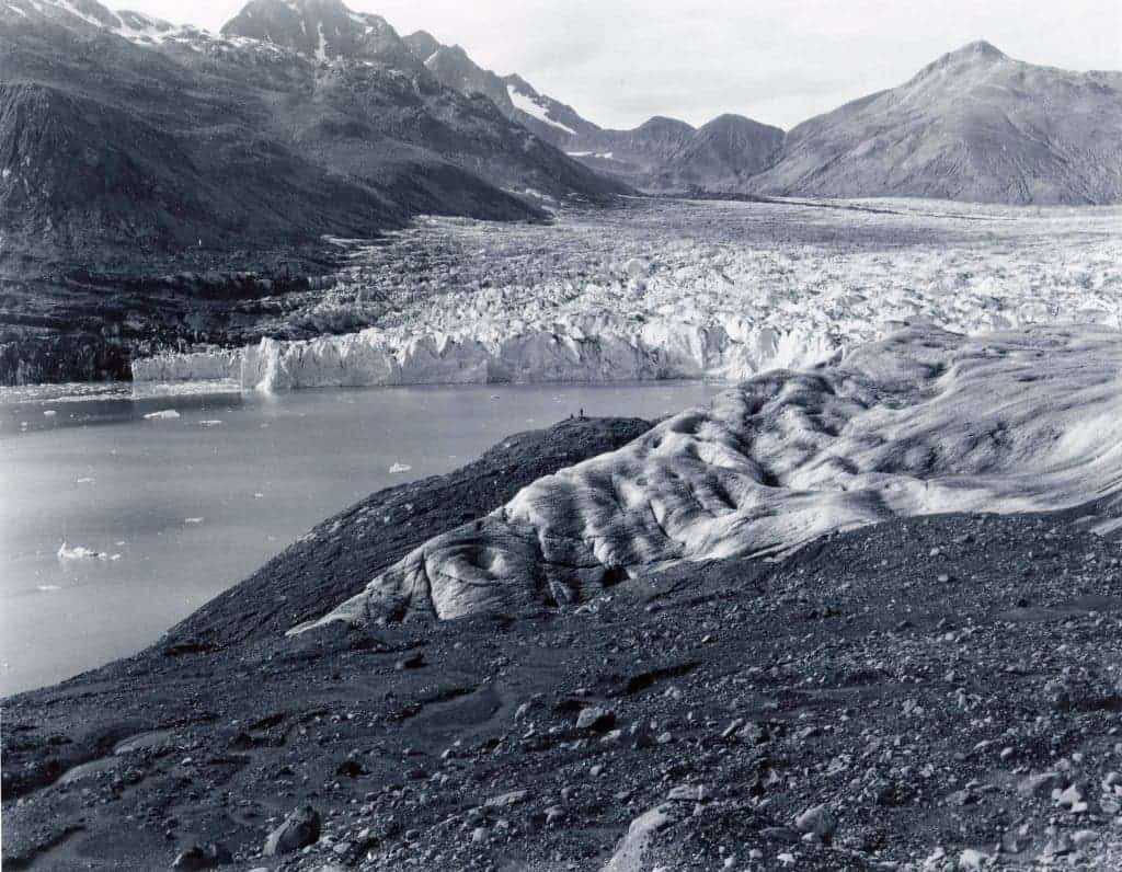
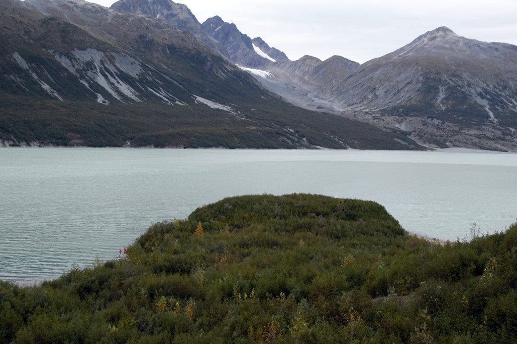
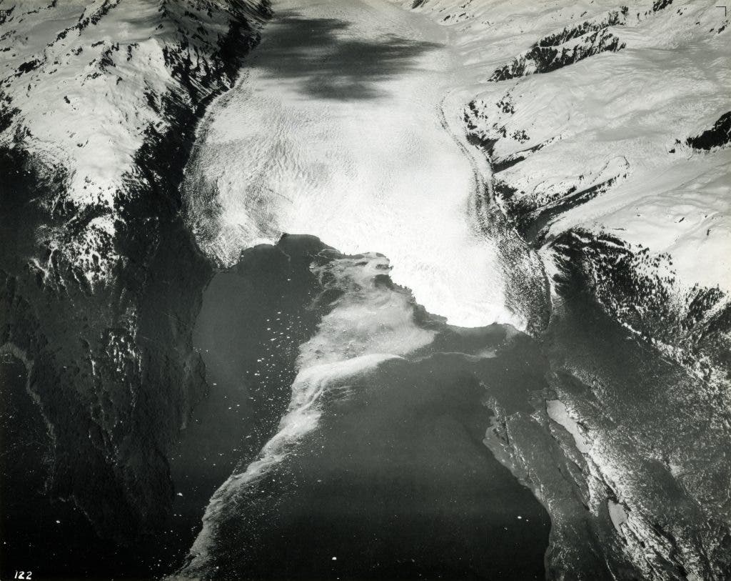
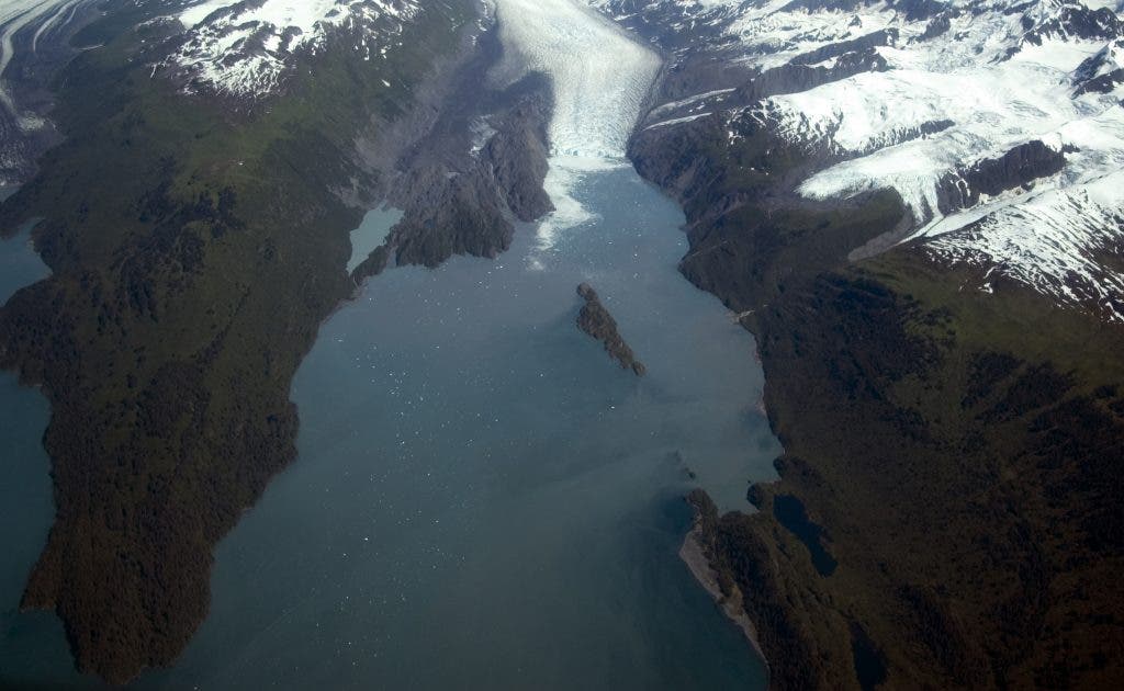
July 23, 1909.
August 13, 2004
While not so spectacular to see, Pedersen also retreated for 1.5 km. Here are a couple of other photos from the same area, but from a different perspective:
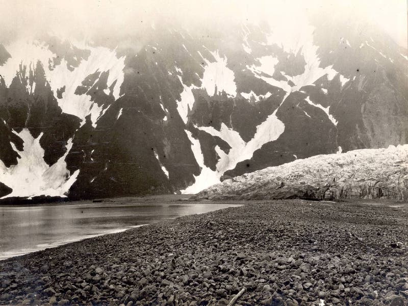
Between the mid-1920s and the early 1940s.
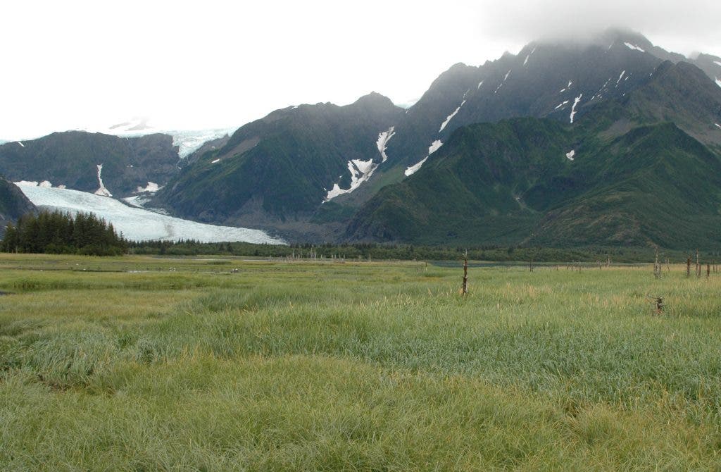
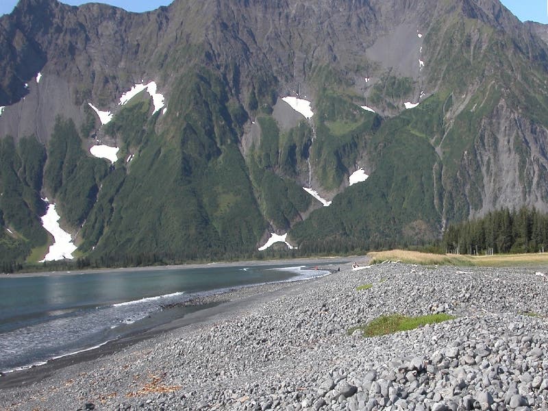
August 10, 2005.
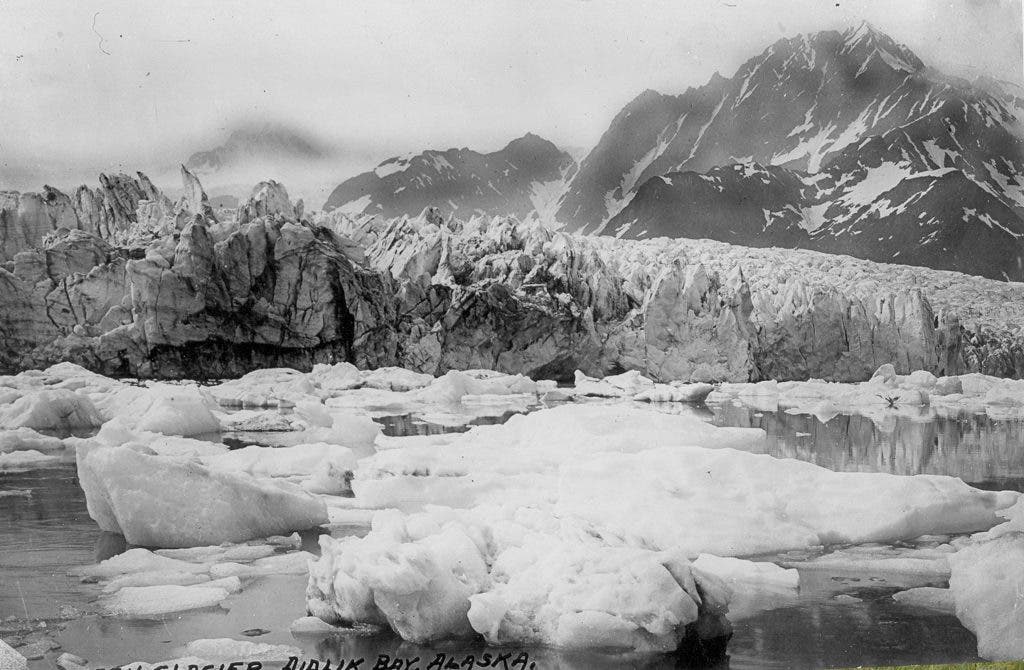
1940s. This photograph is from a postcard labeled Pederson Glacier, Aialik Bay, Alaska. The water in the foreground is part of an ice-marginal lake/lagoon located adjacent to Aialik Bay. When photographed, Pedersen Glacier was calving icebergs into the lake from a séracs-capped terminus that ranged from 20-40 m (66–131 feet) high. Note the stands of trees that have developed between the sediment filled wetland and the glacier.
Even for shorter periods of time, the effects are visible. These aerial pictures were taken at only 3 years apart, at Bear Glacier:
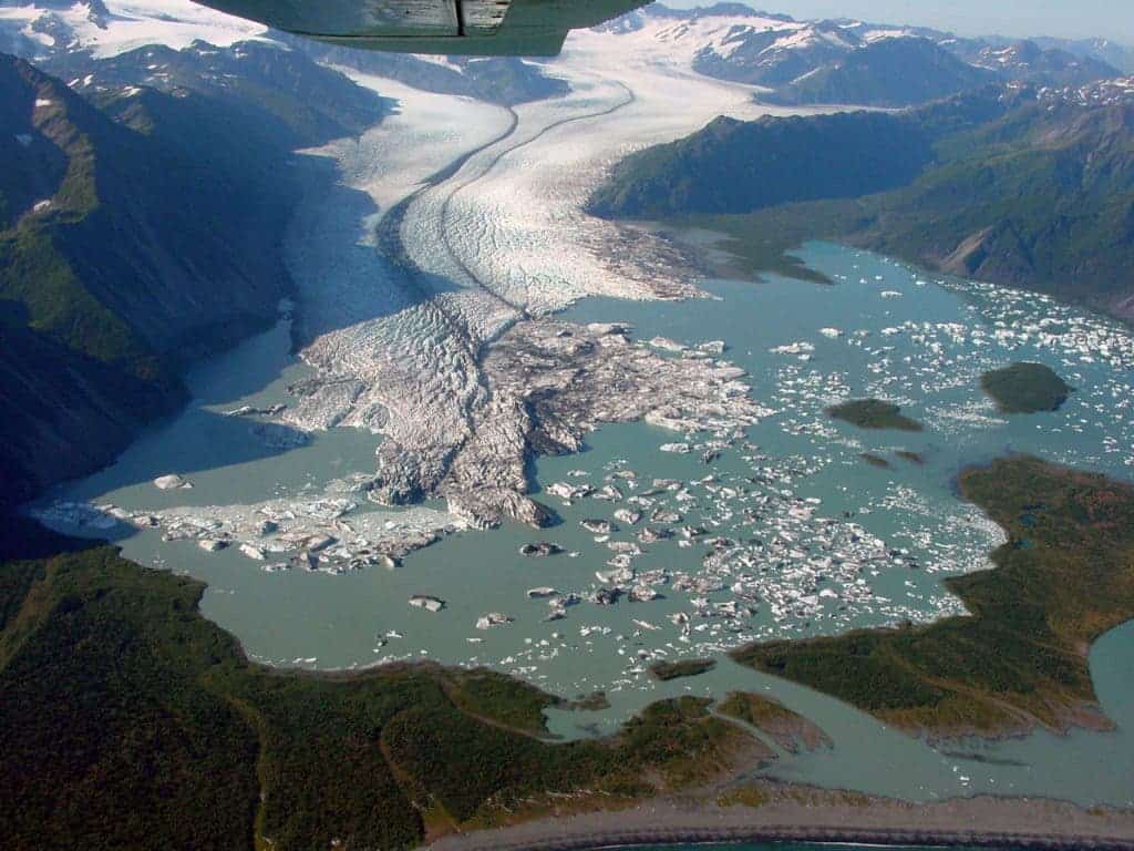
September 2, 2002.
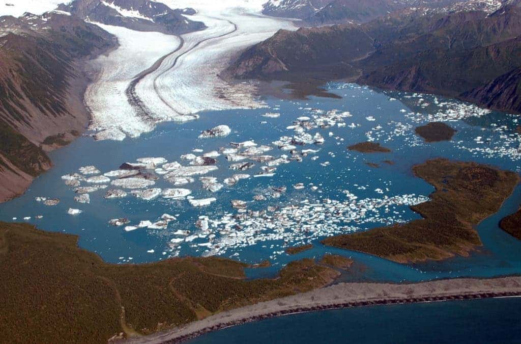
August 6, 2005

August 13, 2007
Three oblique aerial photographs that show changes in the terminus of Bear Glacier, Kenai Mountains, Kenai Fjords National Park, Alaska, during the five year period between 2002 and 2007. It’s incredible how much the landscape can change and how much glacier can retreat in a matter of years. During the 35 months between photographs, the triangular-shaped terminus of the glacier retreating more than 3 kilometers (1.9 miles) with the large triangular lobe disappearing, the result of intensive passive calving. There are older aerial oblique photos as well, as you can see below:
June 1937.
July 28, 2006
This is Yale glacier… it still is Yale glacier – but it likely soon won’t be, not anymore. All of the eastern tributaries have retreated and lost contact with Yale Glacier. An island and a large area of glacially sculpted bedrock have emerged from beneath the retreating glacier. The 2006 photograph was made from an altitude of approximately 3,200 meters (10,500 feet), while Washburn’s, 1937 photograph was made from an altitude of more than 5,200 meters (17,050 feet).
By now, I think you get the idea: glaciers are retreating – hard and fast. Here are some more before-and-after gifs I found on Imgur, depicting this change. If you want to see more images, as well as a more thorough description on the USGS website.


Comments
Something to say?
Log in or Sign up for free